| Turn map |
Directions & comments |
|
|

At the intersection of The Great North Walk & River Avenue Start (a footpath).

The Great North Walk (about 5 m back from the start).

Find the Alfred Cook Park at the start.

After 60 m pass the "Whitefire Grill and Bar" (20 m on your right).
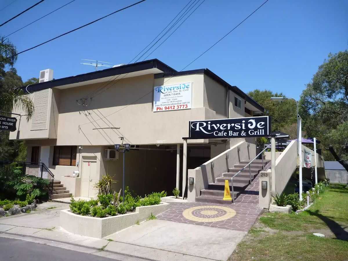
Then find the "Riverside Cafe Bar & Grill" (25 m on your right).
|
|
|

After another 25 m continue straight.
|
|
|
After another 10 m continue straight.
After another 65 m continue straight.

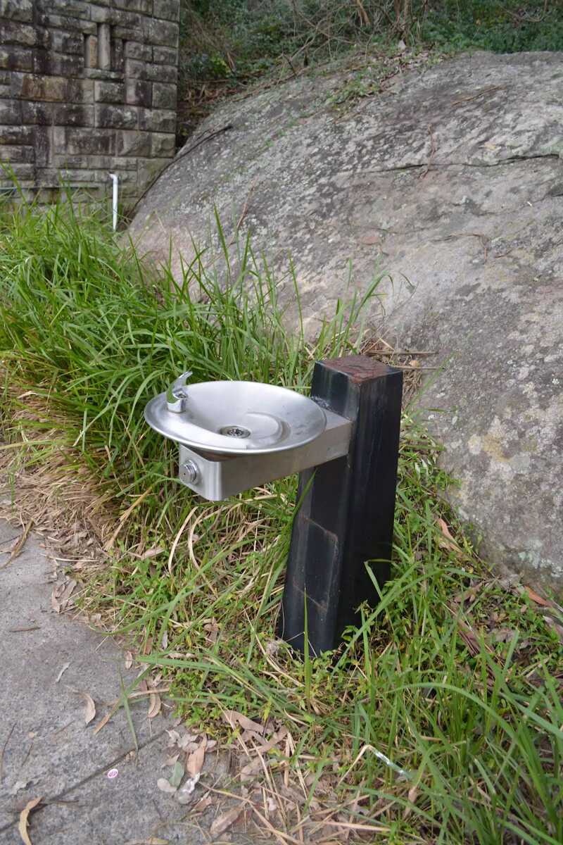
After another 15 m find the "Potable Water" (70 m on your left).

After another 8 m pass the BBQ (20 m on your left).

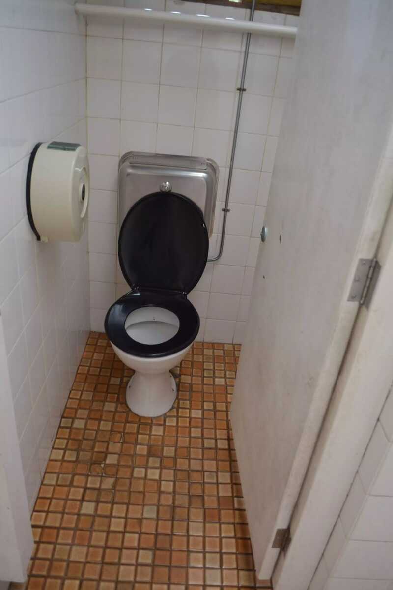
Then pass the toilet (75 m on your left).

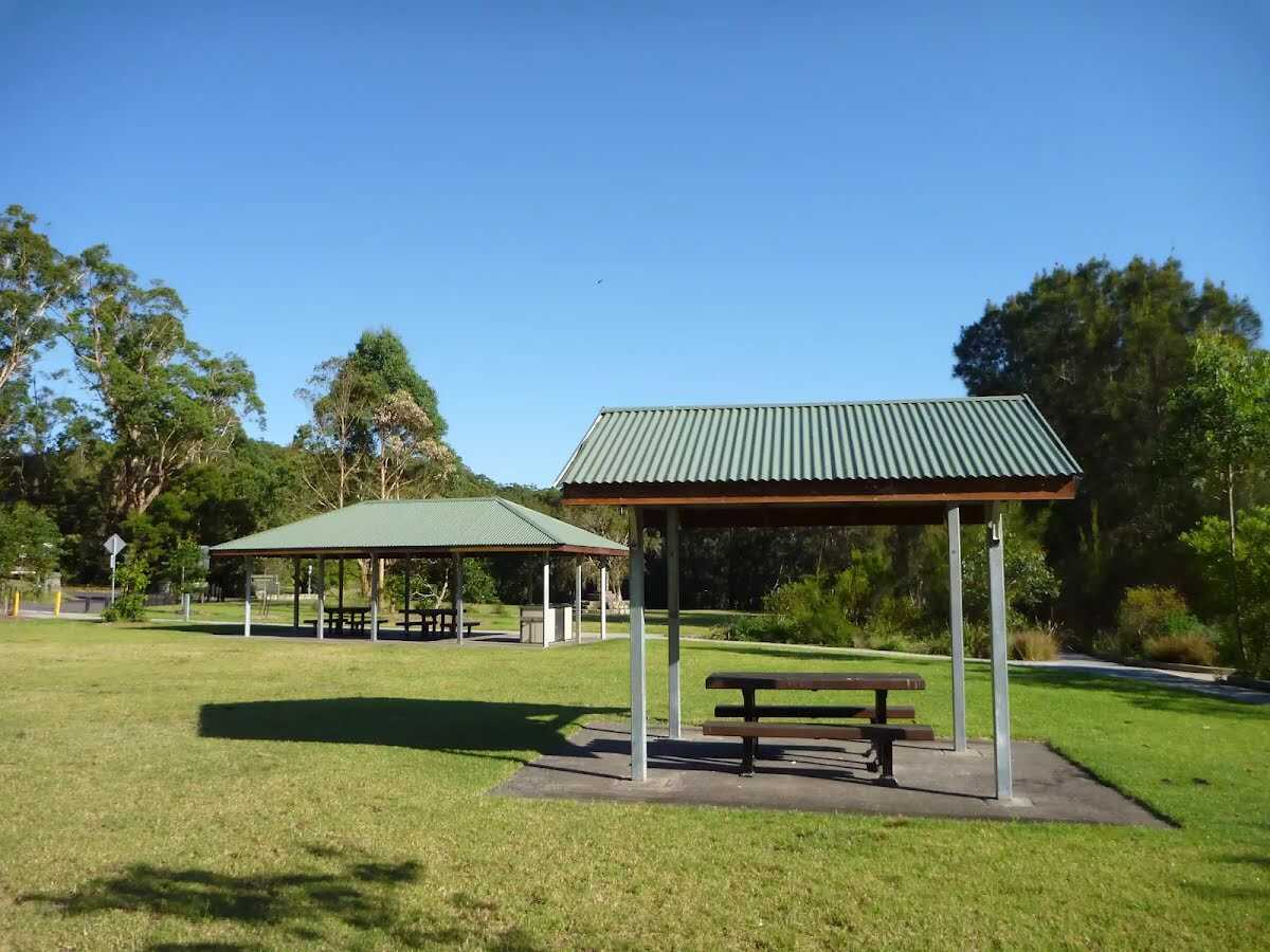
After another 8 m find the "Koonjeree Picnic Area" (5 m on your left).
Then find the "Toilet" (65 m on your left).
Continue straight.

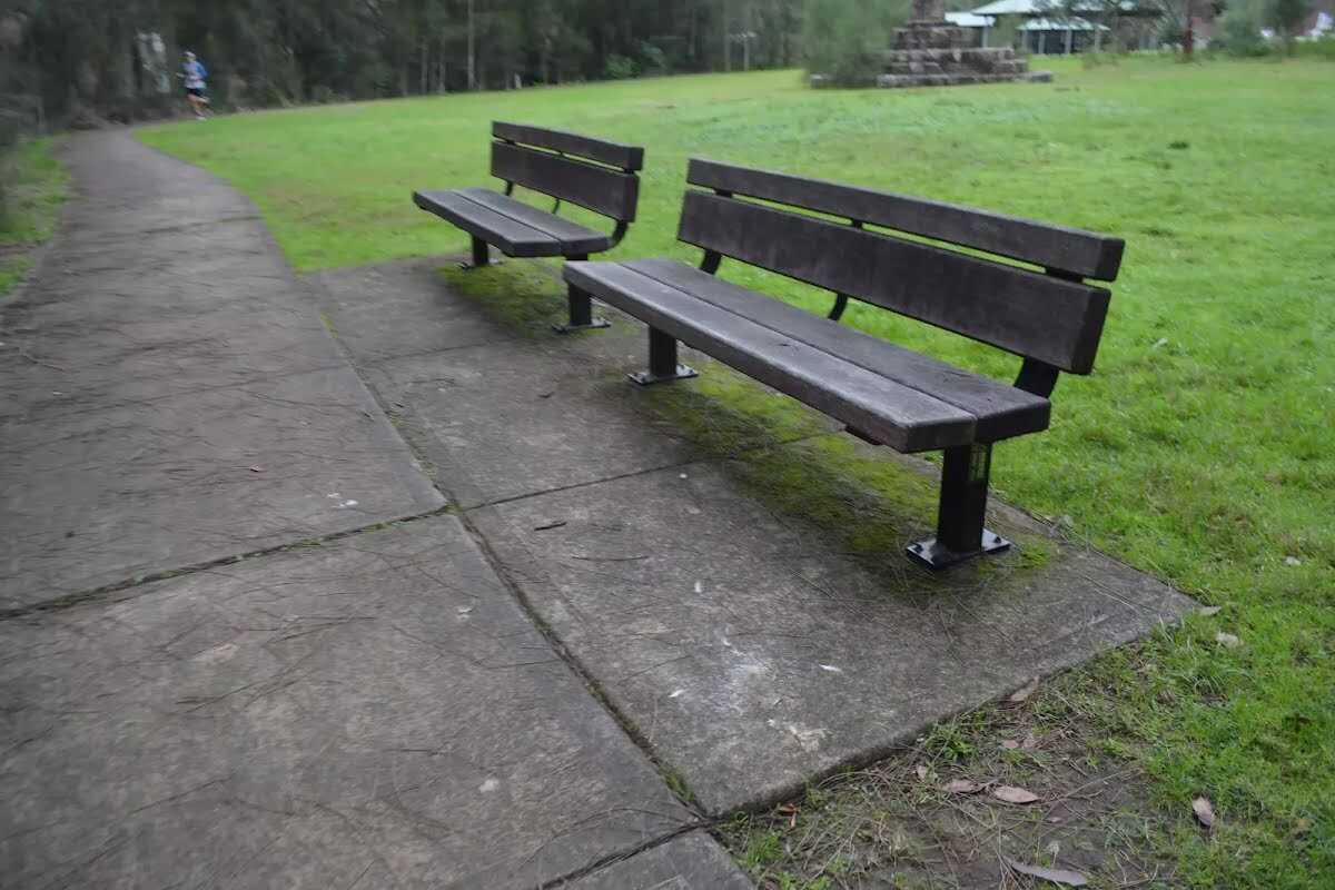
After another 65 m find the "Seat" (on your right).

After another 20 m find the "Trip Hazard" (on your right).
|
|
|

Turn right.

After another 5 m cross the bridge (about 10 m long)

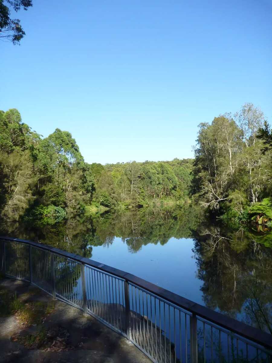
Then find the "Lane Cove River Lookout" (55 m on your left).
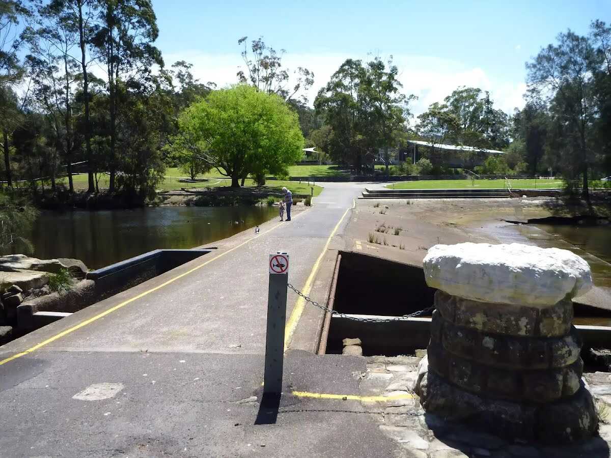
After another 25 m find the "Lane Cove Weir" (on your left).
After another 60 m find the "Seat" (9 m on your left).
Continue straight.
After another 55 m pass the toilet (80 m on your left).
|
|
|
Turn right.

After another 6 m pass the playground (55 m on your left).
After another 40 m find the "Picnic Table" (25 m on your right).
Then find the "BBQ" (55 m on your right).

After another 10 m find the "Parking Accessible" (35 m on your right).

Then pass the car park (40 m on your right).
After another 30 m pass the "The Great North Walk" (60 m on your right).
|
|
|
Continue straight, to head along Max Allen Road.
After another 120 m pass the toilet (65 m on your right).
Continue straight, to head along Max Allen Road.
After another 50 m pass the car park (60 m on your right).
|
|
|
After another 4 m (at the intersection of The Great North Walk & Max Allen Road) continue straight, to head along The Great North Walk (a walking track).
After another 8 m pass the "Great North Walk" (on your right).
|
|
|
After another 280 m continue straight, to head along The Great North Walk.
|
|
|
After another 120 m (at the intersection of Lane Cove Depot Road & The Great North Walk) continue straight, to head along Lane Cove Depot Road (a service road).
|
|
|

After another 15 m (at the intersection of The Great North Walk & Lane Cove Depot Road) veer right, to head along The Great North Walk (a walking track).
After another 325 m come to the viewpoint (105 m on your left).
|
|
|
After another 85 m continue straight, to head along The Great North Walk.
After another 315 m cross the bridge (about 5 m long)

After another 160 m cross the ford.
After another 170 m cross the bridge

Then head down the 7 stone steps (about 3 m long)
After another 55 m head down the 26 steps (about 20 m long)
Then cross the bridge (about 8 m long)
|
|
|
After another 40 m continue straight, to head along The Great North Walk.
After another 6 m pass the sign (on your right).
After another 85 m cross the bridge (about 7 m long)
After another 75 m pass the toilet (140 m on your right).
Then cross the bridge (about 3 m long)
After another 10 m cross the bridge (about 5 m long)
After another 115 m cross the bridge (about 15 m long)

After another 8 m head up the 11 steps (about 8 m long)
After another 690 m come to the viewpoint.
After another 400 m cross the bridge (about 4 m long)
After another 80 m come to the viewpoint.

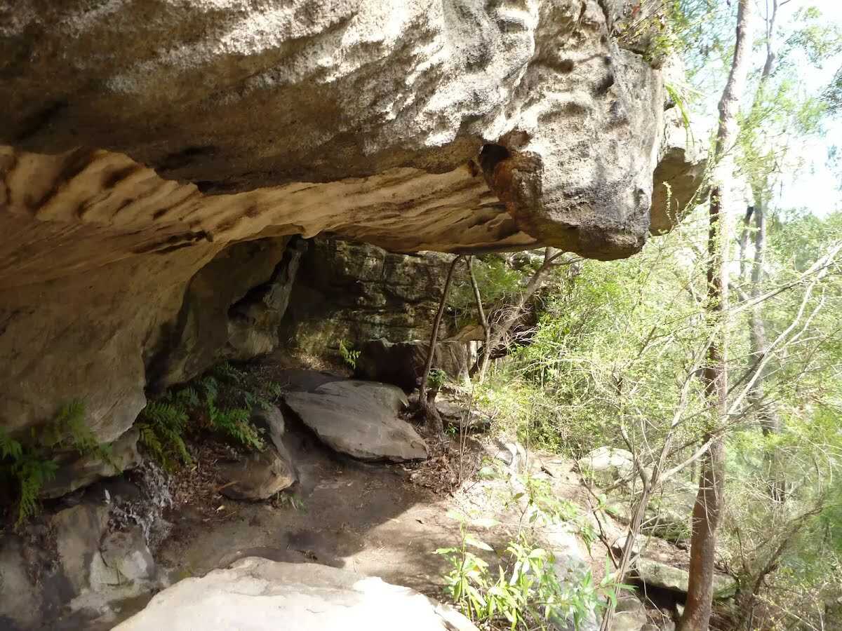
After another 140 m find the "Sandstone caves" (15 m on your left).
After another 50 m cross the ford.
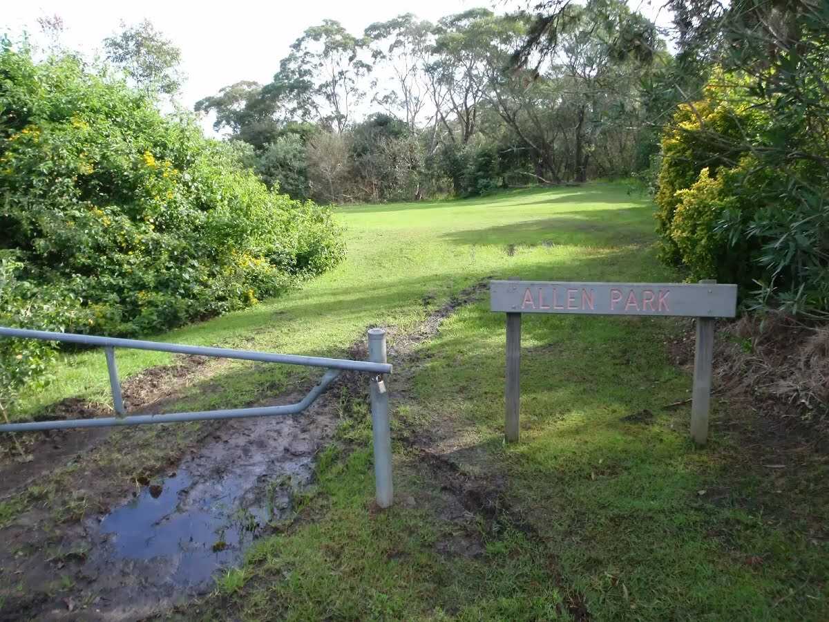
After another 175 m find the "Allen Park" (100 m on your right).
After another 55 m head up the 5 steps (about 2 m long)
|
|
|

After another 1 m turn left, to head along The Great North Walk.
After another 15 m pass the sign (on your right).
After another 80 m continue straight, to head along The Great North Walk.
After another 110 m cross the ford.
After another 80 m continue straight, to head along The Great North Walk.

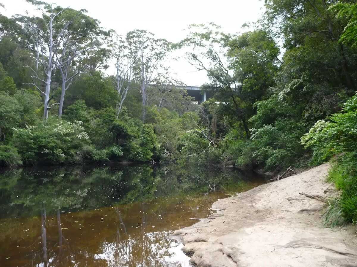
After another 40 m find the "Blue Hole" (45 m on your left).
After another 110 m pass the sign (9 m on your left).
|
|
|
Continue straight, to head along The Great North Walk.
|
|
|
The starting point of an alternate access track. Alternate exit to Macquarie Park station. Details below.
After another 75 m continue straight, to head along The Great North Walk.
After another 15 m head down the 5 earthen steps (about 4 m long)
After another 70 m come to the viewpoint (7 m on your left).
After another 390 m pass the sign (7 m on your left).
|
|
|
Continue straight, to head along The Great North Walk.
After another 75 m cross the bridge (about 9 m long)
|
|
|
After another 145 m turn left, to head along The Great North Walk.
After another 10 m pass the sign (6 m on your left).
After another 560 m head down the 4 steps
Then cross the ford.
After another 5 m head up the 6 earthen steps (about 4 m long)
|
|
|
After another 25 m (at the intersection of Gloucester Avenue Trail & The Great North Walk) continue straight, to head along Gloucester Avenue Trail (a vehicle track).
|
|
|
After another 35 m (at the intersection of Gloucester Avenue Trail & The Great North Walk) turn left, to head along The Great North Walk (a walking track).
After another 370 m head down the 11 earthen steps (about 5 m long)
Then cross the ford.
After another 85 m cross the bridge (about 4 m long)
Then cross the bridge
|
|
|
After another 55 m veer right, to head along The Great North Walk.

After another 35 m veer left, to head along The Great North Walk.
|
|
|
After another 110 m turn left, to head along The Great North Walk.
After another 130 m continue straight, to head along The Great North Walk.
After another 180 m continue straight, to head along The Great North Walk.
After another 6 m come to the viewpoint (10 m on your left).
After another 40 m continue straight, to head along The Great North Walk.
Then come to the viewpoint (10 m on your left).
|
|
|
After another 250 m continue straight, to head along The Great North Walk.
After another 80 m cross the ford.
After another 155 m pass the "Walking and Service Trails in the Lane Cove Valley" (8 m on your right).
|
|
|
Veer left, to head along The Great North Walk.
After another 20 m cross the bridge (about 7 m long)
|
|
|
After another 105 m veer right, to head along The Great North Walk.
|
|
|
After another 35 m continue straight, to head along The Great North Walk.
After another 75 m cross the bridge (about 15 m long)
|
|
|
After another 220 m turn left, to head along The Great North Walk.
|
|
|
After another 45 m veer left, to head along The Great North Walk.

After another 325 m cross the stepping stones.
After another 470 m cross the ford.
|
|
|
After another 10 m turn left.
|
|
|
After another 270 m turn left.
After another 8 m pass the "The Great North Walk" (on your left).
After another 15 m find the "Browns Waterhole" (30 m on your left).
|
|
|
After another 15 m veer right, to head along The Great North Walk.
After another 15 m pass the "Walking and Service Trails in the Lane Cove Valley" (8 m on your right).
|
|
|
After another 500 m turn left, to head along The Great North Walk.
After another 10 m pass the sign (on your right).
Continue straight, to head along The Great North Walk.
After another 70 m pass the sign (on your right).
At the intersection of The Great North Walk & The Step - Main loop continue straight, to head along The Great North Walk.
After another 620 m pass the sign (on your right).
|
|
|
At the intersection of Lane Cove Valley Walk & The Great North Walk continue straight, to head along The Great North Walk.
|
|
|
After another 70 m (at the intersection of The Great North Walk & Devlins Creek Trail) continue straight, to head along The Great North Walk.
After another 55 m pass the sign (5 m on your left).
After another 470 m pass the "Dog paw cave" (95 m on your right).
After another 65 m cross the ford.
After another 420 m continue straight, to head along The Great North Walk.
After another 65 m cross the ford.
After another 30 m continue straight, to head along The Great North Walk.
After another 470 m continue straight, to head along The Great North Walk.
After another 370 m cross the ford.
After another 40 m cross the ford.
|
|
|
After another 170 m (at the intersection of Morona Avenue Firetrail & The Great North Walk) veer left, to head along The Great North Walk (a walking track).
After another 10 m pass the "Walking and Service Trails in the Lane Cove Valley" (on your right).
After another 15 m pass the "The Great North Walk" (on your left).
After another 25 m pass the "Depth Marker" (on your left).
|
|
|
Continue straight, to head along The Great North Walk.
After another 185 m pass the "The Great North Walk" (on your right).
Then cross the stepping stones.
After another 35 m pass the sign (9 m on your left).
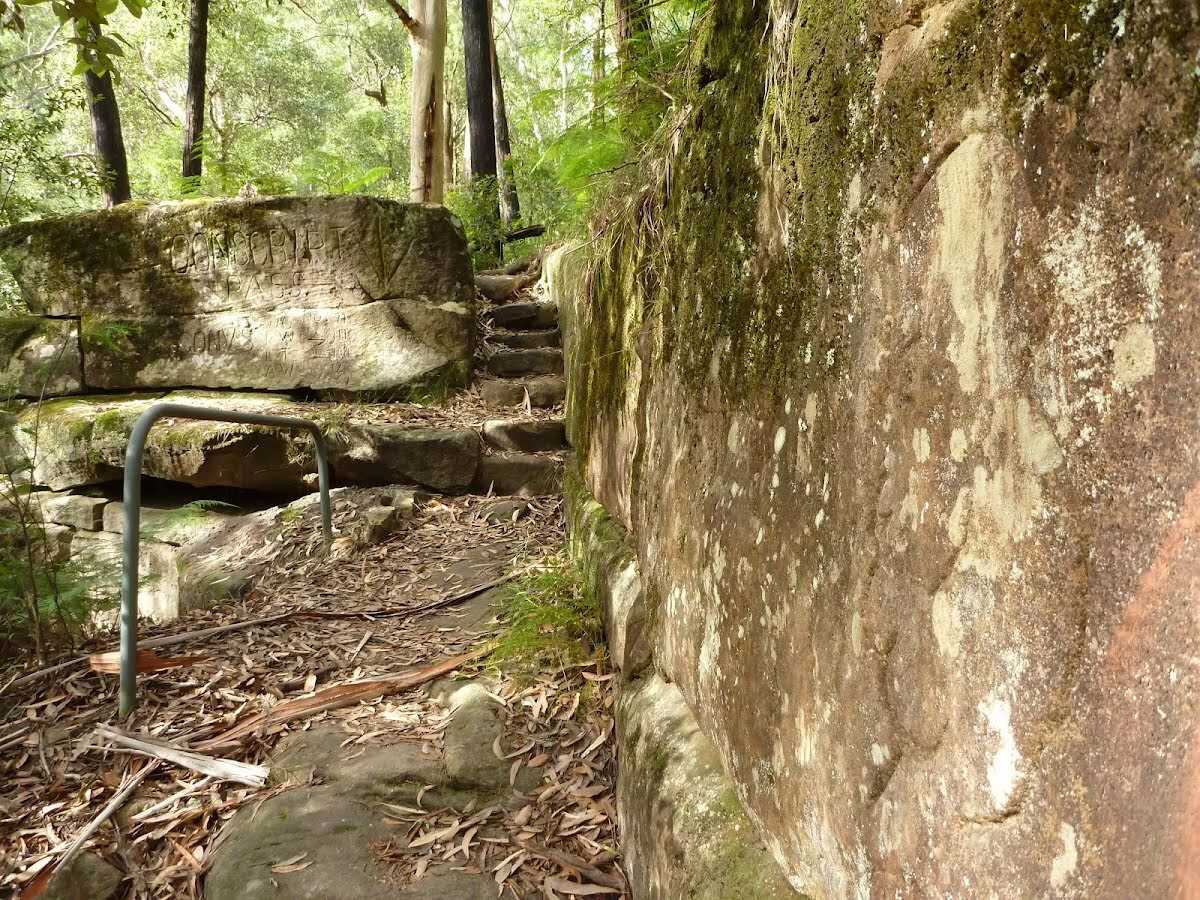
After another 10 m head up the 14 stone steps (about 7 m long)
After another 6 m find the "Conscript Pass" (on your left).
After another 9 m head up the 14 stone steps (about 10 m long)
After another 70 m head up the 27 stone steps (about 20 m long)
After another 9 m head up the 16 stone steps (about 7 m long)
After another 2 m (at the intersection of The Great North Walk & Lorna Pass) turn left, to head along Lorna Pass.
After another 30 m pass the "The Great North Walk" (7 m on your left).
After another 40 m cross the ford.
After another 75 m head up the 57 earthen steps (about 60 m long)
After another 35 m pass the sign (on your left).
|
|
|
Turn right.
After another 15 m pass the "The Great North Walk" (on your left).
After another 195 m pass the "Walking and Service Trails in the Lane Cove Valley" (on your left).
Then pass a seat (6 m on your right)., has a backrest.
Then pass the "The Great North Walk" (on your left).
After another 140 m pass the toilet (30 m on your right).
24/7
Then pass the car park (35 m on your right).
|
|
|
Turn left.
After another 25 m continue straight.
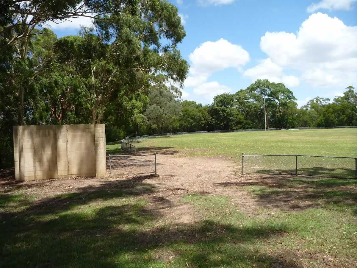
After another 50 m find the "Thornleigh Oval" (10 m on your right).
Then pass the "The Great North Walk" (15 m on your right).
|
|
|
After another 10 m continue straight, to head along Handley Avenue.
After another 450 m pass the "The Great North Walk" (7 m on your right).
|
|
|
At the intersection of Orchard Street & Handley Avenue turn right, to head along Orchard Street.
|
|
|
After another 20 m (at the intersection of Orchard Street & Station Street) turn left, to head along Station Street.

After another 420 m find the "Subway" (30 m on your right).
About 150 m past the end is a car park.
Then cross the bridge
After another 25 m pass the "Curl and Wisker Cafe" (95 m on your right).
Then find the "Zacs Great Food" (95 m on your left).
Then pass the "The Great North Walk" (95 m on your right).
|
|
|
Start.
|
|
|
After another 45 m turn right.
After another 9 m cross the bridge (about 185 m long)
|
|
|
After another 100 m continue straight.
After another 215 m pass the "Tuckwell Park" (on your right).
After another 75 m pass the car park (60 m on your left).
Then find the "Eden Gardens" (40 m on your left).
|
|
|
After another 400 m turn left.
|
|
|
After another 4 m turn right.
After another 55 m pass the "Ribs and Rumps" (65 m on your right).
After another 90 m pass the pay phone (25 m on your left).
After another 35 m pass the car park (15 m on your right).
|
|
|
Continue straight.
After another 20 m pass the "Go Hun" (40 m on your left).
Then pass the "Sambal" (40 m on your left).
After another 160 m pass the car park (5 m on your right).
|
|
|
After another 40 m turn left.
|
|
|
After another 8 m veer right.
|
|
|
After another 5 m continue straight.
|
|
|
After another 30 m turn right.
|
|
|
After another 25 m veer left.
|
|
|

After another 4 m come to the end.
|