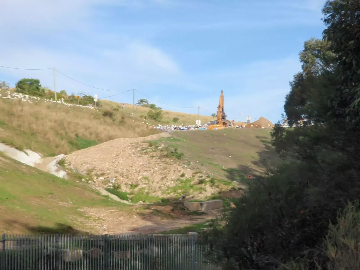
This long day-walk starts from the Girrakool picnic area and works its way south, alongside Piles creek and through the Brisbane Waters National Park. The walk climbs over Scopas Peak and passes the Kariong brook falls, before winding to the top of Mt Wondabyne and finishing at the Woy Woy train station, (passing the Woy Woy landfill site). If doing a car shuffle, you can park a car near the landfill and save the road section. Let us begin by acknowledging the Darkinjung & Guringai people, Traditional Custodians of the land on which we travel today, and pay our respects to their Elders past and present.
Before you start any bushwalk ensure you;
• Tell someone you trust where you are going and what to do if you are overdue
• Have adequate equipment, supplies, skills & knowledge for the whole journey
• Consider the impact of weather forecasts, park/track closures & fire dangers
• Can respond to emergencies & call for help at any point
• Are healthy and fit enough for this journey
If not, change plans and stay safe. It is okay to delay and ask people for help.
Getting started From the lower side of the car park, this walk follows the 'To The Great North Walk' sign down the path to the lower picnic area. The walk passes the toilet block (on the left) and comes to another picnic area. The path passes through this picnic area to turn right following the 'Piles Creek Loop Track' sign down the steps. The footpath then leads to an intersection with the Broula Lookout track (on the left) and a 'car park' sign pointing back up the hill. From the intersection, this walk follows the 'Girrakool Loop' sign down along the stone path. The path soon heads down some steps and comes to a fenced and signposted 'Illoura Lookout'.....
Turn map
Directions & comments
From the Girrakool Road Start (a walking track).
Then to find the car park.
Girrakool Picnic Area (about 45 m back from the start).
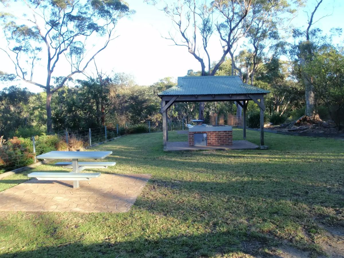
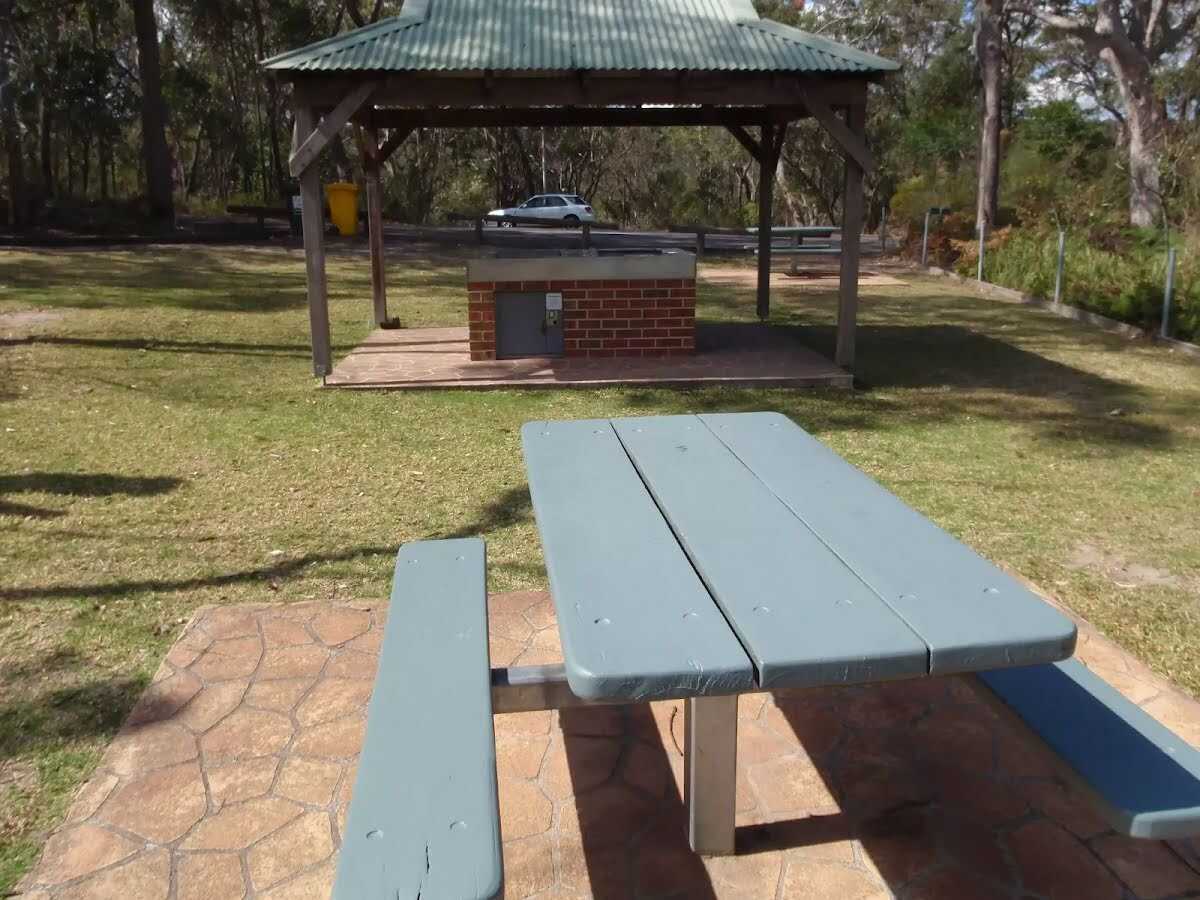
Girrakool picnic area is a wonderful family destination, just 5 minutes' drive from Kariong. The picnic area provides all the necessary facilities for a full day's activities, including barbecues, tables, shelters, water and toilets. National Park fees apply. The main picnic area is on the eastern side of the car park, and smaller, older picnic area is at the north-eastern corner of the car park. The southern Girrakool picnic area is located near the toilets. The picnic area is dedicated to John 'Jack' Higgs, the first superintendent of Brisbane Water National Park, and Mrs Vera Murdoch, who provided the funds. 'Girrakool' is an Aboriginal word meaning 'place of still waters'.
There is a sign (about 7 m back from the start).
After another 25 m pass the toilet (10 m on your left).
After another 60 m pass the BBQ (25 m on your left).
After another 100 m (from the Girrakool Loop Track) continue straight, to head along Girrakool Loop Track.
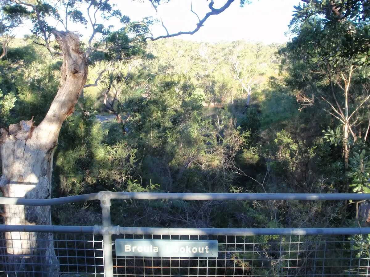
After another 15 m find the "Broula Lookout" (40 m on your left).
Broula Lookout is fenced and a fairly short walk down from the Girrakool picnic area. Over time, the trees in the area have grown, filtering what would otherwise be a great vantage point for the Piles Creek waterfall. Broula is an Aboriginal word referring to a place of trickling water.
After another 25 m (at the intersection of Girrakool Loop Track & Piles Creek Loop) turn left, to head along Piles Creek Loop.
After another 40 m find the "Illoura Lookout" (on your right).
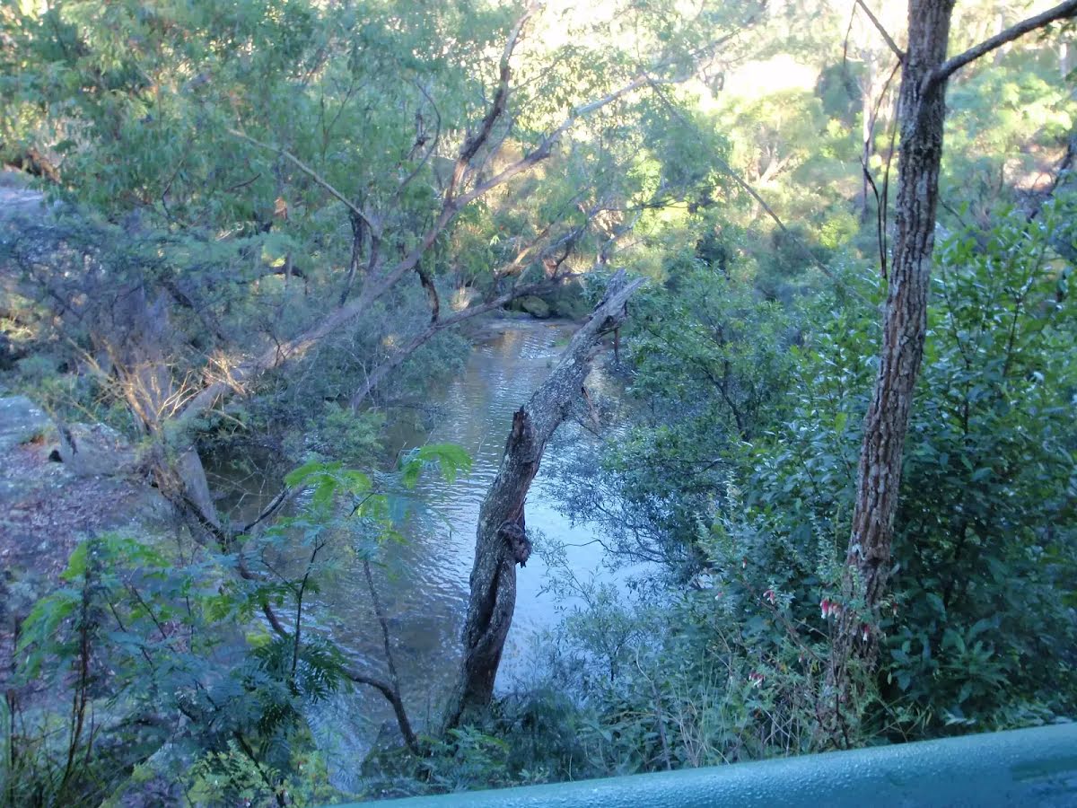
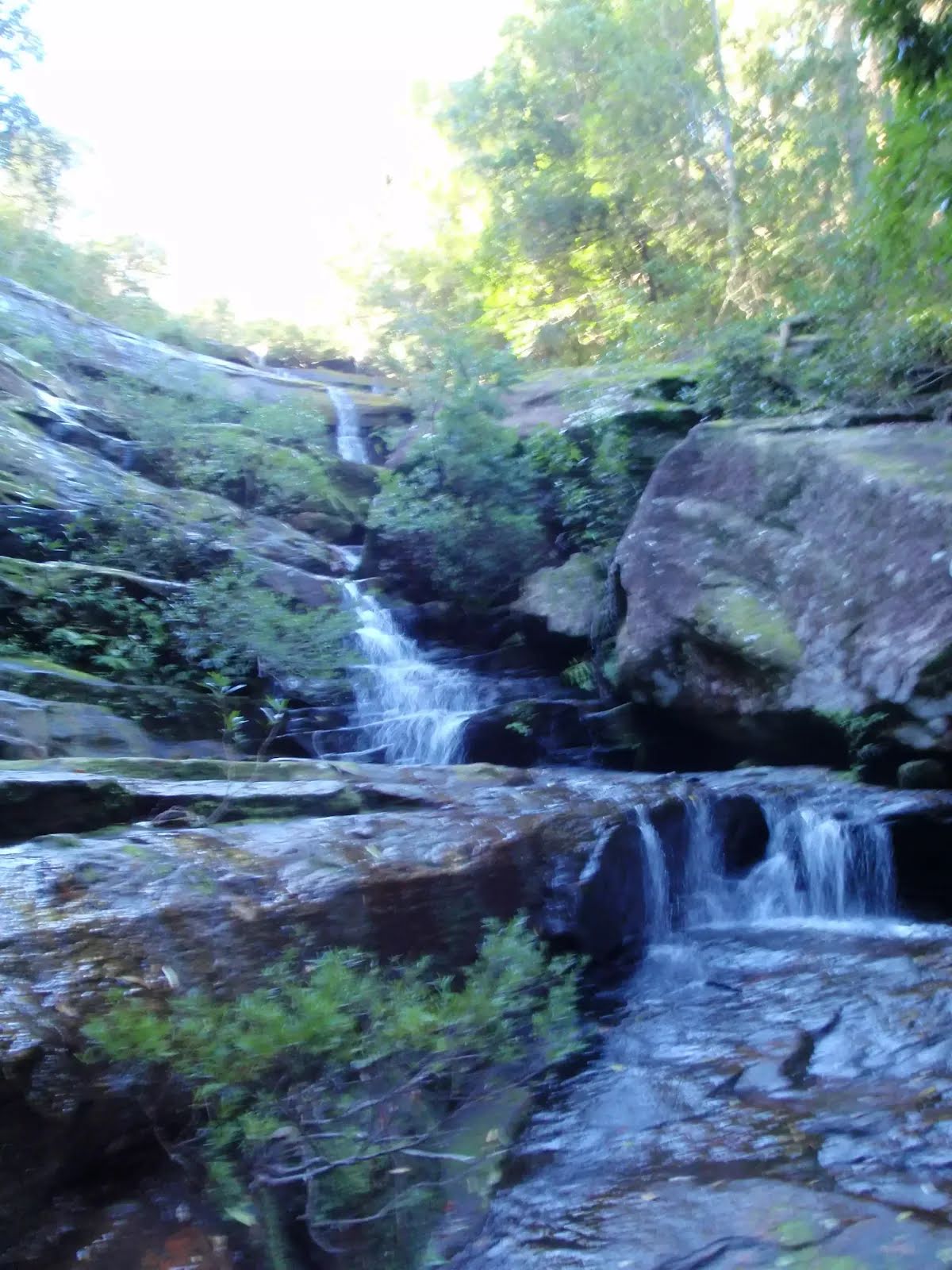
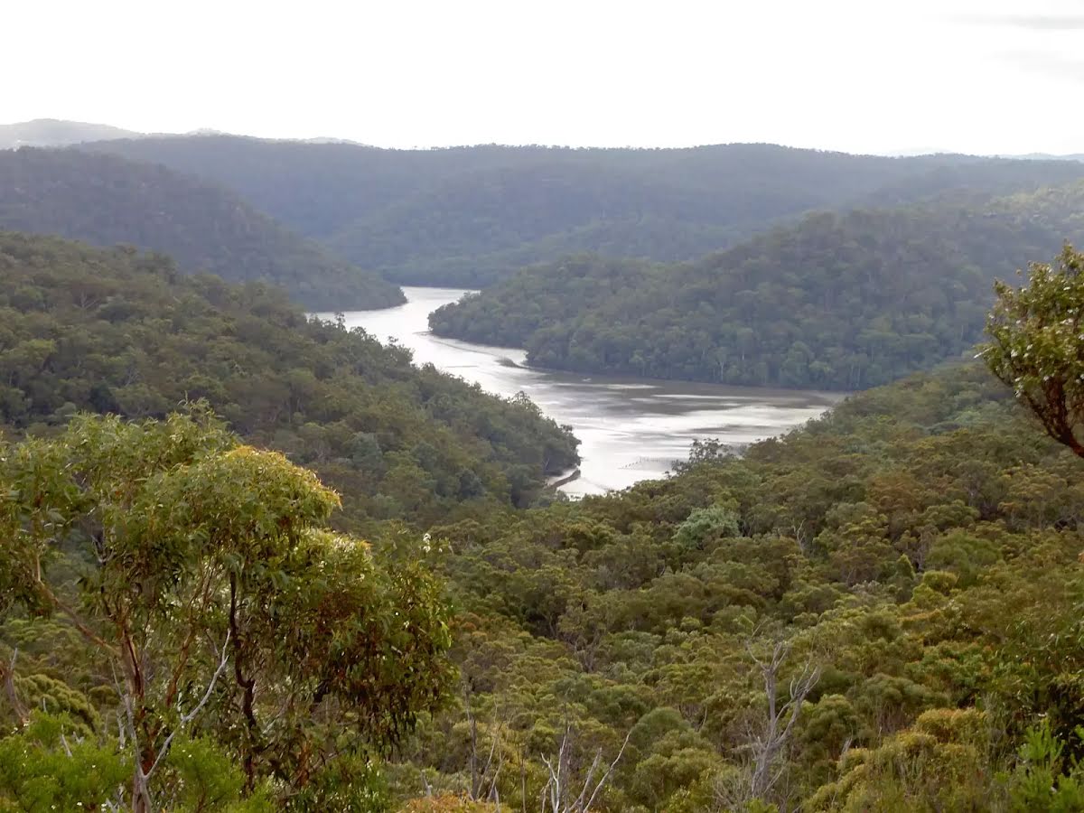
Illoura Lookout, Brisbane Water National Park, can be found a short walk south-west of the Girrakool picnic area, following the Great North Walk sign. This lookout provides a filtered view up and down the Leask and Piles Creek junction. There is a view of a waterfall from Piles Creek. Illoura is an Aboriginal word referring to a pleasant or peaceful place.
After another 7 m (from the Piles Creek Loop) continue straight, to head along Piles Creek Loop.
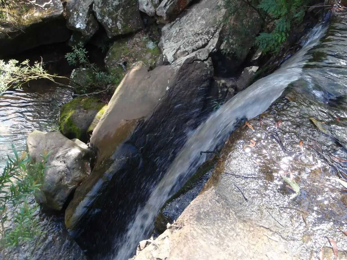
After another 20 m find the "Piles Creek Waterfall" (on your right).
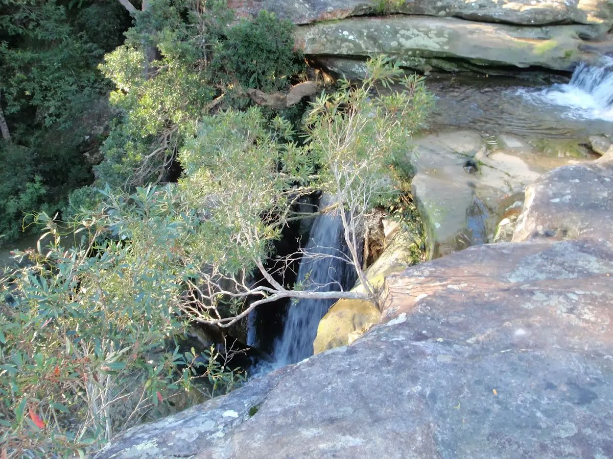
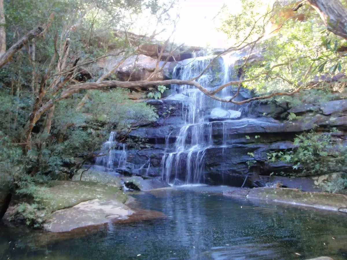
The large waterfall on Piles Creek is south of Girrakool Picnic Area in Brisbane Water National Park. At the Piles Creek Loop track crossing at the top of the falls, there is a large rock platform. The cliff edge is unfenced and would be dangerous to approach for the view. The water falls down the large drop, into a big pool below. The 'Bundilla Lookout' on the other side of the valley provides the only square view onto the falls, but even this only witnesses the top half.
After another 910 m (from the Piles Creek Loop) continue straight, to head along Piles Creek Loop.
The starting point of an optional sidetrip. An optional side trip to Piles Ck Lookout. To start this optional side trip turn right here. On returning from this side trip turn left when you get back to this intersection. Details below.
After another 135 m (from the Piles Creek Loop) continue straight, to head along Piles Creek Loop.
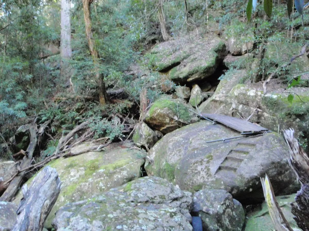
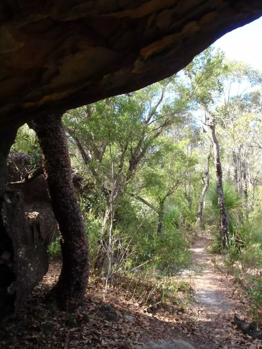
After another 150 m find the "Monolith Cave" (on your left).
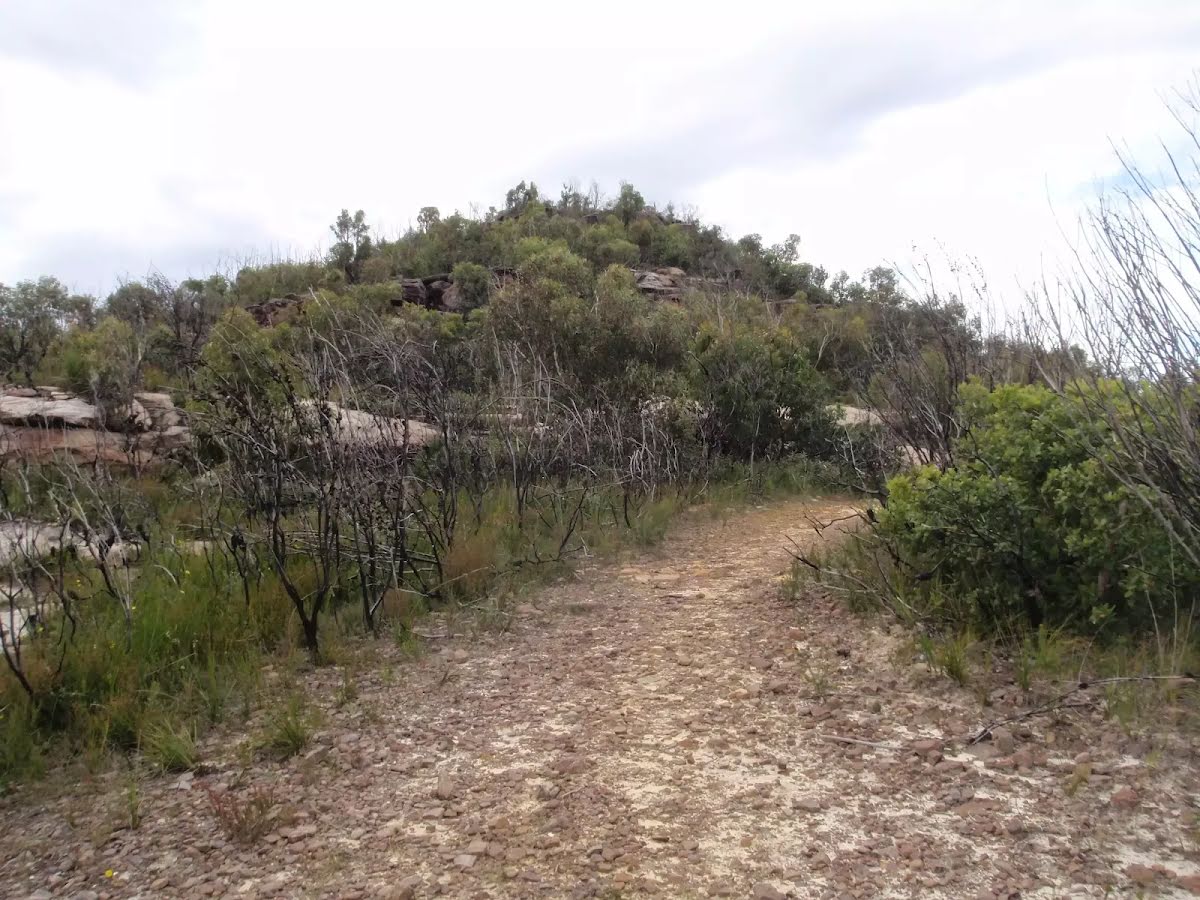
Monolith Cave is an informally named cave and interesting rock formation high on the ridge east of Piles Creek and North of Rat Gully in the Brisbane Water National Park. The cave is a fairly large sandstone overhang on the edge of the track. The cave provides shelter for walkers and is a great spot to rest and enjoy the area. This rock and the more Monolithic rock about 60m to the south are interesting to explore, and provide great views of the surrounding area. Take great care if exploring the rocks.
After another 390 m (from the Piles Creek Loop) turn left.
After another 1.3 km come to the viewpoint.
After another 305 m come to the viewpoint.
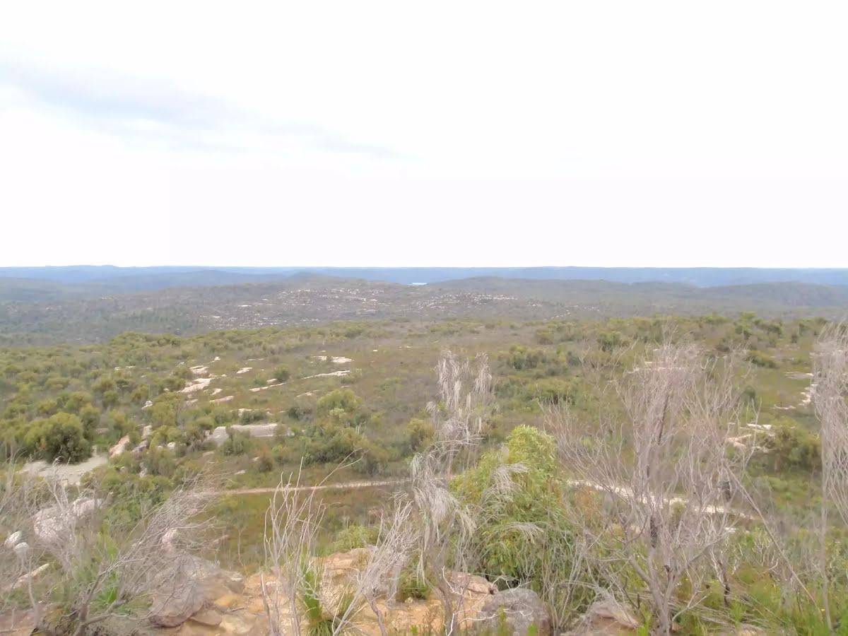
After another 1.4 km pass the "Scopas Peak" (25 m on your left).
After another 1.1 km (from the Rifle Range Firetrail) veer right, to head along Rifle Range Firetrail (a vehicle track).
After another 1.1 km come to the viewpoint.
After another 55 m (from the Rifle Range Firetrail) turn left (a walking track).
After another 20 m pass the sign (on your right).
After another 1.9 km veer right.
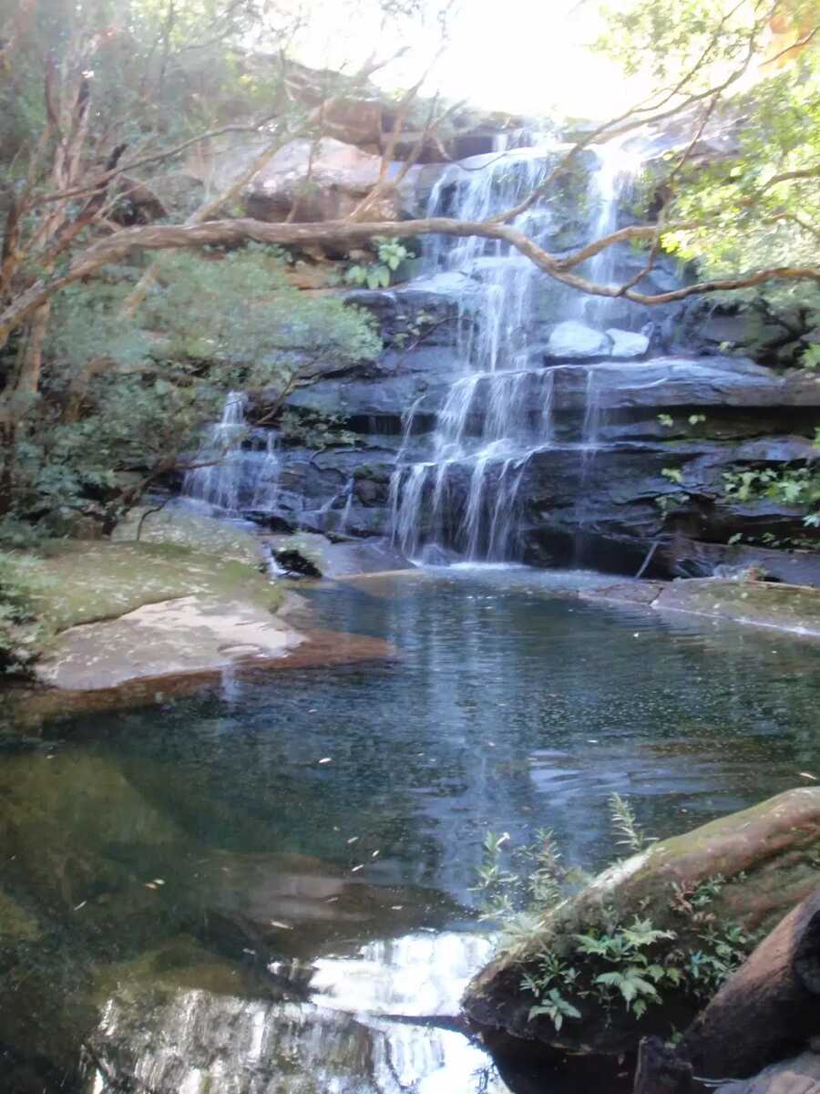
After another 15 m find the "Kariong Brook Falls" (on your right).
This tranquil spot of the Great North Walk is home to some lovely falls and a water hole. The eastern side of the creek has a tall sandstone cave and wall. After rain these falls can become very spectacular, other times is a cool place to rest. A great spot to stop for a snack.
Continue straight.
After another 640 m (from the Thommos Loop) veer right, to head along Thommos Loop (a vehicle track).
After another 15 m pass the "The Great North Walk" (on your left).
After another 1.5 km (from the Thommos Loop) continue straight (a walking track).
After another 810 m (from the Mullet Creek Firetrail) turn right, to head along Mullet Creek Firetrail (a vehicle track).
After another 215 m (from the Mullet Creek Firetrail) turn left (a walking track).
The starting point of an optional sidetrip. An optional side trip to Mt Wondabyne Peak. To start this optional side trip turn left here. On returning from this side trip turn left when you get back to this intersection. Details below.
After another 940 m continue straight.
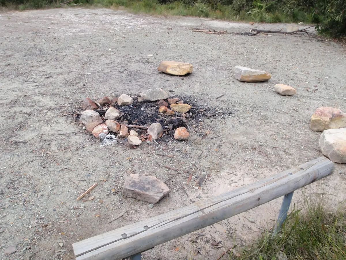
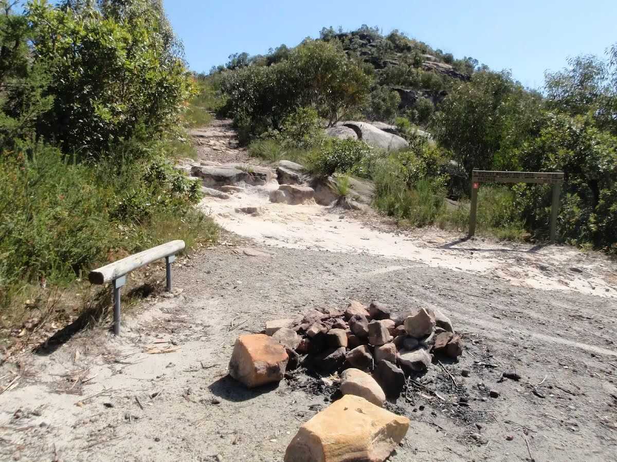
After another 145 m come to the "Mt Wondabyne Campsite".
This basic campsite is found at the end of a management trail, near the base of Mt Wondabyne. The campsite is at the bottom of a small (east facing) rock wall and has trees surrounding much of the area, providing some shelter. There is an established fire circle and a basic seat. There is no water or other facilities. (There is also small cave suitable for sleeping a few people about half way up Mount Wondabyne).
After another 700 m (at the intersection of Tunnel Trail & Mount Wondabyne Trig Firetrail) turn right, to head along Tunnel Trail.
After another 470 m (at the intersection of Rocky Ponds Trail & Tunnel Trail) continue straight, to head along Tunnel Trail.
After another 150 m (at the intersection of Tunnel Trail & Dillons Trail) turn left, to head along Dillons Trail (a walking track).
After another 25 m (at the intersection of Dillons Trail & Dillons Firetrail) turn left, to head along Dillons Firetrail (a vehicle track).
After another 1.3 km (at the intersection of Dillons Firetrail & Old Balast railway) continue straight, to head along Dillons Firetrail.
After another 360 m head through/around the gate.
After another 35 m (at the intersection of Nagari Road & Dillons Firetrail) veer left, to head along Nagari Road (a vehicle track).
After another 1000 m head through/around the gate.
Mo-Fr 07:00-17:00 Sa-Su 08:00-16:00
After another 15 m (from the Nagari Road) continue straight, to head along Nagari Road.
After another 490 m (from the Railway Street) continue straight, to head along Railway Street (a highway|tertiary).
After another 30 m (from the Railway Street) continue straight, to head along Railway Street.
After another 100 m (from the Railway Street) continue straight, to head along Railway Street.
After another 40 m cross the bridge (about 30 m long)
After another 305 m (at the intersection of Hillview Street & Railway Street) continue straight, to head along Railway Street.
After another 390 m (at the intersection of MacArthur Parade & Railway Street) continue straight, to head along Railway Street.
After another 400 m (at the intersection of Rawson Road & Railway Street) continue straight, to head along Railway Street (a road).
After another 380 m (at the intersection of Melba Street & Railway Street) continue straight, to head along Railway Street.
After another 230 m (at the intersection of Railway Street & Ocean Beach Road) continue straight, to head along Railway Street.
After another 145 m (at the intersection of Station Street & Railway Street) continue straight, to head along Railway Street.
After another 115 m (from the Railway Street) continue straight, to head along Railway Street.
After another 120 m pass the car park (6 m on your left).
About 220 m past the end is "McDonald's".
Continue straight.
After another 130 m come to the end.
About 15 m past the end is "Disabled Parking".
About 45 m past the end is a car park. This car park is wheelchair accessible.
An optional side trip to Piles Ck Lookout.
Turn map
Directions & comments
Start.
After another 25 m come to "Piles Creek Lookout".
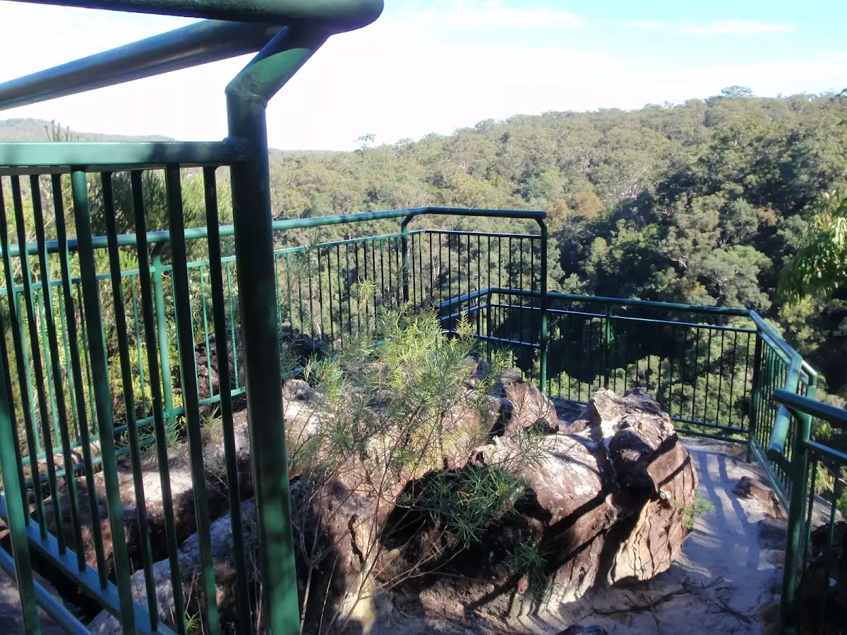
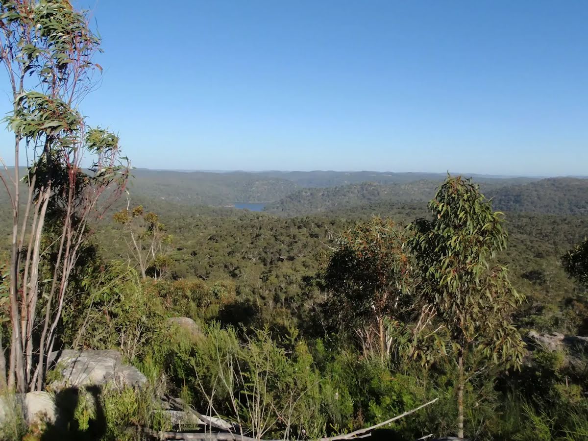
Piles Creek lookout (not formally named), Brisbane Water National Park, sits high on the ridge, east of Piles Creek and north of Rat Gully. This lookout provides views over the Piles Creek valley and can be enjoyed from behind a fence. The valley is surprisingly steep at this point and the views downstream are quite extensive.
Continue another 0 m to find Piles Creek Lookout at the end.
"Piles Creek Lookout".
Turn around and retrace your steps back the 25 m to the main route.
An optional side trip to Mt Wondabyne Peak.
Turn map
Directions & comments
Start.
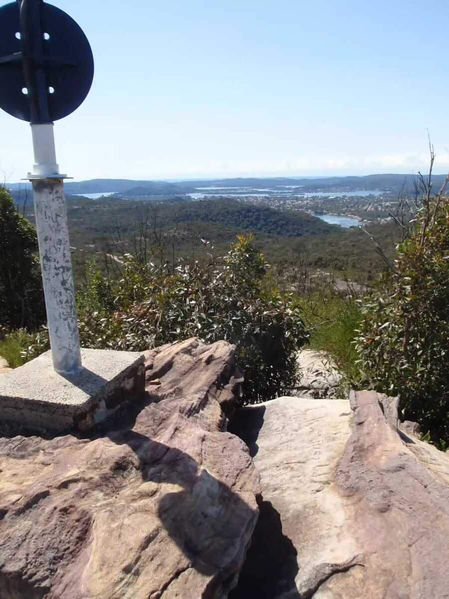
After 195 m find the "Mt Wondabyne" (5 m on your left).
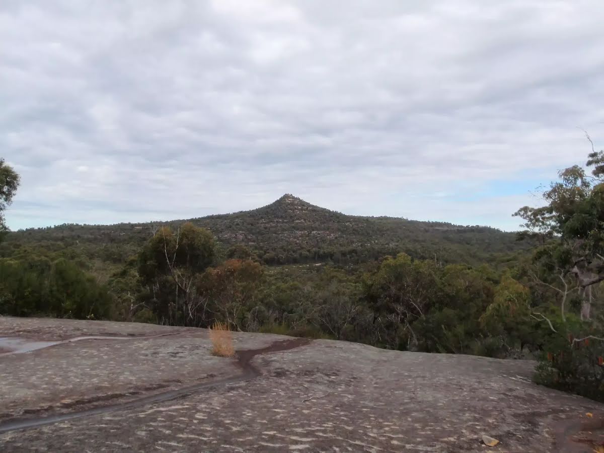
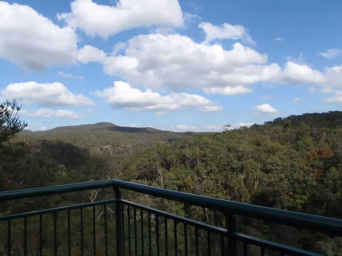
Mount Wondabyne is one of the most prominent peaks in Brisbane Water National Park. The long cone-shaped hill has a rocky top and is home to a trig station. Walkers can enjoy full 360-degree panoramic views from the top. To the east are good views over the Brisbane Water, Woy Woy and other central coast suburbs. West, down next to Mullet Creek, you can see some buildings near Wondabyne Station and the train line. Otherwise, most of the expansive views are over much of Brisbane Water National Park. There are some small trees providing limited shade, a great place to soak up the views.
After another 20 m come to the end.
"Mount Wondabyne".
Turn around and retrace your steps back the 215 m to the main route.
Girrakool to Woy Woy station via Mt Wondabyne
Grading
Class 4/6
Hard track
Length
20.3 km
Time
7 h 30 min to 8 h 30 min
Quality of track
Rough track, where fallen trees and other obstacles are likely (4/6)
Gradient
Very steep (4/6)
Signage
Minimal directional signs (4/6)
Infrastructure
Limited facilities, not all cliffs are fenced (3/6)
Partly cloudy. High chance of showers, most likely during this afternoon and evening. The chance of a thunderstorm from late this morning, possibly severe. Winds north to northwesterly 15 to 25 km/h becoming light in the evening. Daytime maximum temperatures between 17 and 21.
UV Alert: Sun protection not recommended, UV Index predicted to reach 2 [Low]
Monday 7 July
8°C → 18°C
Partly cloudy. 20% chance of rain
Partly cloudy. The chance of fog about the Upper Hunter in the early morning. Slight chance of a shower. Light winds becoming westerly 15 to 25 km/h in the morning. Overnight temperatures falling to between 4 and 9 with daytime temperatures reaching between 13 and 18.
Tuesday 8 July
7°C → 19°C
Mostly sunny. 5% chance of rain
Mostly sunny. The chance of morning fog about the Upper Hunter. Winds northwesterly 20 to 30 km/h. Overnight temperatures falling to between 2 and 8 with daytime temperatures reaching between 14 and 19.
Wednesday 9 July
8°C → 20°C
Mostly sunny. 10% chance of rain
Mostly sunny. Winds northwesterly 15 to 25 km/h becoming light during the evening. Overnight temperatures falling to between 5 and 8 with daytime temperatures reaching between 15 and 19.
Closed areas: Somersby Falls walking track closed for upgrade Somersby Falls walking track, including access to the middle and bottom waterfalls will be closed from 30 June to 10 October 2025 while the track is upgraded.
The picnic area and carpark will remain open during the works.
Consider visiting the nearby Girrakool picnic area less than 5 minutes away which also has waterfalls, walking tracks and a well established picnic area. Penalties apply for non-compliance. For more information, contact the local NPWS Central Coast Area Office on 02 4320 4200.
Closed areas: Partial closure Piles Creek Loop Walking Track Part of Piles Creek Loop Walking Track is closed while rockfall investigations and mitigation works are undertaken.
The closed area is between the suspension bridge and Bundilla Lookout on the western side of Piles Creek.
Areas that will remain open are:
Piles Creek Loop Walking Track on the eastern side of Piles Creek
Access to the Great North Walk from Girrakool Picnic Area
Bundilla Lookout
Barriers and signage are in place around the closed area. Penalties apply for non-compliance. For more information, contact the local NPWS office on 02 4320 4200.
Closed areas: Brieses fire trail partial closure The section of Brieses fire trail between Mooney Mooney Creek and Old Mooney Dam trail is closed until further notice due to a landslip, making it unsafe for vehicles.
Signs are in place around closed areas. This area will re-open as soon as it is safe and repair works have been completed. Penalties apply for non-compliance. For more information, contact the local NPWS office on 02 4320 4200.
Closed areas: Warrah Trig Road closed to vehicles Warrah Trig Road is closed to vehicles due to an increase in illegal activities throughout the area.
The road will remain closed until investigations are completed and further recommendations are made.
The road is open to pedestrians and cyclists.