| Turn map |
Directions & comments |
|
|

Start.

Then cross the bridge (about 20 m long)

There is a car park (about 20 m back from the start). This car park is wheelchair accessible.

Find the shelter at the start.

Find the seat at the start.
Find the shelter at the start.
|
|
|

After another 4 m turn right.
Then cross the bridge
Then pass the shelter (10 m on your right).
After another 15 m pass the car park (8 m on your right). This car park is wheelchair accessible.
Then pass the shelter (25 m on your right).
|
|
|

After another 4 m continue straight.

After another 7 m pass the pay phone (on your right).

Then pass the "The Falls Take-Away" (70 m on your right).
Then pass the car park (35 m on your right).
Then pass the "Coronation Park" (on your left).

After another 35 m pass the water tap (45 m on your left).

Then pass the toilet (50 m on your left)., male.
Then pass the toilet (50 m on your left). This toilet is wheelchair accessible.
|
|
|
Turn right.
After another 10 m pass a seat (about 8 m ahead).
|
|
|

From the Station Street turn left, to head along Station Street (a road).
After another 20 m pass the water tap (15 m on your left).
Then pass the toilet (25 m on your left).
07:00-17:00
Then pass the toilet (50 m on your left)., female.
|
|
|
At the intersection of Frost Lane & Station Street turn right, to head along Frost Lane (a vehicle track).
After another 10 m pass a seat (7 m on your right).
After another 8 m pass the "LoveBites Coffee Co - The Village" (15 m on your right).
|
|
|
From the Frost Lane turn left (a footpath).
After another 55 m pass the "Stockyard Carpark" (20 m on your left).
Then pass the "Blue Mist Cafe" (5 m on your right).
After another 15 m pass the "Canton Palace" (6 m on your right).
After another 10 m pass the "Fed" (6 m on your right).
After another 10 m pass a seat (60 m on your left).
|
|
|

Veer right.
After another 15 m pass the car park (about 35 m ahead).
After another 25 m pass the car park (70 m on your left).
After another 50 m pass the "Wenty Kebabs & Pizza" (30 m on your right).
After another 15 m pass the car park (45 m on your right).
After another 150 m pass the shelter (30 m on your right).

After another 20 m pass the playground (about 25 m ahead).
|
|
|
Turn left.
|
|
|
After another 3 m continue straight.
After another 20 m pass the toilet (5 m on your left).
Then pass a seat (30 m on your right).

After another 40 m pass the picnic table (35 m on your right).

After another 30 m pass the sign (on your right).
After another 70 m cross the bridge (about 9 m long)
|
|
|
After another 115 m continue straight.
|
|
|
After another 10 m turn left.
After another 45 m cross the bridge (about 9 m long)
After another 7 m cross the bridge (about 4 m long)
After another 95 m cross the bridge (about 30 m long)
|
|
|
After another 145 m continue straight.
|
|
|
After another 20 m continue straight.
|
|
|
After another 80 m continue straight.
|
|
|
After another 115 m veer right.
After another 25 m cross the bridge (about 7 m long)
|
|
|
After another 25 m continue straight.
After another 40 m cross the bridge (about 6 m long)
After another 35 m cross the bridge (about 15 m long)
|
|
|
After another 15 m turn left.
After another 10 m cross the bridge (about 9 m long)
After another 60 m cross the bridge (about 6 m long)
After another 55 m cross the bridge (about 7 m long)
|
|
|
After another 295 m turn right.
|
|
|

After another 245 m (at the intersection of Fletcher Street & Jamieson Street) veer left, to head along Fletcher Street (a residential road).
After another 335 m pass the "Myoori Park" (60 m on your left).
|
|
|
After another 120 m (from the Fletcher Street) turn left (a walking track).
After another 130 m pass the "Murray Park" (25 m on your right).
|
|
|
After another 4 m (from the The Avenue) continue straight.
|
|
|
After another 315 m (from the Falls Road) veer left, to head along Falls Road (a residential road).
|
|
|
After another 6 m (from the Falls Road) continue straight, to head along Falls Road.
After another 25 m pass the sign (25 m on your right).
|
|
|
After another 85 m (at the intersection of Sir H Burrell Drive & Wilson Street) turn right, to head along Sir H Burrell Drive (a service road).
After another 65 m pass the sign (7 m on your left).

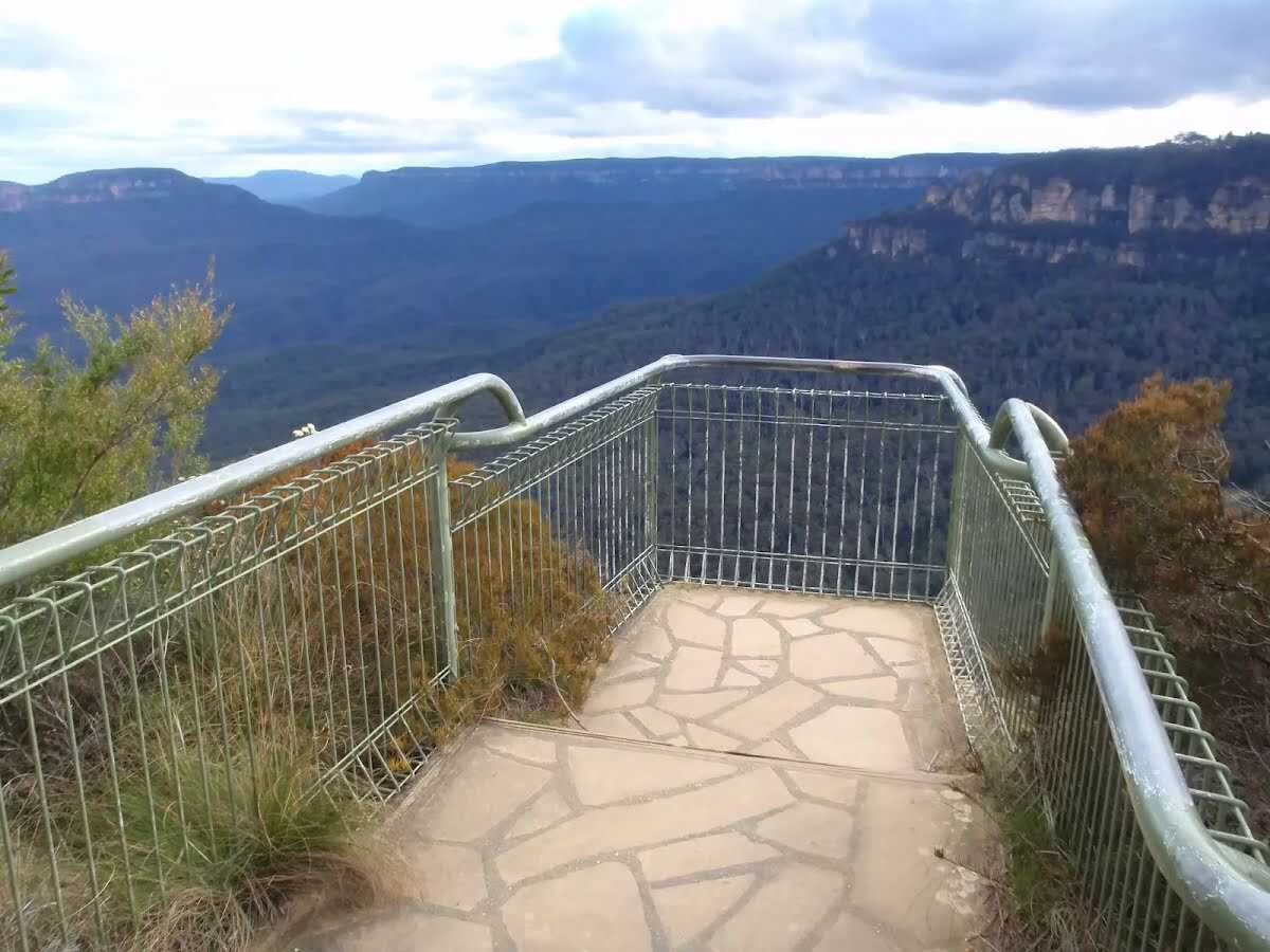
After another 8 m come to the "Wentworth Falls Lookout" (20 m on your left). This viewpoint is wheelchair accessible.
|
|
|
The starting point of an optional sidetrip. Side trip to Wentworth Falls Lookout. To start this optional side trip turn left here. On returning from this side trip veer left when you get back to this intersection. Details below.
From the Sir H Burrell Drive continue straight, to head along Sir H Burrell Drive.
Then pass a seat (10 m on your left).
Then find the "Wentworth Falls Lookout" (15 m on your left).
Then pass a seat (15 m on your left).
After another 20 m pass the "Wentworth Falls tracks and lookouts" (9 m on your left).
After another 10 m pass the sign (8 m on your left).
After another 55 m pass the sign (30 m on your left).
After another 70 m pass the sign (6 m on your left).
After another 55 m pass the shelter (45 m on your right).

After another 7 m pass the BBQ (50 m on your right).
After another 75 m pass the sign (8 m on your left).
|
|
|
From the Sir H Burrell Drive continue straight, to head along Sir H Burrell Drive.
After another 15 m find the "Jamison Lookout" (6 m on your left).
After another 30 m pass the picnic table (about 20 m ahead).
|
|
|
From the Sir H Burrell Drive turn right, to head along Sir H Burrell Drive.
After another 100 m pass the toilet (30 m on your right). This toilet is wheelchair accessible.
|
|
|
From the Sir H Burrell Drive turn left (a footpath).
|
|
|
After another 35 m (from the Short Cut Track) continue straight, to head along Short Cut Track (a walking track).
|
|
|
After another 390 m (from the Short Cut Track) continue straight, to head along Short Cut Track.
|
|
|
After another 40 m (from the Short Cut Track) continue straight, to head along Short Cut Track.
|
|
|
After another 150 m (from the Short Cut Track) veer right, to head along Short Cut Track.
|
|
|
After another 100 m (from the Short Cut Track) turn left.
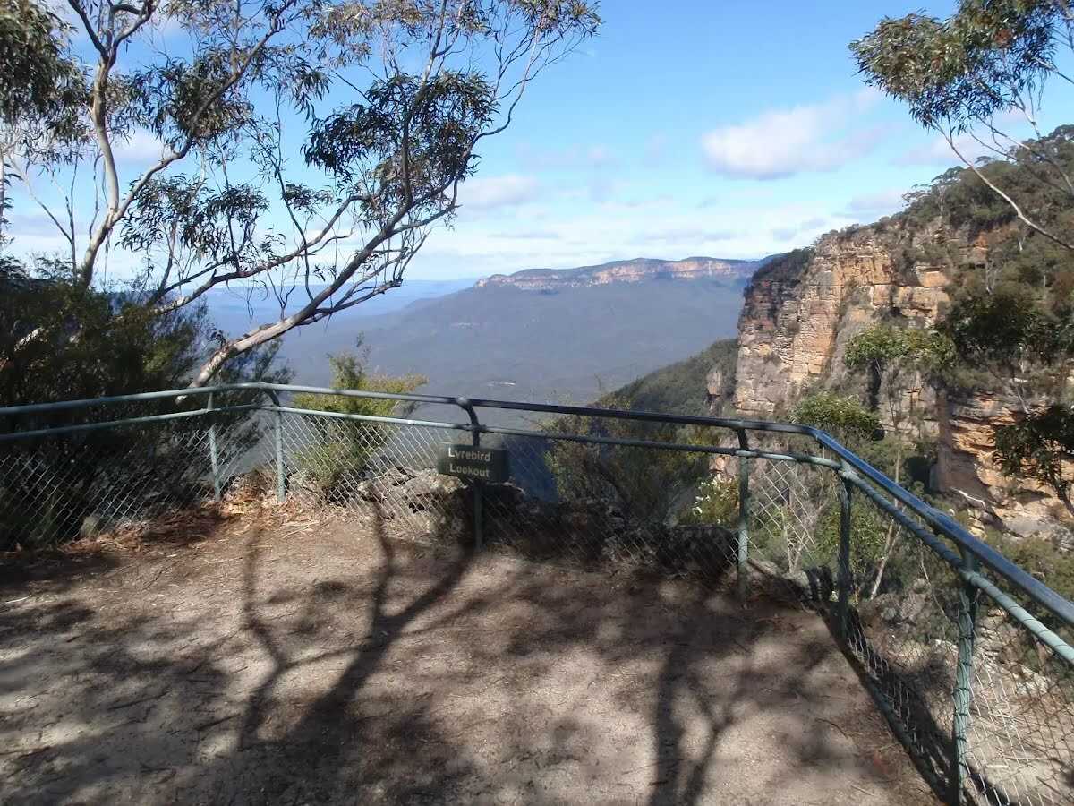
After another 295 m come to the "Lyrebird Lookout".
|
|
|

Lyrebird Lookout turn sharp right, to head along Overcliff Track.
After another 30 m find the "Lyrebird Lookout" (on your right).
|
|
|
After another 40 m (from the Overcliff Track) continue straight, to head along Overcliff Track.
After another 180 m pass the sign (on your left).
|
|
|
At the intersection of Valley of the Waters Track & Overcliff Track turn left, to head along Valley of the Waters Track.
After another 155 m pass the sign (on your left).
|
|
|
The starting point of an optional sidetrip. Side trip to Queen Victoria Lookout. To start this optional side trip continue straight here. On returning from this side trip turn left when you get back to this intersection. Details below.
From the Valley of the Waters Track turn right, to head along Valley of the Waters Track.
After another 5 m come to the viewpoint (25 m on your left).
After another 10 m find the "Queen Victoria Lookout" (20 m on your left).

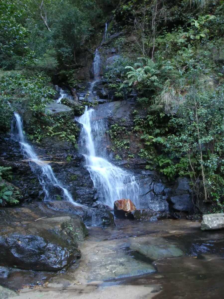
After another 55 m pass the "Edith Falls" (55 m on your left).
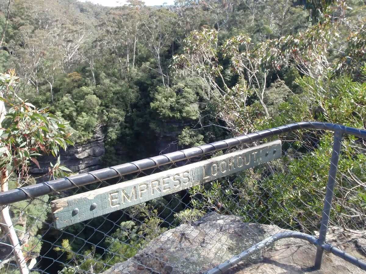
Then find the "Empress Lookout" (on your left).
Then find the "Lodore Falls" (40 m on your left).
|
|
|
From the Valley of the Waters Track turn right, to head along Valley of the Waters Track.
After another 10 m pass the sign (on your right).
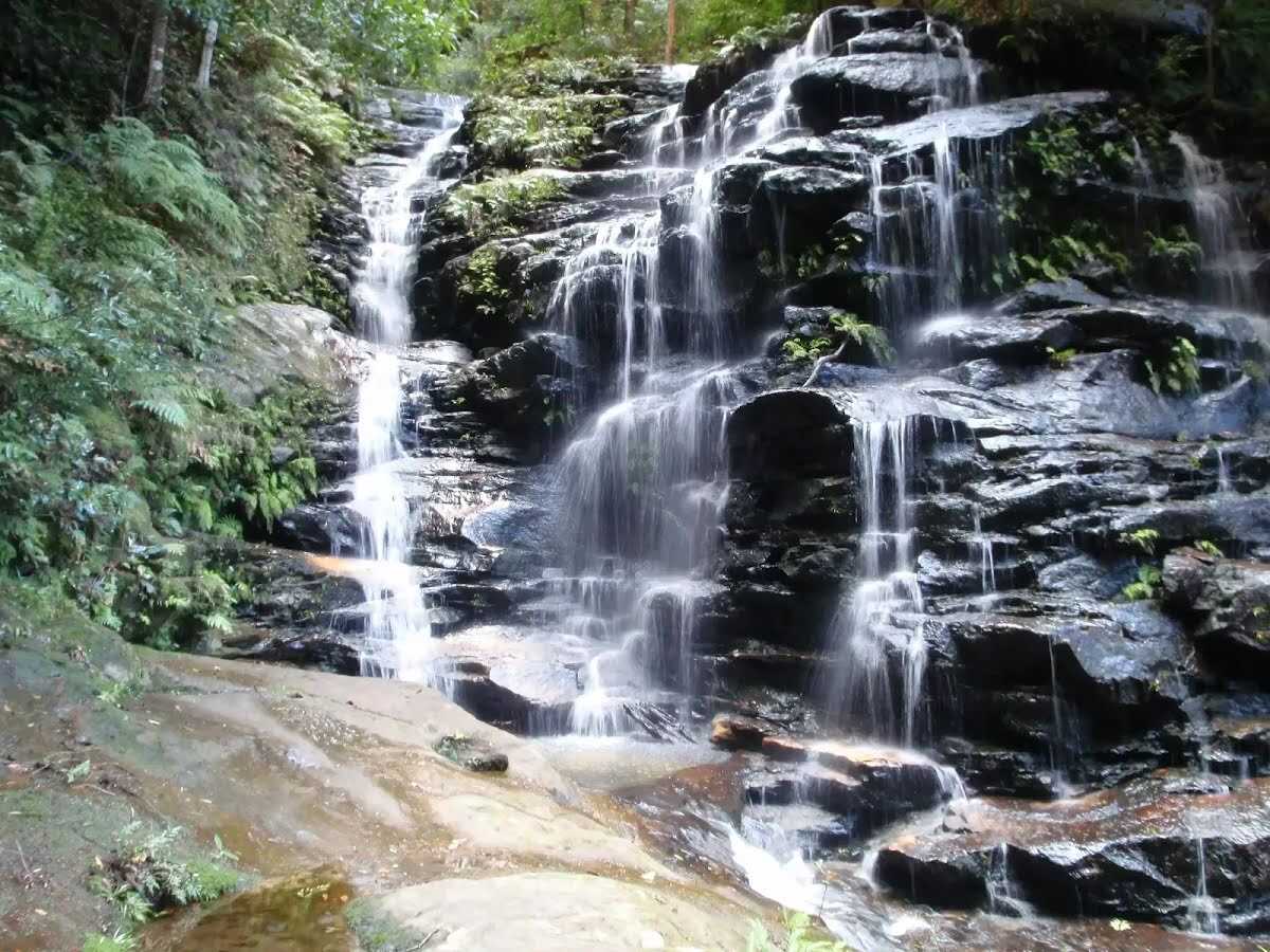
After another 20 m find the "Sylvia Falls" (35 m on your left).
|
|
|
After another 60 m (at the intersection of Nature Track & Valley of the Waters Track) continue straight, to head along Nature Track.
After another 25 m cross the bridge (about 3 m long)
Then pass the picnic table (on your right).
Then pass the "Isobel Falls" (10 m on your right).
After another 8 m pass the sign (on your right).
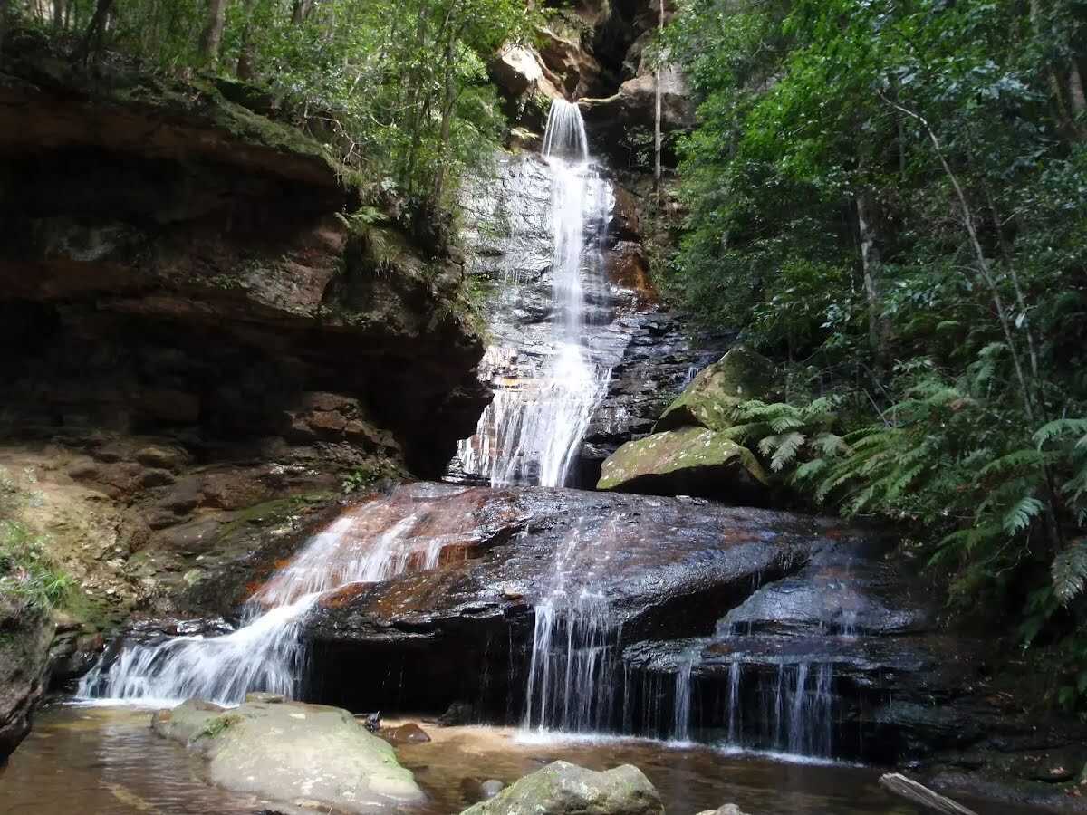
After another 55 m find the "Empress Falls" (45 m on your left).
|
|
|
After another 110 m (at the intersection of Grand Cliff Top Track & Nature Track) veer left, to head along Grand Cliff Top Track.
Then cross the Lillians Bridge (about 7 m long)
After another 1.1 km (at the intersection of Grand Cliff Top Walk & Inspiration Point Track) continue straight, to head along Grand Cliff Top Walk.
After another 125 m (from the Grand Cliff Top Walk) continue straight, to head along Grand Cliff Top Walk.

After another 360 m pass the artwork (65 m on your right).
|
|
|
After another 100 m continue straight.
After another 85 m pass the "Jamison's Restaurant" (60 m on your right).
Then pass the "Eucalypt Restaurant" (75 m on your right).
Then pass the "Embers Restaurant" (45 m on your right).
|
|
|
Continue straight.
After another 50 m pass the "Gasparini Fairground Organ" (30 m on your right).
After another 20 m pass the car park (65 m on your right).
|
|
|
After another 60 m turn right.

After another 25 m head through/around the gate.
|
|
|
Turn left.
|
|
|
After another 150 m veer left.
|
|
|
After another 80 m (from the Sublime Point Road) turn left, to head along Sublime Point Road (a residential road).
|
|
|
After another 7 m (at the intersection of Sublime Point Road & Watkins Road) turn left, to head along Sublime Point Road (a road).
|
|
|
After another 290 m (at the intersection of Sublime Point Road & Orchard Lane) continue straight, to head along Sublime Point Road.
After another 65 m pass the shelter (65 m on your right).
After another 155 m pass the shelter (50 m on your left).
|
|
|
After another 145 m (from the Sublime Point Road) continue straight, to head along Sublime Point Road.
|
|
|
After another 15 m (at the intersection of Sublime Point Road & Dundas Street) continue straight, to head along Sublime Point Road.
|
|
|
After another 190 m (from the Sublime Point Road) continue straight, to head along Sublime Point Road.
|
|
|
After another 25 m (at the intersection of Sublime Point Road & Willoughby Road) continue straight, to head along Sublime Point Road.
|
|
|
After another 40 m (from the Sublime Point Road) turn right (a walking track).
|
|
|
After another 75 m veer right.
|
|
|
After another 8 m turn left.
|
|
|
After another 180 m continue straight.
|
|
|
After another 65 m continue straight.
|
|
|

After another 20 m turn sharp left.
|
|
|
After another 30 m (from the Sublime Point Road) turn right, to head along Sublime Point Road (a road).
|
|
|
After another 60 m (at the intersection of Sublime Point Road & West Street) continue straight, to head along Sublime Point Road.
After another 490 m pass the shelter (55 m on your left).
Then pass a seat (on your left)., has a backrest.
Then pass the water tap (on your right).
|
|
|
After another 75 m continue straight.
After another 55 m pass the water tap (on your left).
Then pass the shelter (on your right).

Then head down the 53 rock steps (about 35 m long)
|
|
|
From the Copeland Pass continue straight.
Then cross the bridge (about 15 m long)
After another 35 m come to the "Sublime Point".

After another 35 m head up the 53 rock steps (about 35 m long)
|
|
|
From the Copeland Pass continue straight.
|
|
|
After another 90 m veer left.
|
|
|
After another 550 m continue straight.
|
|
|
After another 55 m turn right.
|
|
|
After another 6 m continue straight.
|
|
|
After another 25 m continue straight.
|
|
|
After another 50 m turn left.
|
|
|
After another 75 m veer right.
|
|
|
After another 75 m continue straight.
|
|
|
After another 35 m turn left.
|
|
|
After another 20 m continue straight.
|
|
|
After another 80 m (at the intersection of Carleton Road & Willoughby Road) turn left, to head along Carleton Road (a residential road).
|
|
|
After another 50 m (from the Carleton Road) turn left (a walking track).
|
|
|
After another 155 m (from the Grand Cliff Top Track) turn right, to head along Grand Cliff Top Track.
After another 65 m head down the 14 steps (about 20 m long)
After another 15 m head down the 12 steps (about 9 m long)
|
|
|
After another 2 m (from the Grand Cliff Top Track) continue straight.
After another 15 m come to the viewpoint (about 35 m ahead).
|
|
|
The starting point of an optional sidetrip. Side trip to Cliff Top Track Lookout. To start this optional side trip continue straight here. On returning from this side trip turn right when you get back to this intersection. Details below.
Turn right.
|
|
|
After another 10 m (from the Grand Cliff Top Track) continue straight, to head along Grand Cliff Top Track.
After another 20 m head down the 20 steps (about 8 m long)
After another 6 m head down the 10 steps (about 3 m long)
After another 20 m head down the 46 steps (about 20 m long)
After another 6 m cross the bridge (about 3 m long)
Then head up the 35 steps (about 20 m long)
After another 6 m head up the 37 steps (about 20 m long)
After another 60 m pass a "Leura Grand Clifftop WT" (on your right)., has a backrest.
Then head up the 9 steps (about 4 m long)
After another 10 m head up the 31 steps (about 15 m long)
After another 15 m head up the 55 steps (about 35 m long)
After another 15 m head up the 30 steps (about 20 m long)
After another 40 m head up the 33 steps (about 25 m long)
Then pass a "Pool of Siloam WT" (40 m on your right).
|
|
|
After another 35 m (at the intersection of Pool of Siloam Track & Grand Cliff Top Track) continue straight, to head along Pool of Siloam Track.
|
|
|
After another 5 m (from the Pool of Siloam Track) turn right, to head along Pool of Siloam Track.
Then find the "Golf Links Lookout" (on your left).
After another 195 m head down the 17 steps (about 15 m long)
Then pass the "Gordon Falls" (70 m on your left).
After another 15 m head down the 11 steps (about 10 m long)
After another 15 m head down the 93 steps (about 140 m long)

After another 5 m cross the stepping stones.
|
|
|
At the intersection of Pool of Siloam Track & Gordon Creek continue straight, to head along Pool of Siloam Track.
After another 9 m find the "Pool of Siloam" (about 20 m ahead).
Then head up the 67 earthen steps (about 15 m long)
Then come to the viewpoint (10 m on your right).
|
|
|
The starting point of an alternate access track. Alternate exit to get to Leura train station. Details below.
After another 5 m (at the intersection of Pool of Siloam Track & Lyrebird Dell Round Walk) continue straight, to head along Pool of Siloam Track.
Then head up the 25 rock steps (about 7 m long)
After another 7 m cross the stepping stones.
After another 20 m head up the 21 rock steps (about 8 m long)
After another 25 m head up the 19 earthen steps (about 7 m long)
Then head up the 252 rock steps (about 220 m long)
|
|
|
From the Pool of Siloam Track continue straight, to head along Pool of Siloam Track.
After another 60 m pass the sign (on your right).
|
|
|
From the Pool of Siloam Track continue straight, to head along Pool of Siloam Track.
After another 40 m pass the toilet (35 m on your right).
|
|
|
At the intersection of Prince Henry Cliff Walk & Pool of Siloam Track continue straight, to head along Prince Henry Cliff Walk.
After another 20 m pass the car park (20 m on your right).
Then find the "Gorden Falls Reserve" (15 m on your left).
After another 15 m pass the shelter (10 m on your right).
Then pass the BBQ (10 m on your right).
|
|
|
From the Prince Henry Cliff Walk turn left, to head along Prince Henry Cliff Walk.
After another 10 m pass a seat (5 m on your left)., has no backrest.
Then pass the picnic table (7 m on your left).
After another 6 m pass the shelter (on your right).
|
|
|
From the Prince Henry Cliff Walk veer left, to head along Prince Henry Cliff Walk.
After another 15 m pass the playground (20 m on your right).
After another 6 m pass the shelter (7 m on your right).
After another 110 m pass a "Gordon Falls Lookout" (about 70 m ahead).
|
|
|
From the Prince Henry Cliff Walk turn right (a steps).
Then head up the steps (about 8 m long)
After another 9 m pass the sign (on your right).
Then pass the "Gordon Falls" (on your left).
After another 20 m pass a seat (10 m on your left)., has a backrest.
|
|
|
After another 20 m turn left.
About 30 m past the end is a seat., has a backrest.
|
|
|

Continue another 0 m to find from the Lone Pine Avenue at the end.
|
| Turn map |
Directions & comments |
|
|
At the intersection of Lyrebird Dell Round Walk & Pool of Siloam Track Start heading along Lyrebird Dell Round Walk (a walking track).
Find the viewpoint at the start.
|
|
|
From the Lyrebird Dell Round Walk continue straight, to head along Lyrebird Dell Round Walk.
After another 20 m find the "Pool of Siloam" (on your right).
After another 80 m come to the viewpoint (70 m on your right).
After another 65 m come to the viewpoint (45 m on your right).
After another 15 m cross the bridge (about 2 m long)
After another 55 m cross the bridge (about 4 m long)
|
|
|
After another 20 m (from the Lyrebird Dell Round Walk) veer left, to head along Lyrebird Dell Round Walk.
After another 90 m pass the artwork (on your right).
|
|
|
After another 50 m (from the Lyrebird Dell Round Walk) continue straight, to head along Lyrebird Dell Round Walk.
|
|
|
After another 15 m (from the Lyrebird Dell Round Walk) veer left, to head along Lyrebird Dell Round Walk.
After another 9 m pass the "Lyre Dell WT Extn (West)" (6 m on your right).
|
|
|
After another 4 m (from the Lyrebird Dell Round Walk) turn left, to head along Lyrebird Dell Round Walk.
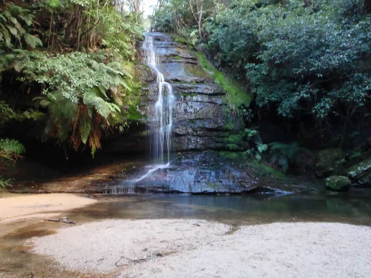
After another 10 m pass the waterfall (15 m on your right).
Then cross the bridge (about 6 m long)
|
|
|
From the Lyrebird Dell Round Walk veer left, to head along Lyrebird Dell Round Walk (a steps).
Then head up the 9 rock steps (about 85 m long)
Then pass the "Lyrebird Dell DUA" (70 m on your left).
After another 25 m pass a seat (on your left)., has a backrest.
|
|
|
At the intersection of Lone Pine Avenue & Lyrebird Dell Round Walk turn right, to head along Lone Pine Avenue (a vehicle track).
Then pass the sign (on your right).
|
|
|
From the Lone Pine Avenue continue straight, to head along Lone Pine Avenue.
After another 140 m pass the car park (40 m on your left).
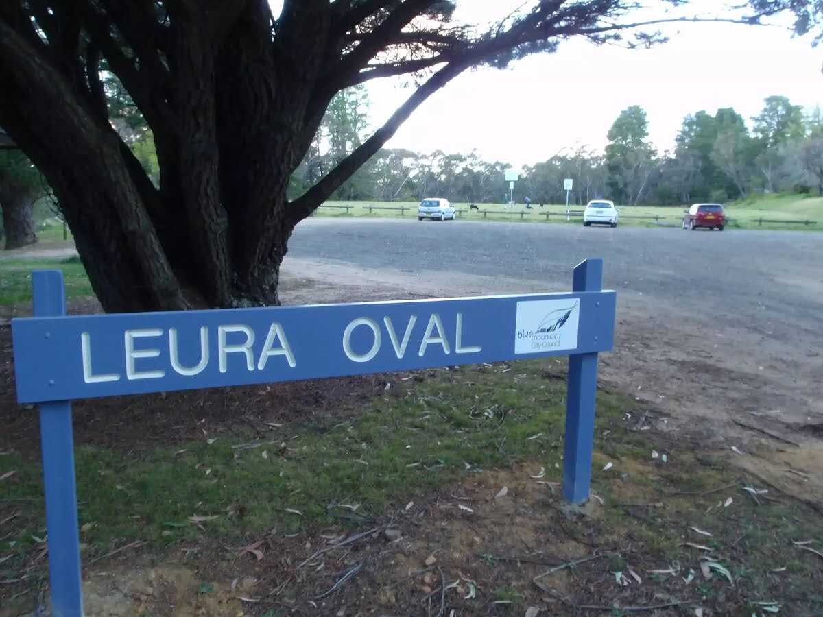
After another 6 m find the "Leura Oval" (55 m on your left).
After another 20 m pass the toilet (25 m on your left).
After another 70 m head through/around the gate.
Then pass the sign (on your left).
|
|
|
From the Lone Pine Avenue continue straight, to head along Lone Pine Avenue (a highway|living_street).
After another 50 m pass the "The Braes Heritage Estate" (15 m on your right).
|
|
|
From the Lone Pine Avenue continue straight, to head along Lone Pine Avenue.
After another 25 m pass the sign (6 m on your right).
After another 10 m pass a seat (5 m on your right)., has a backrest.
|
|
|
After another 40 m (from the Lone Pine Avenue) continue straight, to head along Lone Pine Avenue.
|
|
|
After another 15 m (at the intersection of Malvern Road & Lone Pine Avenue) continue straight, to head along Malvern Road (a residential road).
|
|
|
After another 55 m (at the intersection of Abbey Street & Malvern Road) turn right, to head along Abbey Street.
After another 570 m pass the shelter (65 m on your left).
After another 180 m pass the car park (about 80 m ahead).
|
|
|
From the Abbey Street turn left (a footpath).
|
|
|
After another 20 m turn right.
|
|
|
After another 8 m (from the Craigend Street) continue straight.
|
|
|
After another 9 m turn left.
After another 120 m pass a seat (65 m on your left)., has a backrest.
Then pass the picnic table (75 m on your left).
Then pass a seat (75 m on your left)., has a backrest.
Then pass the "Bloome Park" (40 m on your left).
|
|
|
Turn right.
After another 5 m pass the car park (15 m on your left).
|
|
|
After another 20 m continue straight.
|
|
|
Continue straight.
After another 45 m pass the car park (15 m on your left).
|
|
|
Continue straight.
After another 8 m pass the car park (15 m on your left).
|
|
|
After another 15 m continue straight.
After another 15 m pass the car park (on your left).
|
|
|
After another 25 m continue straight.
|
|
|
After another 10 m continue straight.
After another 45 m pass a seat (about 60 m ahead)., has a backrest.
Then pass the car park (about 35 m ahead).
|
|
|
Turn left.
After another 15 m pass the car park (on your left).
|
|
|
From the Leura Mall continue straight.
After another 6 m pass the car park (10 m on your left).
|
|
|
From the Leura Mall turn right, to head along Leura Mall (a road).
|
|
|
After another 10 m (at the intersection of Megalong Street & Leura Mall) turn left, to head along Megalong Street (a highway|primary).
|
|
|
After another 6 m (from the Megalong Street) continue straight, to head along Megalong Street.
After another 20 m pass the "Thai Square" (about 45 m ahead).
Then pass the car park (25 m on your left).
Then pass the shelter (20 m on your left).
|
|
|
From the Megalong Street turn right (a footpath).
After another 10 m pass the car park (65 m on your left).
After another 7 m pass a seat (5 m on your left).
|
|
|
Continue straight.
|
|
|
After another 10 m continue straight.
Then pass the "Cafe Leura" (35 m on your right).
|
|
|
Continue straight.
Then pass the "Landseer's of Leura" (30 m on your right).
Then pass a seat (25 m on your right).
After another 30 m pass the sign (25 m on your right).
|
|
|
Continue straight.
After another 15 m pass the car park (55 m on your right).
|
|
|
Continue straight.
After another 5 m pass the "The Wayzgoose Cafe" (30 m on your right).
After another 9 m pass the "Pizza Sublime" (9 m on your left).
Then pass the toilet (60 m on your right). This toilet is wheelchair accessible.
Then pass the car park (20 m on your right).
|
|
|
Continue straight.
|
|
|
After another 2 m continue straight.
After another 15 m pass the car park (75 m on your right).
After another 10 m pass the cafe (50 m on your left).
After another 15 m pass the toilet (40 m on your right). This toilet is wheelchair accessible.
After another 10 m pass a seat (25 m on your right).
|
|
|
Continue straight.
After another 10 m pass the car park (on your right).
After another 20 m pass a seat (25 m on your right).
Then pass the "Leura Gourmet Cafe & Deli" (6 m on your left).
Then pass the water tap (25 m on your right).
|
|
|
Continue straight.
After another 8 m pass the "The Laneway" (60 m on your right).
Mo-Fr 06:30-14:00
After another 40 m pass the "Leura Chinese Restaurant" (6 m on your left).
After another 15 m pass the "The Red Door Cafe" (35 m on your right).
|
|
|
Continue straight.
After another 10 m pass the "Leura Village Takeaway" (6 m on your left).
Then pass a seat (20 m on your right).
After another 10 m pass the car park (20 m on your left).
Then pass the "Polar Bear Of Leura" (5 m on your left).
After another 15 m pass the "The BLU Baked Goods" (6 m on your left).
Then pass the "Mr Collins of Leura" (35 m on your right).
Then pass the car park (on your right).
|
|
|
Continue straight.
|
|
|
After another 6 m turn right.
Then pass the "Sparrows Cafe" (about 40 m ahead).
|
|
|
Turn left.
After another 15 m pass the pay phone (6 m on your left).
|
|
|
Continue straight.
|
|
|
After another 4 m (from the Railway Parade) continue straight.
Then pass the "Kiss and Ride" (10 m on your left).
|
|
|
Veer right.
Then pass the shelter (on your left).
Then head down the steps (about 3 m long)
|
|
|
After another 2 m continue straight.
Then pass the car park (30 m on your right).
Then cross the bridge (about 25 m long)
Then pass the "Jiggle Korean BBQ" (35 m on your right).
|
|
|
Turn left.
Then cross the bridge (about 15 m long)
Then pass the sign (on your right).
|
|
|
Continue straight.
Then pass a seat (5 m on your right).
After another 15 m head up the steps (about 10 m long)
About 55 m past the end is a toilet.
Mo-Fr 05:35-16:00
About 55 m past the end is "The Bunker".
About 70 m past the end is a car park.
About 25 m past the end is a shelter.
About 45 m past the end is a toilet. This toilet is wheelchair accessible.
Mo-Fr 08:00-17:00
, female.
About 30 m past the end is a pay phone.
|
|
|
The end.
|