St Johns Lookout

5 min to 10 min

270 m
return

↑ 25 m
↓ -25 m

Smooth & flat
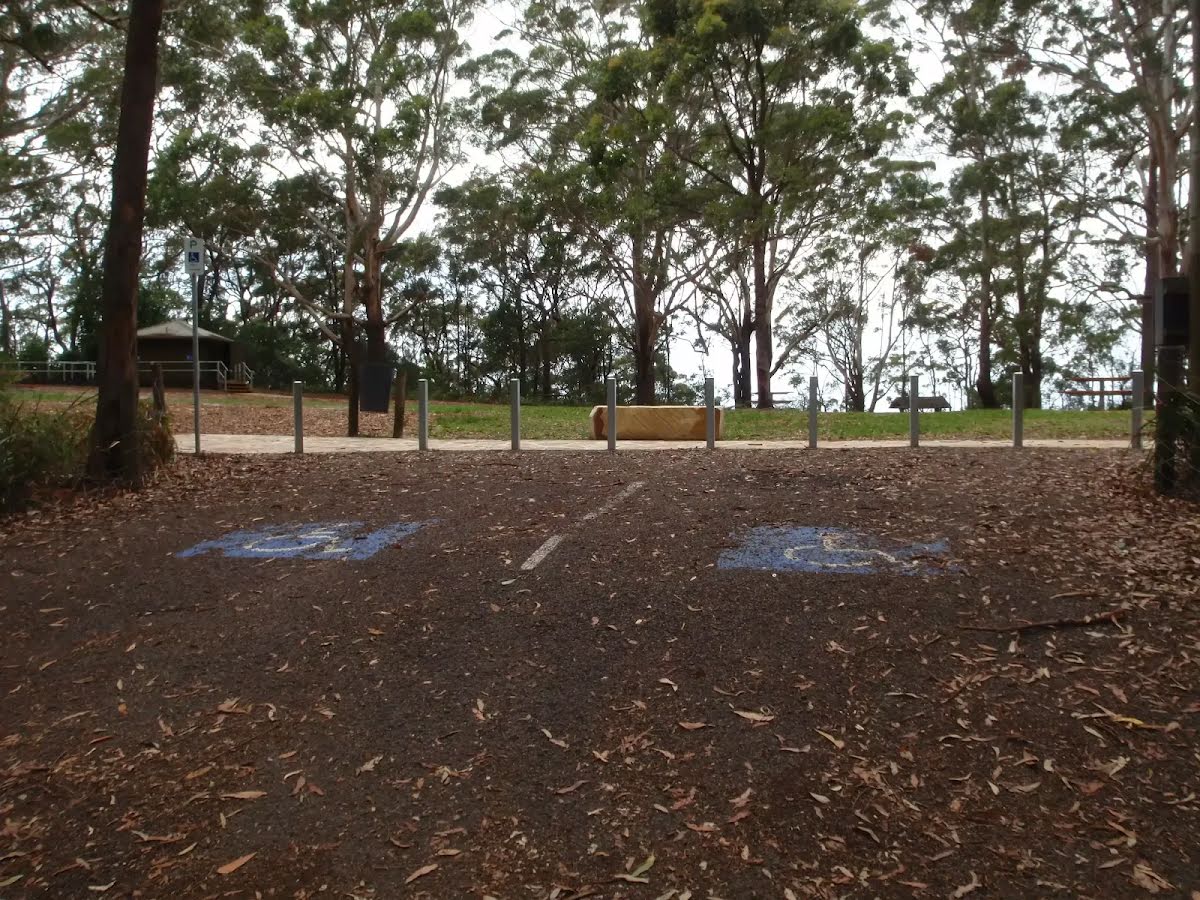
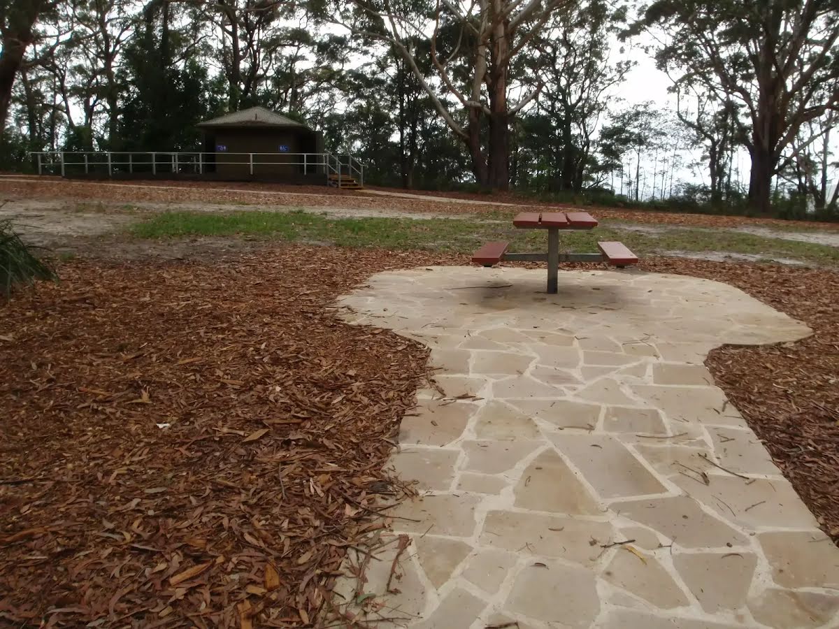
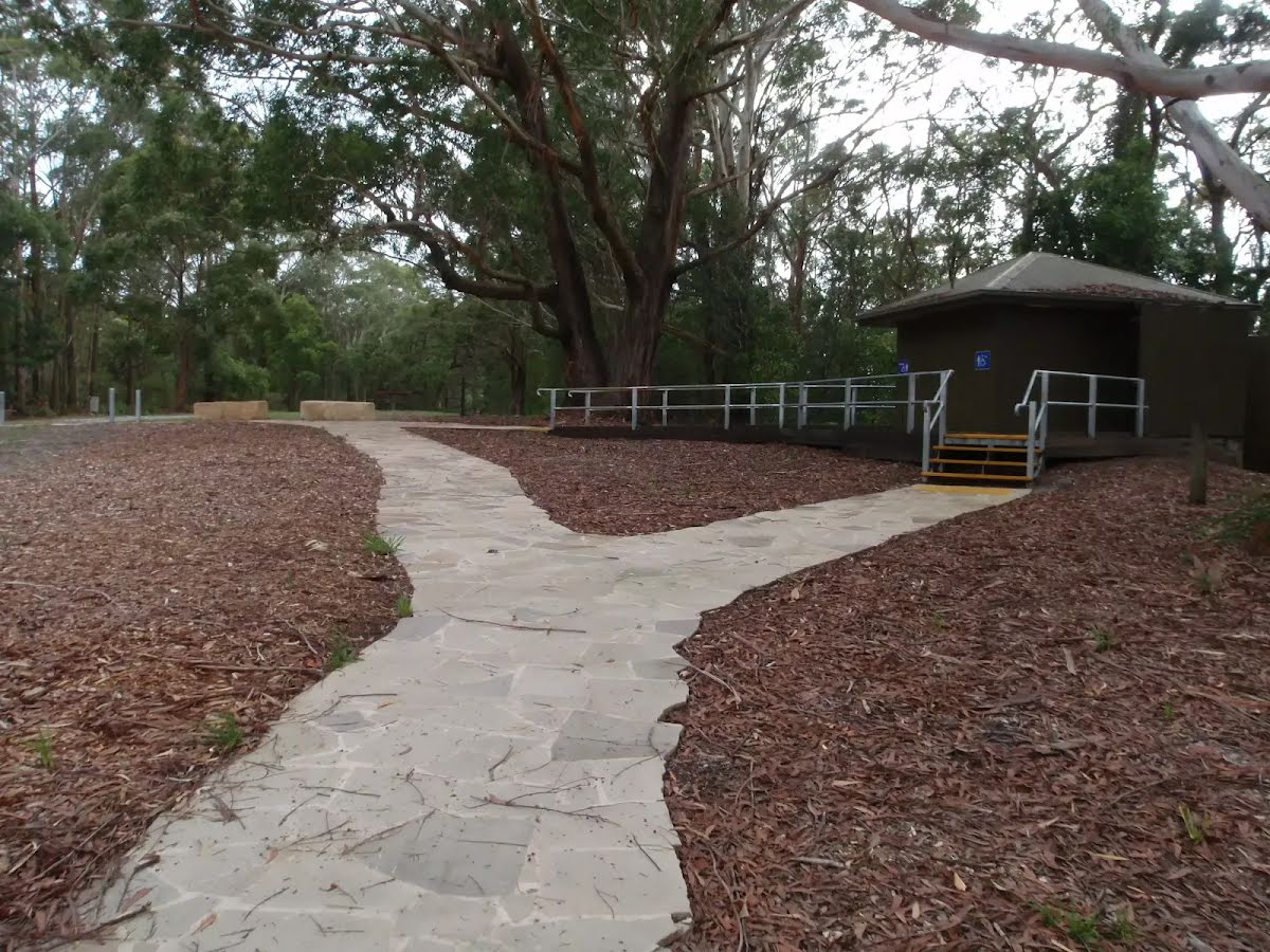
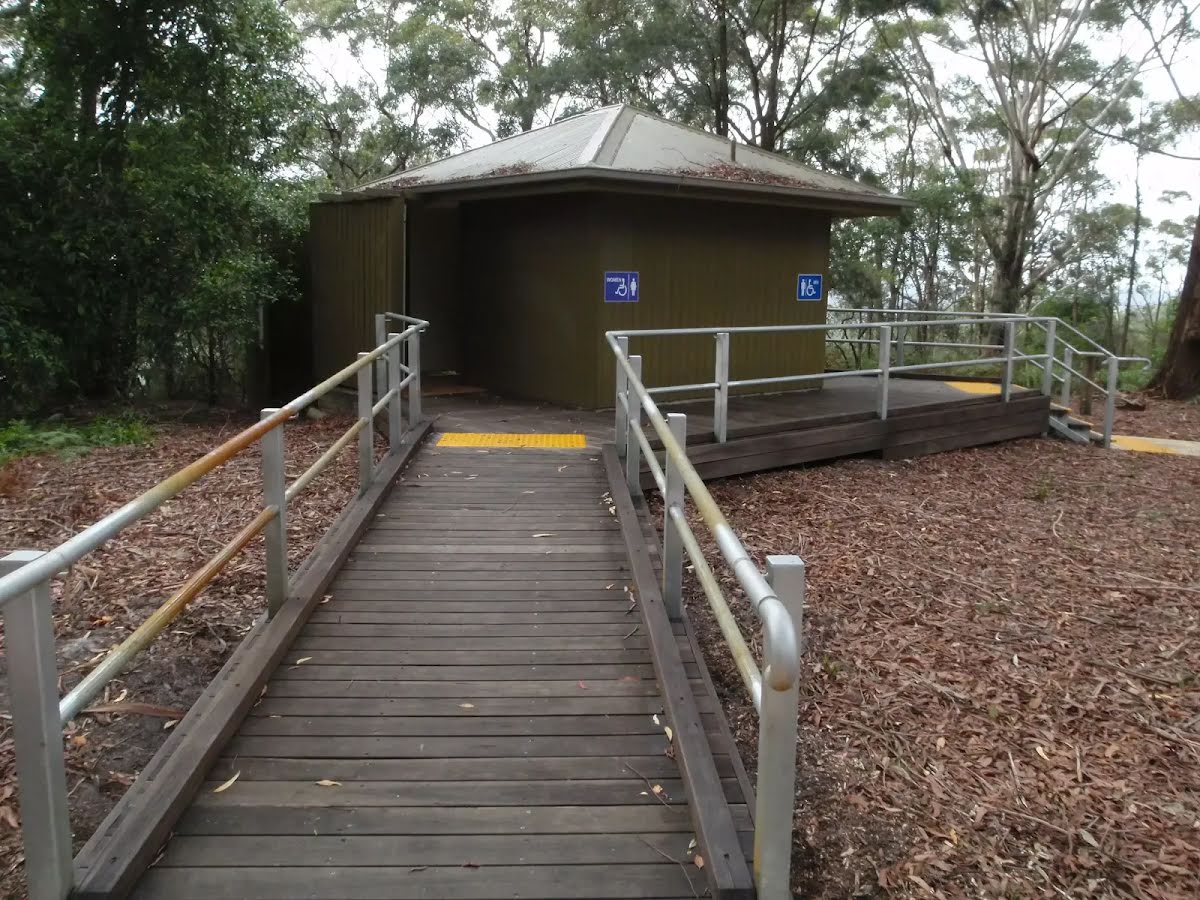
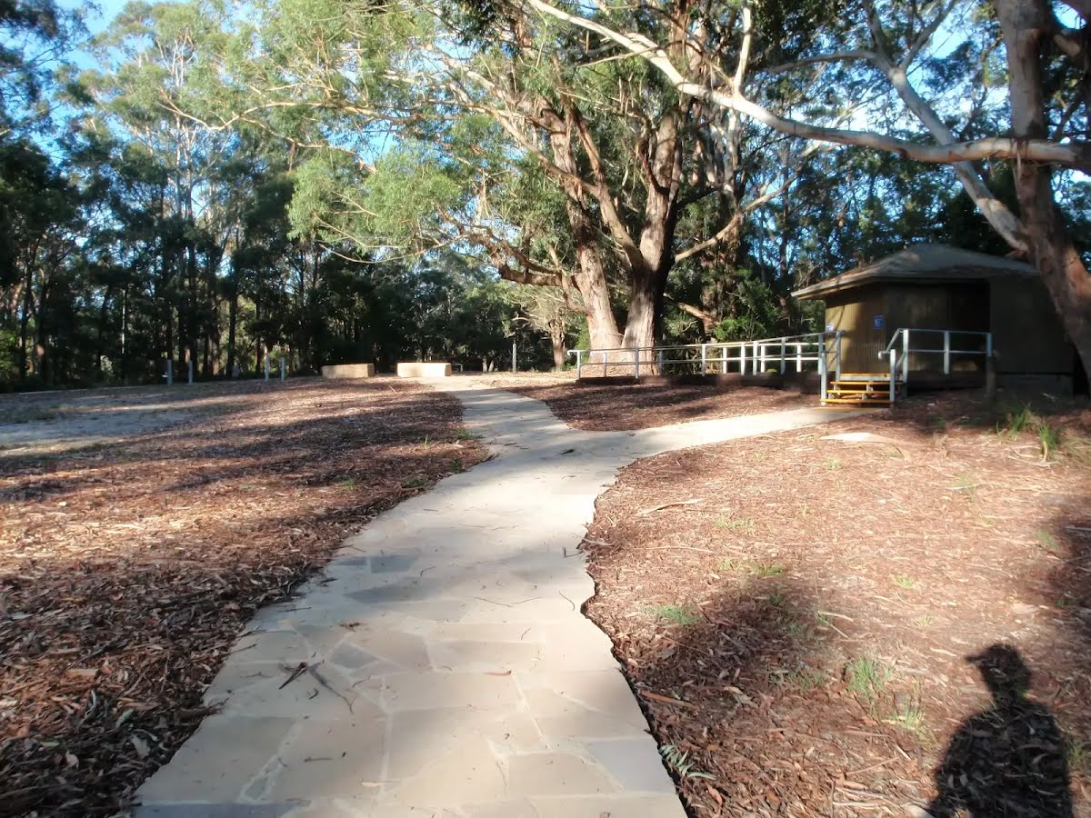
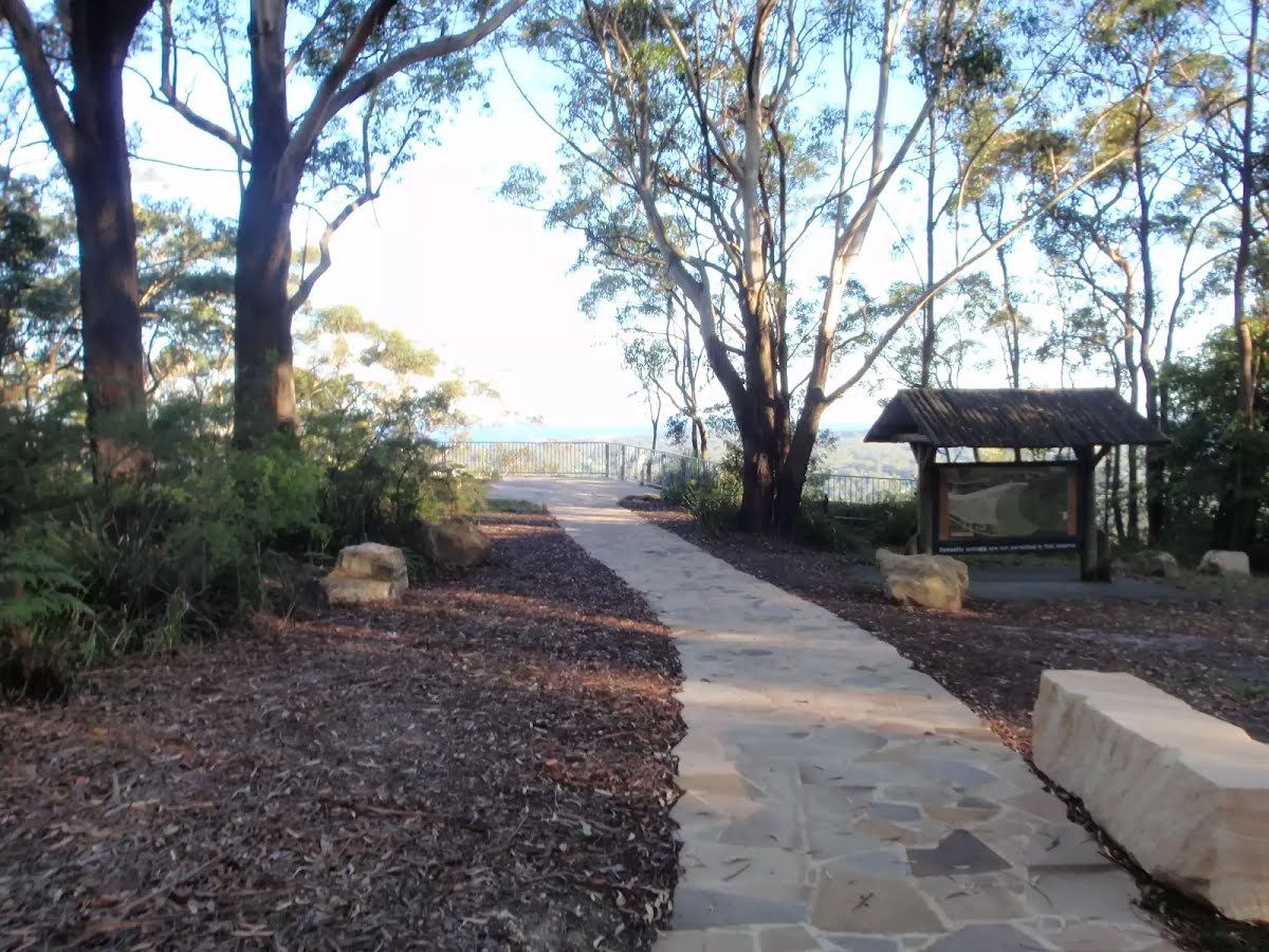
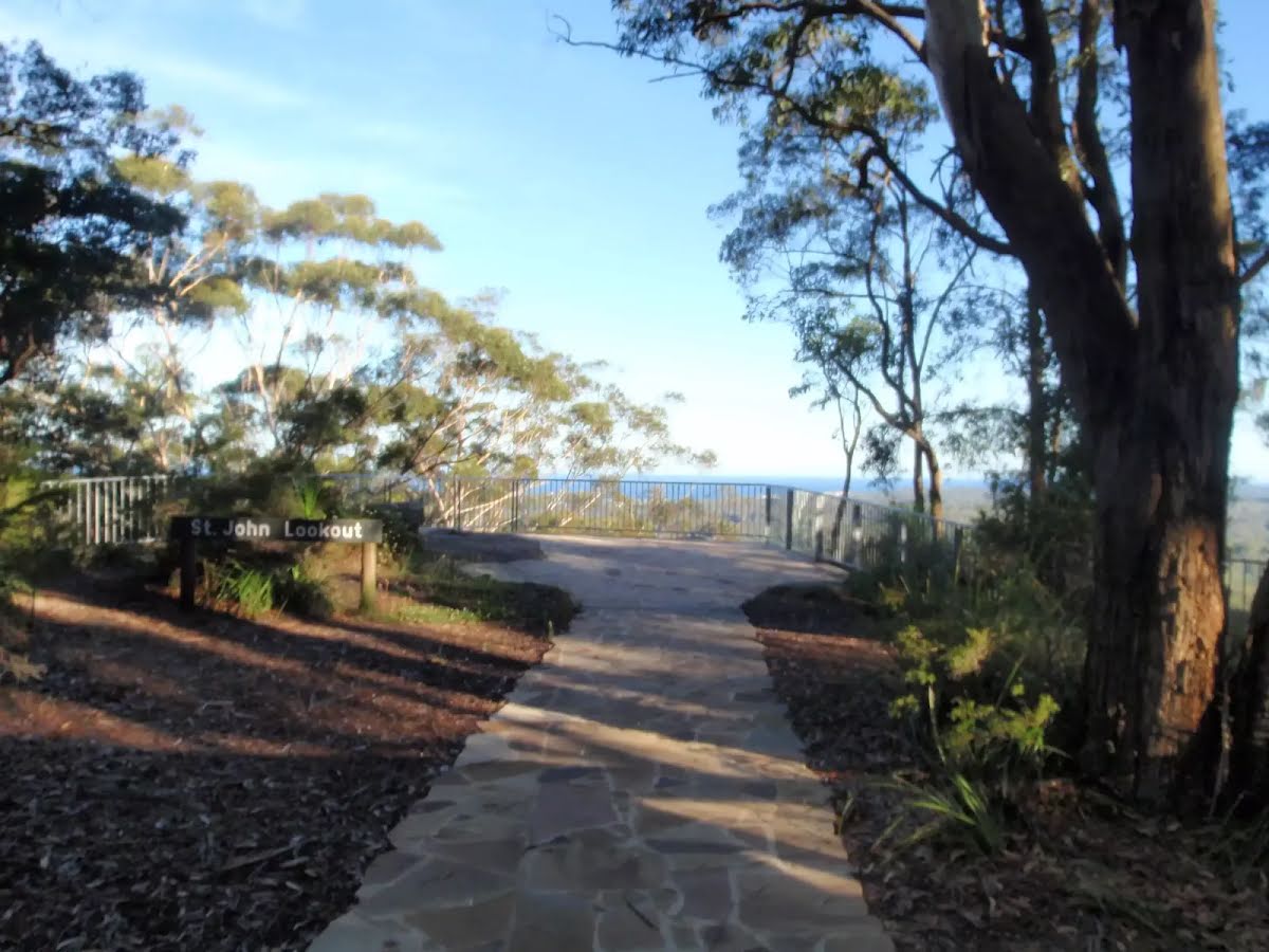
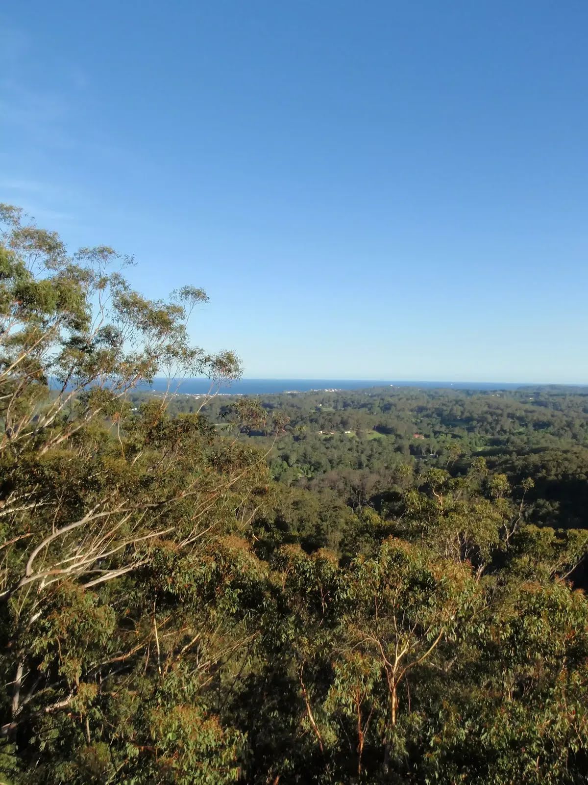
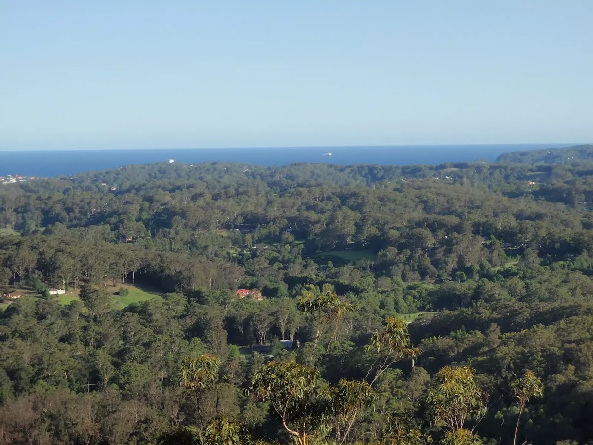
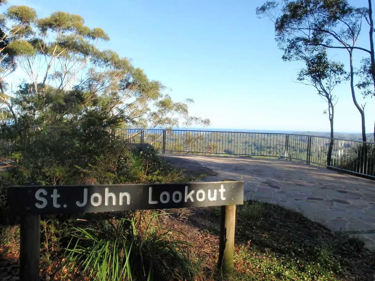
This is a very short walk across the picnic area to the lookout - you can see the end of the walk from the start. The council has installed a sandstone footpath that arcs around the picnic area and leads to St Johns Lookout. The path also leads to picnic tables and accessible toilets. You will also find electric BBQs, just off the path. A great spot with some shade, the view from the lookout is great on a sunny day. Let us begin by acknowledging the Traditional Custodians of the land on which we travel today, and pay our respects to their Elders past and present.
Show all
Accessible car parks. | Photo by admin, 2009.
Path leading to picnic table. | Photo by admin, 2009.
Toilet block at St Johns Lookout picnic area. | Photo by admin, 2009.
St Johns Lookout picnic area toilet. | Photo by admin, 2009.
Path passing the toilet. | Photo by admin, 2009.
Path leading to St Johns Lookout. | Photo by admin, 2009.
St Johns Lookout. | Photo by admin, 2009.
View from St Johns Lookout. | Photo by admin, 2009.
View from the lookout. | Photo by admin, 2009.
Downloads GPX PDF

+
-
Safer Bushwalks
Tips on staying safe on track
Before you start any bushwalk ensure you;
• Tell someone you trust where you are going and what to do if you are overdue
• Have adequate equipment, supplies, skills & knowledge for the whole journey
• Consider the impact of weather forecasts, park/track closures & fire dangers
• Can respond to emergencies & call for help at any point
• Are healthy and fit enough for this journey
If not, change plans and stay safe. It is okay to delay and ask people for help.
+
-
Getting There
Transport options and directions
Start (-33.4054168,151.3912932)
Mode Car (There is free parking available.)
DirectionsFrom The Entrance Road, A49, Holgate.
  • Turn on to Carlton Road then drive for 1.3 km
  • Turn left onto Wattle Tree Road and drive for another 2.5 km
  • Turn left onto Paroo Road and drive for another 2.9 km
  • Turn left onto Tapley Road and drive for another 1 km
  • Turn sharp left onto Atkinson Road and drive for another 910 m
  • Turn sharp left onto Toomeys Road and drive for another 70 m
+
-
Track Notes
Turn by turn instructions & maps
Getting started
From the mobility parking spots (marked with blue wheelchair symbol, on Toomey Rd), this walk follows the sandstone footpath past the picnic table to come to the front of the toilet block.....
Turn map Directions & comments
Start.
After another 7 m turn left.
After 40 m pass the picnic table (9 m on your left).
Veer right.
After another 10 m continue straight.
After another 9 m pass the toilet (6 m on your left).

24/7
After another 2 m continue straight.
After another 20 m find the "St Johns Lookout picnic area" (on your right).
St Johns Lookout picnic area

St Johns Lookout picnic area is a large open area found at the top of Katandra Reserve on Toomeys Rd. The picnic area provides wheelchair accessible toilets, picnic tables, free electric BBQ's, parking areas and information boards. There is plenty of open space with some natural shade provided by the surrounding trees. There are garbage bins provided but no drinking water.
+
-
St Johns Lookout picnic area is a large open area found at the top of Katandra Reserve on Toomeys Rd. The picnic area provides wheelchair accessible toilets, picnic tables, free electric BBQ's, parking areas and information boards. There is plenty of open space with some natural shade provided by the surrounding trees. There are garbage bins provided but no drinking water.

After another 20 m pass the "Mount Elliot" (65 m on your right).
Turn left.
After another 40 m find the "St Johns Lookout" (9 m on your right).
St Johns Lookout
St Johns Lookout

This fenced lookout is found at the top of Katandra Reserve, near the toilets. The lookout was upgraded by Gosford Council in September 2009 and now provides a safer platform and easier access. From the lookout, there are extensive views south-east over Matcham, Erina Heights and Terrigal, out to the ocean. The Guringai Walk passes below the lookout - please take extra care to not drop anything from the platform.
+
-
This fenced lookout is found at the top of Katandra Reserve, near the toilets. The lookout was upgraded by Gosford Council in September 2009 and now provides a safer platform and easier access. From the lookout, there are extensive views south-east over Matcham, Erina Heights and Terrigal, out to the ocean. The Guringai Walk passes below the lookout - please take extra care to not drop anything from the platform.

(St Johns Lookout) Turn around here and retrace the main route for 135 m to get back to the start.
+
-
Terrain
Know the Hills, grading & facilities

St Johns Lookout


Grading
Class 1/6
Smooth & flat
Length 270 m
Time 5 min to 10 min
Quality of track Smooth and hardened path (1/6)
Gradient Flat, no steps (1/6)
Signage Clearly signposted (1/6)
Infrastructure Generally useful facilities (such as fenced cliffs and seats) (1/6)
Experience Required No experience required (1/6)
Weather Weather generally has little impact on safety (1/6)

Some facilities on route
Toilet: There is one 60 m from the start.


Order of key facilities on route
ItemFrom StartName & link to notes
Toilet
60 m[toilet]
+
-
Articles
Discover more details to thrive on track
+
-
Reviews & Feedback
Share your experience
+
-
Weather & Alerts
Check forecasts & closures
Show Full Weather
Alerts and Closures
Show all alerts
Show all alerts
Show all alerts
+
-
Other Journeys
Discover nearby and similar journeys
Some of the information and maps on this page was generated using data from the awesome © OpenStreetMap contributors.
Please see how you can embed some widgets, access data and other stuff to that might be helpful.