| Turn map |
Directions & comments |
|
|

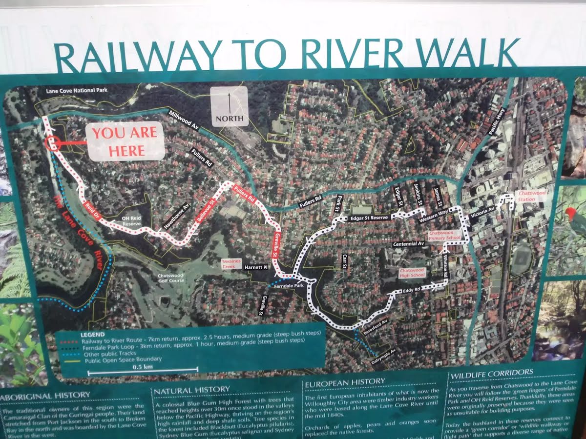
Start.

Then cross the bridge (about 15 m long)
|
|
|

After another 40 m (from the Pacific Highway) turn right, to head along Pacific Highway (a highway|trunk).
|
|
|

After another 35 m (from the Pacific Highway) turn left (a footpath).
|
|
|

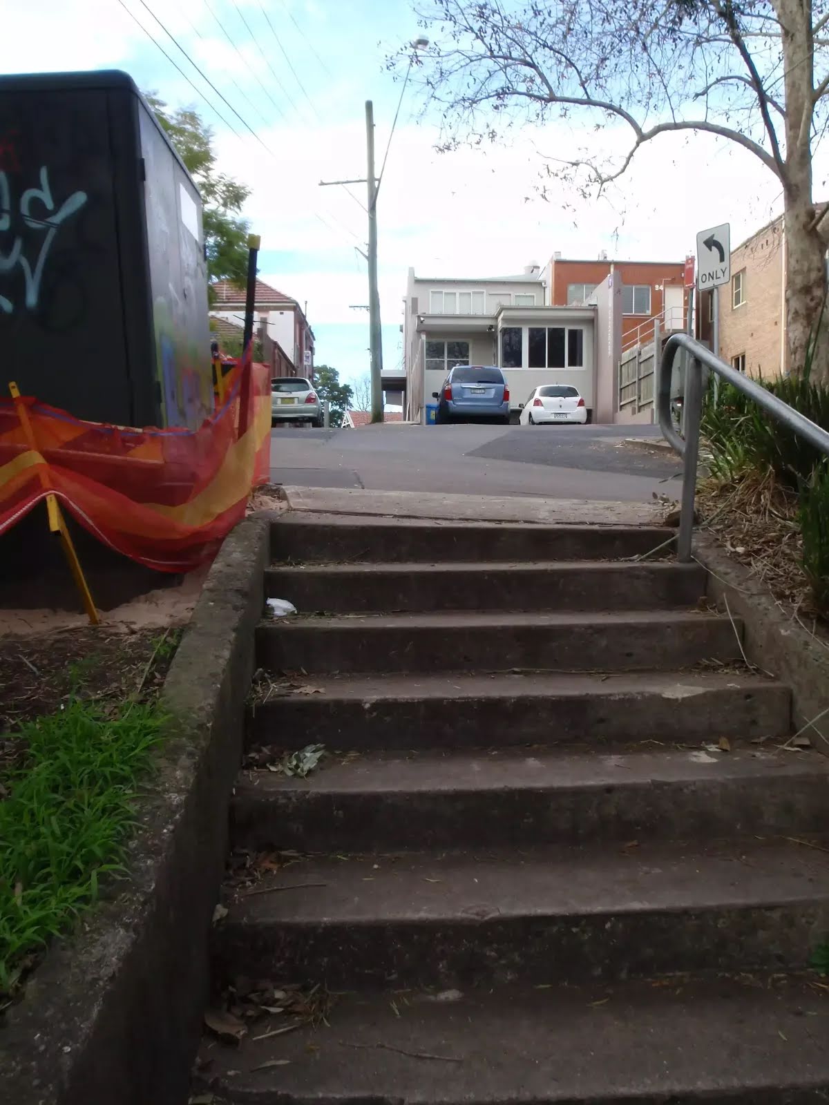
After another 60 m (from the Larkin Lane) continue straight (a steps).

Then head down the steps (about 60 m long)
|
|
|
At the intersection of Larkin Street & The Rifleway continue straight, to head along The Rifleway (a footpath).
|
|
|
After another 185 m (at the intersection of Shirley Road & The Rifleway) turn left, to head along Shirley Road (a residential road).
After another 205 m (at the intersection of Shirley Road & Alston Way) continue straight, to head along Shirley Road.
After another 290 m (at the intersection of Shirley Road & Glen Road) continue straight, to head along Shirley Road.
After another 65 m (at the intersection of Shirley Road & Toongarah Road) continue straight, to head along Shirley Road.

After another 80 m pass the "Loyal Henry Park" (80 m on your right).
From the Shirley Road continue straight, to head along Shirley Road.
|
|
|

After another 135 m (at the intersection of Abingdon Road & Shirley Road) veer left, to head along Shirley Road.
|
|
|
After another 180 m (at the intersection of Longford Street & Shirley Road) turn right, to head along Longford Street.
|
|
|
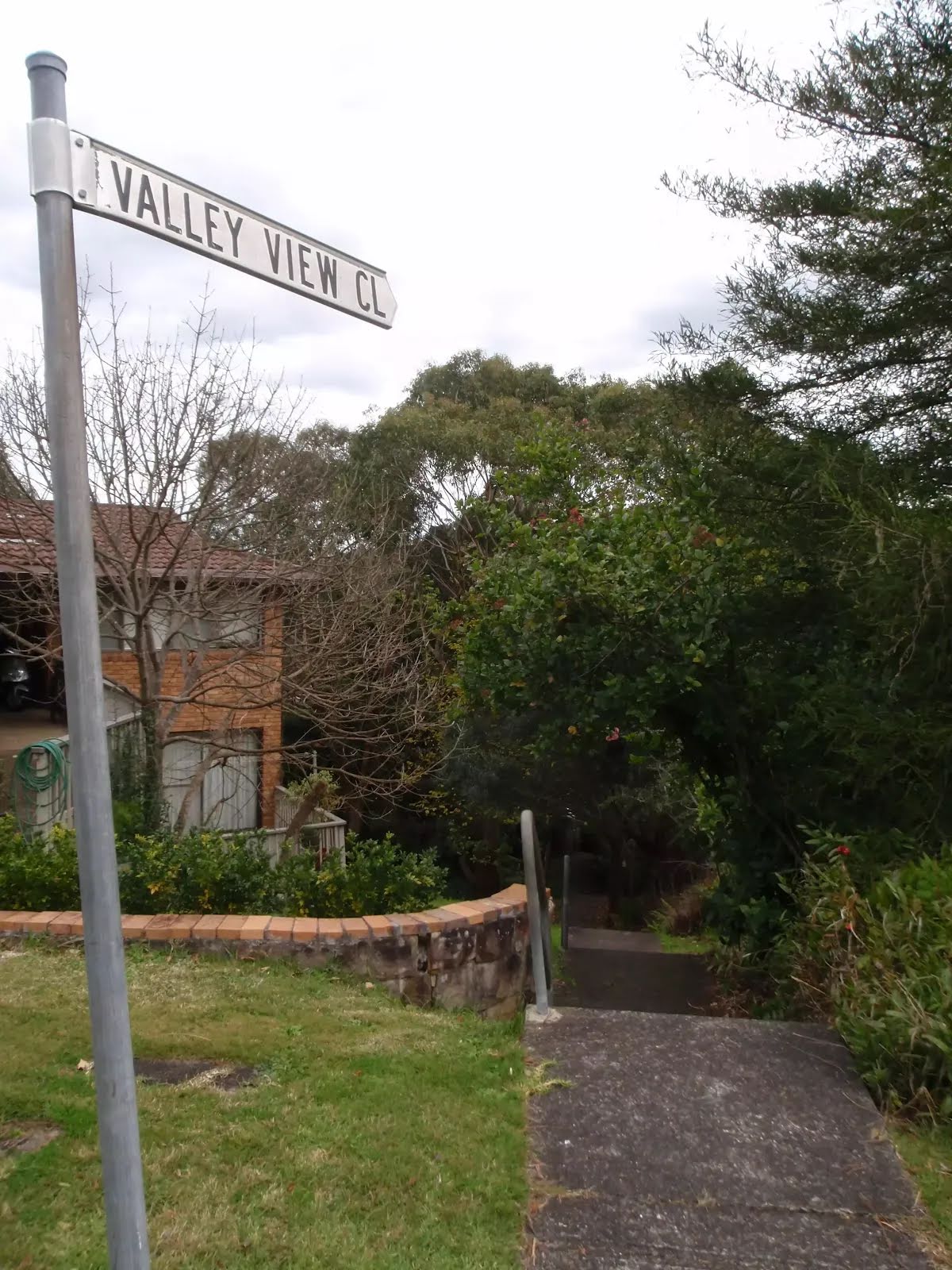
After another 110 m (from the Longford Street) turn left (a walking track).
|
|
|

After another 80 m (from the Valley View Close) veer right (a steps).
Then head down the concrete steps (about 65 m long)
|
|
|
After another 2 m continue straight.
|
|
|
After another 210 m continue straight.
|
|
|
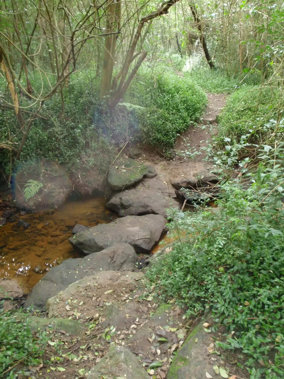
After another 155 m (from the Blue Gum Creek Walking Track) continue straight, to head along Blue Gum Creek Walking Track (a vehicle track).
After another 255 m pass the "Fullers Park" (35 m on your right).

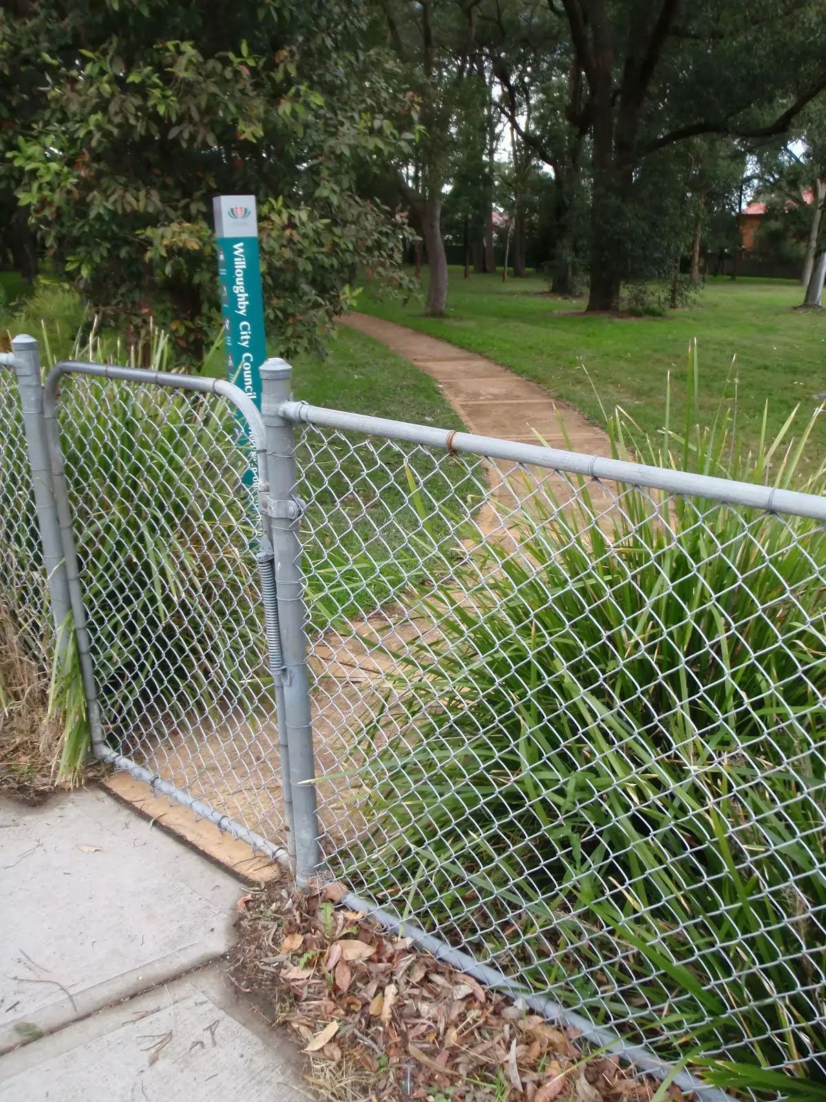
After another 330 m head through/around the gate.
|
|
|
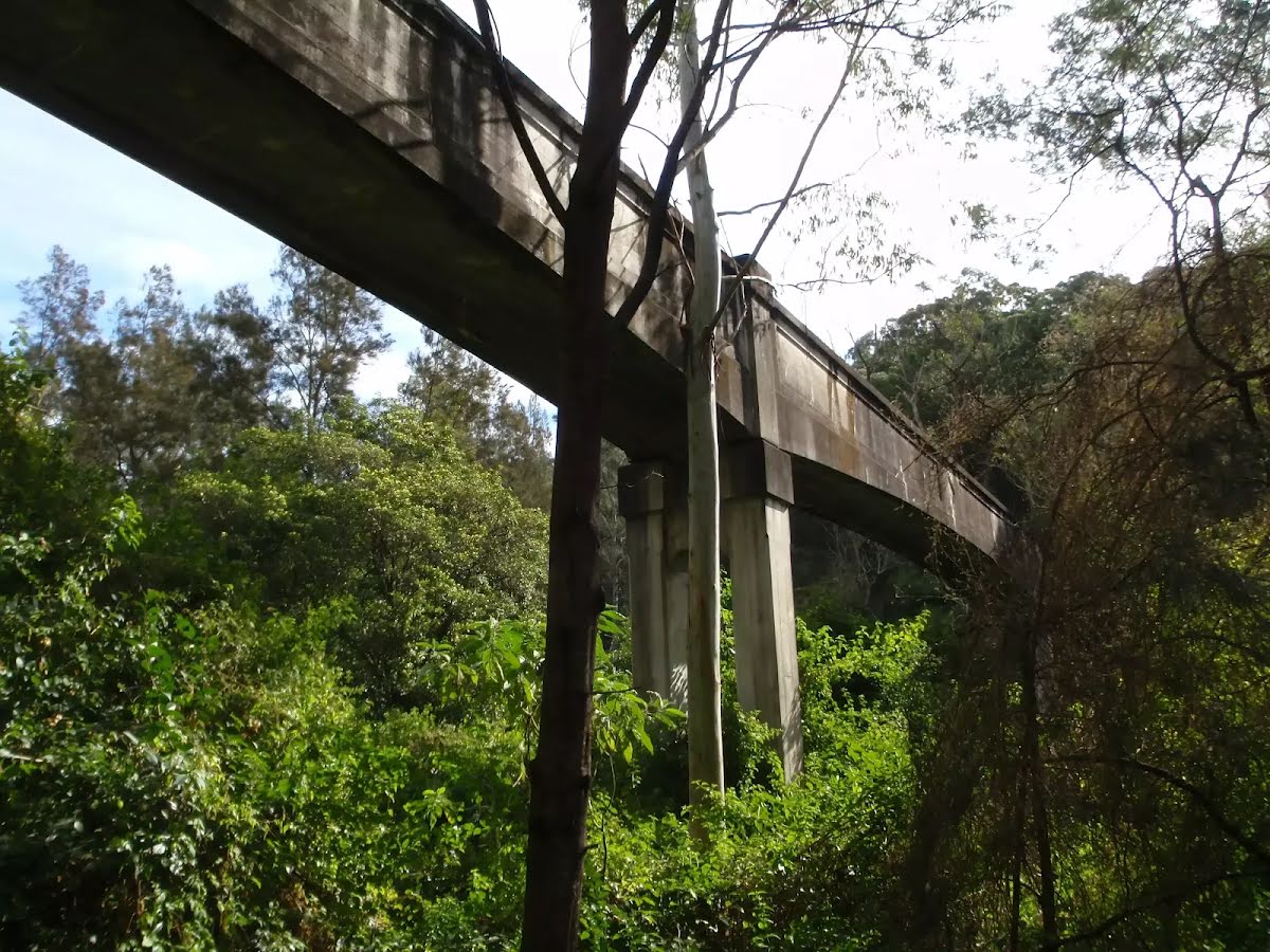
At the intersection of Lady Game Drive & Blue Gum Creek Walking Track turn left, to head along Lady Game Drive (a highway|tertiary).
|
|
|
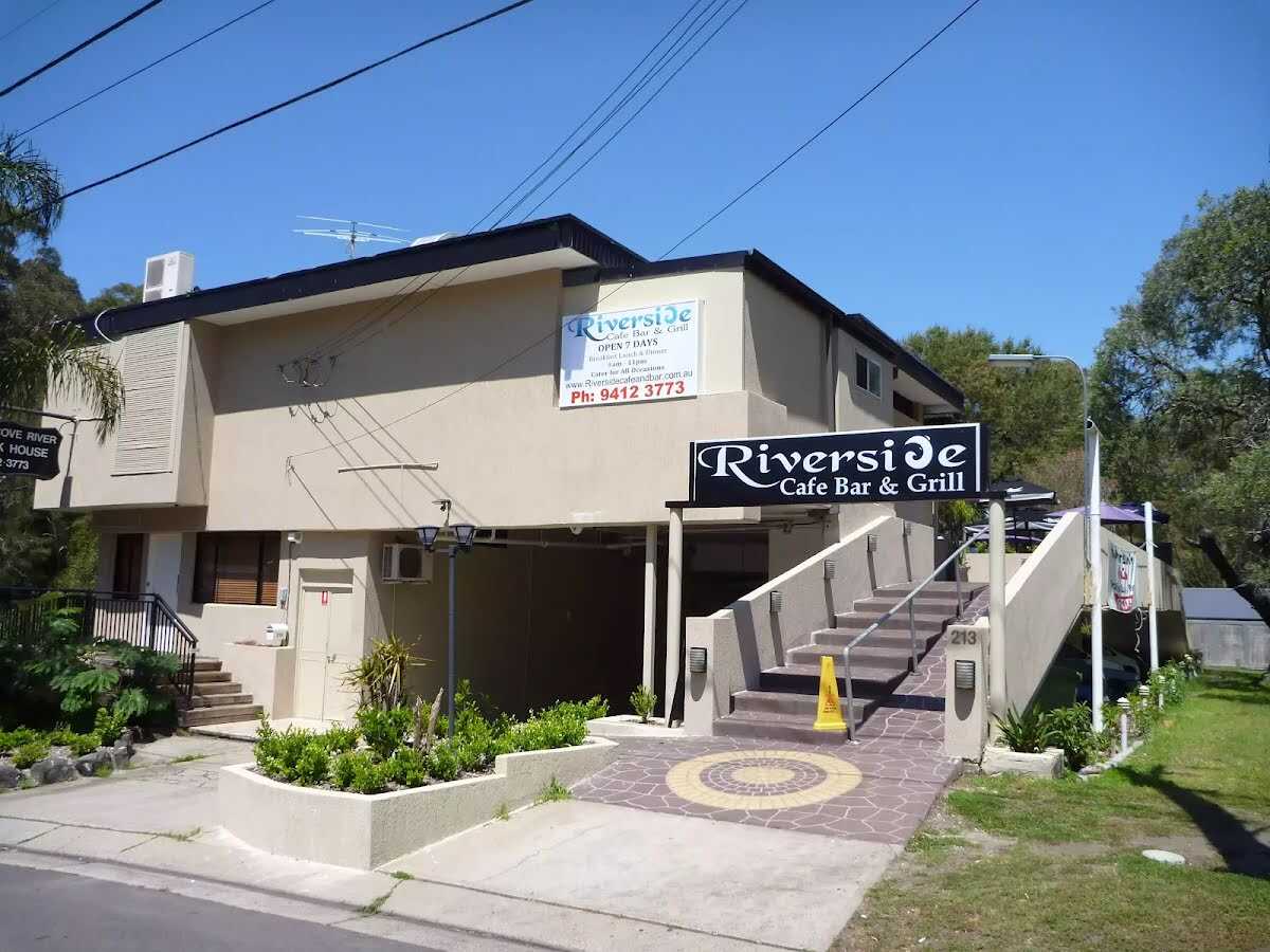
The starting point of an optional sidetrip. An optional side trip to Riverside Cafe. To start this optional side trip turn right here. On returning from this side trip turn left when you get back to this intersection. Details below.
After another 45 m (from the Lady Game Drive) continue straight, to head along Lady Game Drive.
After another 8 m (at the intersection of Delhi Road & Lady Game Drive) continue straight, to head along Fullers Road (a residential road).
|
|
|

After another 20 m (from the Fullers Road) turn sharp right (a walking track).
|
|
|
After another 10 m (from the Rail to River Walk) veer left, to head along Rail to River Walk.
After another 25 m (from the Rail to River Walk) continue straight, to head along Rail to River Walk.

After another 185 m pass a seat (5 m on your left)., has a backrest.
|
|
|
From the Rail to River Walk turn left, to head along Rail to River Walk.

After another 35 m pass the sign (on your left).
Then pass the "Railway to River Walk" (on your right).
|
|
|
After another 10 m (at the intersection of Reid Drive & Rail to River Walk) continue straight, to head along Reid Drive (a residential road).
After another 195 m (at the intersection of Reid Drive & The Fairway) continue straight, to head along Reid Drive.
After another 130 m head through/around the gate.

After another 15 m pass the car park (on your left).

After another 70 m pass the BBQ (55 m on your right).

Then pass the playground (60 m on your right).
From the Reid Drive continue straight, to head along Reid Drive.

Then pass the water tap (40 m on your right).

After another 15 m pass the picnic table (70 m on your right).
|
|
|
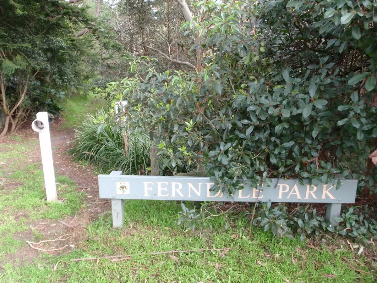
At the intersection of Ferndale Park Loop & Reid Drive continue straight, to head along Ferndale Park Loop (a footpath).
After another 30 m pass the playground (35 m on your right).
After another 15 m pass the BBQ (50 m on your right).
|
|
|
After another 80 m (at the intersection of Ferndale Walk Track & Ferndale Park Loop) continue straight (a walking track).
|
|
|
After another 175 m (at the intersection of Bellevue Street & Hawthorne Avenue) turn right, to head along Bellevue Street.
After another 270 m (from the Bellevue Street) continue straight, to head along Bellevue Street.
|
|
|
After another 220 m (at the intersection of Fullers Road & Bellevue Street) turn right, to head along Fullers Road.
After another 90 m (from the Fullers Road) continue straight, to head along Fullers Road.
|
|
|
After another 225 m (from the Greville Street) turn right, to head along Greville Street (a residential road).
After another 125 m (at the intersection of Wilfred Avenue & Greville Street) continue straight, to head along Greville Street.
After another 80 m (at the intersection of Harnett Place & Wilfred Avenue) continue straight, to head along Harnett Place.
|
|
|
After another 40 m (at the intersection of Harnett Place & Ferndale Park Loop) continue straight, to head along Ferndale Park Loop (a walking track).
|
|
|
After another 115 m (at the intersection of Ferndale Walk Track & Ferndale Park Loop) turn left, to head along Ferndale Walk Track.
Then pass the sign (on your right).
|
|
|
After another 60 m (from the Ferndale Walk Track) continue straight, to head along Ferndale Walk Track.
After another 25 m pass the sign (5 m on your right).
|
|
|
After another 35 m (from the Ferndale Walk Track) continue straight, to head along Ferndale Walk Track.
|
|
|
After another 140 m (from the Ferndale Walk Track) continue straight, to head along Ferndale Walk Track.
|
|
|
After another 35 m (from the Ferndale Walk Track) continue straight, to head along Ferndale Walk Track.
After another 210 m head through/around the gate.
|
|
|
At the intersection of Park Avenue & Ferndale Walk Track turn left, to head along Park Avenue (a residential road).
|
|
|
After another 40 m (from the Park Avenue) turn right (a walking track).
After another 195 m continue straight.
After another 90 m head into the "Bartels Park".
After another 105 m pass the water tap (35 m on your left).
After another 55 m pass a seat (7 m on your right).
Then head through the playground .
After another 20 m head through/around the gate.
|
|
|
After another 2 m (at the intersection of Edgar Street & Eldora Lane) turn right, to head along Edgar Street (a residential road).
|
|
|
After another 25 m (at the intersection of Edgar Street & Western Way) turn left, to head along Western Way (a service road).
|
|
|
After another 95 m (at the intersection of Jenkins Street & Western Way) turn right, to head along Jenkins Street (a residential road).
|
|
|
After another 45 m (at the intersection of Jenkins Street & Western Way) turn left, to head along Western Way (a service road).
|
|
|
After another 85 m (at the intersection of James Street & Western Way) continue straight, to head along Western Way (a steps).

Then head up the steps (about 10 m long)
|
|
|
At the intersection of Western Way & James Street veer right (a footpath).
After another 8 m head into the "Kenneth Slessor Park".
After another 80 m pass the picnic table (5 m on your right).
Then pass the playground (15 m on your right).
Then pass a seat (9 m on your right).
Then pass the sign.
|
|
|
After another 8 m continue straight.
|
|
|
After another 10 m turn right.
|
|
|
After another 30 m turn left.
After another 70 m pass the car park (50 m on your right).
|
|
|
After another 45 m continue straight.

After another 20 m pass the "Citadel" (30 m on your right). This cafe is wheelchair accessible.
Mo-Fr 07:00-15:00
|
|
|

After another 75 m come to the end.
CoCo Fresh Tea & Juice (about 120 m back from the start). This cafe is wheelchair accessible.
11:00-21:00
About 50 m past the end is "Burger Patch".
About 45 m past the end is "Wilson Parking".
About 10 m past the end is "Hakata Maru".
About 65 m past the end is a water tap.
About 40 m past the end is "Ipoh Club". This restaurant is wheelchair accessible.
About 50 m past the end is "San Ma Ru Korean Restaurant".
About 15 m past the end is a pay phone.
About 115 m past the end is "Saigon Rolls".
About 115 m past the end is "McDonald´s Chatswood Interchange".
About 110 m past the end is "Toastie Smith".
About 105 m past the end is "Pepper Lunch".
About 140 m past the end is "Long Fong".

About 150 m past the end is "Ripple"., has no backrest.
About 125 m past the end is "Liu's Kitchen".

About 35 m past the end is a toilet. This toilet is male and female.
About 35 m past the end is "Makoto Bento". This restaurant is wheelchair accessible.
Mo-We 11:30-14:30, 17:30-21:00
Th-Sa 11:30-14:30, 17:30-21:30
About 90 m past the end is a fast-food restaurant.
About 95 m past the end is "Domino's Pizza".
About 75 m past the end is "Krispy Kreme".
About 85 m past the end is "Stone + Peel".
|
|
|
From the Lady Game Drive Start (a footpath).
After another 15 m (from the Rail to River Walk) continue straight.
After another 6 m cross the bridge (about 60 m long)
|
|
|
Turn right.
|
|
|
After another 4 m turn right.
Then head up the steps (about 7 m long)
|
|
|
Turn right.
|
|
|
After another 25 m come to the end.
Riverside Cafe Bar & Grill (about 30 m back from the start).
About 25 m past the end is "Whitefire Grill and Bar".

Turn around and retrace your steps back the 115 m to the main route.
|