Antarctic Beech Walk
Forum rules
Please keep the width of embedded images (using [img] [/img] tags) in this forum to no more than 800 pixels wide (this will avoid them being clipped without notice by most users' window sizes). Attached images can be any resolution so long as the file size is no more than 1 MB (attachments will be displayed by the forums as thumbnails no larger than 800 pixels linked to the full-size image).
Please include a description of the pictures' content so that readers know what they're all about.
For topics focussed on narrative rather than the photos, please consider posting in one of the 'Trip Report' forums instead.
5 posts
• Page 1 of 1
Antarctic Beech Walk
![]() by iandsmith » Fri 15 Oct, 2010 6:47 am
by iandsmith » Fri 15 Oct, 2010 6:47 am
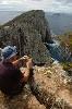
I've been spending some time going through old pics and came across these I thought I'd share with you. This track is at Gloucester Tops where the Gloucester Falls walks are located but concentrates more on vegetation. Many of these trails were only opened after WWII and the creek pictured here doesn't even have a name (according to NPWS when I spoke with them). P.S. I know the photo captions contain a misspelling!
- Attachments
-
-
-
- Antartic Beech Forest Track (56).jpg (111 KiB) Viewed 3323 times
-
-
- Antartic Beech Forest Track (6) sp.jpg (127.35 KiB) Viewed 3323 times
-
iandsmith - Athrotaxis cupressoides

- Posts: 364
- Joined: Thu 22 Jan, 2009 3:27 pm
- Location: Newcastle
Re: Antarctic Beech Walk
![]() by HitchHiking » Fri 15 Oct, 2010 8:15 am
by HitchHiking » Fri 15 Oct, 2010 8:15 am
Those small falls a beautiful ! How long is the walk?
Evan- Terra Rosa Gear, Handcrafted adventure equipment from Melbourne.
-

HitchHiking - Athrotaxis cupressoides
- Posts: 293
- Joined: Mon 04 Oct, 2010 11:51 am
- Location: Melbourne
- ASSOCIATED ORGANISATIONS: www.TerraRosaGear.com
- Region: Victoria
- Gender: Male
Re: Antarctic Beech Walk
![]() by hoangle1009 » Fri 15 Oct, 2010 1:49 pm
by hoangle1009 » Fri 15 Oct, 2010 1:49 pm
Awesome pictures. Where is this place?
- hoangle1009
- Nothofagus gunnii

- Posts: 10
- Joined: Fri 08 Oct, 2010 10:03 pm
- Region: Victoria
- Gender: Male
Re: Antarctic Beech Walk
![]() by iandsmith » Wed 20 Oct, 2010 8:42 pm
by iandsmith » Wed 20 Oct, 2010 8:42 pm
The walk isn't that long, say one to two hours but you have the option to branch out onto other walks.
They are located at Gloucester Falls up on Gloucester Tops in Barrington National Park. The turnoff from The Bucketts Way (or Thunderbolt's Way) is clearly marked about 10 kms short of Gloucester coming from the south.
Cheers
They are located at Gloucester Falls up on Gloucester Tops in Barrington National Park. The turnoff from The Bucketts Way (or Thunderbolt's Way) is clearly marked about 10 kms short of Gloucester coming from the south.
Cheers
-
iandsmith - Athrotaxis cupressoides
- Posts: 364
- Joined: Thu 22 Jan, 2009 3:27 pm
- Location: Newcastle
Re: Antarctic Beech Walk
![]() by HitchHiking » Wed 20 Oct, 2010 9:08 pm
by HitchHiking » Wed 20 Oct, 2010 9:08 pm
Will mark it down to head that way when I can. Cheers eh
Evan- Terra Rosa Gear, Handcrafted adventure equipment from Melbourne.
-
HitchHiking - Athrotaxis cupressoides
- Posts: 293
- Joined: Mon 04 Oct, 2010 11:51 am
- Location: Melbourne
- ASSOCIATED ORGANISATIONS: www.TerraRosaGear.com
- Region: Victoria
- Gender: Male
5 posts
• Page 1 of 1
Who is online
Users browsing this forum: No registered users and 6 guests