I've never walked it. Am considering using it to link the Wolgan and Capertee Valleys as part of a bike ride. I suspect it can't be ridden (in either a track sense or a 'permission' sense) but would it be vaguely practicable to hike-a-bike it?
TIA
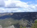
The Pipeline Track
Forum rules
NSW & ACT specific bushwalking discussion. Please avoid publishing details of access to sensitive areas with no tracks.
NSW & ACT specific bushwalking discussion. Please avoid publishing details of access to sensitive areas with no tracks.
39 posts
• Page 1 of 2 • 1, 2
The Pipeline Track
![]() by climberman » Tue 17 Dec, 2013 9:29 am
by climberman » Tue 17 Dec, 2013 9:29 am
- climberman
- Phyllocladus aspleniifolius

- Posts: 657
- Joined: Tue 09 Dec, 2008 7:32 pm
Re: The Pipeline Track
![]() by michael_p » Tue 17 Dec, 2013 9:54 am
by michael_p » Tue 17 Dec, 2013 9:54 am
Hi Climberman,
I am really sure I read about someone who walked their bike down the Pipeline Track on the "Crazy Guy on a Bike" website. I'll have a look and see if I can find it and get back to you.
Cheers,
Michael.
I am really sure I read about someone who walked their bike down the Pipeline Track on the "Crazy Guy on a Bike" website. I'll have a look and see if I can find it and get back to you.
Cheers,
Michael.
One foot in front of the other.
-
michael_p - Athrotaxis selaginoides

- Posts: 1388
- Joined: Sun 15 Nov, 2009 6:58 pm
- Location: Macarthur Region of Sydney.
- Region: New South Wales
- Gender: Male
Re: The Pipeline Track
![]() by michael_p » Tue 17 Dec, 2013 10:04 am
by michael_p » Tue 17 Dec, 2013 10:04 am
Found it: http://www.crazyguyonabike.com/doc/page/?o=1&page_id=326494&v=5W. Looks hard but possible.
Cheers,
Michael.
Cheers,
Michael.
One foot in front of the other.
-
michael_p - Athrotaxis selaginoides
- Posts: 1388
- Joined: Sun 15 Nov, 2009 6:58 pm
- Location: Macarthur Region of Sydney.
- Region: New South Wales
- Gender: Male
Re: The Pipeline Track
![]() by tom_brennan » Tue 17 Dec, 2013 10:28 am
by tom_brennan » Tue 17 Dec, 2013 10:28 am
Pipeline Track is closed on the Glen Davis side indefinitely - http://www.environment.nsw.gov.au/Natio ... osure.aspx
They went up the Glen Davis side, down the Newnes side. The Newnes side is much harder, and I suspect would be very difficult to go up with a bike. They also had two, which makes portaging a lot easier on the very steep bits. It's tough going pushing a fully laden touring bike up steep fire trail, let alone rough, scrambly bush track.
I remember riding down Mt Cookem many years ago, it helped that I was able to completely unload my bike, and attach the panniers to my backpack.
michael_p wrote:Found it: http://www.crazyguyonabike.com/doc/page/?o=1&page_id=326494&v=5W. Looks hard but possible.
They went up the Glen Davis side, down the Newnes side. The Newnes side is much harder, and I suspect would be very difficult to go up with a bike. They also had two, which makes portaging a lot easier on the very steep bits. It's tough going pushing a fully laden touring bike up steep fire trail, let alone rough, scrambly bush track.
I remember riding down Mt Cookem many years ago, it helped that I was able to completely unload my bike, and attach the panniers to my backpack.
Bushwalking NSW - http://bushwalkingnsw.com
-

tom_brennan - Athrotaxis selaginoides
- Posts: 1415
- Joined: Wed 29 Sep, 2010 9:21 am
- Location: Sydney
- Region: New South Wales
- Gender: Male
Re: The Pipeline Track
![]() by climberman » Tue 17 Dec, 2013 12:27 pm
by climberman » Tue 17 Dec, 2013 12:27 pm
Thanks Tom.
Bugger.
My fully laden bike is not very laden! We'll look elsewhere though.
Thanks BWA team!
Bugger.
My fully laden bike is not very laden! We'll look elsewhere though.
Thanks BWA team!
- climberman
- Phyllocladus aspleniifolius
- Posts: 657
- Joined: Tue 09 Dec, 2008 7:32 pm
Re: The Pipeline Track
![]() by johnw » Tue 17 Dec, 2013 12:38 pm
by johnw » Tue 17 Dec, 2013 12:38 pm
tom_brennan wrote:Pipeline Track is closed on the Glen Davis side indefinitely - http://www.environment.nsw.gov.au/Natio ... osure.aspx
Anyone know the reason for this? It's been some years since I did that walk but I recall the final approach down into Glen Davis township was via a (Dept. Lands managed?) fire trail then what appeared to be public roads.
John W
In Nature's keeping they are safe, but through the agency of man destruction is making rapid progress - John Muir c1912
In Nature's keeping they are safe, but through the agency of man destruction is making rapid progress - John Muir c1912
-
johnw - Lagarostrobos franklinii

- Posts: 9604
- Joined: Wed 23 Jan, 2008 11:59 am
- Location: Macarthur Region - SW Sydney
- Region: New South Wales
- Gender: Male
Re: The Pipeline Track
![]() by tom_brennan » Tue 17 Dec, 2013 3:33 pm
by tom_brennan » Tue 17 Dec, 2013 3:33 pm
johnw wrote:Anyone know the reason for this?
Private Property - presumably NPWS couldn't agree access
Bushwalking NSW - http://bushwalkingnsw.com
-
tom_brennan - Athrotaxis selaginoides
- Posts: 1415
- Joined: Wed 29 Sep, 2010 9:21 am
- Location: Sydney
- Region: New South Wales
- Gender: Male
Re: The Pipeline Track
![]() by DaveNoble » Tue 17 Dec, 2013 4:49 pm
by DaveNoble » Tue 17 Dec, 2013 4:49 pm
Years ago - friends of mine went over thePipeline Track with bikes - but it seemed a lot of hard work rather than a fun ride. I think they start from the Capertee side.
On another occasion, I saw a bike rider with a heavily laden touring bike (he was on his way to way out west somewhere) - going up Shale (Petries) Gully - looking in the wrong place for the Pipeline Track. We put him right - but I don't know if he made it over.
Another way to connect the valleys by bike is to ride via Baal Bone Gap.
Dave
- DaveNoble
- Athrotaxis selaginoides
- Posts: 1032
- Joined: Sun 03 Feb, 2008 3:56 pm
Re: The Pipeline Track
![]() by climberman » Tue 17 Dec, 2013 6:26 pm
by climberman » Tue 17 Dec, 2013 6:26 pm
Thanks folks. Cheers for the Baal Bone tip Dave.
- climberman
- Phyllocladus aspleniifolius
- Posts: 657
- Joined: Tue 09 Dec, 2008 7:32 pm
Re: The Pipeline Track
![]() by michael_p » Tue 17 Dec, 2013 6:55 pm
by michael_p » Tue 17 Dec, 2013 6:55 pm
climberman wrote:...Baal Bone...
Pretty sure this is the Baal Bone route: http://www.crazyguyonabike.com/doc/page/?o=1&page_id=310522&v=3t
One foot in front of the other.
-
michael_p - Athrotaxis selaginoides
- Posts: 1388
- Joined: Sun 15 Nov, 2009 6:58 pm
- Location: Macarthur Region of Sydney.
- Region: New South Wales
- Gender: Male
Re: The Pipeline Track
![]() by Lindsay » Thu 14 Jan, 2016 1:44 pm
by Lindsay » Thu 14 Jan, 2016 1:44 pm
Is it possible to bypass the private land on the Pipeline Track?
-

Lindsay - Phyllocladus aspleniifolius
- Posts: 679
- Joined: Thu 01 Oct, 2009 3:00 pm
- Location: Sydney
- Region: New South Wales
- Gender: Male
Re: The Pipeline Track
![]() by tom_brennan » Thu 14 Jan, 2016 2:28 pm
by tom_brennan » Thu 14 Jan, 2016 2:28 pm
Yes - it's a bit unclear exactly which bit is the problem. The last km or so into Glen Davis is outside the National Park - and may all be in the private property in question. Maybe 700m or so that you may have to wander off track, to take you around the property and to the camping area. Wouldn't be surprised if there are pads or tracks there already. The bush lower down around Glen Davis is quite open.
Bushwalking NSW - http://bushwalkingnsw.com
-
tom_brennan - Athrotaxis selaginoides
- Posts: 1415
- Joined: Wed 29 Sep, 2010 9:21 am
- Location: Sydney
- Region: New South Wales
- Gender: Male
Re: The Pipeline Track
![]() by Lindsay » Thu 14 Jan, 2016 7:37 pm
by Lindsay » Thu 14 Jan, 2016 7:37 pm
tom_brennan wrote:Yes - it's a bit unclear exactly which bit is the problem. The last km or so into Glen Davis is outside the National Park - and may all be in the private property in question. Maybe 700m or so that you may have to wander off track, to take you around the property and to the camping area. Wouldn't be surprised if there are pads or tracks there already. The bush lower down around Glen Davis is quite open.
Thanks Tom. I am thinking about a walk from the Glowworm Tunnel to Glen Davis and it would be a pain in the bum to have to turn around a few hundred metres from the end.
-
Lindsay - Phyllocladus aspleniifolius
- Posts: 679
- Joined: Thu 01 Oct, 2009 3:00 pm
- Location: Sydney
- Region: New South Wales
- Gender: Male
Re: The Pipeline Track
![]() by tom_brennan » Fri 15 Jan, 2016 8:28 am
by tom_brennan » Fri 15 Jan, 2016 8:28 am
See attached - red is the private property, blue is the current track, green is the detour you would need to take to avoid it. Basically up and down a steep 40m hill
- Attachments
-
- pipeline_track.png (371.77 KiB) Viewed 41342 times
Bushwalking NSW - http://bushwalkingnsw.com
-
tom_brennan - Athrotaxis selaginoides
- Posts: 1415
- Joined: Wed 29 Sep, 2010 9:21 am
- Location: Sydney
- Region: New South Wales
- Gender: Male
Re: The Pipeline Track
![]() by Lindsay » Fri 15 Jan, 2016 10:36 am
by Lindsay » Fri 15 Jan, 2016 10:36 am
Thanks again Tom. That clears things up. According to the topo map the track runs slightly further east, up the hill and within the national park, but these things are approximate. Thanks for the map, I'll take it with me. The private property should be easy to avoid.
-
Lindsay - Phyllocladus aspleniifolius
- Posts: 679
- Joined: Thu 01 Oct, 2009 3:00 pm
- Location: Sydney
- Region: New South Wales
- Gender: Male
Re: The Pipeline Track
![]() by davidf » Fri 15 Jan, 2016 12:37 pm
by davidf » Fri 15 Jan, 2016 12:37 pm
thanks, i've been looking of the traverse for a while and realised access issuees.
climberman, a light bike and stuff would take you a half day at most over the pipeline track from newnes. youd cruise it.
climberman, a light bike and stuff would take you a half day at most over the pipeline track from newnes. youd cruise it.
- davidf
- Athrotaxis cupressoides

- Posts: 280
- Joined: Thu 24 Jan, 2013 12:17 pm
- Region: New South Wales
Re: The Pipeline Track
![]() by tom_brennan » Sat 16 Jan, 2016 10:51 am
by tom_brennan » Sat 16 Jan, 2016 10:51 am
Lindsay wrote:According to the topo map the track runs slightly further east, up the hill and within the national park, but these things are approximate.
Ignore the track on the official topo map. It's been made up for most of it's length, and particularly near Glen Davis.
The mind boggles sometimes with LPI and these tracks. Does someone seriously tell their staff to "just draw where you think it goes"? It's not like it's even close, it's up to 400m out in places!!
Bushwalking NSW - http://bushwalkingnsw.com
-
tom_brennan - Athrotaxis selaginoides
- Posts: 1415
- Joined: Wed 29 Sep, 2010 9:21 am
- Location: Sydney
- Region: New South Wales
- Gender: Male
Re: The Pipeline Track
![]() by robertoman » Sat 16 Jan, 2016 11:36 am
by robertoman » Sat 16 Jan, 2016 11:36 am
I have walked along through the "Forbidden Zone" into Glen Davis. I figured I would walk from Newnes until I had to stop. Next thing I was in Glen Davis. Not at all sure what the problem is, or where I was supposed to stop. Wandered around for a while, then walked back to Newnes. Not recommending others do it. I was a little bemused though.
- robertoman
- Atherosperma moschatum

- Posts: 62
- Joined: Fri 01 Oct, 2010 7:45 pm
- Region: New South Wales
- Gender: Male
Re: The Pipeline Track
![]() by Lindsay » Sat 16 Jan, 2016 3:09 pm
by Lindsay » Sat 16 Jan, 2016 3:09 pm
Tom, I'll rely on your map rather than the topo to avoid the private property, and robertoman, I take it there were no signs, fences, guard dogs, minefields or anything else indicating the track was closed?
-
Lindsay - Phyllocladus aspleniifolius
- Posts: 679
- Joined: Thu 01 Oct, 2009 3:00 pm
- Location: Sydney
- Region: New South Wales
- Gender: Male
Re: The Pipeline Track
![]() by tom_brennan » Sun 17 Jan, 2016 5:52 pm
by tom_brennan » Sun 17 Jan, 2016 5:52 pm
There use to be a Private Property sign at the north eastern end (PP1 on my map). And the log book (VISBK on my map) is just before the property starts at the other end.
Bushwalking NSW - http://bushwalkingnsw.com
-
tom_brennan - Athrotaxis selaginoides
- Posts: 1415
- Joined: Wed 29 Sep, 2010 9:21 am
- Location: Sydney
- Region: New South Wales
- Gender: Male
Re: The Pipeline Track
![]() by picrick » Wed 30 Mar, 2016 9:11 pm
by picrick » Wed 30 Mar, 2016 9:11 pm
Hi, Just wondering if anyone has had any success in walking the track recently?
- picrick
- Nothofagus cunninghamii

- Posts: 1
- Joined: Wed 30 Mar, 2016 8:51 pm
- Region: New South Wales
- Gender: Male
Re: The Pipeline Track
![]() by LeftRightShoot » Wed 27 Jul, 2016 10:52 am
by LeftRightShoot » Wed 27 Jul, 2016 10:52 am
No, but... Ive just noticed on open streetmap that the trail is listed as starting on The Gullies road (bottom of the big bend) https://www.openstreetmap.org/search?qu ... 5/150.2750
While this is certainly still not in the NP, I believe it completely avoids the area of contention.
Does anyone know if this is a valid and/or tolerated way to start the walk?
While this is certainly still not in the NP, I believe it completely avoids the area of contention.
Does anyone know if this is a valid and/or tolerated way to start the walk?
- LeftRightShoot
- Athrotaxis cupressoides
- Posts: 154
- Joined: Sat 29 May, 2010 5:49 pm
- Region: Tasmania
- Gender: Male
Re: The Pipeline Track
![]() by tom_brennan » Wed 27 Jul, 2016 11:23 am
by tom_brennan » Wed 27 Jul, 2016 11:23 am
No, it's even more in the Private Property than the route I posted above.
Bushwalking NSW - http://bushwalkingnsw.com
-
tom_brennan - Athrotaxis selaginoides
- Posts: 1415
- Joined: Wed 29 Sep, 2010 9:21 am
- Location: Sydney
- Region: New South Wales
- Gender: Male
Re: The Pipeline Track
![]() by Warin » Sat 11 Nov, 2017 8:07 am
by Warin » Sat 11 Nov, 2017 8:07 am
The track in OSM was entered by a walker using their GPS data (dated 2015). I will enter the LPI data that appears to avoid the private property into OSM ... however it would be best if those going there would correct the OSM data to match what they find.
-

Warin - Athrotaxis selaginoides
- Posts: 1459
- Joined: Sat 11 Nov, 2017 8:02 am
- Region: New South Wales
Re: The Pipeline Track
![]() by ribuck » Sat 11 Nov, 2017 6:28 pm
by ribuck » Sat 11 Nov, 2017 6:28 pm
Warin wrote:The track in OSM was entered by a walker using their GPS data (dated 2015). I will enter the LPI data that appears to avoid the private property into OSM ... however it would be best if those going there would correct the OSM data to match what they find.
OSM mappers should map a track as it is found "on the ground". Any parts that have access problems are then tagged "access=private". Private paths are shown with a pink fringe on the many OSM renderings.
-

ribuck - Athrotaxis selaginoides
- Posts: 1893
- Joined: Wed 15 May, 2013 3:47 am
- Region: Other Country
- Gender: Male
Re: The Pipeline Track
![]() by LeftRightShoot » Sat 11 Nov, 2017 6:35 pm
by LeftRightShoot » Sat 11 Nov, 2017 6:35 pm
I can supply a validated GPX file if you'd like. There is a short section (a few hundred meters) between two stiles that is on private property. I have waypoints for this section marked. It should be noted that (at my last enquiry) the track is closed to walkers. Also note that the trail marked on the LPI maps is very very, *very* wrong.
- LeftRightShoot
- Athrotaxis cupressoides
- Posts: 154
- Joined: Sat 29 May, 2010 5:49 pm
- Region: Tasmania
- Gender: Male
Re: The Pipeline Track
![]() by Warin » Sat 11 Nov, 2017 8:35 pm
by Warin » Sat 11 Nov, 2017 8:35 pm
The LPI paths near the northern end avoid the private property, look to avoid going up and down the contours. They may be little used these days as people prefer to use the wider vehicle tracks (through the private property) but I would not dismiss them without on the ground examination. I did add in the intermittent creeks and some cliff lines to the OSM data - also from the LPI base map. I did mark a section as private with a note ...
You can see the addition here http://www.openstreetmap.org/way/539743 ... /150.27642 Note that the new paths are not well rendered yet if you zoom out, that will come eventually.
I would certain try to use them in preference to the private property or even close to it - avoids confrontation. It may not be a well defined track but then they only get that way with use. I have walked right past a path shown in LPI that is little used .. took some finding to actually see it. Even then it faded out towards the end - yet I am certain that 100 years ago there was a path there to a rock structure. No one seems to go there now. Conversely there are new paths not shown in LPI and some paths have varied there course.
-
Warin - Athrotaxis selaginoides
- Posts: 1459
- Joined: Sat 11 Nov, 2017 8:02 am
- Region: New South Wales
Re: The Pipeline Track
![]() by LeftRightShoot » Sat 11 Nov, 2017 8:46 pm
by LeftRightShoot » Sat 11 Nov, 2017 8:46 pm
Sorry, I believe your amendment is incorrect and still goes through private property. Please remove it as it will upset the land owner and potentially delay the reopening of the track. The company I work for has permission to use this track as long as we navigate off track around the private property. This track is closed to other users. Here is a snippet of a map I produced for navigating around the stiles.
- Attachments
-
- Avoiding Private Land
- Capture.GIF (22.72 KiB) Viewed 37092 times
- LeftRightShoot
- Athrotaxis cupressoides
- Posts: 154
- Joined: Sat 29 May, 2010 5:49 pm
- Region: Tasmania
- Gender: Male
Re: The Pipeline Track
![]() by Warin » Sun 12 Nov, 2017 7:52 am
by Warin » Sun 12 Nov, 2017 7:52 am
cnschulz wrote:Sorry, I believe your amendment is incorrect and still goes through private property.
If it goes through private property and the landowner objects to public use then it should be tagged 'access=private' - it should not be removed.
I made 2 path additions - the one I think you are referring to is an extension of Tooral St and goes close to a building. This one I would think is the one of concern. However the LPI map shows the planed extension of Tooral St to the National Park boundary. Humm looks like DP758446 is the one of concern, with a following DP20363. And, of course, does it exist on the ground anyway.
The second path I added comes off the south side of Naroo Circuit and would probably attract less attention from locals being a greater distance from them. It is also close to a camping area so people wandering around might be more expected. So I would think this path would be more easily tolerated/accepted. But is it the same owner - DP758446.
So ..I'll mark them both access=private - but only from the National Park boundary to the public road.
-
Warin - Athrotaxis selaginoides
- Posts: 1459
- Joined: Sat 11 Nov, 2017 8:02 am
- Region: New South Wales
Re: The Pipeline Track
![]() by LeftRightShoot » Sun 12 Nov, 2017 8:18 am
by LeftRightShoot » Sun 12 Nov, 2017 8:18 am
No, the primary concern is navigating around the two stiles as illustrated in the bottom section of my snippet and on the map from Tom, above. The remainder of the track is either in National Park or has not been raised as a concern with us by Nat Parks. The northern end of the map has NP signage. This is a very sensitive issue and can jeopardise the ongoing use of the track for *everyone* as well as commercial operators. In a separate battle I am furious that OSM users have added our private campsites to their map, and although they are listed as private, that information is not shown to casual browsers and we constantly have weekend campers showing up on our private property. In the pipeline case, following the map as marked on the LPI topos would be "more correct" than updating the map with a track segment that should never, ever be walked. I imagine that the intent of NPWS would be to let this track segment grow over and to follow the now semi-established footpad we have created as per the maps above. As stated earlier, I am more than happy to supply ground verified mutli-sampled gpx of the entire track. In any case this entire track is CLOSED for public access and should be recorded as such.
- LeftRightShoot
- Athrotaxis cupressoides
- Posts: 154
- Joined: Sat 29 May, 2010 5:49 pm
- Region: Tasmania
- Gender: Male
39 posts
• Page 1 of 2 • 1, 2
Return to New South Wales & ACT
Who is online
Users browsing this forum: No registered users and 7 guests