| Start | (-33.1203552,151.644115) |
| Mode | Car |
| Directions | From Pacific Highway, A43
|
| Turn map | Directions & comments |
|---|---|
 |
|
 |
|
 |
|
 |
|
 |
|
 |
|
 |
|
 |
|
 |
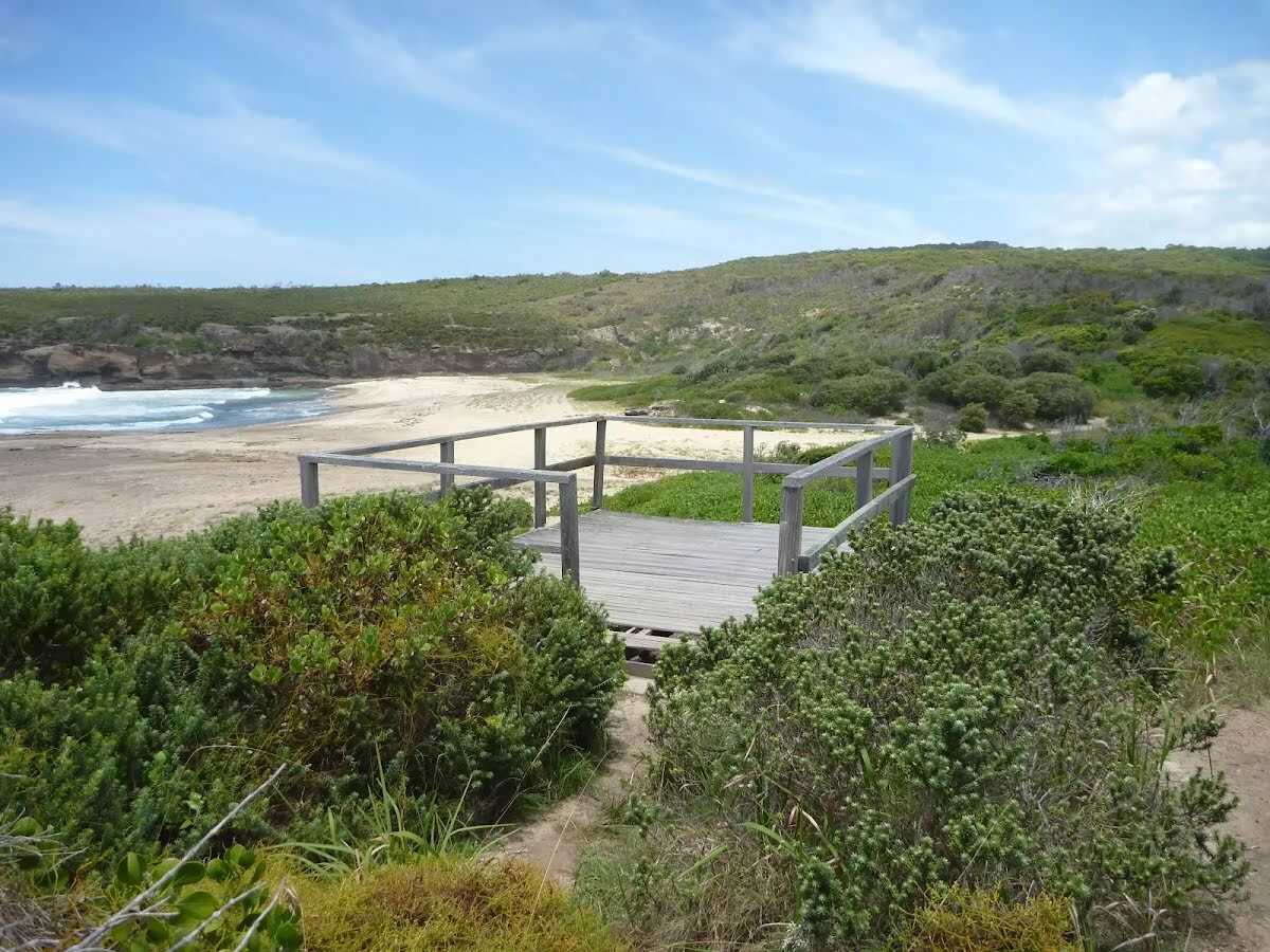 Pinney's Lookout overlooks the northern side of Pinney's Beach on the Wallarah Peninsula. From this timber platform, the whole of Pinney's Beach can be seen, including Pinney's Headland to the south. Some of the timber on this lookout was missing when visited, so take care.
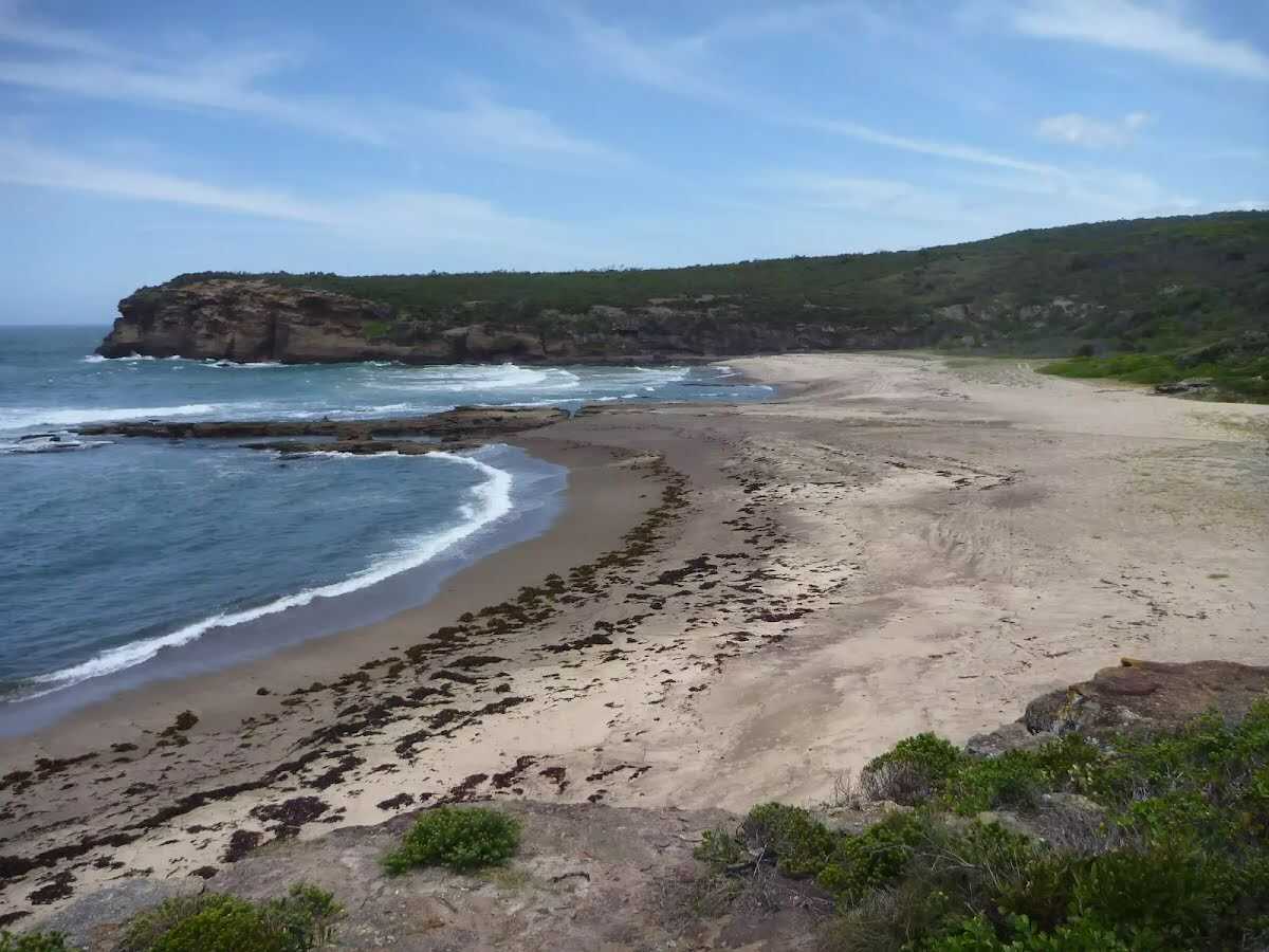 Pinney's Beach is a good beach for fishing, surfing and swimming. This beach is accessible on foot, via the coastal walk. This beach is not patrolled and rock platforms can be dangerous, even when the seas appear calm. Personal fishing is permitted off all the coast in Wallarah National Park, although a licence is needed. A midden (dated to about 1200 years old), with about 20 stone artefacts, was discovered here in the 1960s, but unfortunately 4WD vehicles have caused erosion to this site.
|
 |
|
 |
The starting point of an optional sidetrip. Side trip to Pinney Beach. To start this optional side trip turn left here. On returning from this side trip continue straight when you get back to this intersection. Details below.
|
 |
|
 |
|
 |
|
 |
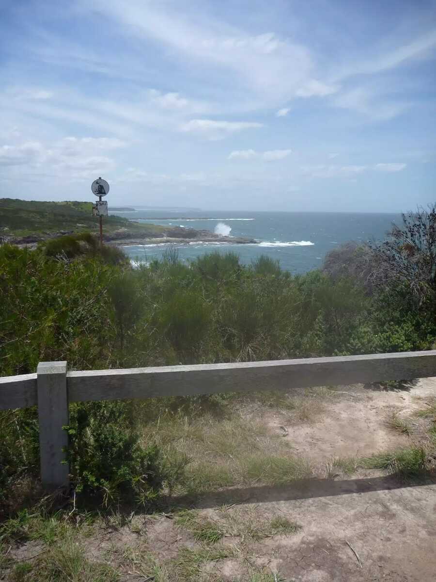 There are magnificent vistas from Pinney's Headland Lookout, particularly to the north. The headland is accessed on foot via the Wallarah Peninsula coastal walk, and the headland itself has a loop walking trail on it. At the southernmost point of this walking loop, there are unfenced rock platforms forming the ocean shoreline - take care.
|
 |
|
 |
|
 |
The starting point of an optional sidetrip. Side trip to Pinney Beach. To start this optional side trip continue straight here. On returning from this side trip turn right when you get back to this intersection. Details below.
|
 |
|
 |
|
 |
|
 |
|
 |
|
 |
|
 |
|
 |
|
 |
|
 |
|
 |
| Turn map | Directions & comments |
|---|---|
 |
|
 |

|
|
Class 4/6 Hard track |
|---|---|
| Length | 5.1 km |
| Time | 1 h 30 min to 2 h 30 min |
| Quality of track | Formed track, with some branches and other obstacles (3/6) |
| Gradient | Short steep hills (3/6) |
| Signage | Minimal directional signs (4/6) |
| Infrastructure | Limited facilities (such as cliffs not fenced, significant creeks not bridged) (4/6) |
| Experience Required | Some bushwalking experience recommended (3/6) |
| Weather | Foretasted & unexpected storms and severe weather may impact on navigation and safety (4/6) |