| Turn map |
Directions & comments |
|
|

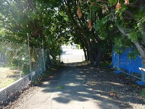
Start.

Then cross the bridge (about 30 m long)
|
|
|

From the StreetToTransitConnection continue straight.

After another 10 m head down the steps (about 15 m long)

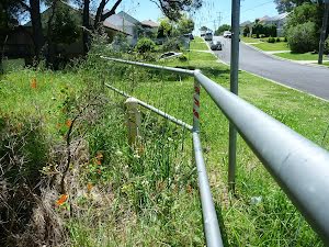
After another 10 m find the "Teralba Station Carpark" (25 m on your right).
This carpark provides ample parking for those leaving their car at the train station
|
|
|
Continue straight.
After another 35 m (at the intersection of Anzac Parade & William Street) continue straight, to head along Anzac Parade (a highway|tertiary).
After another 7 m (from the Anzac Parade) continue straight, to head along Anzac Parade.

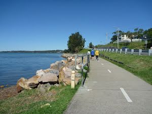
After another 160 m pass the toilet (20 m on your right).

After another 6 m pass the "Anzac Park" (9 m on your right).

Then pass the "Maddz on York" (65 m on your right).
|
|
|
At the intersection of Anzac Parade & York Street continue straight, to head along Anzac Parade.
After another 120 m (at the intersection of Anzac Parade & Margaret Street) continue straight, to head along Anzac Parade.
After another 40 m (from the Anzac Parade) continue straight, to head along Anzac Parade.
After another 140 m (at the intersection of Anzac Parade & Cumberland Street) continue straight, to head along Anzac Parade.
|
|
|

After another 55 m (at the intersection of Lake Crescent & Anzac Parade) turn left, to head along Lake Crescent (a residential road).
|
|
|

After another 400 m turn right.
After another 180 m cross the bridge (about 180 m long)
After another 370 m cross the bridge (about 170 m long)
|
|
|

After another 35 m turn around.
|
|
|
After another 70 m (from the Creek Reserve Road Shared Path) continue straight.
After another 15 m continue straight.
|
|
|

After another 215 m (from the Creek Reserve Road) veer left.

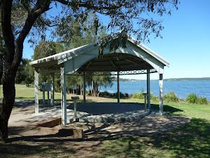
After another 15 m pass the shelter (55 m on your left).

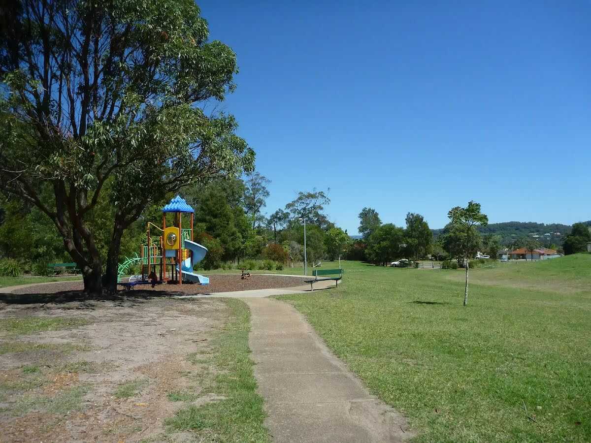
After another 25 m pass the "Variety Playground" (15 m on your left).
Continue straight.
After another 70 m pass the car park (9 m on your right). This car park is wheelchair accessible.
|
|
|
Veer left.
After another 50 m continue straight.

After another 25 m turn sharp right.
After another 20 m pass the shelter (about 50 m ahead).
|
|
|
Continue straight.

After another 35 m pass the water tap (on your left). This water tap is wheelchair accessible.
After another 6 m pass the shelter (20 m on your right).
After another 30 m continue straight.
After another 150 m continue straight.
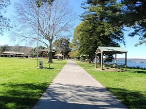
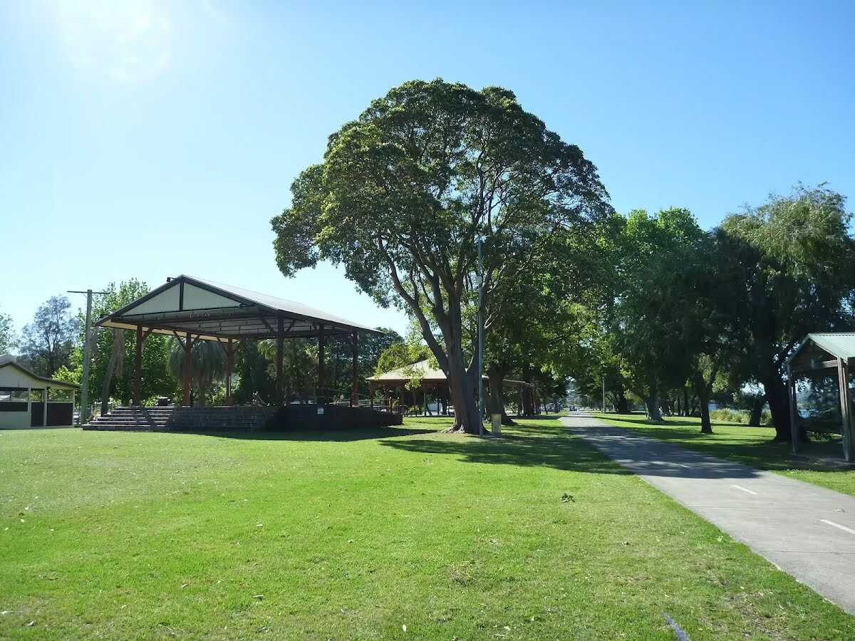
After another 55 m find the "Speers Point Park" (20 m on your left).
Speers Point Park on Lake Macquarie at Boolaroo is a multi-use public park. Situated by the water, Speers Point Park offers open lawns amongst she-oaks and gumtrees. There are sheltered picnic tables, barbeques, water fountains, an elevated stage area, a children's playground, public wharf and toilets. There is also a public swimming pool, Speers Point Swim Centre. For more information about Speers Point Park, contact Lake Macquarie City Council during business hours on 49210333.
|
|
|
After another 4 m continue straight.
After another 35 m continue straight.
After another 30 m pass the playground (on your left).

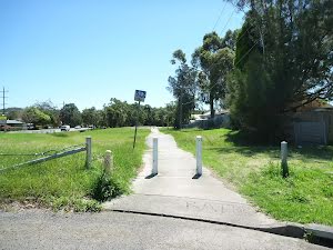
After another 40 m head through the bicycle barrier.
|
|
|
After another 6 m continue straight.
After another 10 m continue straight.
After another 40 m cross the bridge (about 10 m long)
After another 7 m pass the water tap (on your left). This water tap is wheelchair accessible.
After another 180 m pass the car park (70 m on your left).
|
|
|
After another 20 m continue straight.
After another 20 m pass the water tap (8 m on your right). This water tap is wheelchair accessible.
Continue straight.

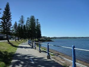
After another 7 m find the "Pippi's at the Point Hotel" (40 m on your left).
The hotel is located on the shores of the beautiful Lake Macquarie at Speers Point, Warners Bay. It offers lovely rooms as well as lunches and dinners. The Great North Walk leads along the shore of the lake, less than a 100 metres away from the hotel.
After another 35 m pass the "Custom Espresso" (25 m on your left).
After another 8 m continue straight.

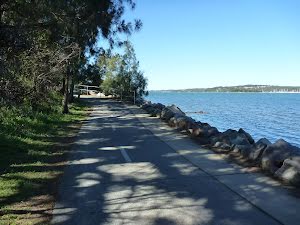
After another 1.2 km pass a seat (on your right).
After another 900 m continue straight.
After another 7 m continue straight.

After another 45 m pass the picnic table (6 m on your left).
After another 55 m pass the water tap (5 m on your left).
After another 180 m pass the car park (5 m on your left). This car park is wheelchair accessible.

After another 80 m pass the artwork (15 m on your right).
After another 20 m cross the bridge (about 20 m long)
After another 25 m continue straight.
After another 60 m continue straight.
|
|
|
After another 105 m continue straight.
After another 9 m pass the water tap (on your left).
Continue straight.
Then pass a seat (10 m on your right).
After another 30 m pass the picnic table (about 25 m ahead).
Then pass the "Warners Bay Takeaway" (45 m on your left).
|
|
|
Turn right.
|
|
|
After another 15 m turn left.
After another 35 m pass the shelter (on your left).
After another 20 m pass the picnic table (25 m on your left).
|
|
|
After another 15 m veer left.
After another 20 m pass the picnic table (15 m on your left).
|
|
|
Turn right.
|
|
|
After another 15 m continue straight.
After another 65 m pass the water tap (about 15 m ahead). This water tap is wheelchair accessible.
Then pass the toilet (20 m on your right). This toilet is wheelchair accessible.
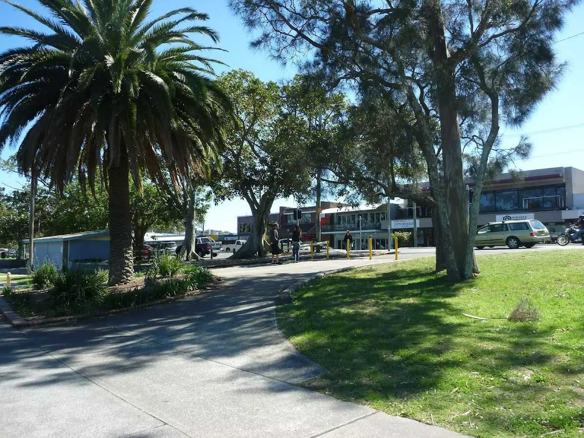
After another 10 m find the "Warners Bay" (on your left).
Warners Bay is a large, open bay on Lake Macquarie, with a public park and small shopping centre nearby. There are cafes and restaurants with alfresco dining, the 'Centro' shopping centre, specialty shops, boutiques and a post office. The public park on the lakeshore has a shared bike/walking path, picnic tables, barbeques, toilets and water. A-must-stop ice cream shop on the Esplanade is Dippin Dots, they have a unique ice cream that has been made using super-cold freezing methods to make little beads of ice cream.
|
|
|
After another 1 m continue straight.
|
|
|
After another 6 m (from the The Esplanade) continue straight.
|
|
|
After another 7 m (from the The Esplanade) continue straight.
|
|
|
After another 10 m turn right.
After another 35 m pass the car park (80 m on your left). This car park is wheelchair accessible.
After another 70 m pass a seat (65 m on your right).
|
|
|
After another 20 m turn right.
|
|
|
After another 10 m (from the King Street) turn around.
|
|
|
After another 9 m (from the King Street) continue straight.
|
|
|
After another 6 m turn left.
|
|
|
After another 85 m (from the Howard Street) turn left (a highway|).
|
|
|
After another 8 m continue straight.
|
|
|
After another 15 m continue straight.
|
|
|
After another 90 m continue straight.
|
|
|
After another 7 m (from the King Street) turn right, to head along King Street (a highway|primary).
|
|
|
After another 35 m (from the Bayview Street) continue straight, to head along Bayview Street (a road).
|
|
|
After another 15 m (from the Bayview Street) turn around (a footpath).
|
|
|
After another 10 m (from the Bayview Street) turn left (a highway|).
|
|
|
After another 9 m continue straight.
|
|
|
After another 820 m (from the Queen Street) turn right (a footpath).
|
|
|
After another 85 m (from the Myles Avenue) turn right, to head along Myles Avenue (a highway|tertiary).
|
|
|
After another 35 m (at the intersection of Myles Avenue & Yorston Street) continue straight, to head along Myles Avenue.
|
|
|
After another 20 m (from the Myles Avenue) continue straight, to head along Myles Avenue.
|
|
|
After another 640 m (at the intersection of Vermont Place & Myles Avenue) turn right, to head along Vermont Place.

After another 120 m (from the The Great North Walk) veer right, to head along The Great North Walk.
After another 15 m find the "Vermont Place Park" (on your right).
Vermont Place Park, at the end of Vermont Place in Warners Bay, is an open grassed park surrounded by native forest. The park has a children's playground, picnic table, a shelter and water fountain (water may not be available).
After another 60 m pass the playground (on your right).
After another 20 m (from the The Great North Walk) continue straight, to head along The Great North Walk.
After another 70 m (from the The Great North Walk) continue straight, to head along The Great North Walk.
|
|
|
After another 120 m (from the The Great North Walk) continue straight, to head along The Great North Walk.
After another 210 m (from the The Great North Walk) continue straight, to head along The Great North Walk (a walking track).
|
|
|
After another 70 m (from the The Great North Walk) continue straight, to head along The Great North Walk.
|
|
|
After another 125 m (from the The Great North Walk) continue straight, to head along The Great North Walk.
|
|
|
After another 65 m (at the intersection of The Great North Walk & Hillsborough Firetrail) continue straight, to head along The Great North Walk (a vehicle track).
|
|
|
After another 90 m (from the The Great North Walk) continue straight, to head along The Great North Walk.
After another 150 m (from the The Great North Walk) continue straight, to head along The Great North Walk.
After another 205 m (from the The Great North Walk) continue straight, to head along The Great North Walk.
|
|
|
After another 30 m (from the The Great North Walk) continue straight, to head along The Great North Walk.
|
|
|
After another 60 m (from the The Great North Walk) continue straight, to head along The Great North Walk (a walking track).
After another 65 m (from the The Great North Walk) continue straight, to head along The Great North Walk.
|
|
|
After another 170 m (from the The Great North Walk) continue straight, to head along The Great North Walk.

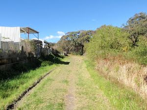
After another 60 m cross the ford.
|
|
|
From the The Great North Walk veer right, to head along The Great North Walk.
|
|
|
After another 190 m (at the intersection of The Great North Walk & SImon and Dom Trail) veer left, to head along The Great North Walk.
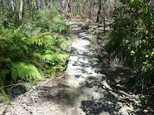
After another 1.1 km head down the earthen steps (about 10 m long)
After another 85 m head down the earthen steps (about 8 m long)
|
|
|
After another 15 m turn left.
|
|
|
After another 185 m continue straight.
After another 45 m cross the ford.
Continue straight.
|
|
|
After another 110 m veer left.
|
|
|
Continue straight.
|
|
|
After another 40 m continue straight.
|
|
|
After another 20 m veer right.
After another 260 m head down the steps (about 35 m long)
|
|
|
After another 125 m (from the Park Street) turn right.
|
|
|
After another 800 m (from the Anjon Street) turn right, to head along Anjon Street (a residential road).
|
|
|
After another 75 m (at the intersection of Patricia Avenue & Anjon Street) turn left, to head along Patricia Avenue (a highway|tertiary).
|
|
|
After another 240 m (from the Patricia Avenue) veer right.
|
|
|
After another 3 m (from the Lincoln Street) continue straight, to head along Lincoln Street.
After another 30 m (from the Lincoln Street) continue straight, to head along Lincoln Street.
|
|
|
After another 90 m (at the intersection of Lincoln Street & Carl Close) continue straight, to head along Lincoln Street.
|
|
|
After another 20 m (at the intersection of Ferris Street & Lincoln Street) veer right, to head along Ferris Street.
After another 20 m pass the picnic table (35 m on your right).
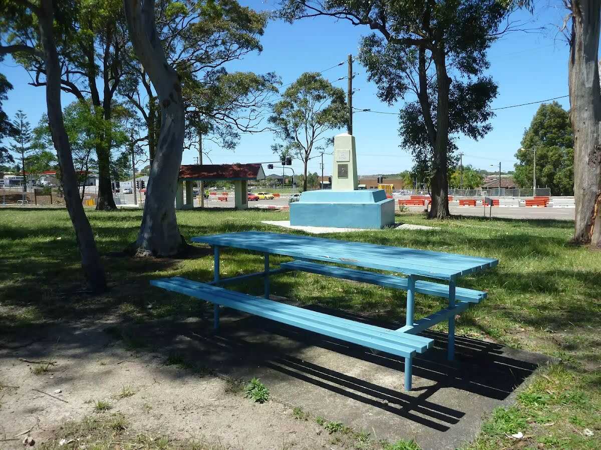
After another 10 m pass the "Anniversary Grove" (4 m on your right).
Then find the "Charlestown Park" (30 m on your right).
'Charlestown Park', by the Pacific Highway in Charlestown, offers a picnic table, shelter, barbeque and war memorial. Charlestown Park is also known and signposted as 'Anniversary Grove'.
After another 15 m pass the "Charlestown Oval" (15 m on your left).
|
|
|
After another 15 m (from the Ferris Street) continue straight, to head along Ferris Street.
|
|
|

Continue another 30 m to find at the intersection of Pacific Highway & Ferris Street at the end.
|