| Turn map |
Directions & comments |
|
|

Start.

After another 20 m head down the 38 concrete steps (about 25 m long)

Then pass the sign (on your left).

After another 15 m head up the 6 steps (about 8 m long)

After another 880 m cross the bridge (about 7 m long)
Then head down the 6 stone steps
After another 520 m head up the 11 surface|wood steps (about 4 m long)
|
|
|

After another 2 m (at the intersection of Riverside Drive & Riverside Walk) turn left, to head along Riverside Drive (a vehicle track).
After another 9 m cross the Porters Creek Bridge (about 10 m long)
|
|
|
After another 15 m (at the intersection of Riverside Drive & Riverside Walk) turn left, to head along Riverside Walk (a walking track).
After another 6 m head down the 5 steps (about 5 m long)

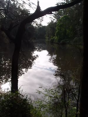
After another 305 m come to the viewpoint.
After another 180 m head down the 11 earthen steps (about 8 m long)
After another 135 m cross the bridge (about 4 m long)
After another 9 m head down the 7 earthen steps (about 6 m long)
|
|
|

After another 370 m continue straight, to head along Riverside Walk.
After another 155 m come to the viewpoint.
After another 20 m head up the 15 stone steps (about 6 m long)
After another 55 m head down the 13 surface|wood steps (about 5 m long)

After another 340 m head through/around the gate.
|
|
|
Continue straight.
After another 30 m continue straight.

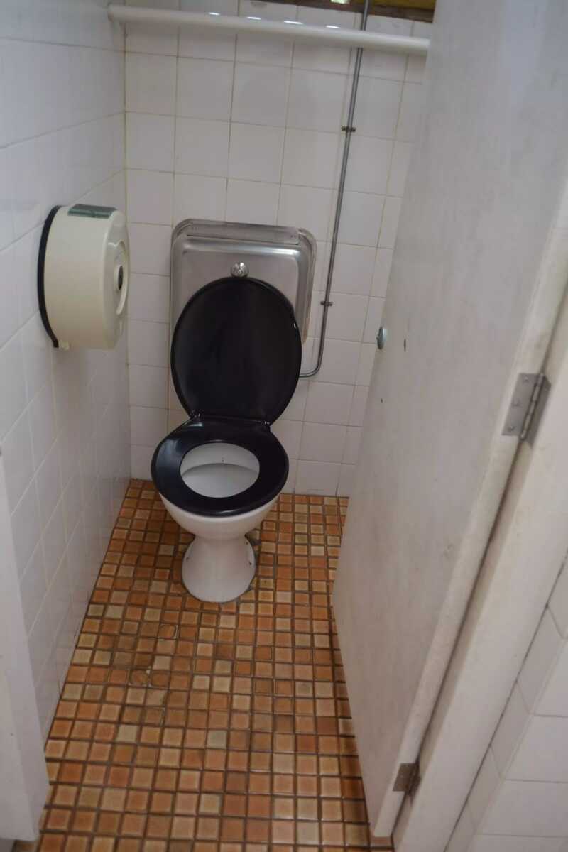
After another 30 m pass the toilet (25 m on your right).
Then head through/around the gate.

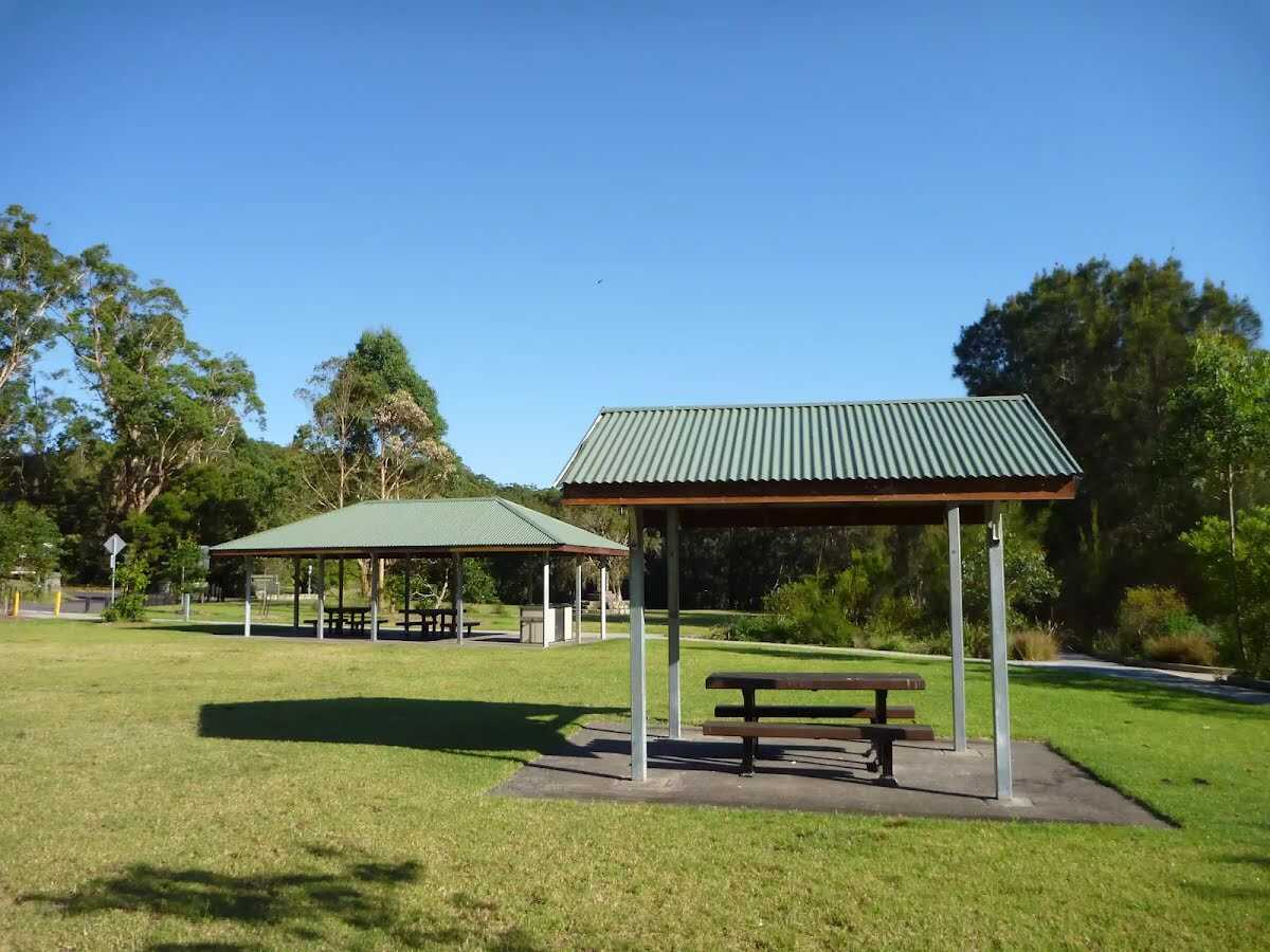
After another 230 m pass the shelter (25 m on your right).
After another 40 m cross the bridge (about 5 m long)
|
|
|
After another 110 m continue straight, to head along Riverside Walk.

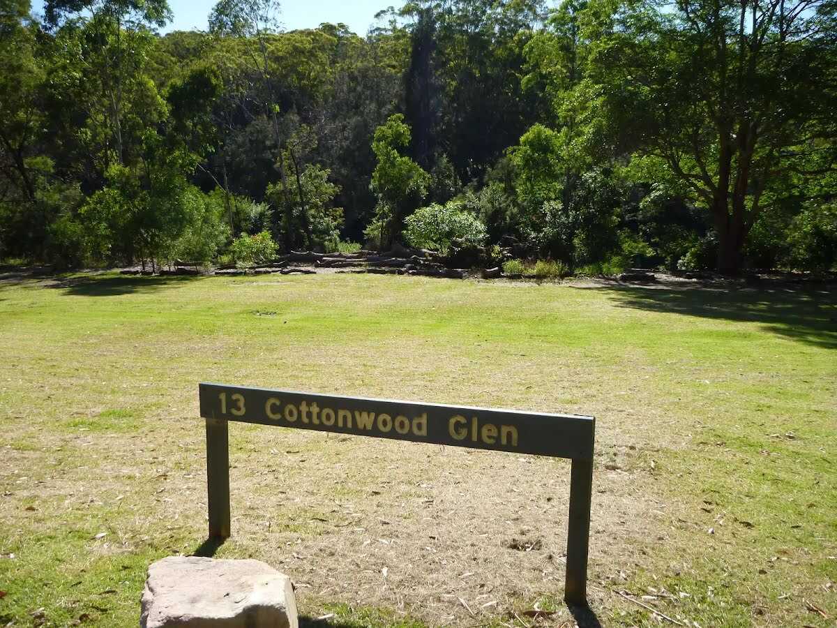
After another 20 m find the "13 Cottonwood Glen" (5 m on your right).
Cottonwood Glen picnic area is a large open grassy spot on the bank of the Lane Cove River. There is a grove of trees along the edge of the river, but you can still get clear views across the water from the car park area. There are several picnic tables and a small toilet block just up the hill.
After another 130 m continue straight, to head along Riverside Walk.
|
|
|
After another 180 m continue straight.

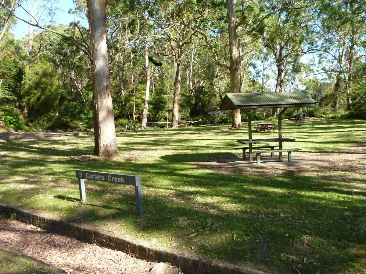
After another 70 m find the "9 Carters Creek" (9 m on your left).
Carters Creek Picnic Area is the ninth formal picnic space along this stretch of the Lane Cove River. This picnic area is home to a couple of sheltered picnic tables, a gas BBQ a large open grassy area, garbage bins, toilets and a car park. There is some limited access to the river view. A pleasant spot among the tall gums.
After another 45 m pass the toilet (15 m on your right).
PH, Sa-Su
|
|
|
Continue straight, to head along Riverside Walk.

After another 35 m head through the bollard.
After another 100 m pass the toilet (35 m on your right).
After another 90 m head down the 12 metal steps (about 4 m long)
After another 135 m cross the bridge (about 2 m long)

After another 85 m pass the BBQ (10 m on your right).
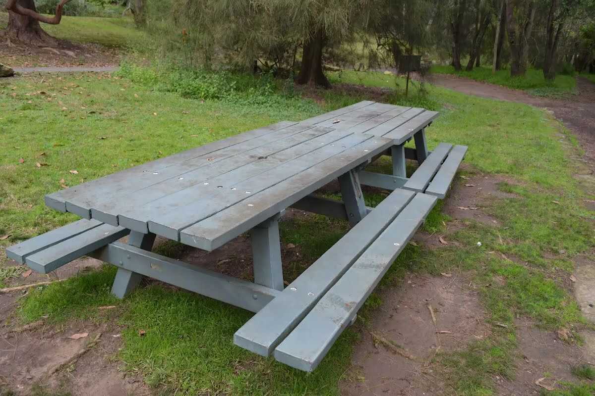
After another 85 m find the "Picnic Table" (on your right).
2 tables are 73cm high, 90cm deep and 2.1m wide. The seats are 36cm high, 31cm deep and 2.1m wide (no backrest).
|
|
|
After another 15 m continue straight, to head along Riverside Walk.

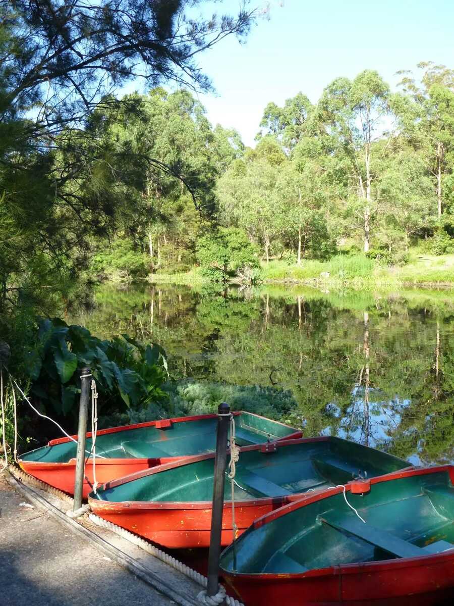
After another 35 m find the "Lane Cove Boatshed" (30 m on your right).
Lane Cove Boatshed, in Lane Cove National Park, is situated on the bank of the (you guessed it) Lane Cove River. You can hire rowboats, kayaks, pedal boats, bikes and canoes, for different ways to enjoy the river. The shop also sells ice-creams, chips and drinks. The shed is open on weekend from 10am - 5pm. During summer school holidays, the shop is also open from 12-5pm. For more info, call Greg on 0418600695.
After another 30 m find the "Picnic Table" (8 m on your right).
The table is 73cm high, 74cm deep and 3m wide. The seats are 41cm high, 29cm deep and 3m wide (no backrest).
After another 50 m find the "Pinch Point" (on your right).
Track narrow to a maximum width of 80cm at this point.

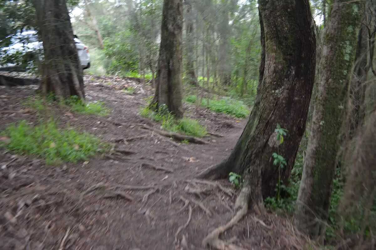
After another 45 m come to the "Wheelchair Rough".
Two sections (of about 15m each) of the track have exposed tree route, making the ground uneven and creating trip hazards.
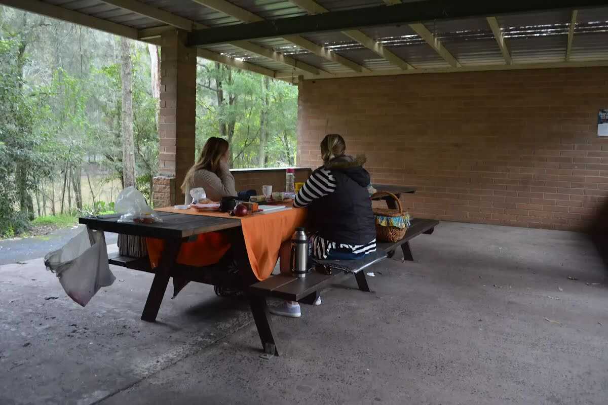
Then find the "Illoura Picnic Shelter" (15 m on your right).
The park brick picnic shelter is on the bank of the Lane Cove River, near the Boatshed. There are two picnic tables in the shelter. The tables are 78cm high, 93cm deep and 2.1m wide. The second table is 4.3m wide. The seats are 44cm high, 29cm deep and 2.1m wide. The second table has seats that are 3.7m. Outside the shelter is another picnic table and wood BBQ. The picnic shelter is nestled in a grove of trees between the carpark and the open grassy Illoura picnic area. There is a small toilet block across the road

After another 10 m find the "Picnic Shelter" (15 m on your right).
2 picnic tables in a large shelter. tables are 78cm high, 93cm deep and 2.1m ( the second table is 4.3) wide. The seats are 44cm high, 29cm deep and 2.1m wide (second table seats are 3.7m).
After another 35 m find the "Illoura Picnic Area" (25 m on your right).
The Illoura Picnic Area in Lane Cove National Park, is an open grassy area beside the river and about 140m downstream of the Boatshed. The picnic area has a water tap, picnic tables and wood fired BBQ. On the other side of the Riverside Drive is a small toilet block. The eastern edge of the picnic area is a large brick picnic shelter.

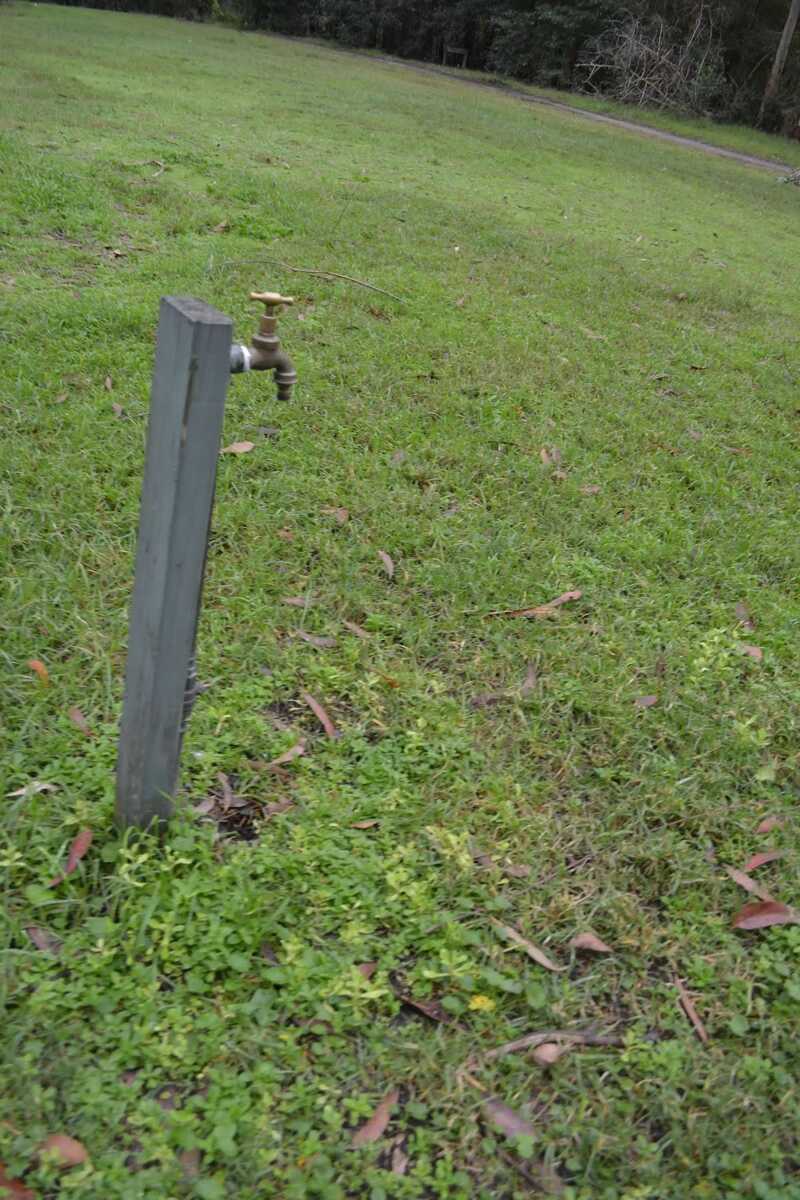
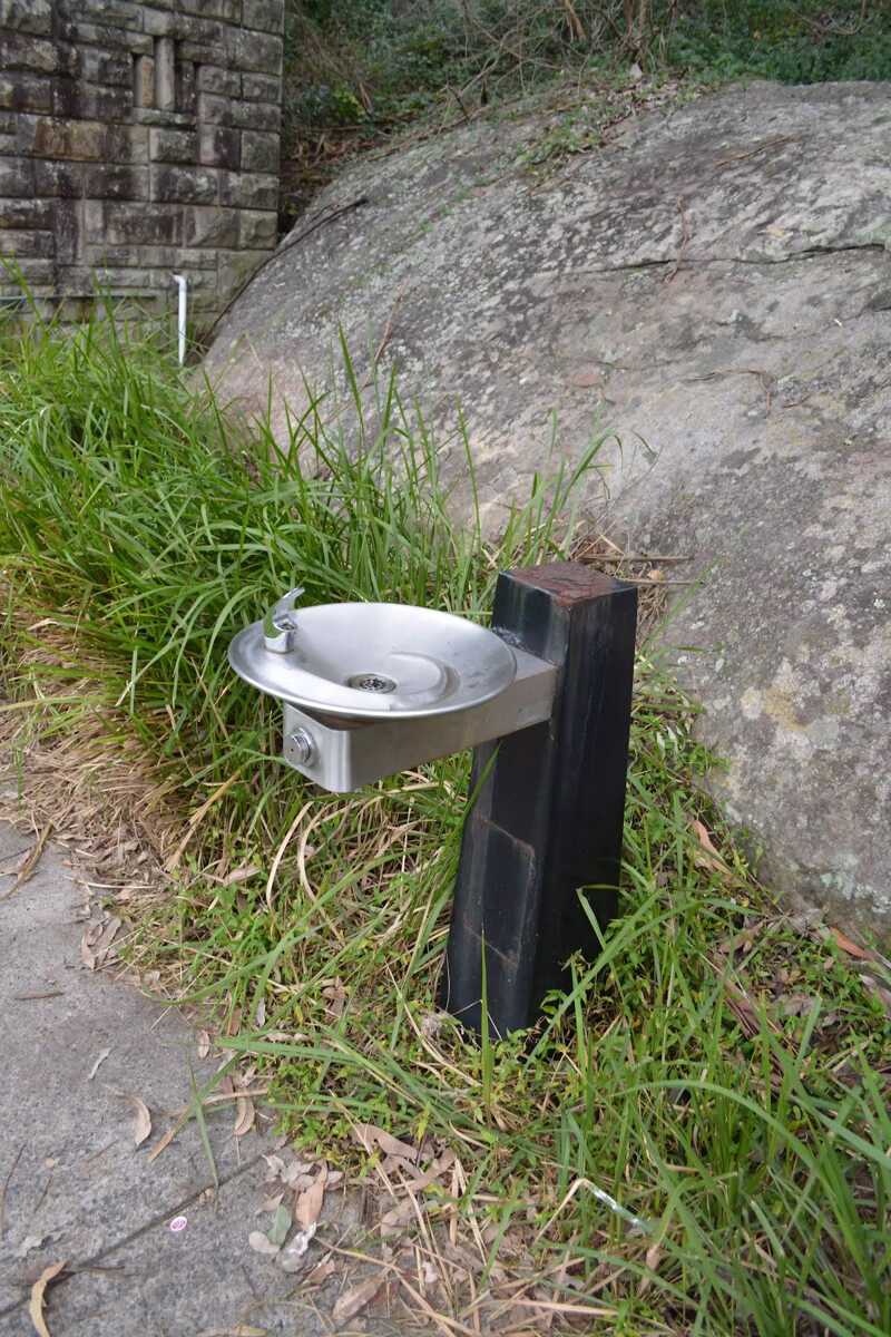
After another 120 m find the "Potable Water" (20 m on your right).
A water tap on the grass, handle is 84cm high.
After another 25 m find the "Picnic Table" (15 m on your right).
A timber slat picnic table under a tree. The table is 72cm high, 92cm deep and 2.1m wide. The seats are 34cm high, 30cm deep and 2.1m wide (no backrest).
After another 8 m find the "BBQ" (20 m on your right).
An timber fired BBQ. Plate is 90cm high, 46cm wide and 42cm deep.

After another 15 m find the "Seat" (15 m on your right).
A timber slat picnic table under a tree. The table is 74cm high, 92cm deep and 2.1m wide. The seats are 38cm high, 30cm deep and 2.1m wide (no backrest).
Then find the "BBQ" (20 m on your right).
An timber fired BBQ. Plate is 94cm high, 46cm wide and 42cm deep.
Then find the "Seat" (20 m on your right).
A timber slat picnic table under a tree. The table is 74cm high, 92cm deep and 2.1m wide. The seats are 40cm high, 30cm deep and 2.1m wide (no backrest).
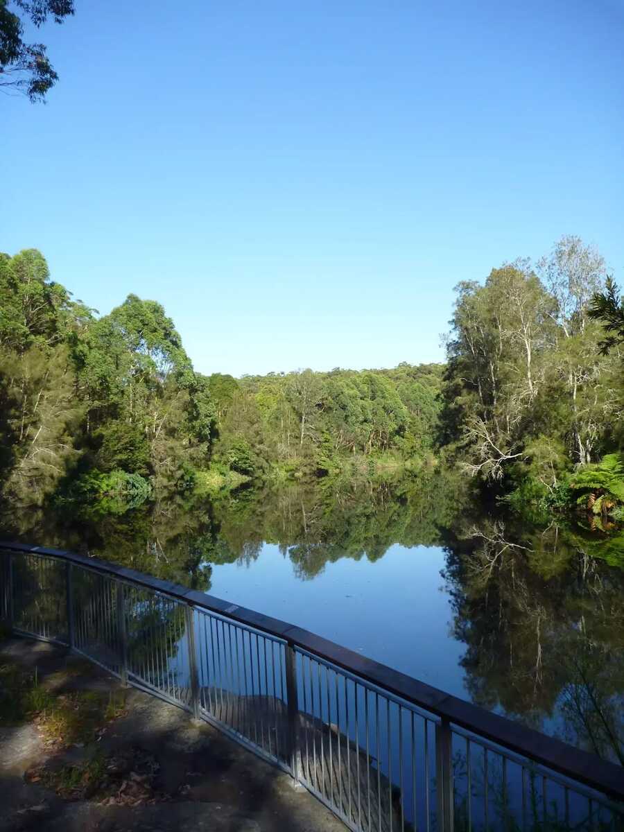
After another 140 m find the "Lane Cove River Lookout" (on your left).
Found along the timber boardwalk on the banks of the Lane Cove River, just up stream from the weir, is this lovely viewing platform. The boardwalk and platform are fenced (1.1m high), there are two main seats and a stepped area for extra seating. The views extend upstream for about 250m and is a great spot to watch water birds and the occasional paddle boat.
Then find the "Seat" (on your right).
Two timber seats, 43cm high, 48cm deep and 1.8m wide with no arm or backrest.
|
|
|

After another 20 m turn sharp left.
|
|
|

After another 15 m turn right.
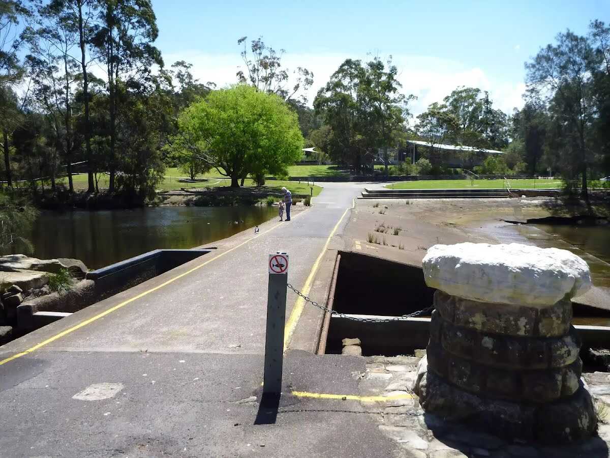
After another 35 m find the "Lane Cove Weir" (30 m on your left).
The Lane Cove River Weir was built in 1938 during the depression. The motivation for building the lake was to make the area more appealing for visitors' picnics. The weir created environmental issues such as silting and a decline in native fish populations. In more recent years, a 'fish ladder' has been constructed to allow fish to undertake their natural migration route for breeding. The weir proves an easy way for walkers to cross the Lane Cove River whilst enjoying the views up and downstream.

Then find the "Trip Hazard" (on your left).
The edges of the weir are ungraded and there is a significant drop with water hazards. Keep clear of edges.
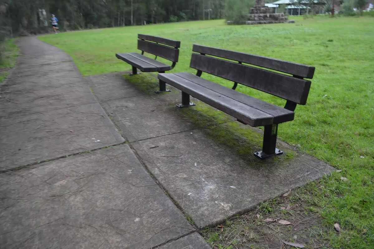
After another 15 m find the "Seat" (on your left).
Two timber seats, 40cm high, 38cm deep and 1.8m wide with a 35cm backrest and no arm rests.
|
|
|

After another 45 m veer right.
After another 30 m find the "Koonjeree Picnic Area" (7 m on your left).
Koonjeree Picnic Area is at the southern end of Lane Cove National Park, just near Fullers Bridge. The picnic area boasts free gas barbecues, flushing toilets, town tap water, picnic tables and shelters, a large open area and car parking. On the bank of the Lane Cove River, this is a pleasant spot to enjoy the park.
|
|
|
Continue straight.
|
|
|
After another 25 m turn left, to head along Riverside Drive.
Then pass the BBQ (5 m on your left).

After another 60 m pass the car park (20 m on your right).

Then find the "Parking Accessible" (15 m on your right).
There are 18 car parking bays. One is marked mobiilty parking near the toilets. The mobility parking area is ashphalt, 3.4m wide and 5.5m deep.
Then find the "Toilet" (15 m on your right).
Male and female toilet block. Entrance is 75cm wide with 2 9cm steps, hand basins 87cm high, cubical doors 65cm wide, toilet seat 42cm high. Male toilet has a urinal with 6cm step. No handrails.
After another 20 m find the "Potable Water" (15 m on your right).
Drinking fountain, 87cm high.
After another 30 m head through/around the gate.
09:00-19:00
|
|
|

After another 25 m come to the end.
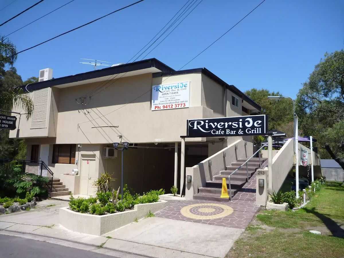
About 50 m past the end is "Riverside Cafe Bar & Grill".
The Riverside Cafe is found at the end of service road on the south-west corner of Fullers Bridge. The nicely renovated building looks over the Lane Cove River and is open 7 days, serving breakfast, lunch and dinner. The food is cafe-style and meals are priced upwards from $13. Ph: (02) 9412 3773.
|