| Start | At the intersection of Currie Road Trail & Currie Road (-33.7601115,151.2246902) |
| Mode | Bus Car (There is free parking available.) |
| Directions | From Warringah Road, A38
|
| Finish | (-33.7688936,151.2039156) |
| Mode (end) | Car Shuttle Bus Car (A park entry fee is required for driving into the park.) |
| Turn map | Directions & comments |
|---|---|
 |
|
 |
|
 |
|
 |
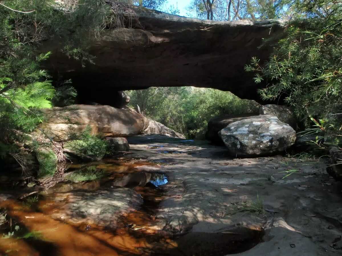
The starting point of an optional sidetrip. An optional side trip to Natural Bridge. To start this optional side trip veer left here. On returning from this side trip turn left when you get back to this intersection. Details below.
|
 |
|
 |
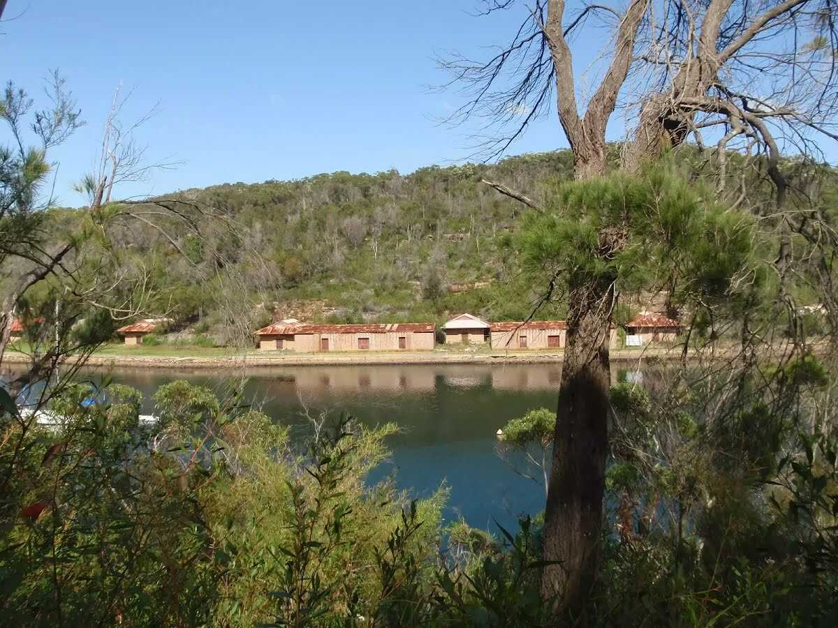 The Magazine Buildings were the premier storage facility for merchants' explosives between 1915 and 1974. During this time, the carefully constructed building where crucial for the safe storage of explosives used for building public works such as the Sydney Harbour Bridge, and additionally used by the Australian Navy during World War II. There is currently no public access to the site, and the buildings are best viewed from across the water at Bantry Bay Picnic Area, or anywhere on the other side of Bantry Bay.
|
 |
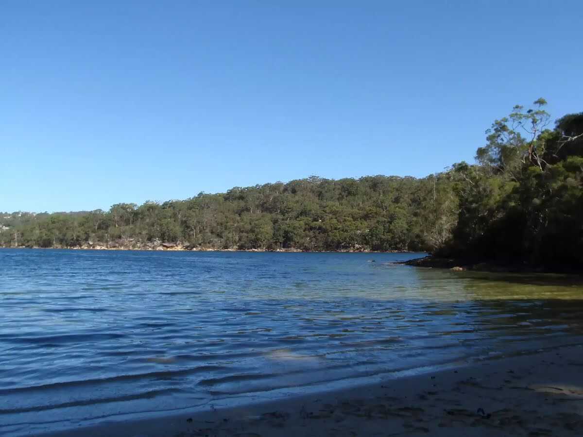
The starting point of an optional sidetrip. An optional side trip to Flat Rock Beach. To start this optional side trip turn left here. On returning from this side trip veer left when you get back to this intersection. Details below.
|
 |
|
 |
|
 |
|
 |
|
 |
|
 |
|
 |
|
 |
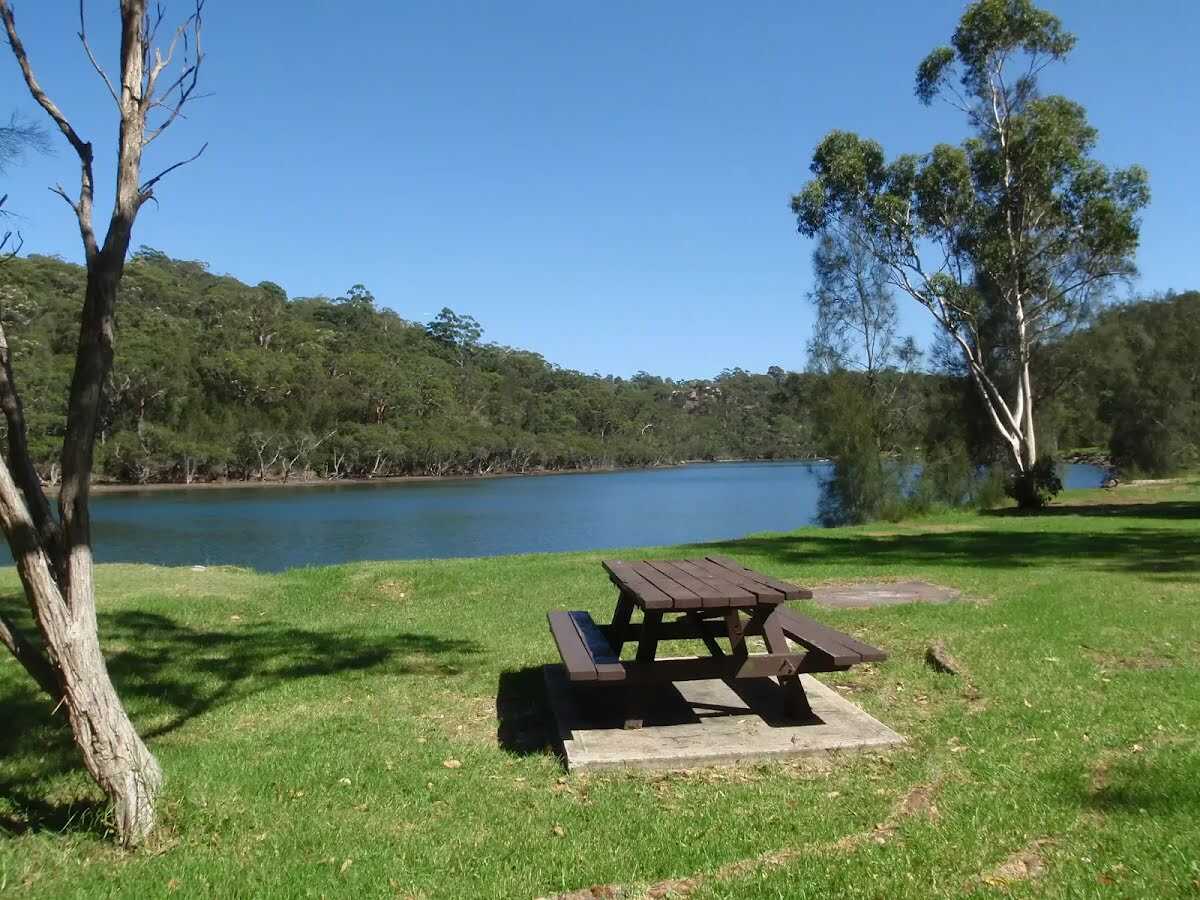 Davidson Picnic Area is in Garigal National Park, under Roseville Bridge (access via Warringah Road, south bound lanes, or via many walking tracks in the area). The picnic area has a boat ramp, wheelchair-accessible toilets, large open grassy areas, picnic tables, free electric BBQ's, and a large rotunda. There are plenty of shady spots provided by the trees. The northern section of the picnic area has a small beach swimming area, and the southern section boasts a boat ramp. The park is open 6am to 8pm (6:30pm outside daylight savings time). Ticket machines are provided to pay the car access fee.
|
 |

|
|
Class 3/6 Moderate track |
|---|---|
| Length | 7.5 km |
| Time | 2 h 45 min to 3 h |
| Quality of track | Formed track, with some branches and other obstacles (3/6) |
| Gradient | Short steep hills (3/6) |
| Signage | Directional signs along the way (3/6) |
| Infrastructure | Limited facilities, not all cliffs are fenced (3/6) |
| Experience Required | Some bushwalking experience recommended (3/6) |
| Weather | Weather generally has little impact on safety (1/6) |
| Item | From Start | Name & link to notes |
|---|---|---|
Toilet
| 7.3 km | [toilet] |