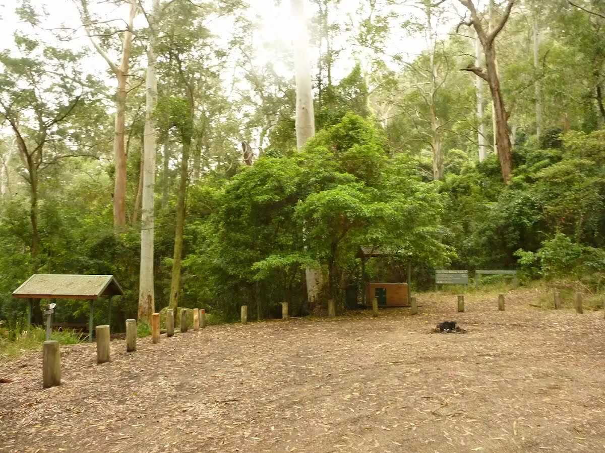
| Start | At the intersection of Bangalow Road & Gap Creek Falls Walking Track (-33.0132165,151.4306063) |
| Mode | Car (There is free parking available.) |
| Directions | From Pacific Motorway, M1
|
| Turn map | Directions & comments |
|---|---|
 |
At the intersection of Bangalow Road & Gap Creek Falls Walking Track Start heading along Gap Creek Falls Walking Track (a walking track).
|
 |
The starting point of an optional sidetrip. An optional side trip to End of Forest Walk. To start this optional side trip continue straight here. On returning from this side trip error >360 when you get back to this intersection. Details below.
|
 |
Continue another 295 m to find the end. Then turn around here and retrace the main route for 680 m to get back to the start.
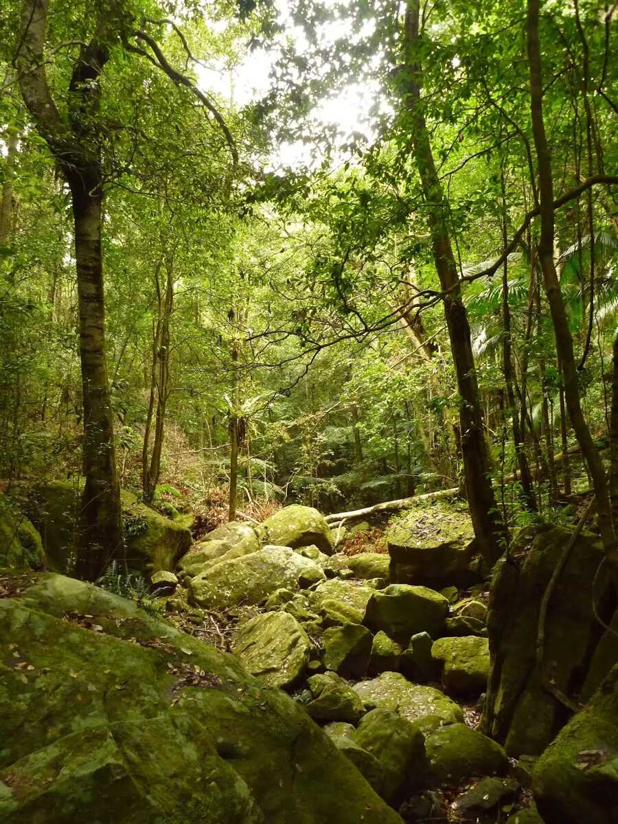
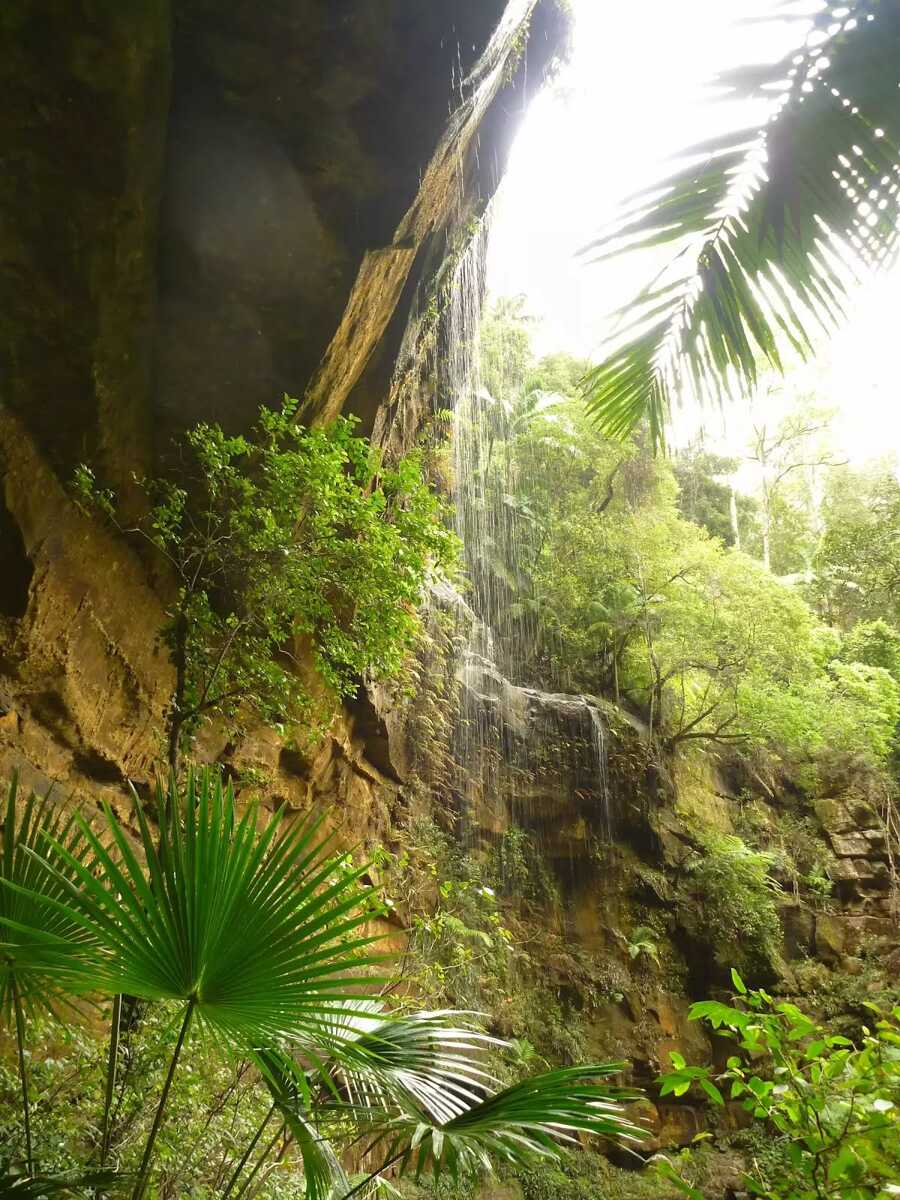 The Gap Creek waterfall, within the Watagans National Park, is arguably the best waterfall in the Hunter region. The Gap Creek waterfall used to be known as Brownie Falls, named after a pioneer saw-milling family in the Martinsville valley. The falls consists of a large amphitheatre of rock surrounded by rainforest. It is possible to walk across the drainage from the falls and then along an unfenced ledge to get behind the falling water of the waterfall. The waterfall is most spectacular after heavy rains, however it is wise to let the roads dry out before using them. A great spot to sit and relax at any time of the year.
|

|
|
Class 3/6 Moderate track |
|---|---|
| Length | 1.4 km |
| Time | 50 min to 1 h |
| Quality of track | Formed track, with some branches and other obstacles (3/6) |
| Gradient | Short steep hills (3/6) |
| Signage | Directional signs along the way (3/6) |
| Infrastructure | Limited facilities, not all cliffs are fenced (3/6) |
| Experience Required | Some bushwalking experience recommended (3/6) |
| Weather | Weather generally has little impact on safety (1/6) |
| Item | From Start | Name & link to notes |
|---|---|---|
Toilet
| -75 m | [toilet] |
Camp site
| 15 m | Gap Creek Campground |