| Start | At the intersection of Pulpit Rock Track & Pulpit Rock Road (-33.6180083,150.3283835) |
| Mode | Bus Car (There is free parking available.) |
| Directions | From Great Western Highway, A32
|
| Finish | Govetts Leap Lookout (-33.6279732,150.3114915) |
| Mode (end) | Car Shuttle Bus Car (There is free parking available.) |
| Turn map | Directions & comments |
|---|---|
 |
|
 |
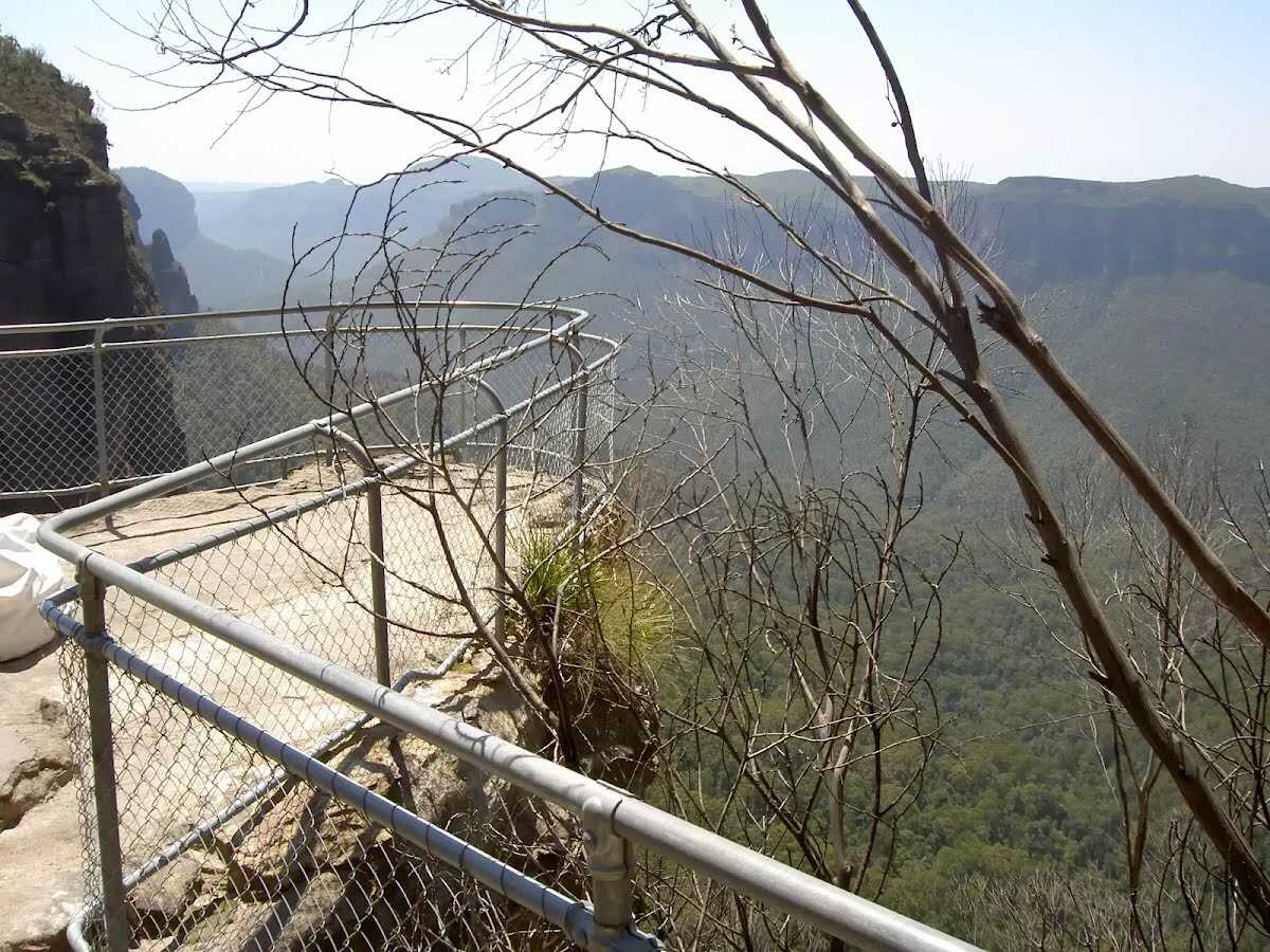
The starting point of an optional sidetrip. An optional side trip to Pulpit Rock Upper Lookout. To start this optional side trip continue straight here. On returning from this side trip continue straight when you get back to this intersection. Details below. 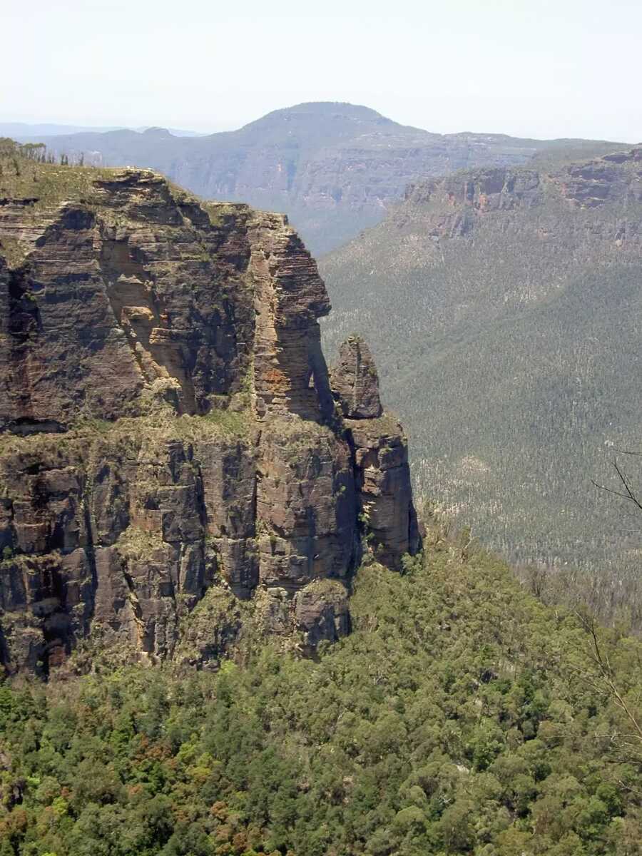 Boyd Lookout, Blue Mountains National Park, looks over the Grose Valley with a spectacular view over Pulpit Rock to the east. It is an unfenced, informal lookout.
|
 |
At the intersection of Popes Glen Track & Pulpit Rock Track turn sharp left, to head along Pulpit Rock Track.
|
 |
|
 |
|
 |
|
 |
|
 |
|
 |
|
 |
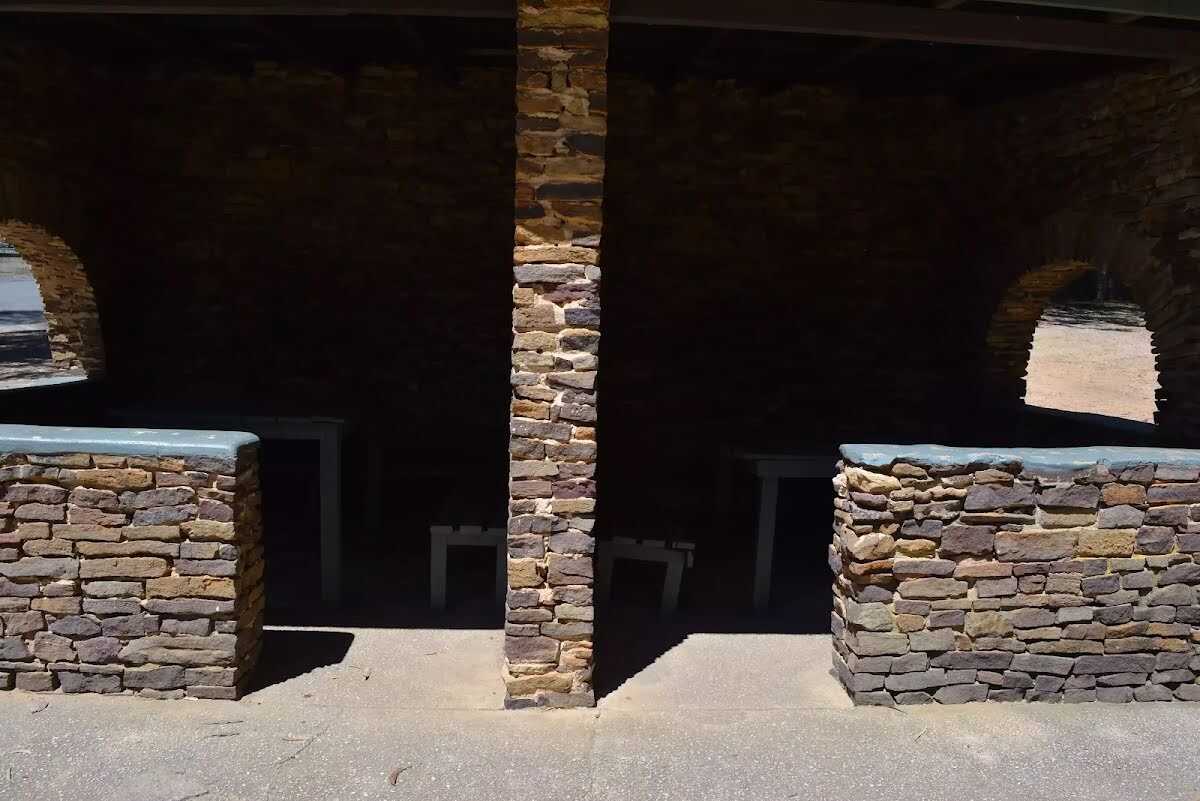 Picnic shelters at the end of Govetts Leap Road. Seats are ~45cm high and benches 75cm high. Most shelters have an entrance ~1.2m wide with, and similar gap between table and wall. The largest shelter has an entrance wider than 4m, bench seating but no tables.
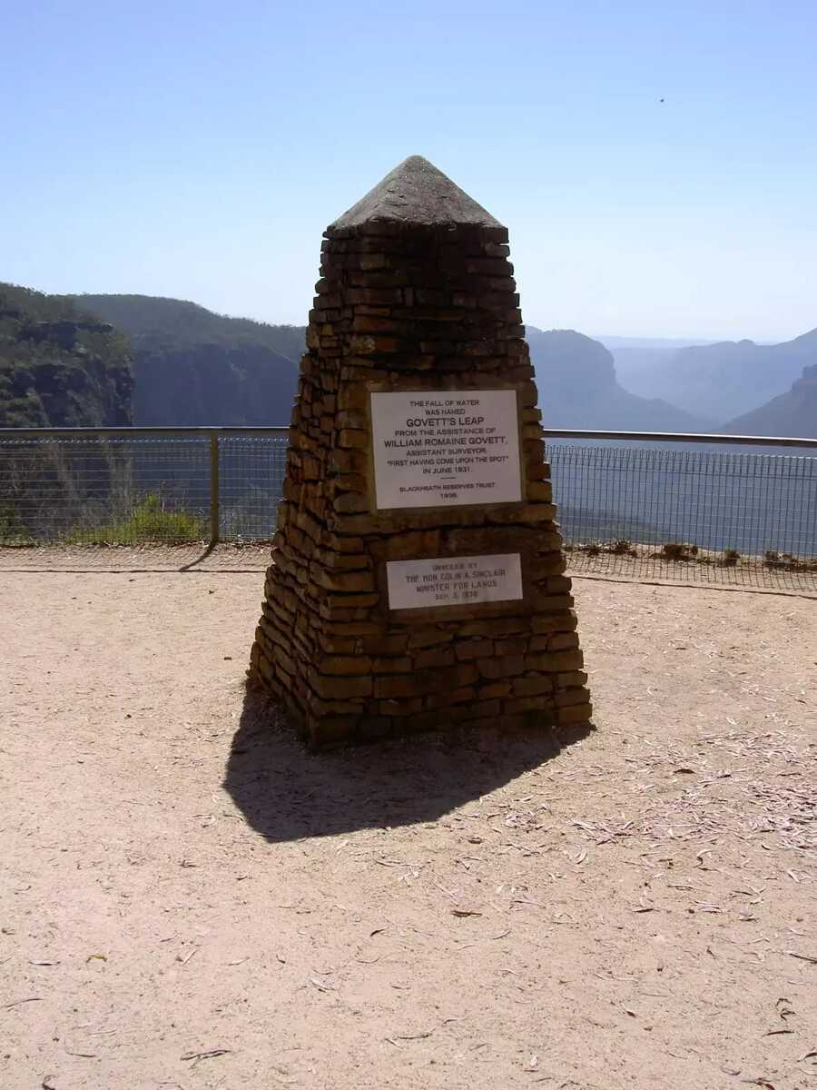 Govetts Leap Lookout is named after the first European man to have enjoyed this view, William Govett, as an assistant surveyor in June 1831. Govetts Leap Lookout offers wonderful views over the Grose Valley and the spectacular Bridal Falls. The word `leap` is an old Scottish word meaning waterfall. The lookout is easily accessed from the car park, there are also toilets and picnic shelters nearby.
|
 |
|
 |
|
 |
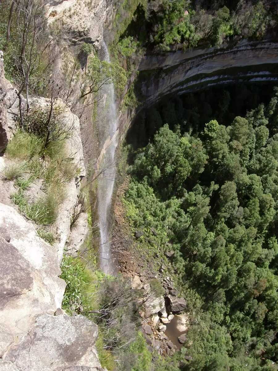
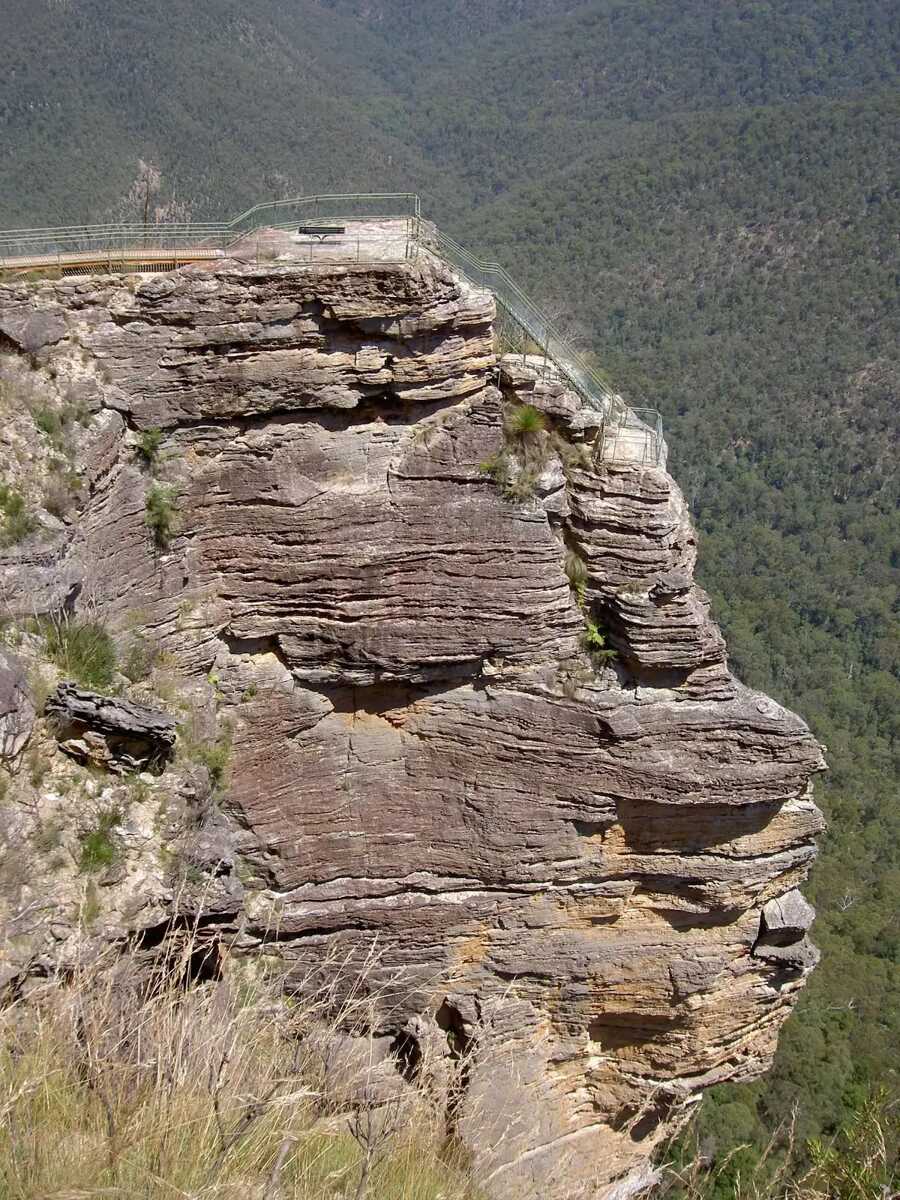 Pulpit Rock Lookout, Blue Mountains National Park, looks over the Grose Valley and back towards Blackheath, with Bridal Veil Falls and the Govetts Leap cliff edge in view. The lookout has many levels with the uppermost lookout having the easiest access.
|

|
|
Class 4/6 Hard track |
|---|---|
| Length | 3.9 km |
| Time | 2 h 45 min to 3 h 15 min |
| Quality of track | Formed track, with some branches and other obstacles (3/6) |
| Gradient | Very steep (4/6) |
| Signage | Directional signs along the way (3/6) |
| Infrastructure | Limited facilities, not all cliffs are fenced (3/6) |
| Experience Required | No experience required (1/6) |
| Weather | Weather generally has little impact on safety (1/6) |
| Item | From Start | Name & link to notes |
|---|---|---|
Shelter
| 70 m | [shelter] |
Toilet
| 70 m | [toilet] |
Seat
| 280 m + 155 m | [seat] |
Toilet
| 3.8 km | [toilet] |