| Start | (-33.7199986,150.3629813) |
| Mode | Car (There is free parking available.) |
| Directions | From
|
| Turn map | Directions & comments |
|---|---|
 |
|
 |
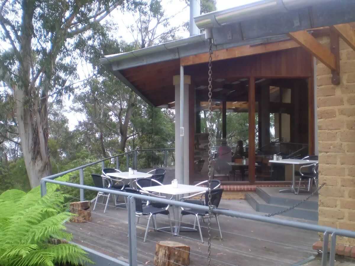 Conservation Hut is a small cafe perched above the Valley of the Waters, Blue Mountains National Park. The hut was opened in 1963 as a meeting place for the local conservation movement. Rebuilt, Conservation Hut opened as a cafe in 1993, serving breakfast, lunch and dinner, seven days a week. Around the Conservation Hut is a small parking area, public toilets, picnic shelters, town water and B&B's. For further information or bookings call (02) 4757 3827.
|
 |
|
 |
|
 |
|
 |
The starting point of an optional sidetrip. An optional side trip to Queen Victoria Lookout. To start this optional side trip continue straight here. On returning from this side trip turn left when you get back to this intersection. Details below.
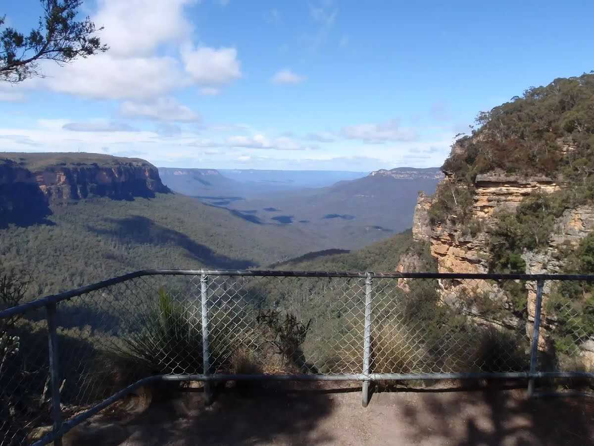
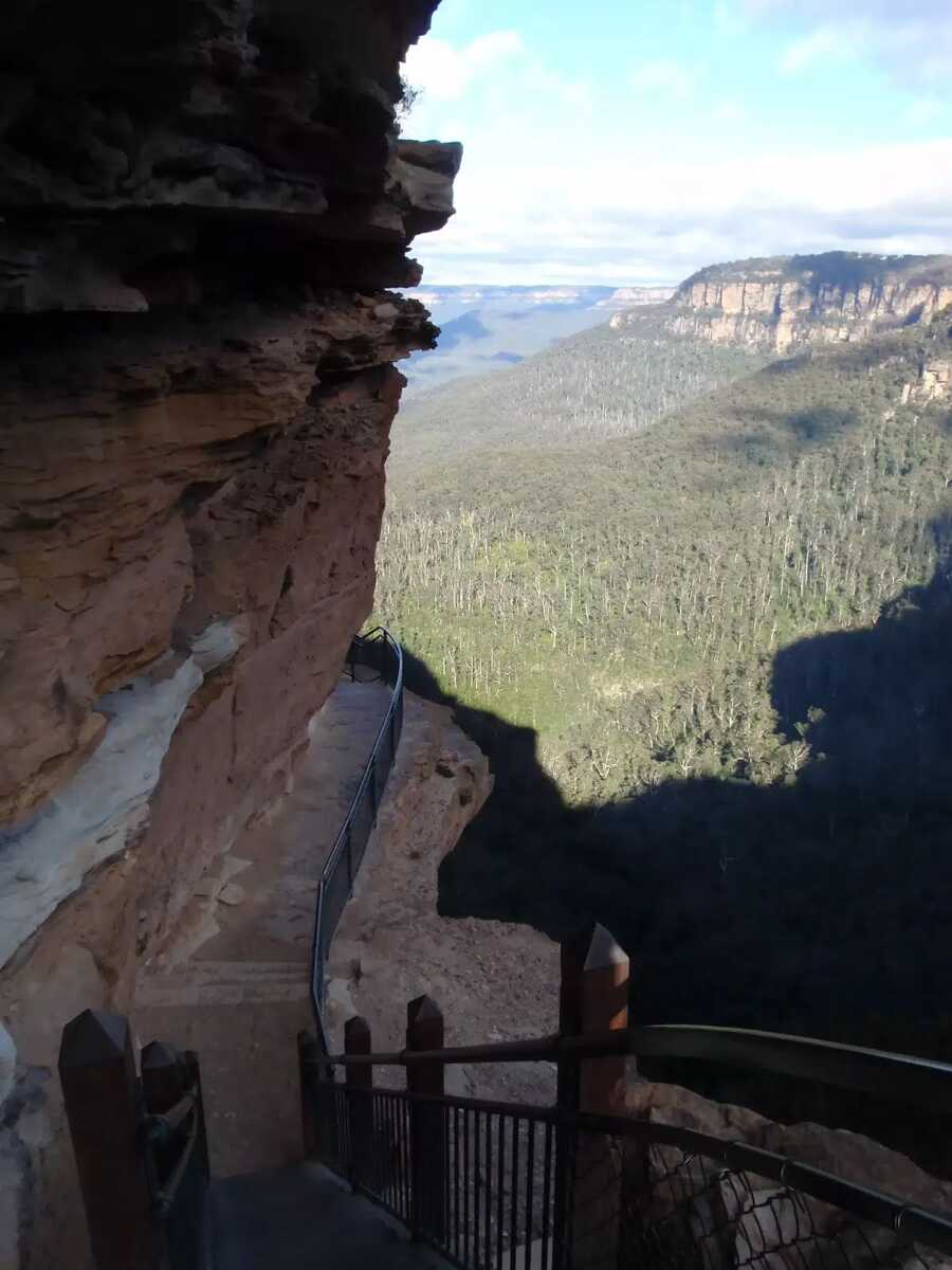
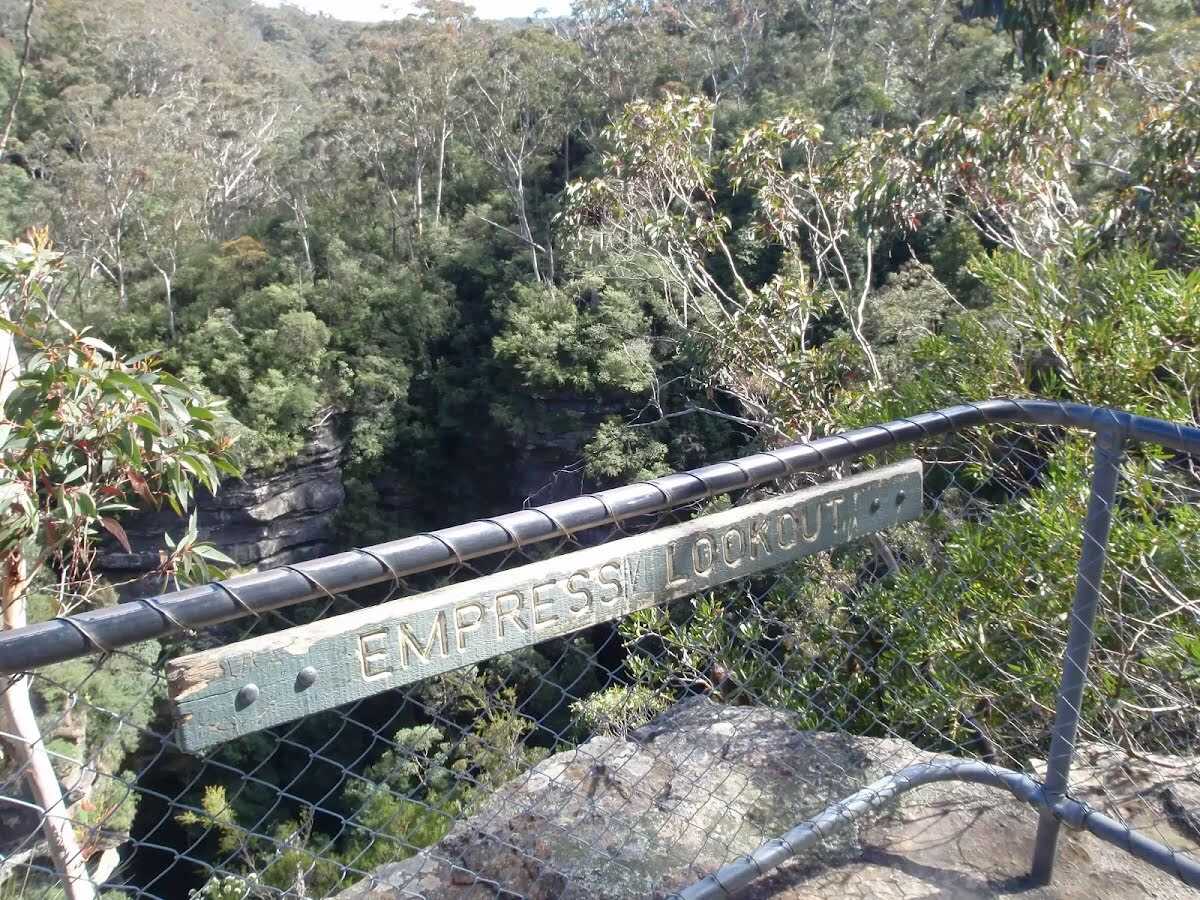 Empress Lookout is a fenced and signposted lookout, perched on a sandstone overhang above the Valley of the Waters Creek. There is a view down to part of the Empress Falls and into the canyon. The views are filtered through the surrounding trees. It makes for a good spot to catch your breath when walking into, or out of, the Valley of the Waters.
|
 |
After another 90 m (at the intersection of Nature Track & Valley of the Waters Track) turn left, to head along National Pass Track.
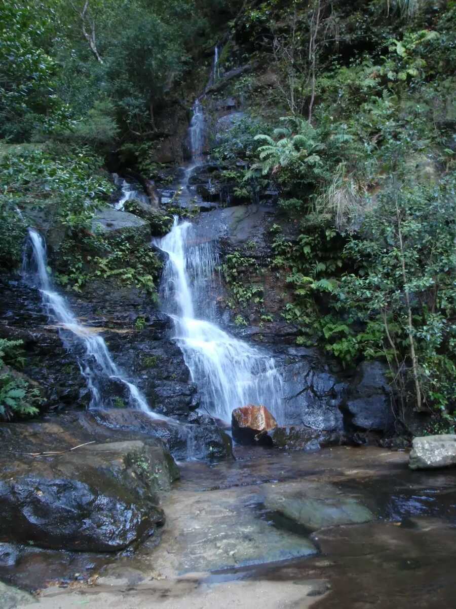
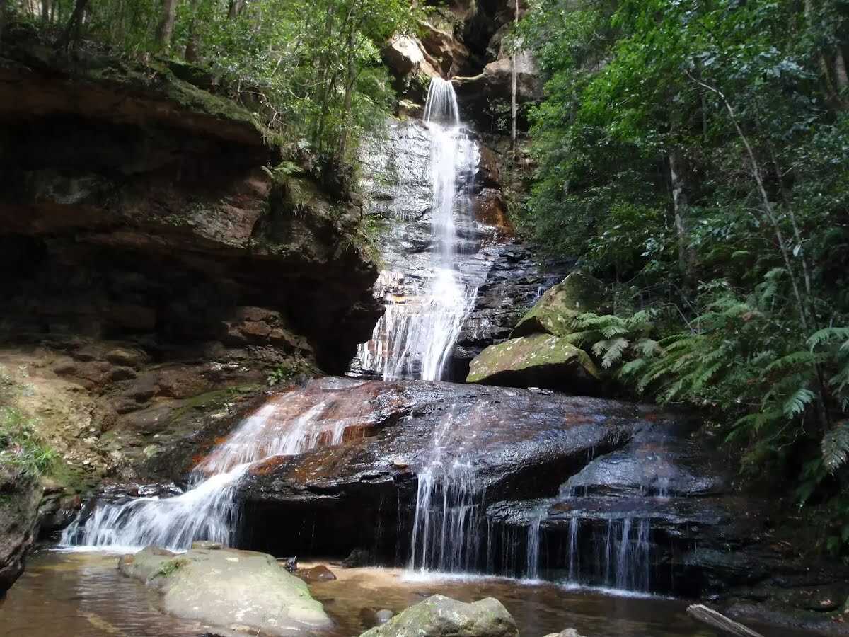 Empress Falls is a spectacular waterfall in the Valley of the Waters. The Valley of the Water Creek comes out of the slot in the cliff and tumbles down a series of cliffs to a sandy pool. The fall is the site of the last abseil in a popular canyon, making a great site for walkers in the area. Stepping stones help walkers cross below the falls. There is a small overhang next to the falls, giving the area shade and offering a great place to rest.
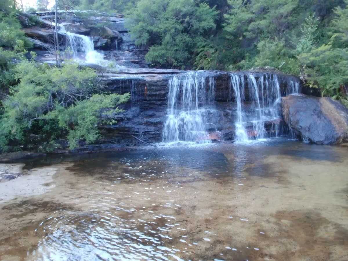
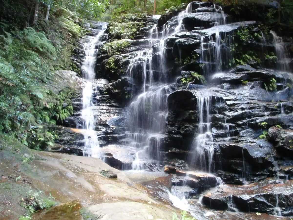 Sylvia Falls on the Valley of the Waters Creek is a lovely tall cascade. The falls are in a deep sandstone canyon with mossy walls. The stairs and handrail pass closely to these falls, helping walkers get nice and close. From near the top of the falls, there is a great view down the valley looking between the canyon walls.
 Lodore Falls are a lovely set of falls on the Valley of the Waters Creek. The narrow falls have a staircase on one side and stepping stones (and handrail) crossing the bottom, making it easier for walkers to appreciate this waterfall from many angles. Just beyond the handrail, the water falls over another cliff, providing a great view down the valley.
|
 |
After another 30 m (at the intersection of Wentworth Pass & National Pass Track) continue straight, to head along National Pass Track.
 The Den Fenella Creek falls down the cliff to this halfway point on the National Pass. Here, the timber platform and handrails, installed by the NPWS, allow walkers to cool off at the pass under the dripping water. As with much of this pass, there are great views into the valley.
|
 |
After another 65 m (at the intersection of Slacks Stairs & National Pass Track) continue straight, to head along National Pass Track.
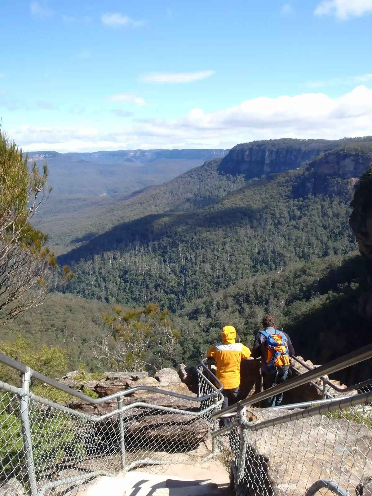
 The National Pass crosses Wentworth Falls halfway down its long drop. At this crossing, NPWS have installed sandstone block bridges to improve access for walkers. There are a few side tracks that have been used to explore the area - beware of the slippery rocks and unfenced ledges. There is also a great view into the valley from where the water continues to fall on it long journey further into the valley. This is a lovely spot to cool down on a warm day.
|
 |
At the intersection of Rocket Point Circuit & National Pass Track continue straight, to head along Wentworth Falls Track.
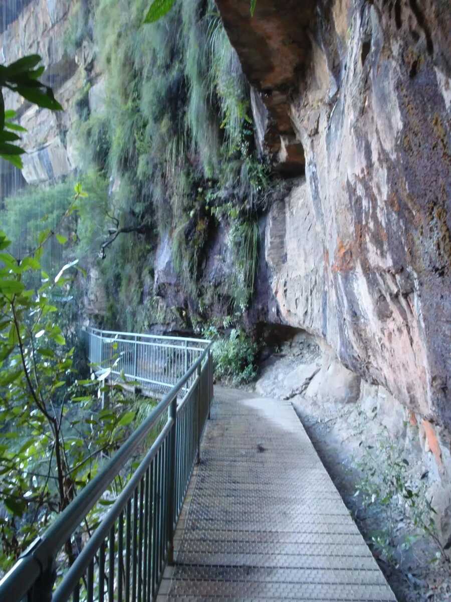
 The Grand Stairway is a very memorable section of the National Pass in the Blue Mountains National Park. The stairway is reported to be 'the tallest outdoor staircase in Australia' and was built in the early 1900's by hand (and dynamite). This stairway, and the rest of the National Pass, was built by a team nicknamed 'the Irish Brigade' for the cost of £430 . Today, the Grand Stairway is well-maintained and provides walkers access to the valley below Wentworth Falls.
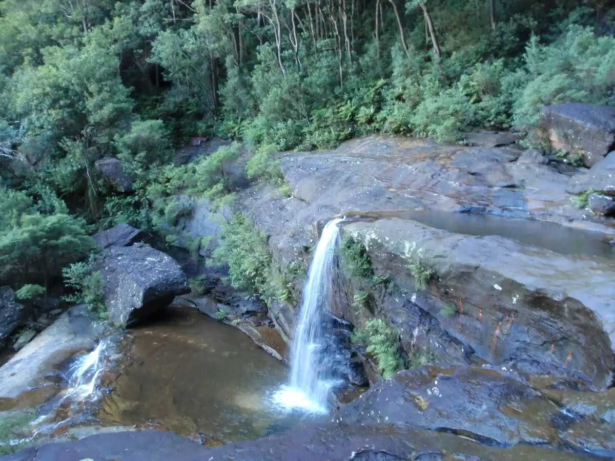
 Queen's Cascades are a lovely set of falls on the Jamison Creek at the top of Wentworth Falls. The creek heads down the wide, two-stage cascades into a sandy pool. From the pool, the water flows between the stepping stones, under the fence and down the very tall Wentworth Falls. There are also great views to Sublime Point across the valley.
|
 |
|
 |
After another 45 m (at the intersection of Undercliff Track & Wentworth Falls Track) turn sharp right, to head along Wentworth Falls Track.
 Fletchers Lookout is a fenced and signposted lookout off the side of the Undercliff Walk, just north of the Wentworth Falls. The lookout provides a fairly close view of the top of Wentworth Falls and a great view into the Jamison Valley. There is a good distant view of Mount Solitary and Narrow Neck, and also great views of the surrounding escarpments.
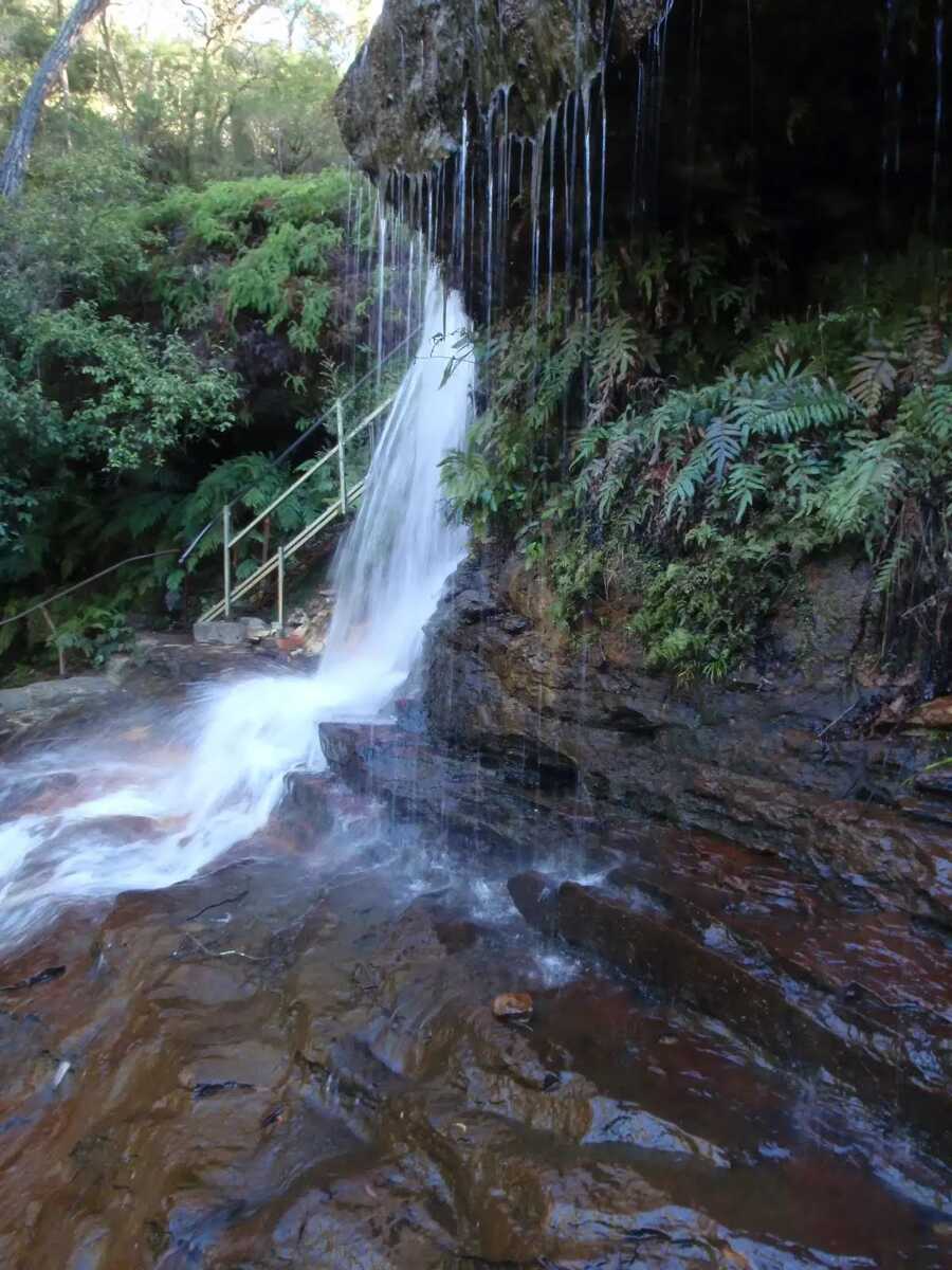 Weeping Rock is a waterfall on Jamison Creek, upstream of Wentworth Falls in the Blue Mountains National Park. The water falls over the wide circular top overhang, to then cascade down the rocks to a pool below. A staircase beside the falls helps walkers view this waterfall from different angles. This is a nice cool spot on hot days. The rocks are slippery and there are no fences, care is needed.
|
 |
|
 |
|
 |
|
 |
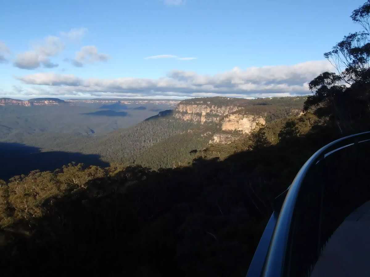 Wentworth Falls Lookout, in the Blue Mountains National Park, is beside Sir H Burrell Drive. The lookout is fenced and has a large information sign about the area. There are some bench seats and great vistas. There is a view to Wentworth Falls (in the valley to the left), but the most captivating view is across the Jamison Valley to Mount Solitary. There are also great views of the Kings Tableland (left), Sublime Point (right) and Narrow Neck (far right) escarpments. This is a great place to enjoy the scope of this World Heritage listed area.
|
 |
|
 |
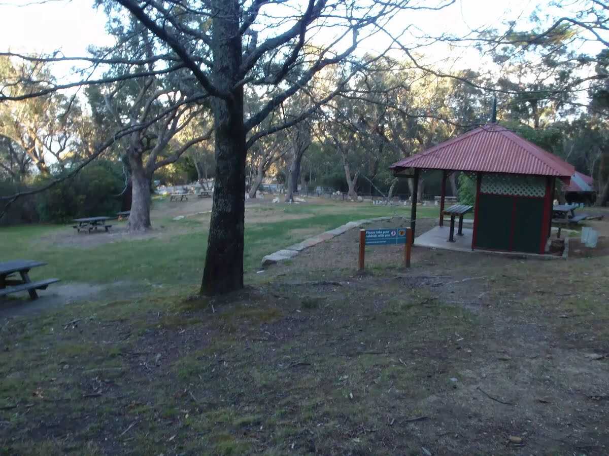 The Wentworth Falls Picnic Area is in the Blue Mountains National Park on Sir H Burrell Drive (Wentworth Falls). The picnic area is host to a couple of wonderful lookouts and some good facilities. A large car park, toilets (wheelchair accessible), picnic tables, free electric BBQs, town water and information signs. This is a great spot to relax between walks in the area.
|
 |
|
 |
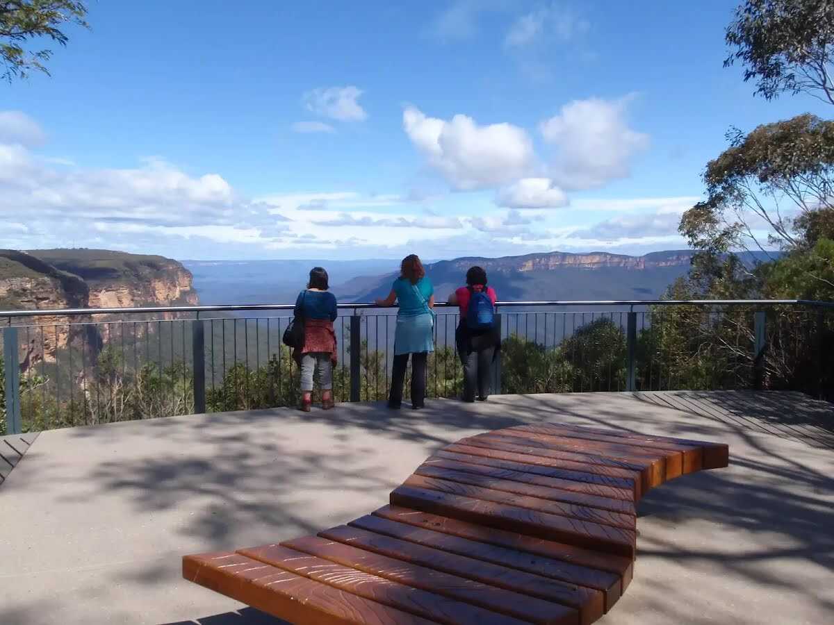 The recently renovated Jamison Lookout is on Sir H Burrell Drive, in the Blue Mountains National Park. The lookout has a wonderful view to the south, down the Jamison Valley to Mount Solitary and beyond. This is a great wheelchair-accessible viewpoint with a large information sign and bench seats. The lookout is fenced, and is located just below the Wentworth Falls Picnic Area.
|
 |
|
 |
|
 |
|
 |
|
 |
|
 |
|
 |
|
 |
|
 |
|
 |

|
|
Class 4/6 Hard track |
|---|---|
| Length | 5.1 km |
| Time | 4 h to 5 h |
| Quality of track | Formed track, with some branches and other obstacles (3/6) |
| Gradient | Very steep (4/6) |
| Signage | Directional signs along the way (3/6) |
| Infrastructure | Limited facilities, not all cliffs are fenced (3/6) |
| Experience Required | Some bushwalking experience recommended (3/6) |
| Weather | Storms may impact on navigation and safety (3/6) |
| Item | From Start | Name & link to notes |
|---|---|---|
Toilet
| 8 m | [toilet] |
Seat
| 1.5 km | [seat] |
Seat
| 3.5 km | [seat] |
Shelter
| 3.9 km | [shelter] |
Toilet
| 4 km | [toilet] |