| Start | (-33.5736804,150.2921125) |
| Mode | Car (There is free parking available.) |
| Directions | From
|
| Finish | (-33.6340635,150.2847534) |
| Mode (end) | Car Shuttle Bus Car (There is free parking available.) Train |
| Turn map | Directions & comments |
|---|---|
 |
|
 |
|
 |
|
 |
|
 |
The starting point of an optional sidetrip. An optional side trip to Victoria Falls. To start this optional side trip continue straight here. On returning from this side trip veer right when you get back to this intersection. Details below. 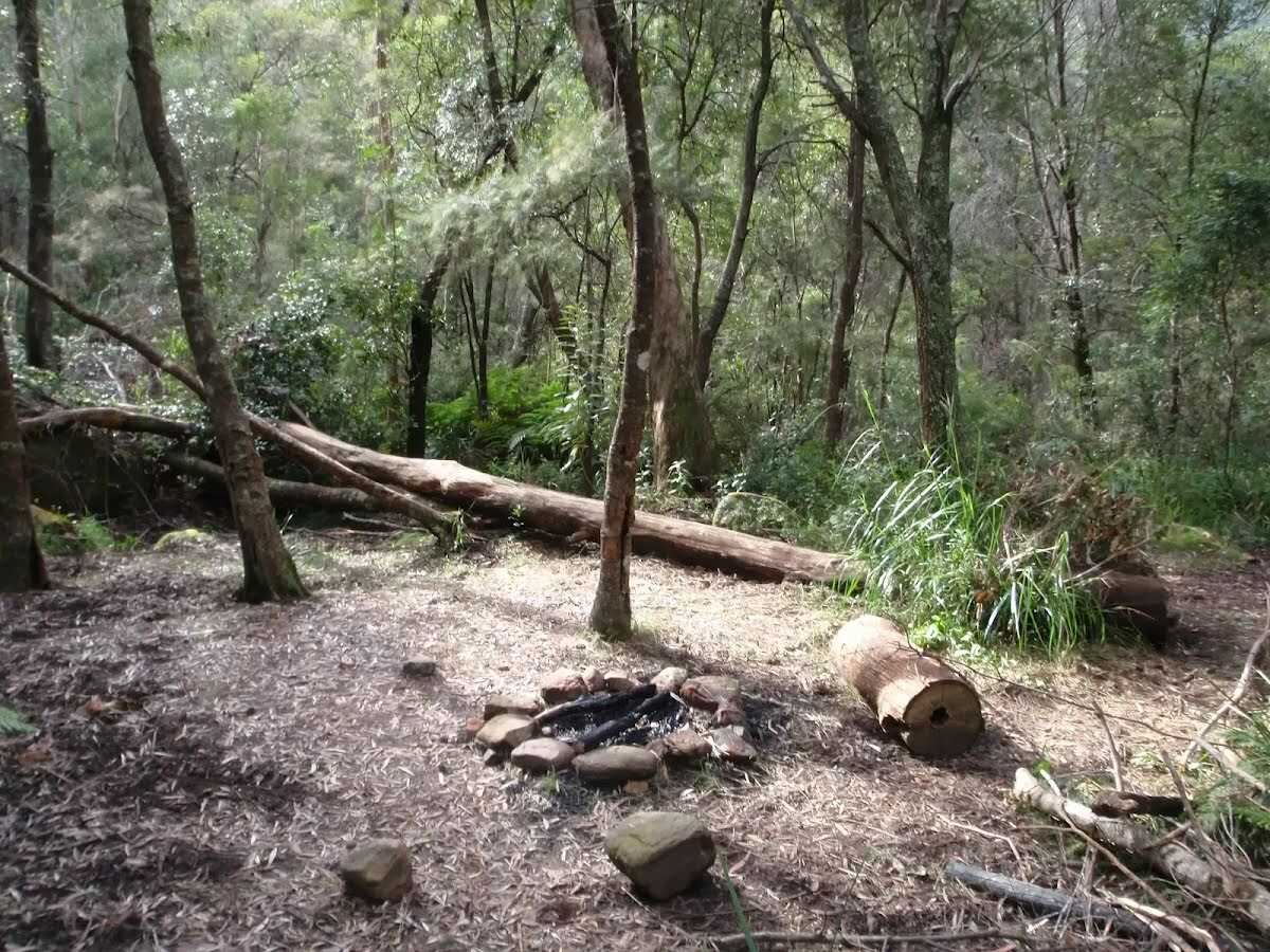 Burra Korain Flat Camping Area, Blue Mountains NP, is a small clearing between the Victoria Creek and Grose River. The campsite is well signposted and has nice sitting logs and plenty of space for a few tents. Water can be accessed from either river or creek but should be treated before use.
|
 |
|
 |
After another 690 m (at the intersection of Perrys Track & Shortridge Pass) continue straight, to head along Blue Gum Forest Track.
This is a free campsite.
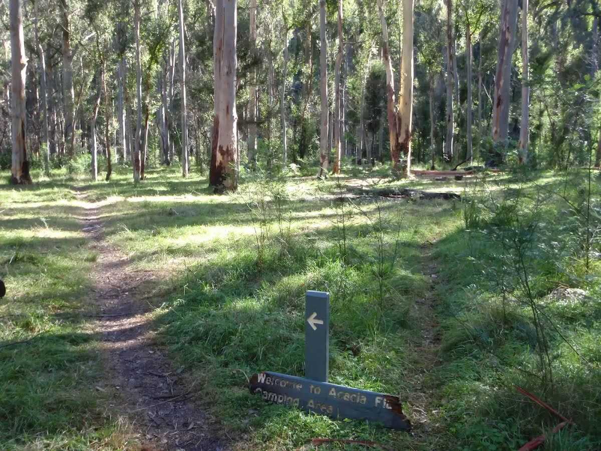 Acacia Flats Camping Ground, Blue Mountains NP, is situated on the floor of the Grose Valley between Perrys Lookdown and Lockley Pylon. The camp ground is approximately 50m from Govetts Creek and approximately 500m upstream from Blue Gum Forest. Acacia Flats Camping Ground is appropriately named after the dense population of Acacias found in this area. Acacia Flats is a wonderful area to camp with tall shady Blue Gums and level grass clearings which make for a great place to pitch a tent. There is a pit toilet and sitting logs to make camping more comfortable, and plenty of room for large groups. Water is available from Govetts Creek (treat before drinking).
|
 |
|
 |
At the intersection of Blue Gum Forest Track & Rodriguez Pass Walking Track continue straight, to head along Rodriguez Pass Walking Track.
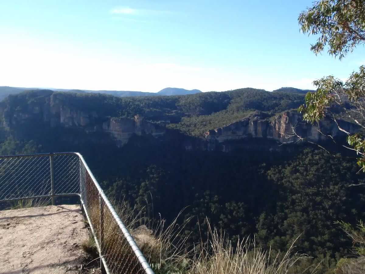
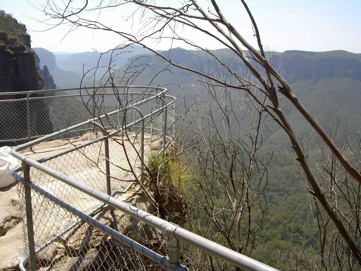
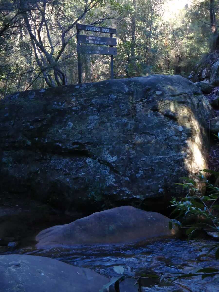 Junction Rock, Blue Mountains NP, is a rock situated in the middle of the Govetts Leap Brook and Govetts Creek junction. The rock is signposted, giving directions to Evans Lookout, Neates Glen, Acacia Flats and the Blue Gum Forest. Junction Rock is a great place for lunch and a swim in summer.
|
 |
|
 |
|
 |
|
 |
|
 |
|
 |
|
 |
|
 |
The starting point of an optional sidetrip. An optional side trip to Boyd Beach. To start this optional side trip turn right here. On returning from this side trip continue straight when you get back to this intersection. Details below.
|
 |
|
 |
|
 |
|
 |
|
 |
|
 |
|
 |
|
 |
|
 |
|
 |
|
 |
|
 |
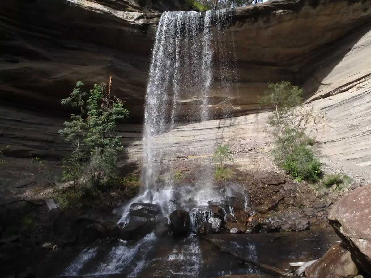 Victoria Falls, Blue Mountains NP, is a large waterfall dropping over a grey rock overhang. The cascade is produced by Victoria Creek dropping over the approximately-15m cliffs. A scree slope leads up behind the falls, and below the falls the rocks are very slippery. These falls are well worth a visit, with the great views from the top of the falls, and the accessibility of the bottom of the falls, making a great trip.
|
| Turn map | Directions & comments |
|---|---|
 |
|
 |

|
|
Class 5/6 Very challenging |
|---|---|
| Length | 23.3 km |
| Time | 8 h 30 min, 13 h to 2 days |
| Quality of track | Rough unclear track (5/6) |
| Gradient | Very steep (4/6) |
| Signage | Minimal directional signs (4/6) |
| Infrastructure | Limited facilities (such as cliffs not fenced, significant creeks not bridged) (4/6) |
| Experience Required | Some bushwalking experience recommended (3/6) |
| Weather | Weather generally has little impact on safety (1/6) |
| Item | From Start | Name & link to notes |
|---|---|---|
Toilet
| -7 m | [toilet] |
Campsite
| 3.4 km | Burra Korain Flat Camping Area |
Camp site
| 3.5 km | Burra Korain Camping Area |
Camp site
| 13.1 km | Acacia Flat Campground |
Campsite
| 13.1 km | Acacia Flats Camping Ground |
Toilet
| 13.3 km | [toilet] |
Toilet
| 13.4 km | [toilet] |
Camp site
| 16.9 km | [camp site] |