Awabakal Coastal Walk
Awabakal Country

40 min to 45 min

1.9 km
oneway

↑ 19 m
↓ -47 m

Hard track
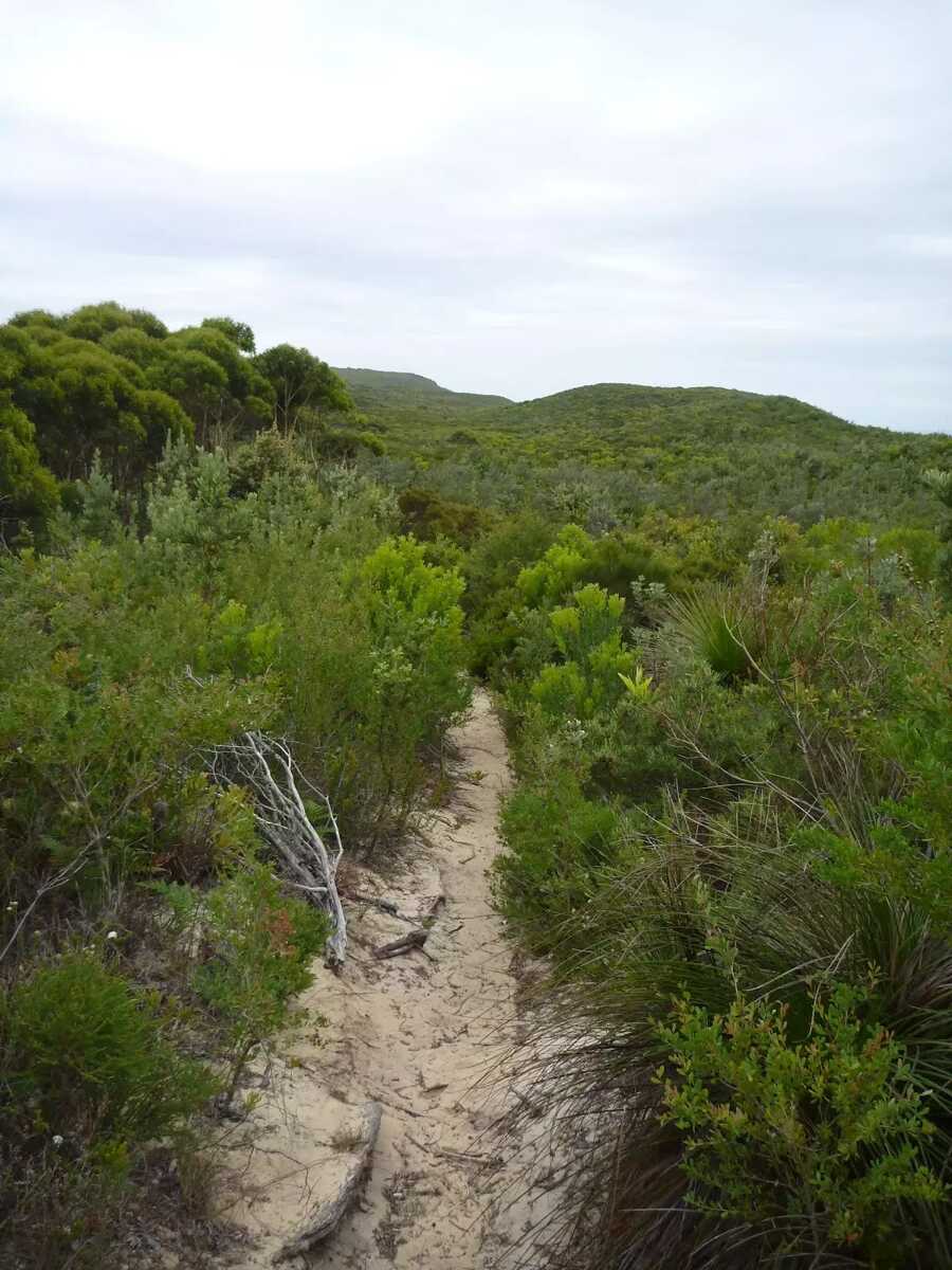
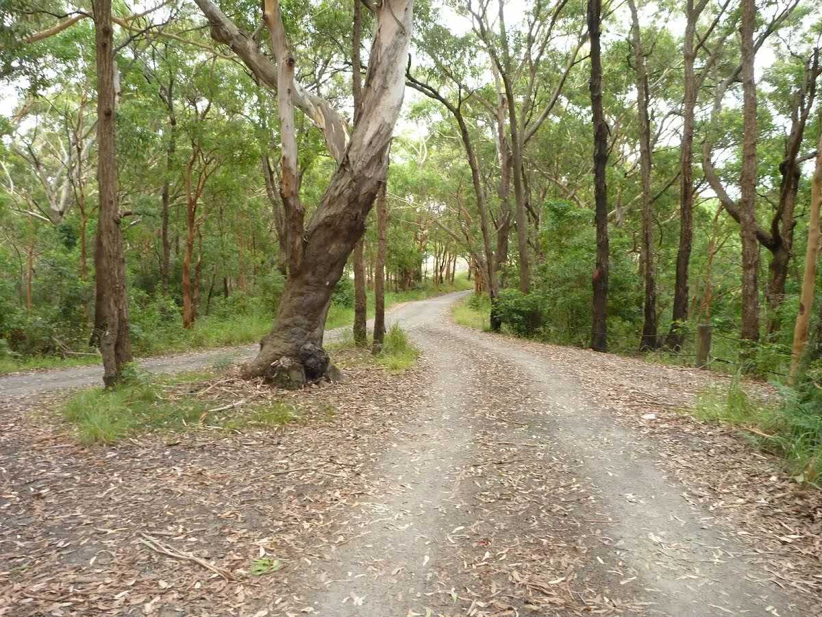
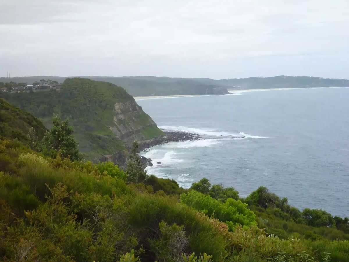
This walk traverses the Awabakal Nature Reserve. Starting from Dudley in the north, this walk travels south through coastal heath and forest, until coming to Redhead. The vegetation throughout this walk is particularly attractive during the wildflower season of July to October. The side trip out to the Awabakal Viewpoint gives great views to the north along the coastline. A car shuffle would be ideal for this one-way walk. The walking tracks are a little overgrown, but if you like native forest and heath, or simply flowers, then this is the walk for you. Let us begin by acknowledging the Awabakal people, Traditional Custodians of the land on which we travel today, and pay our respects to their Elders past and present. 
Show all
Awabakal car park near Dudley in the Awabakal Nature Reserve. | Photo by admin, 2011.
Locked gate at the Awabakal Car Park near Dudley. | Photo by admin, 2011.
Metal gate and timber fence at the Awabakal car park in the Awabakal Nature Reserve. | Photo by admin, 2011.
Narrow trail through forest near the Awabakal car park. | Photo by admin, 2011.
Attractive forest near the Awabakal car park. | Photo by admin, 2011.
Open area with large tree and picnic table in Awabakal Nature Reserve. | Photo by admin, 2011.
Tree and picnic table in Awabakal Nature Reserve. | Photo by admin, 2011.
A Picnic table and tree near the Awabakal Nature Reserve. | Photo by admin, 2011.
Uphill trail in the Awabakal Nature Reserve. | Photo by admin, 2011.
Sandy trail in the Awabakal Nature Reserve. | Photo by admin, 2011.
Sandy trail near the Awabakal Viewpoint. | Photo by admin, 2011.
Sandy trail near the Awabakal Viewpoint in the Awabakal Nature Reserve. | Photo by admin, 2011.
Intersection near the Awabakal Viewpoint in the Awabakal Nature Reserve. | Photo by admin, 2011.
Views from the Awabakal Viewpoint. | Photo by admin, 2011.
Sandy intersection near the Awabakal Viewpoint. | Photo by admin, 2011.
Narrow track near the Awabakal Viewpoint. | Photo by admin, 2011.
Narrow track in the Awabakal Nature Reserve. | Photo by admin, 2011.
Track through forest on the Awabakal Coastal Walk. | Photo by admin, 2011.
Views across the Awabakal Nature Reserve. | Photo by admin, 2011.
Intersection of track in the Awabakal Nature Reserve. | Photo by admin, 2011.
Sandy track on the Awabakal Coastal Walk. | Photo by admin, 2011.
Fringe Lilly on the Awabakal Nature Reserve. | Photo by admin, 2011.
Ant in sand on the Awabakal Nature Reserve. | Photo by admin, 2011.
Views across the Awabakal Nature Reserve. | Photo by admin, 2011.
Overgrown track on the Awabakal Coastal Walk in the Awabakal Nature Reserve. | Photo by admin, 2011.
Vegetation on the Awabakal Coastal Walk. | Photo by admin, 2011.
Mountain Devil flower on the Awabakal Coastal Walk. | Photo by admin, 2011.
Ant on sand in the Awabakal Nature Reserve. | Photo by admin, 2011.
Sandy track through heath on the Awabakal Coastal Walk. | Photo by admin, 2011.
Sandy track in the Awabakal Nature Reserve. | Photo by admin, 2011.
Track through vegetation in the Awabakal Nature Reserve. | Photo by admin, 2011.
Track on the Awabakal Coastal Walk. | Photo by admin, 2011.
Uphill sandy track on the Awabakal Coastal Walk. | Photo by admin, 2011.
Views over heath in the Awabakal Nature Reserve. | Photo by admin, 2011.
Sandy and eroded track on the Awabakal Coastal Walk. | Photo by admin, 2011.
Views on the Awabakal Coastal Walk in the Awabakal Nature Reserve. | Photo by admin, 2011.
Sandy track intersection near Redhead in the Awabakal Nature Reserve. | Photo by admin, 2011.
Leafy track near Collier St in Redhead in the Awabakal Nature Reserve. | Photo by admin, 2011.
Looking at Collier St Redhead from the Awabakal Nature Reserve. | Photo by admin, 2011.
Collier St in Redhead near the Awabakal Nature Reserve. | Photo by admin, 2011.
Sign and track into the Awabakal Nature Reserve. | Photo by admin, 2011.
Map Notes Terrain Reviews Conditions More
Downloads GPX PDF

Some of the information and maps on this page was generated using data from the awesome © OpenStreetMap contributors.
Please see how you can embed some widgets, access data and other stuff to that might be helpful.