| Start | At the intersection of Old Quarry Trail & Grahame Drive (-33.5098802,151.4123034) |
| Mode | Car (There is free parking available.) |
| Directions | From Empire Bay Drive
|
| Finish | Mount Bouddi Carpark (-33.5162393,151.403381) |
| Mode (end) | Car Shuttle Car (There is free parking available.) |
| Turn map | Directions & comments |
|---|---|
 |
|
 |
|
 |
|
 |
 Little Beach campsite is a small grassed area, wedged between the hills and set back from the beach. The campsite has six designated sites, a composting toilet, rubbish bins, Gas BBQ's and a shelter. There is no drinking water onsite and the beach is only 20m away.
|
 |
|
 |
|
 |
|
 |
|
 |
|
 |
|
 |
The starting point of an optional sidetrip. An optional side trip to S.S. Maitland Shipwreck. To start this optional side trip turn left here. On returning from this side trip turn right when you get back to this intersection. Details below.
|
 |
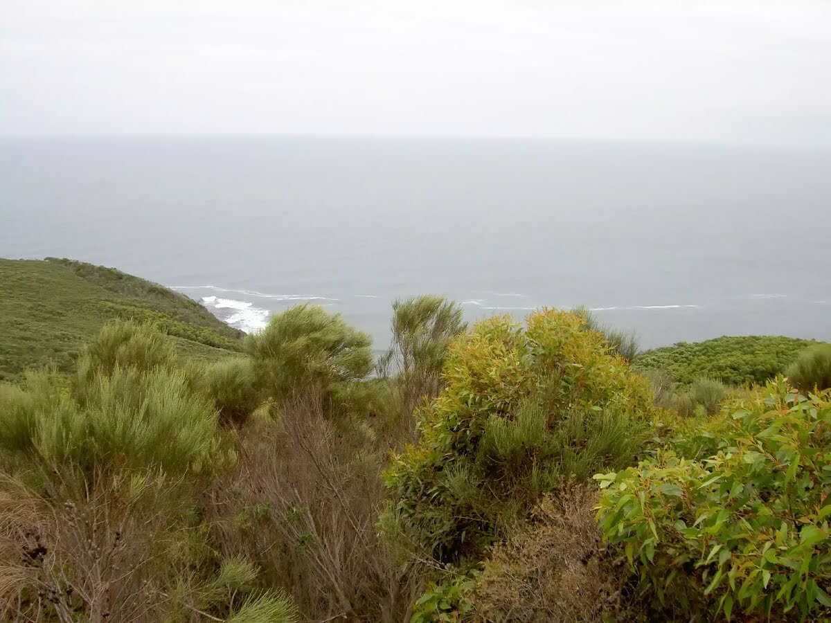 Bouddi Lookout, Bouddi National Park, is a great first look at the Bouddi Coast as you come out of the bush on Bouddi Spur. There are views of the Pacific Ocean crashing into the heath covered headlands in front of the lookout. Not as grand a view as other lookouts in the area, but worth a pause on your way to the Bouddi Coast Track.
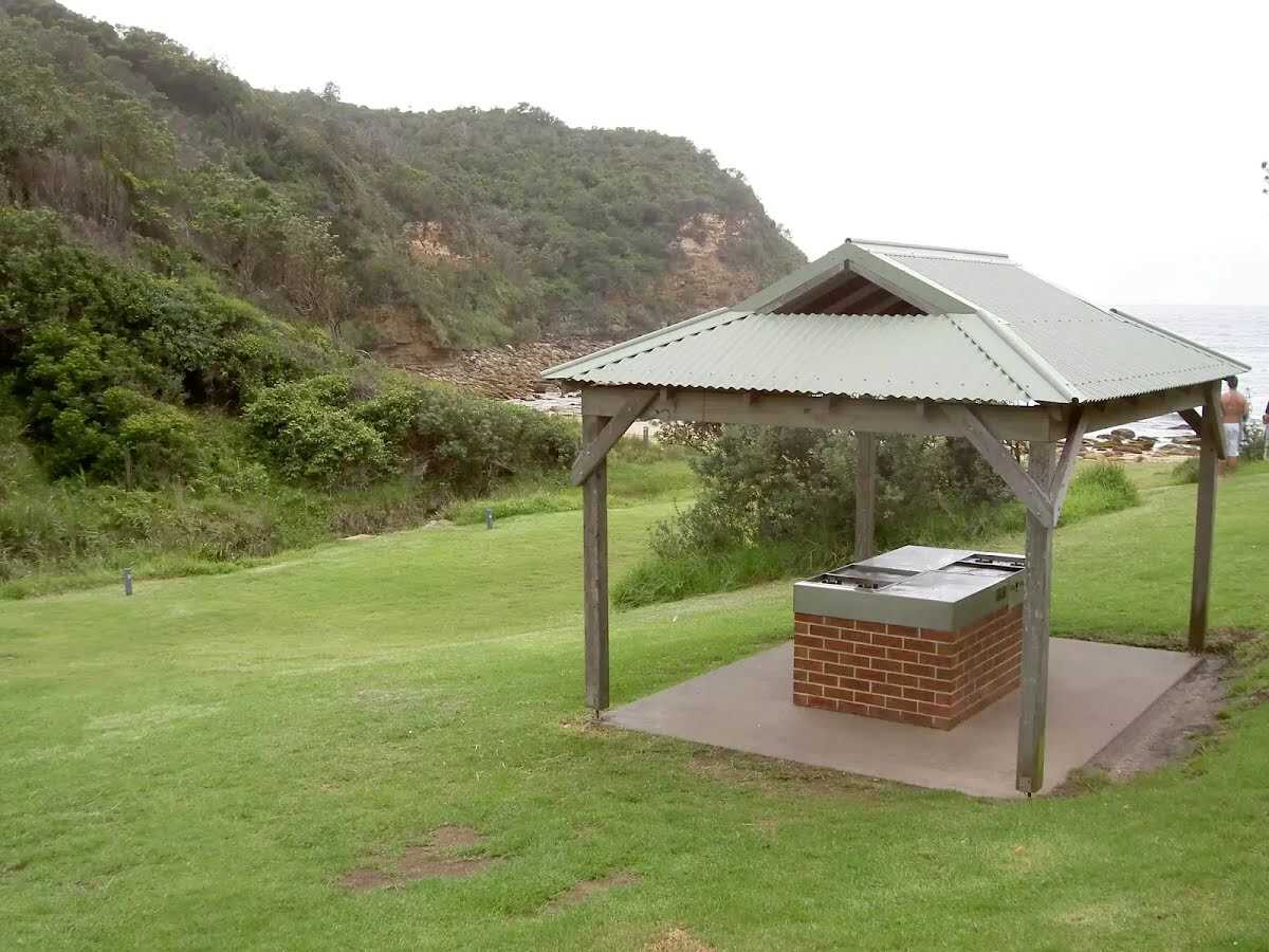
 The Dingeldei Memorial Shelter was built in 1962, thanks to volunteers. A.W. (Bill) Dingeldei was a trustee of the park who did considerable work on it himself. Today the Dingeldei picnic area is a quiet, leafy spot, perched on the hill behind Mount Bouddi. The picnic area contains a picnic table, toilets, BBQ and rubbish facilities. It also has a new car park with ample spaces.
|
 |
| Turn map | Directions & comments |
|---|---|
 |
|
 |
|
 |
|
 |

|
|
Class 4/6 Hard track |
|---|---|
| Length | 5.1 km |
| Time | 2 h to 2 h 45 min |
| Quality of track | Rough track, where fallen trees and other obstacles are likely (4/6) |
| Gradient | Short steep hills (3/6) |
| Signage | Directional signs along the way (3/6) |
| Infrastructure | Limited facilities, not all cliffs are fenced (3/6) |
| Experience Required | No experience required (1/6) |
| Weather | Weather generally has little impact on safety (1/6) |
| Item | From Start | Name & link to notes |
|---|---|---|
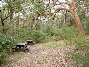
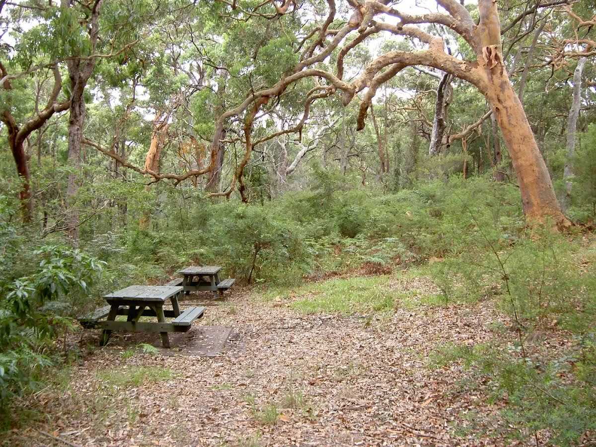
Camp site
| 590 m | Little Beach Camping Area |
Campsite
| 610 m | Little Beach Campsite |
Shelter
| 620 m | [shelter] |
Toilet
| 670 m | [toilet] |
Shelter
| 5.1 km | Mount Bouddi Picnic Area |
Toilet
| 5.1 km | [toilet] |