Hi guys
Looking for some advice on a 2-day hike. Tossing up between a regular Bungalow or Razorback return hike with an overnight camp at Federation and a Bogong loop up the Staircase to Cleve Cole Hut overnight and down Eskdale.
A few questions:
- Which mountain is more scenic/enjoyable?
- Is there reliable water at Federation, Cleve Cole and Michell Huts? If not, which mountain is better for natural water supply?
- Is there any camping options around Feathertop for the night before or do you have to find accommodation in Harrietville, Bright or Mt Beauty?
Thanks
Feathertop or Bogong?
Forum rules
Victoria specific bushwalking discussion. Please avoid publishing details of access to sensitive areas with no tracks.
Victoria specific bushwalking discussion. Please avoid publishing details of access to sensitive areas with no tracks.
18 posts
• Page 1 of 1
Feathertop or Bogong?
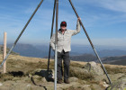
![]() by HenryVIIII » Wed 16 Jan, 2019 3:57 pm
by HenryVIIII » Wed 16 Jan, 2019 3:57 pm
- HenryVIIII
- Nothofagus gunnii

- Posts: 18
- Joined: Wed 11 Nov, 2015 2:44 pm
- Region: New South Wales
- Gender: Male
Re: Feathertop or Bogong?
![]() by paidal_chalne_vala » Wed 16 Jan, 2019 7:39 pm
by paidal_chalne_vala » Wed 16 Jan, 2019 7:39 pm
There are so many routes up Mt. FT and Mt. Bogong. I have walked them all .For Mt. Bogong I like the Quartz Ridge up Mt. Bogong the best, although Mulhauser spur combined with Long spur is a good one too and sees less foot traffic than the usual routes that come in from the Tawonga side of the hill.
The way I did it last summer was to leave the car at the bend in the road along the Hollow way( an unsealed road.). Walk up the 4 x 4 track to the Granite flat spur trail head. Head up and up , follow the Eskdale spur pole line and go over the summit and down the Quartz Ridge. When you reach the bottom of the track there is water in a stream and a good campsite at the old helipad at Bogong Creek Saddle.
The return route involves retracing your steps . It means you will be going up and down Mt. Bogong twice in one weekend. If you are not fit then you soon will be!. You will need good weather to do this because you will be walking above the tree line for about 3 hours from the top of the Eskdale spur until you reach the tree line on the scenic Quartz Ridge and the same again on the way back.
As for Mt. FT, you can walk up the NW spur , and camp at MUMC hut. There is water there. The next day walk up to the top along the track and then return via the Bungalow spur. There is water at Fed. hut and in a spring near the Old Bungalow spur hut ruins. The distance along the Great Alpine road in Harrietville between the Bungalow spur and the NW spur trail heads is approximately 5 kms.
Camping the night before for Mt. Bogong usually means putting a tent up at Mtn. Creek campsite near Tawonga. Camping the night before a Mt. FT trip along the Ovens river is easy esp. near the Old Harrietville rd. bridge in the Freeburgh area.
- paidal_chalne_vala
- Lagarostrobos franklinii

- Posts: 2479
- Joined: Sun 22 Jan, 2012 10:30 pm
- ASSOCIATED ORGANISATIONS: VNPA.BTAC.Friends of Baw Baw.Mt.Bogong Club.
- Region: Victoria
- Gender: Male
Re: Feathertop or Bogong?
![]() by HenryVIIII » Thu 17 Jan, 2019 9:04 am
by HenryVIIII » Thu 17 Jan, 2019 9:04 am
Thanks for that info!
We decided to do Bogong. Do you know how many good camping spots there are with reliable water? I was looking at Cleve Cole Hut and Michell Hut but am open to any spot nearish the summit. Bogong Creek Saddle might be a bit too far though.
We decided to do Bogong. Do you know how many good camping spots there are with reliable water? I was looking at Cleve Cole Hut and Michell Hut but am open to any spot nearish the summit. Bogong Creek Saddle might be a bit too far though.
- HenryVIIII
- Nothofagus gunnii
- Posts: 18
- Joined: Wed 11 Nov, 2015 2:44 pm
- Region: New South Wales
- Gender: Male
Re: Feathertop or Bogong?
![]() by HenryVIIII » Thu 17 Jan, 2019 9:17 am
by HenryVIIII » Thu 17 Jan, 2019 9:17 am
Also is the Mountain Creek Campsite usually busy on Australia Day? I'm assuming it would be.
- HenryVIIII
- Nothofagus gunnii
- Posts: 18
- Joined: Wed 11 Nov, 2015 2:44 pm
- Region: New South Wales
- Gender: Male
Re: Feathertop or Bogong?
![]() by neilmny » Thu 17 Jan, 2019 1:05 pm
by neilmny » Thu 17 Jan, 2019 1:05 pm
HenryVIIII wrote:Also is the Mountain Creek Campsite usually busy on Australia Day? I'm assuming it would be.
Pretty much choka block on any public holiday weekend.
-
neilmny - Lagarostrobos franklinii
- Posts: 2604
- Joined: Fri 03 Aug, 2012 11:19 am
- Region: Victoria
- Gender: Male
Re: Feathertop or Bogong?
![]() by paidal_chalne_vala » Thu 17 Jan, 2019 7:08 pm
by paidal_chalne_vala » Thu 17 Jan, 2019 7:08 pm
RE: MT. Bogong. If you hike in from The Mitta Mitta side and walk up Mulhauser spur and then along Long spur then the campsite at the Long Spur/ T Spur Junction is a good one, it always has fewer people and there is a reliable stream there.
You will need a 4 x4 vehicle , a chainsaw and a map and compass to do this route. Camping the night before at any of the campsites near Mitta Mitta is one way to approach such a mission. Mtn. Ck. on long weekends is horrifically crowded. Tom's hut just off the Trapper's Gap road is a better place to camp. You will need a 4 x 4 jalopy to reach Tom's hut. Take a chainsaw.
Bogong Creek saddle can be reached from Clover Arboretum on the BHP / Falls Creek Road. It will take a day(12kms) to reach that campsite at the bottom of the Quartz Ridge. From there you can do a day trip the next day ( day 2 ) with lighter packs to the Mt.Bogong summit and back. Day 3 you could walk out the same way or return another way i.e . go up Mt. Arthur and down the Black Possum spur track to increase your tolerance of pain and suffering.
- paidal_chalne_vala
- Lagarostrobos franklinii
- Posts: 2479
- Joined: Sun 22 Jan, 2012 10:30 pm
- ASSOCIATED ORGANISATIONS: VNPA.BTAC.Friends of Baw Baw.Mt.Bogong Club.
- Region: Victoria
- Gender: Male
Re: Feathertop or Bogong?
![]() by Xplora » Fri 18 Jan, 2019 4:08 am
by Xplora » Fri 18 Jan, 2019 4:08 am
The spring at Cleve Cole should still be running. It was recently. Just get the water from the tap inside. If not then there are creeks nearby. Should be enough people around Cleve Cole to show you the way. I would imagine it will be packed also. Bogong Creek Saddle down Quartz will take about 2 hours from the summit if you are fit. Nice walk and possible in a day doing the Staircase. May have less people there and water is excellent. You can camp either side of the track or up at the helipad but strictly you are not supposed to camp on helipads or block the track. If Mountain creek is busy then you can walk up the track and camp at the base of the Staircase (on the left) but it may be a bit overgrown now. There are a couple of other spots up the track a bit from the car camping spot. Handy to be by the car but as already mentioned, it is likely to be busy and you may not get a spot if you arrive late.
- Xplora
- Athrotaxis selaginoides

- Posts: 1584
- Joined: Sat 01 Aug, 2015 7:24 am
- Region: Victoria
- Gender: Male
Re: Feathertop or Bogong?
![]() by paidal_chalne_vala » Fri 18 Jan, 2019 7:48 am
by paidal_chalne_vala » Fri 18 Jan, 2019 7:48 am
Bivouac hut on the Staircase can also become ludicrously crowded with hike in campers. I like the Bogong Creek Saddle campsite/ Quartz Ridge. There are flat sheltered campsites along the lower Quartz Ridge but you would have to go and fetch water and bring it back from the bottom of the track at the stream near the Quartz Ridge intentions book.
- paidal_chalne_vala
- Lagarostrobos franklinii
- Posts: 2479
- Joined: Sun 22 Jan, 2012 10:30 pm
- ASSOCIATED ORGANISATIONS: VNPA.BTAC.Friends of Baw Baw.Mt.Bogong Club.
- Region: Victoria
- Gender: Male
Re: Feathertop or Bogong?
![]() by Xastorm » Mon 21 Jan, 2019 9:48 am
by Xastorm » Mon 21 Jan, 2019 9:48 am
Planning an overnighter to Feathertop this weekend, can anyone confirm if there is reliable water at Fed Hut or carry it all in?
- Xastorm
- Atherosperma moschatum

- Posts: 98
- Joined: Sat 29 Dec, 2018 6:58 pm
- Region: Victoria
Re: Feathertop or Bogong?
![]() by HenryVIIII » Mon 21 Jan, 2019 11:02 am
by HenryVIIII » Mon 21 Jan, 2019 11:02 am
Thanks for the info guys
Gonna go up the staircase to Cleve Cole then back down the Eskdale
I usually carry a PLB on all overnight hikes in case of injury, is there anywhere in Mt Beauty you can hire one? If not, I assume the mountain will be crowded enough that help will be there if needed?
Gonna go up the staircase to Cleve Cole then back down the Eskdale
I usually carry a PLB on all overnight hikes in case of injury, is there anywhere in Mt Beauty you can hire one? If not, I assume the mountain will be crowded enough that help will be there if needed?
- HenryVIIII
- Nothofagus gunnii
- Posts: 18
- Joined: Wed 11 Nov, 2015 2:44 pm
- Region: New South Wales
- Gender: Male
Re: Feathertop or Bogong?
![]() by paidal_chalne_vala » Mon 21 Jan, 2019 1:24 pm
by paidal_chalne_vala » Mon 21 Jan, 2019 1:24 pm
The Hills will be swarming with hikers this Jan. Long weekend. There is no water left in the tank at Fed. hut on Mt. FT.
Best option is to camp either at the old hut ruins site on the Bungalow spur and access the spring from there and avoid the masses who will be camping at Fed. hut
OR
Push onto the spring on the MUMC hut track just past the turn off for the summit. Fill up your containers i.e you will need to cart 7 L. of H2o and push onto camp on the top of the Diamantina spur at the best campsite in the whole Mt. FT area. Take a trowel to dig a latrine wherever you go.
If you wish to register your hike with VIC. Police then fax. or e mail your trip details to Wangaratta cop shop. Myrtleford and Mt. Beauty cop shops are often unattended.
- paidal_chalne_vala
- Lagarostrobos franklinii
- Posts: 2479
- Joined: Sun 22 Jan, 2012 10:30 pm
- ASSOCIATED ORGANISATIONS: VNPA.BTAC.Friends of Baw Baw.Mt.Bogong Club.
- Region: Victoria
- Gender: Male
Re: Feathertop or Bogong?
![]() by Xastorm » Mon 21 Jan, 2019 8:17 pm
by Xastorm » Mon 21 Jan, 2019 8:17 pm
Cheers, we’re hiking it Friday so hopefully not as crowded. Will carry in our water to be safe.
- Xastorm
- Atherosperma moschatum
- Posts: 98
- Joined: Sat 29 Dec, 2018 6:58 pm
- Region: Victoria
Re: Feathertop or Bogong?
![]() by Lophophaps » Mon 21 Jan, 2019 8:58 pm
by Lophophaps » Mon 21 Jan, 2019 8:58 pm
In many years on Feathertop the creek on the Tom Kneen Track has always been running. Get water about 30 minutes up from the start of Bungalow Spur (I've never timed it!) at the deep elbow, a few places on the track, at the Bungalow site, and Tom Kneen. I'd avoid Federation as it will be swarming. MUMC is an option, or go along Razorback to Twin Knobs or down Diamantina Spur a short way. Good waterless campsites, less people.
-
Lophophaps - Auctorita modica

- Posts: 3383
- Joined: Wed 09 Nov, 2011 9:45 am
- Region: Victoria
- Gender: Male
Re: Feathertop or Bogong?
![]() by Xastorm » Mon 21 Jan, 2019 9:04 pm
by Xastorm » Mon 21 Jan, 2019 9:04 pm
Thankyou, will definitely give Fed hut a miss based on 2x advice.
- Xastorm
- Atherosperma moschatum
- Posts: 98
- Joined: Sat 29 Dec, 2018 6:58 pm
- Region: Victoria
Re: Feathertop or Bogong?
![]() by paidal_chalne_vala » Mon 21 Jan, 2019 11:32 pm
by paidal_chalne_vala » Mon 21 Jan, 2019 11:32 pm
Don't cart water all the way up the Bungalow spur. Get it from the spring along the MUMC hut track. Take a spare 4 L. bladder that you can clip onto your pack. I have one and I use it all the time.
- paidal_chalne_vala
- Lagarostrobos franklinii
- Posts: 2479
- Joined: Sun 22 Jan, 2012 10:30 pm
- ASSOCIATED ORGANISATIONS: VNPA.BTAC.Friends of Baw Baw.Mt.Bogong Club.
- Region: Victoria
- Gender: Male
Re: Feathertop or Bogong?
![]() by Xplora » Tue 22 Jan, 2019 4:27 am
by Xplora » Tue 22 Jan, 2019 4:27 am
HenryVIIII wrote:I usually carry a PLB on all overnight hikes in case of injury, is there anywhere in Mt Beauty you can hire one? If not, I assume the mountain will be crowded enough that help will be there if needed?
No need to carry a PLB unless you really want to. You will have phone reception. At Cleve Cole you get best reception on the track from the hut to the dunny. It also has a cradle connected to an antenna. Reception is pretty good all round the area you will be covering.
- Xplora
- Athrotaxis selaginoides
- Posts: 1584
- Joined: Sat 01 Aug, 2015 7:24 am
- Region: Victoria
- Gender: Male
Re: Feathertop or Bogong?
![]() by paidal_chalne_vala » Tue 22 Jan, 2019 9:04 am
by paidal_chalne_vala » Tue 22 Jan, 2019 9:04 am
It will be Hot this coming long weekend. Be sure to start early each day and be at your campsite by 12 noon.
- paidal_chalne_vala
- Lagarostrobos franklinii
- Posts: 2479
- Joined: Sun 22 Jan, 2012 10:30 pm
- ASSOCIATED ORGANISATIONS: VNPA.BTAC.Friends of Baw Baw.Mt.Bogong Club.
- Region: Victoria
- Gender: Male
Re: Feathertop or Bogong?
![]() by Xplora » Wed 23 Jan, 2019 5:20 am
by Xplora » Wed 23 Jan, 2019 5:20 am
paidal_chalne_vala wrote:It will be Hot this coming long weekend. Be sure to start early each day and be at your campsite by 12 noon.
Actually the forecast is for cooler conditions on Sunday with the chance of some rain Saturday and Sunday. I am thinking 24 degrees on the mountain is much better than the 40 expected at Albury. A bit of cloud and nice breeze sounds pretty perfect for walking.
- Xplora
- Athrotaxis selaginoides
- Posts: 1584
- Joined: Sat 01 Aug, 2015 7:24 am
- Region: Victoria
- Gender: Male
18 posts
• Page 1 of 1
Who is online
Users browsing this forum: No registered users and 14 guests