Robert Green (who goes by RVG here) asked me recently if I would like to search out the remains of a “lost” hut that was destroyed in the 2003 fires and record the GPS coordinates - Boltons on the Finn.
We had a rough idea of where the hut was located. Using old and current maps, and the memories of people who had visited it before it was destroyed, we were able to narrow down the area to half a grid square on current topos. Naturally, all the maps had the hut in different locations…
From what I understand the hut was loved by both skiers and walkers for its simplicity and beautiful setting. Being a while away from the main thoroughfares of the area, I imagine it drew in a crowd looking for quiet and solitude, and those seeking a great base for some cross-country ski excursions.
A little background - https://khuts.org/index.php/the-huts/ko ... e-finn-hut
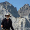
22/12/2018 - With purpose, I started early and set off for Munyang power station from Canberra. I arrived in good time and headed straight for the non-existent bridge over the Munyang River and the start of the Disappointment Spur track (not marked on current maps). It was an easy rock hop across the river despite the rain we had the previous days. I reached the last gauge just before Disappointment hut from which I bush bashed up and sometimes through the rocky creek until reaching clear ground around 1850m. I followed Disappointment Ridge for a while, passing some beautiful and intact snow gums while slowing descending the ridge on its eastern side.
I dropped down slowly with the massive Finns swamp coming in to view in the distance. It was dense and steep country. Equally rugged and beautiful. This is what Klaus Hueneke told Robert and I about the area - That 7x7 km area between Disappointment Spur, the Burrungubuggee, Tin Hut to the north and the Snowy R to the south is one of the least visited and most isolated, often snow covered, parts of the mountains. One could camp in there and never see anyone else for years. Perhaps, for ever. After a few slips and slides, and repeatedly checking the compass, I broke out of the scrub right in front of the impressive Finns River. After quite a bit of searching, I found a suitable crossing point and made the final push to the area where I thought the hut site was. Using a photo I was sent of the hut, I was confident I had found the site at 630450 5981263 (WGS84 datum).
There wasn’t much left in the area. I found small bits of tin, a bottle, cans, tree branches that were cut with saws and a large pile of rocks placed under some snow gums. The rocks were most likely from the huts fireplace. I could see why the Bolton family decided to put a hut here. Beautiful spot.
After spending a bit time in the area, I left in a hailstorm and headed up Finns River. This was beautiful walking. I crossed at Finns swamp and headed up, up, up to the top of Gungarten where I encountered some snow flurries and more rain. I then followed Disappointment Ridge all the way to 1900m mark and camped the night. I headed down to the Disappointment spur track the next morning feeling content and happy with the findings.
Photos of the site here - https://drive.google.com/drive/folders/1er2l97n6BfEo2wouXrE9btATBc-zJ-bA
My route for the first day - http://maps.ozultimate.com/?lat=-36.315747584663846&lng=148.42447757720947&zoom=15&id=1545541544808
So… Time to get this thing rebuilt I think. Thoughts?
Thanks to Robert Green, Roger Caffin, David Scott, Klaus Hueneke, Graham Scully and AndrewA. All your help made for a very memorable adventure.
Searching out Boltons on the Finn - KNP
Forum rules
Posting large/multiple images in this forum is OK. Please start topic titles with the name of the location or track.
For topics focussed on photos rather than the trip, please consider posting in the 'Gallery' forum instead.
This forum is for posting information about trips you have done, not for requesting information about a track or area.
31 posts
• Page 1 of 2 • 1, 2
Searching out Boltons on the Finn - KNP
![]() by Zapruda » Tue 15 Jan, 2019 1:54 pm
by Zapruda » Tue 15 Jan, 2019 1:54 pm
- Attachments
-
-
-
-
-
-
-
-
-
-
Last edited by Zapruda on Tue 15 Jan, 2019 6:38 pm, edited 1 time in total.
-

Zapruda - Athrotaxis selaginoides

- Posts: 1690
- Joined: Thu 07 Apr, 2016 10:46 am
- Region: Australian Capital Territory
- Gender: Male
Re: Searching out Boltons on the Finn - KNP
![]() by potato » Tue 15 Jan, 2019 2:33 pm
by potato » Tue 15 Jan, 2019 2:33 pm
Its a beautiful spot. Best to leave the area as it is now found.
- potato
- Athrotaxis cupressoides

- Posts: 330
- Joined: Thu 28 Jan, 2016 1:06 pm
- Region: Tasmania
- Gender: Male
Re: Searching out Boltons on the Finn - KNP
![]() by crollsurf » Tue 15 Jan, 2019 5:27 pm
by crollsurf » Tue 15 Jan, 2019 5:27 pm
Thats brilliant Zapruda. Any detail on that red marker post to who and why?
I'm a member of KHA so I love the huts but I'm kind of with potato on this one, it's not on most peoples radar and with no easy access, it would be an expensive rebuild.
I'm a member of KHA so I love the huts but I'm kind of with potato on this one, it's not on most peoples radar and with no easy access, it would be an expensive rebuild.
-

crollsurf - Lagarostrobos franklinii

- Posts: 2259
- Joined: Tue 07 Mar, 2017 10:07 am
- Location: Sydney
- Region: New South Wales
- Gender: Male
Re: Searching out Boltons on the Finn - KNP
![]() by Mark F » Tue 15 Jan, 2019 7:39 pm
by Mark F » Tue 15 Jan, 2019 7:39 pm
Well done Zapruda - any video of the grassy knoll  . Some of the issues with rebuilding huts or other infrastructure is the ongoing use and maintenance - resources are limited and "bang for the buck" is a powerful influencer of the npws budget. It also seems to be in the wilderness zone so an even more persuasive case is required. As an aside I note the large decrease in winter visitation to the areas of knp north of the highway which suggests areas like this will, sadly, remain low visitation.
Crollsurf - I think the red pole is a marker on the Aqueduct track at the start of the aqueduct. Most probably the point where Zapruda left the Aqueduct track to climb onto Disappointment Spur.
Crollsurf - I think the red pole is a marker on the Aqueduct track at the start of the aqueduct. Most probably the point where Zapruda left the Aqueduct track to climb onto Disappointment Spur.
"Perfection is attained not when there is nothing more to add, but when there is nothing more to remove".
-
Mark F - Lagarostrobos franklinii
- Posts: 2332
- Joined: Mon 19 Sep, 2011 8:14 pm
- Region: Australian Capital Territory
- Gender: Male
Re: Searching out Boltons on the Finn - KNP
![]() by Zapruda » Wed 16 Jan, 2019 6:40 am
by Zapruda » Wed 16 Jan, 2019 6:40 am
crollsurf wrote:Any detail on that red marker post to who and why?
Hey Crollsurf, Mark is correct, the red marker is next to a weir on Disappointment spur track. This was the point I went off track. I am not exactly sure of its purpose. Maybe to control flooding on the track after snow melt?
Mark F wrote:Well done Zapruda - any video of the grassy knoll
Mark, I sadly lost the video. There may be a babushka lady with some more photos though.
Potato, Crollsurf and Mark, I agree with you all about the cost of a hut rebuild and I am also weary of too much infrastructure in this beautiful national park. I'm looking at it from a historical and heritage point of view. I wish we could focus more on the history of the area rather than things like this new "great walk" track they are putting in. I cant lie that a little bit of me also wants a the hut there because of its fantastic location. Also, selfishly I would love it as a base for ski adventures in the area.
Last edited by Zapruda on Wed 16 Jan, 2019 7:26 am, edited 1 time in total.
-
Zapruda - Athrotaxis selaginoides
- Posts: 1690
- Joined: Thu 07 Apr, 2016 10:46 am
- Region: Australian Capital Territory
- Gender: Male
Re: Searching out Boltons on the Finn - KNP
![]() by potato » Wed 16 Jan, 2019 7:23 am
by potato » Wed 16 Jan, 2019 7:23 am
Zapruda wrote: I cant lie that a little bit of me also wants a the hut there because of its fantastic location. Also, selfishly I would love it as a base for ski adventure in the area.
I had that same feeling as well... I visit that area each winter but I different views about the euro heritage. So I would rather the park spend its money on dealing with the impacts of current lot humans - anyone seen Perisher Creek lately?
- potato
- Athrotaxis cupressoides
- Posts: 330
- Joined: Thu 28 Jan, 2016 1:06 pm
- Region: Tasmania
- Gender: Male
Re: Searching out Boltons on the Finn - KNP
![]() by Zapruda » Wed 16 Jan, 2019 7:32 am
by Zapruda » Wed 16 Jan, 2019 7:32 am
potato wrote:anyone seen Perisher Creek lately?
Sadly, the ski resorts seem to come first and everything else in that part of the park second. I couldn't believe it this year after the snow melted when NPWS were asking for volunteers to clean up Perisher. I don't understand why Perisher wasn't footing the bill and cleaning up their own mess.
-
Zapruda - Athrotaxis selaginoides
- Posts: 1690
- Joined: Thu 07 Apr, 2016 10:46 am
- Region: Australian Capital Territory
- Gender: Male
Re: Searching out Boltons on the Finn - KNP
![]() by potato » Wed 16 Jan, 2019 8:29 am
by potato » Wed 16 Jan, 2019 8:29 am
Apply a clean up tax to the lift ticket?
How long did it take you to walk up from where you left the Disappointment track to the 1850m level?
How long did it take you to walk up from where you left the Disappointment track to the 1850m level?
- potato
- Athrotaxis cupressoides
- Posts: 330
- Joined: Thu 28 Jan, 2016 1:06 pm
- Region: Tasmania
- Gender: Male
Re: Searching out Boltons on the Finn - KNP
![]() by Zapruda » Wed 16 Jan, 2019 8:35 am
by Zapruda » Wed 16 Jan, 2019 8:35 am
potato wrote: How long did it take you to walk up from where you left the Disappointment track to the 1850m level?
Around 20 minutes. The regrowth is thick but there is a boulder field that I was able to use to make the going a bit faster. Last time I went up this way I veered too much to the left and was slowed down quite a bit by the scrub.
-
Zapruda - Athrotaxis selaginoides
- Posts: 1690
- Joined: Thu 07 Apr, 2016 10:46 am
- Region: Australian Capital Territory
- Gender: Male
Re: Searching out Boltons on the Finn - KNP
![]() by potato » Wed 16 Jan, 2019 10:02 am
by potato » Wed 16 Jan, 2019 10:02 am
Thanks - that not too bad at all.
- potato
- Athrotaxis cupressoides
- Posts: 330
- Joined: Thu 28 Jan, 2016 1:06 pm
- Region: Tasmania
- Gender: Male
Re: Searching out Boltons on the Finn - KNP
![]() by Zapruda » Wed 16 Jan, 2019 10:04 am
by Zapruda » Wed 16 Jan, 2019 10:04 am
It’s was the descent down to Finns River that was the most challenging.
-
Zapruda - Athrotaxis selaginoides
- Posts: 1690
- Joined: Thu 07 Apr, 2016 10:46 am
- Region: Australian Capital Territory
- Gender: Male
Re: Searching out Boltons on the Finn - KNP
![]() by Mark F » Wed 16 Jan, 2019 10:57 am
by Mark F » Wed 16 Jan, 2019 10:57 am
I believe the easiest way onto Disappointment Spur is a bit further down the track towards Munyang (around GR 272783). I think this is where an old track ran up to a building(s) on the end of the ridge (GR 277779). I have been meaning to investigate for a while.
"Perfection is attained not when there is nothing more to add, but when there is nothing more to remove".
-
Mark F - Lagarostrobos franklinii
- Posts: 2332
- Joined: Mon 19 Sep, 2011 8:14 pm
- Region: Australian Capital Territory
- Gender: Male
Re: Searching out Boltons on the Finn - KNP
![]() by potato » Wed 16 Jan, 2019 11:00 am
by potato » Wed 16 Jan, 2019 11:00 am
Zapruda wrote:It’s was the descent down to Finns River that was the most challenging.
Interesting, thanks. I have only approached the area from Gungartan.
- potato
- Athrotaxis cupressoides
- Posts: 330
- Joined: Thu 28 Jan, 2016 1:06 pm
- Region: Tasmania
- Gender: Male
Re: Searching out Boltons on the Finn - KNP
![]() by Zapruda » Wed 16 Jan, 2019 11:01 am
by Zapruda » Wed 16 Jan, 2019 11:01 am
Mark F wrote:I believe the easiest way onto Disappointment Spur is a bit further down the track towards Munyang (around GR 272783). I think this is where an old track ran up to a building(s) on the end of the ridge (GR 277779). I have been meaning to investigate for a while.
Last time I went up that way to the radio tower I found it a little scrubby on top. Slow going. Beautiful and fun but only worth it if you have the time.
-
Zapruda - Athrotaxis selaginoides
- Posts: 1690
- Joined: Thu 07 Apr, 2016 10:46 am
- Region: Australian Capital Territory
- Gender: Male
Re: Searching out Boltons on the Finn - KNP
![]() by Zapruda » Wed 16 Jan, 2019 11:04 am
by Zapruda » Wed 16 Jan, 2019 11:04 am
potato wrote:Zapruda wrote:It’s was the descent down to Finns River that was the most challenging.
Interesting, thanks. I have only approached the area from Gungartan.
An excellent approach for sure but if you are a bit fire trail averse like me, this option or Marks is definitely more enjoyable.
-
Zapruda - Athrotaxis selaginoides
- Posts: 1690
- Joined: Thu 07 Apr, 2016 10:46 am
- Region: Australian Capital Territory
- Gender: Male
Re: Searching out Boltons on the Finn - KNP
![]() by rcaffin » Wed 16 Jan, 2019 7:16 pm
by rcaffin » Wed 16 Jan, 2019 7:16 pm
My wife & I went straight up from Disappointment Hut to the SMA 066 trig point to the N many years ago, and it was not (very) difficult. The reality is that any route around there on the S side of the ridge will be controlled by the post-fire scrub - and the snow if done in winter.
We camped right on the ridge - well tucked in to a bit of shelter up there anyhow. Not exactly sure exactly whereabouts on the ridge we camped - the view was (as usual) a bit limited ...
Cheers
Roger
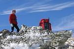
- DisappointmentSpurS2.jpg (52.52 KiB) Viewed 44185 times
We camped right on the ridge - well tucked in to a bit of shelter up there anyhow. Not exactly sure exactly whereabouts on the ridge we camped - the view was (as usual) a bit limited ...
Cheers
Roger
-
rcaffin - Athrotaxis selaginoides
- Posts: 1238
- Joined: Thu 17 Jul, 2008 3:46 pm
Re: Searching out Boltons on the Finn - KNP
![]() by Zapruda » Wed 16 Jan, 2019 7:28 pm
by Zapruda » Wed 16 Jan, 2019 7:28 pm
Correct Roger. Lots of regrowth but luckily the treeline ends / thins fairly suddenly and before you know it you are in open country.
I wish they still made the Olympus in that purple. I love it.
I wish they still made the Olympus in that purple. I love it.
-
Zapruda - Athrotaxis selaginoides
- Posts: 1690
- Joined: Thu 07 Apr, 2016 10:46 am
- Region: Australian Capital Territory
- Gender: Male
Re: Searching out Boltons on the Finn - KNP
![]() by rcaffin » Wed 16 Jan, 2019 7:31 pm
by rcaffin » Wed 16 Jan, 2019 7:31 pm
Yeah, that was 'a few years ago' now. Good tent though: it served us for many years.
Cheers
Roger
Cheers
Roger
-
rcaffin - Athrotaxis selaginoides
- Posts: 1238
- Joined: Thu 17 Jul, 2008 3:46 pm
Re: Searching out Boltons on the Finn - KNP
![]() by kanangra » Sun 20 Jan, 2019 4:33 pm
by kanangra » Sun 20 Jan, 2019 4:33 pm
Thanks Zapruda. That was really interesting. I've often thought about visiting that site but never managed it. Must put that right. From what I understand the Boltons accessed their holding via Daveys then Reids on the Burrungubugge. Then up and over into Tolbar Ck. Must have been hard going getting out of there? Apparently the SMA built a hut on Tolbar ck but I don't think it is still there?
Judging from your coordinates the hut site for Boltons is a little to the north east of where it is marked on my Geehi Dam 1:25000 sheet printed 2001.
Well done.
K.
Judging from your coordinates the hut site for Boltons is a little to the north east of where it is marked on my Geehi Dam 1:25000 sheet printed 2001.
Well done.
K.
- kanangra
- Athrotaxis selaginoides
- Posts: 1340
- Joined: Sun 25 May, 2008 3:52 pm
Re: Searching out Boltons on the Finn - KNP
![]() by kanangra » Sun 20 Jan, 2019 4:37 pm
by kanangra » Sun 20 Jan, 2019 4:37 pm
Just a note both Tolbar Hut and Boltons Hut are mentioned in the article Fifty Three Ski huts of NSW.
K.
K.
- kanangra
- Athrotaxis selaginoides
- Posts: 1340
- Joined: Sun 25 May, 2008 3:52 pm
Re: Searching out Boltons on the Finn - KNP
![]() by kanangra » Sun 20 Jan, 2019 5:20 pm
by kanangra » Sun 20 Jan, 2019 5:20 pm
Just a further note that may interest I have looked up the old Parish map for the parish of Munyang and it showed 4 lots on the Finns River in the vicinity of the hut site. All 4 lots had their western boundary on the river. The northern most was Lot 5 of 100 acres owned by Sara Alice Reid. Then Lot 3 of 200 acres owned by Sara Alice Bolton then Lot 4 of 300 acres owned by Sara Alice Reid and Lot 6 of 200 acres owned by Sara Alice Reid. Presumably the one person.
The map also shows the track over from the Burrungubugge River across the Tolbar. The eastern boundary of the parish is the Burrungubugge River and the track continues and says to Snowy Plains. On the western side of the river 3 lots are shown. two of them are shown as owned by Dora B Reid; Lot 2 of 200 acres and Lot 7 of 100 acres. Presumably a relation of Sara Alice Reid? This is the area of Reid's Hut site.
K
- kanangra
- Athrotaxis selaginoides
- Posts: 1340
- Joined: Sun 25 May, 2008 3:52 pm
Re: Searching out Boltons on the Finn - KNP
![]() by RVG » Sun 20 Jan, 2019 5:52 pm
by RVG » Sun 20 Jan, 2019 5:52 pm
The Bolton family lived at Diggers Creek, on Snowy Plains, from which a track led to the Burrungubugge River. Just south of the Burrungubugge River lived the Reids, who not only had land beside the Burrungubugge but who also owned four parish portions several miles further south near the Finn River.
Love blossomed and John Bolton married a Reid. They had a largish family which built and occupied quite a few huts in the mountains. For instance, nearby Daveys Hut was built for Tom Bolton. (The current spelling "Davies" is a misspelling. No family called Davies ever lived there.)
Doubtless a family arrangement led to the Boltons taking over the Reid property on the Finns and building a hut there.
- RVG
- Atherosperma moschatum

- Posts: 81
- Joined: Sat 02 May, 2015 2:18 pm
- Region: New South Wales
Re: Searching out Boltons on the Finn - KNP
![]() by Zapruda » Mon 21 Jan, 2019 6:59 am
by Zapruda » Mon 21 Jan, 2019 6:59 am
Thanks Kanangra. I still use your trip reports from a few years ago. Good info.
Yes, old maps suggest a track from Burrungubugge to the area as well as one from Tin hut down through Finns Swamp. Tolbar hut no longer exists unfortunately. I will head up Tolbar creek in cooler weather and see If I can find the site and also the track running east/west. Recent accounts suggest it is becoming hard to follow.
Exactly. None of the maps had the hut in the exact location. Not uncommon though.
I have found reference to a hut that went by the name of Sara Reids hut or Sarah Boltons hut. This hut was located roughly 500m southwest of Boltons on the Finn. Presumably burning down in 1939 fires. Interesting.
kanangra wrote:Thanks Zapruda. That was really interesting. I've often thought about visiting that site but never managed it. Must put that right. From what I understand the Boltons accessed their holding via Daveys then Reids on the Burrungubugge. Then up and over into Tolbar Ck. Must have been hard going getting out of there? Apparently the SMA built a hut on Tolbar ck but I don't think it is still there?
Yes, old maps suggest a track from Burrungubugge to the area as well as one from Tin hut down through Finns Swamp. Tolbar hut no longer exists unfortunately. I will head up Tolbar creek in cooler weather and see If I can find the site and also the track running east/west. Recent accounts suggest it is becoming hard to follow.
kanangra wrote:Judging from your coordinates the hut site for Boltons is a little to the north east of where it is marked on my Geehi Dam 1:25000 sheet printed 2001.
K.
Exactly. None of the maps had the hut in the exact location. Not uncommon though.
kanangra wrote:Sara Alice Bolton
I have found reference to a hut that went by the name of Sara Reids hut or Sarah Boltons hut. This hut was located roughly 500m southwest of Boltons on the Finn. Presumably burning down in 1939 fires. Interesting.
- Attachments
-
- Litho showing tracks
-
Zapruda - Athrotaxis selaginoides
- Posts: 1690
- Joined: Thu 07 Apr, 2016 10:46 am
- Region: Australian Capital Territory
- Gender: Male
Re: Searching out Boltons on the Finn - KNP
![]() by johnrs » Mon 21 Jan, 2019 9:26 am
by johnrs » Mon 21 Jan, 2019 9:26 am
Heh Zapruda
What type of tent is in your picture?
And how big was the Finn river, just little holes amongst the tussocks or a creek with ponds and water races?
Thanks
John
What type of tent is in your picture?
And how big was the Finn river, just little holes amongst the tussocks or a creek with ponds and water races?
Thanks
John
- johnrs
- Phyllocladus aspleniifolius

- Posts: 621
- Joined: Mon 09 Aug, 2010 6:09 pm
- Region: New South Wales
Re: Searching out Boltons on the Finn - KNP
![]() by Zapruda » Mon 21 Jan, 2019 9:48 am
by Zapruda » Mon 21 Jan, 2019 9:48 am
johnrs wrote:Heh Zapruda
What type of tent is in your picture?
And how big was the Finn river, just little holes amongst the tussocks or a creek with ponds and water races?
Thanks
John
Hey John,
The tent is a Tarptent Notch Li. Its been fantastic. Easily one of the nicest Ultralight tents I have used in the past decade, and I have used a lot... https://www.tarptent.com/product/notch-li/
Finns river was surprisingly substantial for a body of water up there. Up around the swamp it was wide and shallow, easy to cross. Down around the 1550m mark where I crossed, it was moving deep and fast. It was around waist deep where I crossed. During snow melt It would be a torrent. I would like to explore it a bit more. There were some cascades I spied in the distance that might be worth further exploration.
Cheers.
-
Zapruda - Athrotaxis selaginoides
- Posts: 1690
- Joined: Thu 07 Apr, 2016 10:46 am
- Region: Australian Capital Territory
- Gender: Male
Re: Searching out Boltons on the Finn - KNP
![]() by MeanderingFlyFisher » Tue 15 Dec, 2020 12:01 pm
by MeanderingFlyFisher » Tue 15 Dec, 2020 12:01 pm
Zapruda wrote:
Finns river was surprisingly substantial for a body of water up there. Up around the swamp it was wide and shallow, easy to cross. Down around the 1550m mark where I crossed, it was moving deep and fast. It was around waist deep where I crossed. During snow melt It would be a torrent. I would like to explore it a bit more. There were some cascades I spied in the distance that might be worth further exploration.
Cheers.
I am planning a trip in there in the next few weeks.
The cascades spied in the distance has me a bit concerned and it does look a bit like waterfall type area on the topo map but nothing ventured nothing gained and it will answer a question I have been asking myself for the past few years
- MeanderingFlyFisher
- Athrotaxis cupressoides
- Posts: 227
- Joined: Sun 02 Aug, 2015 7:21 pm
- Location: Warrnambool,Vic
- Region: Victoria
- Gender: Male
Re: Searching out Boltons on the Finn - KNP
![]() by Zapruda » Wed 23 Dec, 2020 6:36 am
by Zapruda » Wed 23 Dec, 2020 6:36 am
MeanderingFlyFisher wrote:Zapruda wrote:
Finns river was surprisingly substantial for a body of water up there. Up around the swamp it was wide and shallow, easy to cross. Down around the 1550m mark where I crossed, it was moving deep and fast. It was around waist deep where I crossed. During snow melt It would be a torrent. I would like to explore it a bit more. There were some cascades I spied in the distance that might be worth further exploration.
Cheers.
I am planning a trip in there in the next few weeks.
The cascades spied in the distance has me a bit concerned and it does look a bit like waterfall type area on the topo map but nothing ventured nothing gained and it will answer a question I have been asking myself for the past few years
I'm keen to hear how the trips goes.
-
Zapruda - Athrotaxis selaginoides
- Posts: 1690
- Joined: Thu 07 Apr, 2016 10:46 am
- Region: Australian Capital Territory
- Gender: Male
Re: Searching out Boltons on the Finn - KNP
![]() by rcaffin » Wed 23 Dec, 2020 8:48 am
by rcaffin » Wed 23 Dec, 2020 8:48 am
It sticks in my mind that we went East to Green Knob one time, then North along The Bar. It felt very remote, and we saw no-one for several days.
Nice country though.
Cheers
Roger
Nice country though.
Cheers
Roger
-
rcaffin - Athrotaxis selaginoides
- Posts: 1238
- Joined: Thu 17 Jul, 2008 3:46 pm
Re: Searching out Boltons on the Finn - KNP
![]() by Zapruda » Wed 23 Dec, 2020 8:55 am
by Zapruda » Wed 23 Dec, 2020 8:55 am
rcaffin wrote:It sticks in my mind that we went East to Green Knob one time, then North along The Bar. It felt very remote, and we saw no-one for several days.
Nice country though.
Cheers
Roger
Agreed, Bar Ridge including Mount Porcupine, Dog Peak and Green Knob is very nice and lonely country.
-
Zapruda - Athrotaxis selaginoides
- Posts: 1690
- Joined: Thu 07 Apr, 2016 10:46 am
- Region: Australian Capital Territory
- Gender: Male
Re: Searching out Boltons on the Finn - KNP
![]() by MeanderingFlyFisher » Wed 23 Dec, 2020 6:26 pm
by MeanderingFlyFisher » Wed 23 Dec, 2020 6:26 pm
Zapruda wrote:
I'm keen to hear how the trips goes.
No worries,I shall do a bit of a report if we make it in a few weeks.
- MeanderingFlyFisher
- Athrotaxis cupressoides
- Posts: 227
- Joined: Sun 02 Aug, 2015 7:21 pm
- Location: Warrnambool,Vic
- Region: Victoria
- Gender: Male
31 posts
• Page 1 of 2 • 1, 2
Return to NSW & ACT Trip Reports & Track Notes
Who is online
Users browsing this forum: No registered users and 10 guests