McMillans Walking Track 2018
Forum rules
Victoria specific bushwalking discussion. Please avoid publishing details of access to sensitive areas with no tracks.
Victoria specific bushwalking discussion. Please avoid publishing details of access to sensitive areas with no tracks.
25 posts
• Page 1 of 1
McMillans Walking Track 2018
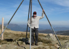
![]() by LLSC » Wed 16 May, 2018 7:57 am
by LLSC » Wed 16 May, 2018 7:57 am
Having heard of McMillans Walking Track, my friend and I were keen to walk it. There is less information readily available on it than on some other tracks. I have written a set of notes about our walk for those who are interested. I hope it provides a little more useful info for those considering the walk. See https://app.box.com/s/0s9vjn7zhumerapy5lhknhkdhstd9jm9
- LLSC
- Nothofagus gunnii

- Posts: 41
- Joined: Sat 18 Nov, 2017 9:05 am
- Region: Victoria
- Gender: Male
Re: McMillans Walking Track 2018
![]() by north-north-west » Wed 16 May, 2018 9:33 am
by north-north-west » Wed 16 May, 2018 9:33 am
Thanks for the report. Another one I've always wanted to do but never got around to.
Good to know the track is being maintained.
Good to know the track is being maintained.
"Mit der Dummheit kämpfen Götter selbst vergebens."
-

north-north-west - Lagarostrobos franklinii

- Posts: 15412
- Joined: Thu 14 May, 2009 7:36 pm
- Location: The Asylum
- ASSOCIATED ORGANISATIONS: Social Misfits Anonymous
- Region: Tasmania
Re: McMillans Walking Track 2018
![]() by DavidB » Wed 16 May, 2018 12:06 pm
by DavidB » Wed 16 May, 2018 12:06 pm
Many thanks LLSC for this report. Plan to walk McMillans with a few others in November. The Ben Cruachan Walking Club also has some useful walk reports. They also help out with track maintenance. Reports can be found at http://bencruachanwalkingclub.com/
- DavidB
- Atherosperma moschatum

- Posts: 87
- Joined: Tue 11 Oct, 2016 9:06 am
- Region: New South Wales
- Gender: Male
Re: McMillans Walking Track 2018
![]() by neilmny » Wed 16 May, 2018 3:46 pm
by neilmny » Wed 16 May, 2018 3:46 pm
Fantastic report thanks for the effort.
-
neilmny - Lagarostrobos franklinii
- Posts: 2576
- Joined: Fri 03 Aug, 2012 11:19 am
- Region: Victoria
- Gender: Male
Re: McMillans Walking Track 2018
![]() by Canadianeh » Wed 16 May, 2018 4:35 pm
by Canadianeh » Wed 16 May, 2018 4:35 pm
Thanks for putting the time in to put this report together! With regard to navigation, did you rely solely on track markers, map and compass? Or did you find the GPS useful? Are you aware of any GPX files for the track that could be used to make navigation more straightforward?
- Canadianeh
- Nothofagus cunninghamii

- Posts: 4
- Joined: Sat 24 Mar, 2018 4:06 pm
- Region: Victoria
Re: McMillans Walking Track 2018
![]() by Xplora » Wed 16 May, 2018 5:24 pm
by Xplora » Wed 16 May, 2018 5:24 pm
Thanks Doc for the report. Having dinner with Gordy at the Glen Wills retreat tonight and I will let him know. Emailed the link to him.
- Xplora
- Athrotaxis selaginoides

- Posts: 1662
- Joined: Sat 01 Aug, 2015 7:24 am
- Region: Victoria
- Gender: Male
Re: McMillans Walking Track 2018
![]() by LLSC » Wed 16 May, 2018 10:47 pm
by LLSC » Wed 16 May, 2018 10:47 pm
Canadianeh wrote:Thanks for putting the time in to put this report together! With regard to navigation, did you rely solely on track markers, map and compass? Or did you find the GPS useful? Are you aware of any GPX files for the track that could be used to make navigation more straightforward?
Hi Canadianeh.
Thanks for your interest. On a few occasions, I did consult the GPS. Someone told me about Mudmaps for iPhone and I love it: it has got me out of a few fixes. I use it when I realise that I have made an error and want confirmation. There were a few occasions on this track when it helped us cut our losses (including when we were on Shamrock Spur on day 1; missing the turnoff from D4 on day 7). I am not an expert navigator, so for me, it is really worthwhile.
I don't know if there is going to be an official electronic map released. I believe that the data used on a recent walk will be given to Vicmaps, so their updated maps will have the correct route in future. There is a version of the route on Open Street Map that looks pretty accurate ( https://www.openstreetmap.org/relation/4034791 ), as far as I can see, but I didn't use it. It does not show the current track up Crooked River but otherwise seems accurate. The track shown after Stonewall goes up the Jeff Spur Track, which would lead to Dargo High Plains Rd OK but, as I understand, was not the official McMWT prior to Crooked River Track being reopened. It used to go up the Jeff Davis Track. It probably doesn't matter much: I believe McMillan used all three tracks, at times. However, my strong preference is to to take the Crooked River Track, to avoid the long road walk along DHP Rd.
I think the notes of the BCWC trip from late last year should be released on their website pretty soon: they will be worth a look, to describe the current track.
Good luck, if you decide to walk it. The walk is interesting and the history, also.
Regards,
LLSC
Further edit on 18th May: the OSM track appears to be recent, showing accurately the route avoiding Mt Lookout and the path across the saddle immediately to the west of the Macalister River. The map itself does indicate the route across Gow's plain at the top of White Timber Spur and does show a track for Crooked River Mining Track and for 30 Mile Creek Mining Track. I haven't seen these details on other maps, so the OSM map is worth a look.
Last edited by LLSC on Fri 18 May, 2018 1:21 pm, edited 2 times in total.
- LLSC
- Nothofagus gunnii
- Posts: 41
- Joined: Sat 18 Nov, 2017 9:05 am
- Region: Victoria
- Gender: Male
Re: McMillans Walking Track 2018
![]() by LLSC » Wed 16 May, 2018 11:01 pm
by LLSC » Wed 16 May, 2018 11:01 pm
Xplora wrote:Thanks Doc for the report. Having dinner with Gordy at the Glen Wills retreat tonight and I will let him know. Emailed the link to him.
Thanks, Xplora. It was great to spend a while with him again. He was very helpful again.
Pls say hi to Ms/Mrs Xplora.
LLSC
- LLSC
- Nothofagus gunnii
- Posts: 41
- Joined: Sat 18 Nov, 2017 9:05 am
- Region: Victoria
- Gender: Male
Re: McMillans Walking Track 2018
![]() by Xplora » Thu 17 May, 2018 5:53 am
by Xplora » Thu 17 May, 2018 5:53 am
I have left your report open for her to read. We have passed the McMillan track on many of our trips and often thought about what it would be like. Not sure if the name will change in time as the evidence against Angus McMillan is pretty damning. Gordy told us or your intentions some time ago and is keen to read your report. Hope to catch up again next time you are in the area.
- Xplora
- Athrotaxis selaginoides
- Posts: 1662
- Joined: Sat 01 Aug, 2015 7:24 am
- Region: Victoria
- Gender: Male
Re: McMillans Walking Track 2018
![]() by publicrejoicer » Thu 17 May, 2018 9:45 pm
by publicrejoicer » Thu 17 May, 2018 9:45 pm
nice detailed report. Bravo
"solvitur ambulando"
- publicrejoicer
- Nothofagus gunnii
- Posts: 35
- Joined: Wed 21 Jun, 2017 7:15 pm
- Location: Colac, Victoria
- ASSOCIATED ORGANISATIONS: The Order Of Walkers
- Region: Victoria
- Gender: Male
Re: McMillans Walking Track 2018
![]() by LLSC » Sun 14 Oct, 2018 7:18 pm
by LLSC » Sun 14 Oct, 2018 7:18 pm
Another interesting book on McMillan, putting a different side to his life is 'Thicker than Water' by Cal Flynn; Fourth Estate; 2016. ISBN 978 1 4607 5050
- LLSC
- Nothofagus gunnii
- Posts: 41
- Joined: Sat 18 Nov, 2017 9:05 am
- Region: Victoria
- Gender: Male
Re: McMillans Walking Track 2018
![]() by scoha » Sun 21 Oct, 2018 5:34 pm
by scoha » Sun 21 Oct, 2018 5:34 pm
Excellent account - been interested in this for a while - looks magic
- scoha
- Athrotaxis cupressoides

- Posts: 110
- Joined: Thu 30 Oct, 2014 5:59 pm
- Region: Victoria
- Gender: Male
Re: McMillans Walking Track 2018
![]() by paidal_chalne_vala » Mon 29 Oct, 2018 7:10 pm
by paidal_chalne_vala » Mon 29 Oct, 2018 7:10 pm
I have walked bits of the McMillan track esp. the Treasure spur section coming up from Mayford on the Dargo river. That section has been worked on and is easy to navigate. Other sections are reportedly way overgrown . :-0
- paidal_chalne_vala
- Lagarostrobos franklinii
- Posts: 2733
- Joined: Sun 22 Jan, 2012 10:30 pm
- ASSOCIATED ORGANISATIONS: VNPA.BTAC.Friends of Baw Baw.Mt.Bogong Club.
- Region: Victoria
- Gender: Male
Re: McMillans Walking Track 2018
![]() by rocketrm2 » Wed 14 Nov, 2018 8:37 pm
by rocketrm2 » Wed 14 Nov, 2018 8:37 pm
My sincere thanks to you guys for your very informative notes on the McMillian track. There is very little info about this walk, you people have filled a vacuum.
- rocketrm2
- Athrotaxis cupressoides
- Posts: 131
- Joined: Wed 01 Jan, 2014 7:02 pm
- Region: Victoria
- Gender: Male
Re: McMillans Walking Track 2018
![]() by paidal_chalne_vala » Tue 27 Nov, 2018 11:15 pm
by paidal_chalne_vala » Tue 27 Nov, 2018 11:15 pm
The VMTC have some track work lined up along a section of Mc Millan's track this green season.
- paidal_chalne_vala
- Lagarostrobos franklinii
- Posts: 2733
- Joined: Sun 22 Jan, 2012 10:30 pm
- ASSOCIATED ORGANISATIONS: VNPA.BTAC.Friends of Baw Baw.Mt.Bogong Club.
- Region: Victoria
- Gender: Male
Re: McMillans Walking Track 2018
![]() by DavidB » Sat 29 Dec, 2018 2:20 pm
by DavidB » Sat 29 Dec, 2018 2:20 pm
Myself and five others walked McMillans in the 2nd half of November. We left Cobungra on Friday, November 16 to undertake a 14 day walk to Woods Point. We had also left two food and water drops near Arbuckle Junction and Mt Shillinglaw. The notes below are not detailed track notes but give an idea of what the track is like. Happy to field any questions about the track. We had two food/water drops which saved some big days carrying water.
The first day was a short and cruisy walk into Black Sallee campsite. The second day was more challenging involving an incredibly steep descent along an old fire trail down the Mayford Spur, across the Dargo River and an equally steep ascent up Treasure Spur to reach our campsite next to Lankey Plain Hut (1550m) on the Dargo High Plains. A rather cold night and in the morning, we met our first deer hunter (first of several encounters). We had already seen deer on the previous day.
The original McMillan’s route took walkers along the Dargo High Plains Road for 25 km or so but we avoided that by following some more recent track markers across country to meet up with the White Timber Track. This took us down to the junction of Thirty Mile and Twenty-Five Mile Creeks. Here we set up camp at a really beautiful but rather cramped site. It also afforded the first of many opportunities to cool off in the creek.
The next section of the walk follows about 10km of what eventually becomes the Crooked River and had a reputation for being unwalkable due to the amount of regrowth on the track. However, recent work by volunteers has markedly improved the track and we encountered no difficulties. We eventually reached a campsite near the old gold mining settlement of Stonewall (named after the Civil War general we presume).
The track then follows the Crooked River including over 25 river crossings as we meandered along a vehicle track. This took us to Talbotville, another old gold mining settlement of some note, and then onto the Wongungarra River for the next campsite. It was here we had our first snake encounter when someone spotted a snake swimming across the river about 20m from where people were having a swim.
Leaving the Wongungarra we had another steep ascent and descent over the Cynthia Range to reach the Wonnangatta River though there was some temporary confusion when we appeared to miss a track marker and started to head across private farmland. But we soon found the right route, crossed the Wonnangatta on a suspension bridge and headed up the river with glimpses of Snowy Bluff to another beaut campsite just below the junction of the Wonnangatta and Moroka Rivers. More swimming opportunities followed.
The next day was quite tough as we turned up the Moroka River and attempted to follow the track markers. After passing through the beautiful Moroka Glen (more deer sightings) the track took us away from the river. McMillan’s original line tended to keep high above the river and we followed some old track markers to a saddle about 500m up. Here another marker directed us to descend but the markers disappeared as did any semblance of a track. We decided to return to the river and stayed there criss-crossing it as we headed upstream. We also had our second snake encounter, this time a red-bellied black curled up in the sun which declined to move away. So we did instead! Our camp was at the foot of an old fire trail and we able to get settle in before rain arrived.
The following day was marked by a big ascent initially up Playboy Creek and then to Beth’s Saddle. After a short side trip to Beth’s Peak (1125m) we reached the start of the old D4 track to our first food drop at ‘Volkswagen’ camp just below Moroka Road. The weather began to deteriorate just in time for happy hour which rapidly became happy 10 minutes as with shivering hands we gulped down the red wine and retired to our tents. We subsequently learnt that the weather was worse than we experienced, with snow and wind at higher elevations. We were lucky to be camped on a sheltered side of the range.
Leaving Volkswagen, we ascended Mt Arbuckle (1581m) and descended through some beautiful alpine meadows to Kelly’s Hut. Ran into more deer hunters here (after hearing a shot in the distance). Our next camp was on Shaw’s Creek, a tributary of the Macalister River, and where we able to get a fire going. A chilly morning and after brief glimpses of sun the cloud and showery weather returned. This morning’s walking was also marked by our second navigation lapse of missing an obvious track marker to take a left turn onto a side track (how could six pairs of eyes miss it?) but we soon realised the error and not much time was lost. This track ascended to Mt Tamboritha (1509m). A rare sighting of a kangaroo or wallaby on the ascent. Again the wildflowers (and ground orchids) were spectacular. After the obligatory photos by the summit cairn we descended steeply along a long and narrow spur to Breakfast Creek (a tributary of the Wellington River).
After pausing by the plaque marking the 1988 reopening of the McMillan’s Track, the next day’s walking combined with the track to the Crinoline (Mt Ligar). However, we bypassed the Crinoline (leave for another day) to steeply descend along a faint footpad to the Macalister River. We lost any sign of track trackers near the river but crossed the river in the right place anyway. This was the deepest and widest of our crossings but we got across without incident. Some more ascending and descending through farmland took us to a gate marked ‘Private Property No Trespassing’. The sign is not obvious to those travelling west but will confuse people heading east and the authorities need to sort this out with the property owner. Some climbing and descending took us to Rumpff Flat (on Mt Skene Creek), an enormous camping area which we had to ourselves.
The following day took us up the notorious McMillan Spur which for steepness rivals the earlier Mayford Spur. This took us to the Jamieson-Licola Road and after a road bash and diversion past Mt Shillinglaw (1301m) – more ground orchids – we reached our second food and water drop just off the Jamieson-Licola Road, and near where McMillan’s joins the Australian Alps Walking Track. This time the weather was kinder and we had a proper happy hour.
On the home run now and our next descent took us to the Black River. This also marked our departure from the catchments of the rivers flowing to the Gippsland coast to the catchments of rivers flowing into the Murray. Sections of the track down to the Black River were in poor condition, mainly fallen timber and regrowth, though re-marking by the volunteers helped a lot. Another snake encounter, this time a tiger. The Black River campsite was too cramped for five tents so we set up a dry camp about 500m south of the river on a small saddle below a rocky knob. Not ideal but so be it. The Black River camp was also the only time we heard wild dogs (about an hour before dawn).
Leaving Black River took us over the ridge and down to Standen Creek (a tributary of the Goulburn and an old gold field settlement) and our last camp. Another snake encounter (species indeterminate) but this time the first half of the party walked past it without noticing. The track has been recently cleared and is well marked. We got in early for a wash in the creek. We also met up with the only bushwalker we encountered in 2 weeks. A solo walker aiming to complete McMillan’s in 6 days. Indeed he did and walked into Woods Point later that evening. As far as can be determined this is the fastest completion of McMillan’s. No mean feat in that sort of country. We reached Woods Point around lunch time the following day (November 30th) after another stiff climb, this time to Johnson Hill.
All in all, McMillan’s was in better shape than expected, largely due to the efforts of the maintenance teams including the bushwalking volunteers. It is still a tough walk but it passes through some magnificent country and more people should attempt it.
- DavidB
- Atherosperma moschatum
- Posts: 87
- Joined: Tue 11 Oct, 2016 9:06 am
- Region: New South Wales
- Gender: Male
Re: McMillans Walking Track 2018
![]() by bigkev » Sat 29 Dec, 2018 9:06 pm
by bigkev » Sat 29 Dec, 2018 9:06 pm
Thanks for the great report David.
Very useful
Very useful
-
bigkev - Athrotaxis cupressoides
- Posts: 445
- Joined: Sat 30 Jun, 2012 6:44 pm
- Region: Victoria
- Gender: Male
Re: McMillans Walking Track 2018
![]() by CaptainC » Tue 08 Jan, 2019 10:53 pm
by CaptainC » Tue 08 Jan, 2019 10:53 pm
Bushwalking Vic and Ben Cruachan walking club have track clearing planned for Australia Day weekend. In the region of Lazarini Spur track off the Jamieson - Licola Road. You can email [email protected] for more details.
They note that The 220km McMillans Walking Track is based on the pack horse track formed on behalf of the Government by Angus McMillan in 1864 to link the various gold fields between Woods Point and Omeo in the Gippsland high country. The track was retraced and cleared as a walking track during the 1980s. I believe that Ben Cruachan Walking Club were the volunteers who reopened it.
They note that The 220km McMillans Walking Track is based on the pack horse track formed on behalf of the Government by Angus McMillan in 1864 to link the various gold fields between Woods Point and Omeo in the Gippsland high country. The track was retraced and cleared as a walking track during the 1980s. I believe that Ben Cruachan Walking Club were the volunteers who reopened it.
- CaptainC
- Athrotaxis cupressoides
- Posts: 113
- Joined: Sat 07 Nov, 2009 8:06 pm
- Region: Victoria
- Gender: Male
Re: McMillans Walking Track 2018
![]() by Lamont » Wed 23 Jan, 2019 3:52 pm
by Lamont » Wed 23 Jan, 2019 3:52 pm
Xplora wrote:I have left your report open for her to read. We have passed the McMillan track on many of our trips and often thought about what it would be like. Not sure if the name will change in time as the evidence against Angus McMillan is pretty damning. Gordy told us or your intentions some time ago and is keen to read your report. Hope to catch up again next time you are in the area.
Just reading 'Caledonia australis' by Don Watson again and came across this, given this book and the other referred to plus others after Watson's, the evidence is thorough and conclusive.
But Australians, even though good people, hate change more than anything.
Once we have an idea or come around to an idea, it's locked in for seemingly eternity.
Having to cross Macmillan's Strait again and again visiting family, raising Angus Macmillan and his known complicity in atrocities has barely raised an eyebrow for these past thirty years.
I would like to walk this track.
I wholeheartedly support a name change.
Free The Glutens https://www.youtube.com/watch?v=FbKMX2vFOaQ
-

Lamont - Athrotaxis selaginoides
- Posts: 1913
- Joined: Sun 21 Feb, 2016 1:27 pm
- Location: Upper Kumbukta West
- ASSOCIATED ORGANISATIONS: https://www.againstmalaria.com/
- Region: Other Country
Re: McMillans Walking Track 2018
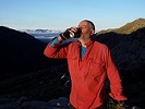
![]() by LLSC » Wed 30 Jan, 2019 3:12 pm
by LLSC » Wed 30 Jan, 2019 3:12 pm
- a friend met on the track: one of a number seen.
- Black River, where the track crosses
- Attachments
-
- some artistry
-
- after the 'tunnelling machine' has been through
-
- profile from Lazarini Spur Track to Black River and back
- Screen Shot 2019-01-30 at 3.58.53 pm.png (21.55 KiB) Viewed 31700 times
-
- a few less logs to block the track now
Last edited by LLSC on Thu 31 Jan, 2019 7:25 pm, edited 1 time in total.
- LLSC
- Nothofagus gunnii
- Posts: 41
- Joined: Sat 18 Nov, 2017 9:05 am
- Region: Victoria
- Gender: Male
Re: McMillans Walking Track 2018
![]() by paidal_chalne_vala » Wed 30 Jan, 2019 6:24 pm
by paidal_chalne_vala » Wed 30 Jan, 2019 6:24 pm
Well done. It is tough work just carrying a fully fuelled chainsaw up a hill such as Keppel's hut track to The Lake Mountain boundary hut trail, which is not that far really.
- paidal_chalne_vala
- Lagarostrobos franklinii
- Posts: 2733
- Joined: Sun 22 Jan, 2012 10:30 pm
- ASSOCIATED ORGANISATIONS: VNPA.BTAC.Friends of Baw Baw.Mt.Bogong Club.
- Region: Victoria
- Gender: Male
Re: McMillans Walking Track 2018
![]() by DavidB » Thu 31 Jan, 2019 10:41 am
by DavidB » Thu 31 Jan, 2019 10:41 am
Fantastic effort. This was one of the more overgrown sections of track back in November so many thanks to the team for clearing it.
- DavidB
- Atherosperma moschatum
- Posts: 87
- Joined: Tue 11 Oct, 2016 9:06 am
- Region: New South Wales
- Gender: Male
Re: McMillans Walking Track 2018
![]() by gbedford » Sun 07 Apr, 2019 9:27 am
by gbedford » Sun 07 Apr, 2019 9:27 am
Having walked sections of McMillan’s Track in the past the excellent trips reports have whetted my appetite to walk the lot. I must do it.
However I don’t support the idea that the name should change. That is damming a person for every good thing they did as well as the bad.
McMillan was the man who marked and led the team that built track. A tremendous effort considering the country it traverses and the with mere sketch maps available. A far cry from the topographical, satellite navigation laden walkers like me and probably most other modern people.
Let’s honour people for what they did well but honest and appropriate about what they did wrong.
- gbedford
- Athrotaxis cupressoides
- Posts: 112
- Joined: Tue 28 Sep, 2010 6:53 pm
- Region: Victoria
- Gender: Male
Re: McMillans Walking Track 2018
![]() by Lamont » Sun 07 Apr, 2019 7:17 pm
by Lamont » Sun 07 Apr, 2019 7:17 pm
gbedford wrote:However I don’t support the idea that the name should change. That is damming a person for every good thing they did as well as the bad.
McMillan was the man who marked and led the team that built track. A tremendous effort considering the country it traverses and the with mere sketch maps available. A far cry from the topographical, satellite navigation laden walkers like me and probably most other modern people.
Let’s honour people for what they did well but honest and appropriate about what they did wrong.
Have you read Caledonia australis?
Free The Glutens https://www.youtube.com/watch?v=FbKMX2vFOaQ
-
Lamont - Athrotaxis selaginoides
- Posts: 1913
- Joined: Sun 21 Feb, 2016 1:27 pm
- Location: Upper Kumbukta West
- ASSOCIATED ORGANISATIONS: https://www.againstmalaria.com/
- Region: Other Country
Re: McMillans Walking Track 2018
![]() by rennicm » Wed 28 Aug, 2019 4:32 pm
by rennicm » Wed 28 Aug, 2019 4:32 pm
LLSC wrote:Canadianeh wrote:Thanks for putting the time in to put this report together! With regard to navigation, did you rely solely on track markers, map and compass? Or did you find the GPS useful? Are you aware of any GPX files for the track that could be used to make navigation more straightforward?
Hi Canadianeh.
Thanks for your interest. On a few occasions, I did consult the GPS. Someone told me about Mudmaps for iPhone and I love it: it has got me out of a few fixes. I use it when I realise that I have made an error and want confirmation. There were a few occasions on this track when it helped us cut our losses (including when we were on Shamrock Spur on day 1; missing the turnoff from D4 on day 7). I am not an expert navigator, so for me, it is really worthwhile.
I don't know if there is going to be an official electronic map released. I believe that the data used on a recent walk will be given to Vicmaps, so their updated maps will have the correct route in future. There is a version of the route on Open Street Map that looks pretty accurate ( https://www.openstreetmap.org/relation/4034791 ), as far as I can see, but I didn't use it. It does not show the current track up Crooked River but otherwise seems accurate. The track shown after Stonewall goes up the Jeff Spur Track, which would lead to Dargo High Plains Rd OK but, as I understand, was not the official McMWT prior to Crooked River Track being reopened. It used to go up the Jeff Davis Track. It probably doesn't matter much: I believe McMillan used all three tracks, at times. However, my strong preference is to to take the Crooked River Track, to avoid the long road walk along DHP Rd.
I think the notes of the BCWC trip from late last year should be released on their website pretty soon: they will be worth a look, to describe the current track.
Good luck, if you decide to walk it. The walk is interesting and the history, also.
Regards,
LLSC
Further edit on 18th May: the OSM track appears to be recent, showing accurately the route avoiding Mt Lookout and the path across the saddle immediately to the west of the Macalister River. The map itself does indicate the route across Gow's plain at the top of White Timber Spur and does show a track for Crooked River Mining Track and for 30 Mile Creek Mining Track. I haven't seen these details on other maps, so the OSM map is worth a look.
The McMillans Track alternative route along Crooked River and Thirty Mile Creek to avoid the Dargo High Plains Road is in Open Street Map at https://www.openstreetmap.org/relation/6250122
- rennicm
- Nothofagus cunninghamii
- Posts: 1
- Joined: Wed 28 Aug, 2019 4:25 pm
- Region: Victoria
25 posts
• Page 1 of 1
Who is online
Users browsing this forum: No registered users and 99 guests