Heading off this week
Re: Heading off this week
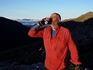
![]() by AWTtrekker » Sun 05 Nov, 2017 3:32 pm
by AWTtrekker » Sun 05 Nov, 2017 3:32 pm
- AWTtrekker
- Atherosperma moschatum

- Posts: 98
- Joined: Fri 06 May, 2016 9:42 pm
- Region: New South Wales
- Gender: Female
Re: Heading off this week
![]() by bigkev » Sun 05 Nov, 2017 3:34 pm
by bigkev » Sun 05 Nov, 2017 3:34 pm
Dreamer wrote:Well done on reaching Hotham Kev, I had been wondering how you were going. Thanks for the update on conditions...sounds pretty good except for the weather. What are the daytime temperatures like (don't say variable!)? Was there anything you wished you had packed (or not packed)?
PS your water availability update on other thread is spectacular...thanks again.
The maximum that I've got temperature wise during the day so far would probably be around the low teens, most days have been in single figures. Looking at the long range forecast it does look as though temps are or the way up though (although maybe that's just wishful thinking). The biggest issue temperature wise has been coming up from the valleys in the rain and then copping wind, sleet and snow on the tops, I've really had to manage keeping myself warm and at the same time having at least one set of warm clothes that never get wet - quite often that'll mean putting on yesterdays wet clothes so as not to get another set wet.
Xplora wrote:Kev - not sure if you have done the Grey Hills and Quartz before so just in case you haven't, there is no real track from Spione Kopje to the Grey Hill ridge line but it is pretty obvious where you have to go once you can see the ridge line. Just find the best track you can through the low scrubby heath stuff. There will be water to fill up on Spione Kopje but none on the Grey Hills then again at Bogong Creek Saddle before you head up. I suspect pick up sticks again on Quartz ridge until you get some height. Hopefully not as many trees down as last year. No doubt you will enjoy a night at Cleve Cole. No real water points on the Long Spur and if you had rain the night before then there is section just before Mulhauser and beyond to the vehicle track where the overgrown scrub will get you pretty wet.
Thanks Xplora, I'll probably go over Mt Nelse and then down Timms Spur. I haven't been on Quartz Ridge for a couple of years (I dropped down to Cairn Creek and up Granny Spur in March 2016). I'm not a big fan of pick up sticks though so we'll see how it goes... When I came down Quarzt Ridge on that walk it was in very good nick, well at least as far as the Cairn Creek turnoff. I haven't walked Long Spur since the fires but I've taken note of the reports on the forum, it sounds like most of the fallen trees may have been cleared up a bit (?) but the scrub is a pain in the bum - at least I'll be pushing down hill through it generally. It is what it is though
-
bigkev - Athrotaxis cupressoides

- Posts: 445
- Joined: Sat 30 Jun, 2012 6:44 pm
- Region: Victoria
- Gender: Male
Re: Heading off this week
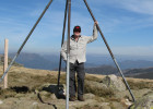
![]() by bigkev » Sun 05 Nov, 2017 3:44 pm
by bigkev » Sun 05 Nov, 2017 3:44 pm
AWTtrekker wrote:Any info from anyone on the condition of the chain across Big River? Planning to go the long way around at this stage but watching the river heights in case we get lucky.
Hi AWTtrekker, Xplora thinks that Big River is still about 10 cm to high to cross safely at the bottom of Duane Spur, (I haven't had any news about the chain) I'm probably going to go around and up Quartz Ridge. Are you in Hotham? Cheers
-
bigkev - Athrotaxis cupressoides
- Posts: 445
- Joined: Sat 30 Jun, 2012 6:44 pm
- Region: Victoria
- Gender: Male
Re: Heading off this week
![]() by Xplora » Sun 05 Nov, 2017 6:57 pm
by Xplora » Sun 05 Nov, 2017 6:57 pm
AWTtrekker wrote:Any info from anyone on the condition of the chain across Big River? Planning to go the long way around at this stage but watching the river heights in case we get lucky.
The river is dropping and the only gauge I have is Joker station. When it is 1.2m then T spur crossing has been doable but there have been no reports about the chain. It doesn't go every year. Someone has to be first but it will not be me. It could be OK now to cross as long there is not big rain the day before.
- Xplora
- Athrotaxis selaginoides

- Posts: 1662
- Joined: Sat 01 Aug, 2015 7:24 am
- Region: Victoria
- Gender: Male
Re: Heading off this week
![]() by Xplora » Mon 06 Nov, 2017 6:18 am
by Xplora » Mon 06 Nov, 2017 6:18 am
- Xplora
- Athrotaxis selaginoides
- Posts: 1662
- Joined: Sat 01 Aug, 2015 7:24 am
- Region: Victoria
- Gender: Male
Re: Heading off this week
![]() by AWTtrekker » Mon 06 Nov, 2017 7:14 pm
by AWTtrekker » Mon 06 Nov, 2017 7:14 pm
- AWTtrekker
- Atherosperma moschatum
- Posts: 98
- Joined: Fri 06 May, 2016 9:42 pm
- Region: New South Wales
- Gender: Female
Re: Heading off this week
![]() by bigkev » Mon 06 Nov, 2017 8:53 pm
by bigkev » Mon 06 Nov, 2017 8:53 pm
AWTtrekker wrote:We aren't at Hotham. We will be at Dibbins Hut on Wednesday night. Had some drama due to a group member getting giardia and had to be evacuated. We are back on track in the next few days.
No worries AWTtrekker, I'm still about a day and a half in front of you. Wow that's a bit of a drama, I hope everything goes OK for you guys now.
Cheers
-
bigkev - Athrotaxis cupressoides
- Posts: 445
- Joined: Sat 30 Jun, 2012 6:44 pm
- Region: Victoria
- Gender: Male
Re: Heading off this week
![]() by Xplora » Tue 07 Nov, 2017 5:16 am
by Xplora » Tue 07 Nov, 2017 5:16 am
AWTtrekker wrote:We aren't at Hotham. We will be at Dibbins Hut on Wednesday night. Had some drama due to a group member getting giardia and had to be evacuated. We are back on track in the next few days.
Do you know the source? May be helpful for others.
- Xplora
- Athrotaxis selaginoides
- Posts: 1662
- Joined: Sat 01 Aug, 2015 7:24 am
- Region: Victoria
- Gender: Male
Re: Heading off this week
![]() by AWTtrekker » Tue 07 Nov, 2017 6:26 am
by AWTtrekker » Tue 07 Nov, 2017 6:26 am
- AWTtrekker
- Atherosperma moschatum
- Posts: 98
- Joined: Fri 06 May, 2016 9:42 pm
- Region: New South Wales
- Gender: Female
-
Lophophaps - Auctorita modica

- Posts: 3467
- Joined: Wed 09 Nov, 2011 9:45 am
- Region: Victoria
- Gender: Male
Re: Heading off this week
![]() by Xplora » Tue 07 Nov, 2017 5:42 pm
by Xplora » Tue 07 Nov, 2017 5:42 pm
AWTtrekker wrote:Somewhere south of Rumpf saddle Xplora. He was the only member of our group who wasn't reliably filtering his water. There are lots of deer prints around cattle once you get up towards Skene so I told him it was self inflicted and he should have known better.
This is a discussion that repeats on this forum. Interesting how it affects the rest of the group when someone self inflicts this sort of stuff. Treat all water to be safe. It matters and does not take up that much time.
- Xplora
- Athrotaxis selaginoides
- Posts: 1662
- Joined: Sat 01 Aug, 2015 7:24 am
- Region: Victoria
- Gender: Male
Re: Heading off this week
![]() by madmacca » Wed 08 Nov, 2017 11:36 am
by madmacca » Wed 08 Nov, 2017 11:36 am
Mark F wrote:I also did it SOBO a few years ago after a very wet winter. Like Lophophaps the section at the bottom where one left the ridge was very vague and the high water level added to the problems. I ended up camping about 10m up from the river on the ridge, rather rocky but managed to find a poor site and get the tent up. The climb was pretty straight forward, steep and on the ridge for the first part and then climbing more gently across the slope as I rose towards Johnnies Top. I expect descending it would be important not to drop too far down before ending up on the crest of the ridge. I would tend to either camp at the tank on Johnnies Top or a km or more past the bottom of the ridge.
I'm glad I'm not the only one who had trouble finding the track SOBO at the start of the climb from the flats towards Johnnie's Top. There's no obvious start to the ridge, and trail markers seem to have gone missing. NOBO I think the navigation is easier.
- madmacca
- Phyllocladus aspleniifolius

- Posts: 514
- Joined: Fri 14 Oct, 2011 11:18 pm
- Region: Victoria
- Gender: Male
Re: Heading off this week
![]() by Mr Bean » Mon 13 Nov, 2017 12:58 pm
by Mr Bean » Mon 13 Nov, 2017 12:58 pm
bigkev wrote:So far I've only met one walker heading south, a young bloke (I think his name was Ben) who I met as I was heading into Barry Saddle after a long day, he looked like he was doing it a lot easier than me
Over the Melbourne Cup weekend, we camped at MacAlister Springs and on Tuesday, did a day walk out to Mt Magdala. On the return we passed a solo walker heading south. It sounds like the person you mentioned. He was certainly making good time (day 26 on that day he said).
Anyway, extremely envious of your travels, as I sit here in the office
- Mr Bean
- Atherosperma moschatum
- Posts: 86
- Joined: Thu 24 Mar, 2016 1:34 pm
- Region: Victoria
- Gender: Male
Re: Heading off this week
![]() by bigkev » Mon 20 Nov, 2017 3:37 pm
by bigkev » Mon 20 Nov, 2017 3:37 pm
I've arrived at Thredbo. The Hotham to Thredbo section was actually a bit of a surprise, Xplora can let his mates know at Parks in Omeo that the Hotham Thredbo section is currently far better maintained than the southern section.
I met up with Anne at Stony Creek, she was flying along on her journey south. Apart from Anne the only other AAWT walker that I've bumped into is a young lady named Hilly who is walking north sometimes solo and sometimes with family or friends.
I didn't bother camping on the long spur off Johnnies Top, I went up and over and camped down on Buemba Creek as I was going OK and there was a lot of thunder storms around.
There are a lot of school groups around at the moment, I rocked up to Tin Mines Huts just as the afternoons thunderstorm arrived to find two school groups with around 40 people there - that was a shock to my system after virtually being alone since leaving Walhalla.
-
bigkev - Athrotaxis cupressoides
- Posts: 445
- Joined: Sat 30 Jun, 2012 6:44 pm
- Region: Victoria
- Gender: Male
Re: Heading off this week
![]() by Dreamer » Mon 20 Nov, 2017 3:44 pm
by Dreamer » Mon 20 Nov, 2017 3:44 pm
- Dreamer
- Atherosperma moschatum
- Posts: 90
- Joined: Fri 21 Oct, 2011 9:55 am
- Region: South Australia
Re: Heading off this week
![]() by gmac » Sat 02 Dec, 2017 7:59 pm
by gmac » Sat 02 Dec, 2017 7:59 pm
Look forward to reading your blog when released and well done with the timing regarding the rainy season
- gmac
- Atherosperma moschatum
- Posts: 75
- Joined: Thu 14 Oct, 2010 9:27 pm
- Region: Victoria
Re: Heading off this week
![]() by bigkev » Sat 02 Dec, 2017 9:42 pm
by bigkev » Sat 02 Dec, 2017 9:42 pm
I'll probably start working on the blog late this week or early next, that'll probably take me longer than the actual walk
My immediate issue is driving back home through the mountains picking up all my empty food drop containers, with all the rain around I think I'll be in for an interesting drive....
-
bigkev - Athrotaxis cupressoides
- Posts: 445
- Joined: Sat 30 Jun, 2012 6:44 pm
- Region: Victoria
- Gender: Male
Re: Heading off this week
![]() by neilmny » Sun 03 Dec, 2017 7:05 am
by neilmny » Sun 03 Dec, 2017 7:05 am
-
neilmny - Lagarostrobos franklinii

- Posts: 2576
- Joined: Fri 03 Aug, 2012 11:19 am
- Region: Victoria
- Gender: Male
Re: Heading off this week
![]() by Lophophaps » Sun 03 Dec, 2017 11:11 am
by Lophophaps » Sun 03 Dec, 2017 11:11 am
-
Lophophaps - Auctorita modica
- Posts: 3467
- Joined: Wed 09 Nov, 2011 9:45 am
- Region: Victoria
- Gender: Male
Re: Heading off this week
![]() by bigkev » Mon 04 Dec, 2017 7:57 am
by bigkev » Mon 04 Dec, 2017 7:57 am
I managed to pick up my Kiandra, Benambra-Corryong Rd and Cowombat Trk food bins on the way home yesterday on what was a pretty epic 12 hour drive down from Canberra.
I've still got one stashed up near Mt Spec that I'll try and get to one Saturday before Christmas.
I'll let you know when I get some stuff online, it might be a week or two as I've got a bit of a back log of 'real' work both at home and at my job that actually pays the bills
Cheers
-
bigkev - Athrotaxis cupressoides
- Posts: 445
- Joined: Sat 30 Jun, 2012 6:44 pm
- Region: Victoria
- Gender: Male
Re: Heading off this week
![]() by AWTtrekker » Mon 11 Dec, 2017 11:01 pm
by AWTtrekker » Mon 11 Dec, 2017 11:01 pm
- AWTtrekker
- Atherosperma moschatum
- Posts: 98
- Joined: Fri 06 May, 2016 9:42 pm
- Region: New South Wales
- Gender: Female
Re: Heading off this week
![]() by bigkev » Tue 12 Dec, 2017 6:36 pm
by bigkev » Tue 12 Dec, 2017 6:36 pm
AWTtrekker wrote:Congrats Kev. Sadly we were caught out by the rain and had to evac out. We made it as far as O'Keefes Hut but Doubtful River was a raging torrent and after a couple of days of waiting and water levels still rising we weren't going to have enough food left to do the extra walking required to circumnavigate Jagungal in order to avoid the larger rivers.
Happy to hear that your safe and well AWTtrekker. We certainly got our share of interesting weather didn't we. I copped cold rain, hail, sleet or snow at some stage almost everyday on the Walhalla to Hotham section and then humid weather with huge thunderstorms on probably 90% of the days on the Hotham to Canberra legs. It all culminated with the big event that caused you to have to bail out. Thankfully I was only a days walk from Tharwa when it hit me (but I knew it was coming and put in some big days to try and beat it towards the end).
I'm slowly starting to get some posts online on my goin' feral blog if you want to bring back the horror
Cheers Kevin
-
bigkev - Athrotaxis cupressoides
- Posts: 445
- Joined: Sat 30 Jun, 2012 6:44 pm
- Region: Victoria
- Gender: Male
Re: Heading off this week
![]() by neilmny » Tue 12 Dec, 2017 6:47 pm
by neilmny » Tue 12 Dec, 2017 6:47 pm
bigkev wrote:............I'm slowly starting to get some posts online on my goin' feral blog if you want to bring back the horrorI'll put a link up when I get some more posts online.
Cheers Kevin
And doing a ripping job Kev
-
neilmny - Lagarostrobos franklinii
- Posts: 2576
- Joined: Fri 03 Aug, 2012 11:19 am
- Region: Victoria
- Gender: Male
-
bigkev - Athrotaxis cupressoides
- Posts: 445
- Joined: Sat 30 Jun, 2012 6:44 pm
- Region: Victoria
- Gender: Male
Who is online
Users browsing this forum: No registered users and 7 guests