cherryz wrote:Thanks so much for the help everyone!
Looks like we'll probably be going for a pretty relaxed walk down south instead sometime next week
http://www.wildwalks.com/bushwalking-an ... burgh.htmlSo I suppose printing out the map and track notes would be enough? if not where could i get maps etc?
any last things i need to do before leaving? thanks guys.
The notes are good and those maps are OK, essentially derived from the topographic maps. I've used them once or twice,
but the proper topographic maps are better in my opinion as they generally cover a wider area and have more detail. For some walks they're essential and I think it's a good idea to carry them anyway. If you do make a navigational error you can better orientate yourself to your surroundings. Learning to read maps and basic navigation techniques are important aspects of bushwalking, even if you're walking mainly on tracks.
From
http://www.wildwalks.com: "
For longer walks please carry full topographical maps of the area (listed for each walk), If you need to make an emergency exit the maps provided may not cover enough terrain."
That said, the walk you are proposing is fairly easy on well defined tracks.
Wild Walks grades it "Hard" but mainly because of the ~500m elevation gain I suspect. I've walked those tracks without any problems, although the Otford-Helensburgh section only once and it was several years ago when we walked from Helensburgh through to Waterfall. The section near Helensburgh was a bit underwhelming, going around the back of a tip and football oval along a wire fence from memory

. Elsewhere it's fine.
The Royal National Park Tourist Map (1:30,000 topographic) covers the area you want. You can get it for about $7 from many camping and outdoor shops around Sydney. In the CBD Paddy Pallin and several others in Kent Street, Map World in Pitt Steet (closed Sundays), or the park itself (from the visitor centre in Audley - out of your way if travelling by train). Your local camping store may also have it...worth asking.
Personally I think
this one is a better walk if starting at Otford Station, as it takes in some of the best parts of the southern end of the Coast Track. It would be more strenuous and longer though. It's one of my favourite circuits (we park at Otford Gap) but usually do it in a clockwise direction, and haven't to date bothered to walk to the figure of eight pool.
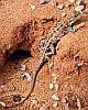
Last things? If you've researched the suggestions given earlier and have the correct gear then you should be OK to go. Might be obvious but take plenty of water in the current heatwave conditions, hats, sunglasses, sunscreen, insect repellant, first aid/emergency items etc. Also keep an eye out for snakes as they sometimes like to sleep in the middle of walking tracks. Finally, enjoy the walk - don't forget to take a camera and post some photos in the gallery section afterwards.