We were looking for a place to walk last weekend. Saw this post and grabbed a copy of Exploring the Jagungal Wilderness off itunes.
We did the Mt Jagungal Circuit from the Snowy plains fire trail. We had a late start and didn't park at the national parks sign until 4pm. We walked on the firetrail from the carpark past Cesjacks hut. As the days are pretty long this time of year we continued on to turnoff towards McCallister Saddle. The book mentioned a possible camp site at Geehi Forks so this was our destination for the night. We arrived around an hour before nightfall and it is a beautiful spot with an open grassy plain and a shallow running creek and this time of year lots of colourful flowers. We were treated to a brief lightning show and downpour, followed by a warm impressively clear starry skied night.
We woke to a beautiful clear day. The plan was to head west to Grey Mare Fire trail but as the terrain between camp and Mt Jagungal was pretty open we decided to head north to the summit. The walking was good and it was easy to navigate to the summit. The views from the top put a smile on both our faces so we found a nice rock to sit on and enjoyed the views over a morning tee of M&M's and water. We had a look from the top and decided to keep on going north down a shallow valley towards I think its a weather station? The top section was straight forwards easy walking but the bottom section although not so long is a tough bash through thick trees and scrub. I would probably (read definitely) go the long way the next time. From here we headed to O'Keefes Hut where we had lunch. We continued on and I filled up my water at Bogong Creek. We continued on to Doubtful creek which we followed back towards Cesjacks. We crossed the river a few times to keep to the easiest walking and least scrub bashing before the valley narrowed into a bit of a gorge. Here it got kinda thick so we climbed out on the west side of the river and found nice views and easier walking in open country. I started feeling very sick as we continued. I think I hadn't left enough time for the water purification tablets to do there thing after filling up earlier. We crossed doubtful creek again just before the ascent unto Cesjacks. We had a rest here and I downed some hydralyte which I promptly threw up along with pretty much all the water I had drank since Bogong but soon felt much improved. We continued up past Cesjscks and followed the trail back to the car arriving back around 730pm.
It is a beautiful part of the world and a massive thanks for putting this book out there. It really helped us plan a great weekend out and the waypoints and campsite suggestions were a massive help.
One warning: my wife was almost carried away by the March Flies. I think she has about 100 bites, buggers were getting her though a long sleeve merino shirt. Make sure to cover up if you head out this way in summer.
Jagungal circuit
Forum rules
Posting large/multiple images in this forum is OK. Please start topic titles with the name of the location or track.
For topics focussed on photos rather than the trip, please consider posting in the 'Gallery' forum instead.
This forum is for posting information about trips you have done, not for requesting information about a track or area.
27 posts
• Page 1 of 1
Jagungal circuit
![]() by Luke001 » Fri 26 Jan, 2018 8:33 pm
by Luke001 » Fri 26 Jan, 2018 8:33 pm
- Luke001
- Nothofagus gunnii

- Posts: 33
- Joined: Wed 10 Nov, 2010 7:03 pm
- Location: Illawarra
- Region: New South Wales
Re: Jagungal circuit
![]() by Luke001 » Fri 26 Jan, 2018 9:06 pm
by Luke001 » Fri 26 Jan, 2018 9:06 pm
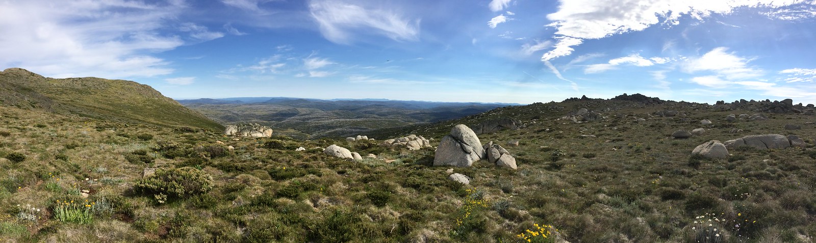
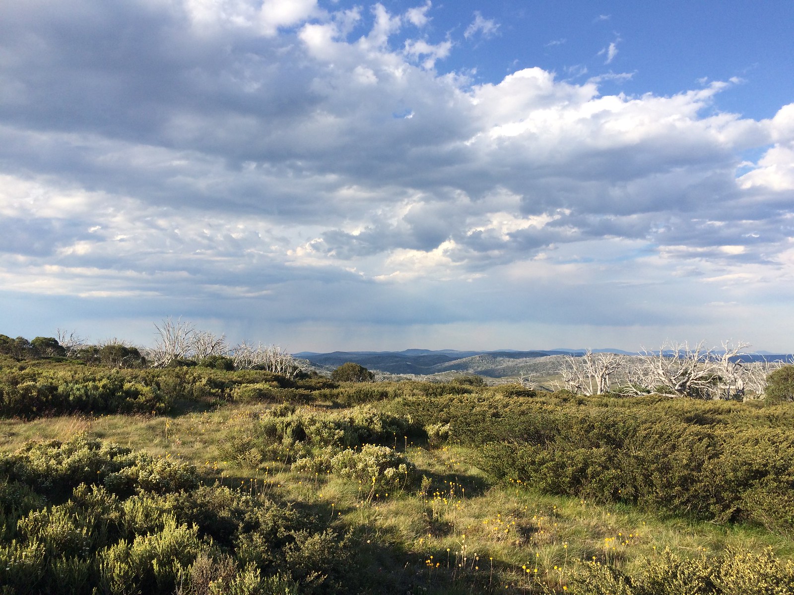
Looking west from the saddle on top of Mt Jagungal
Looking north from near Geehi Fork heading towards Mt Jagungal (which is the Mt in middle)
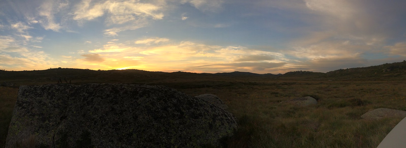
Watching the sun rise to the east from inside the tent (Camp at Geehi Forks)
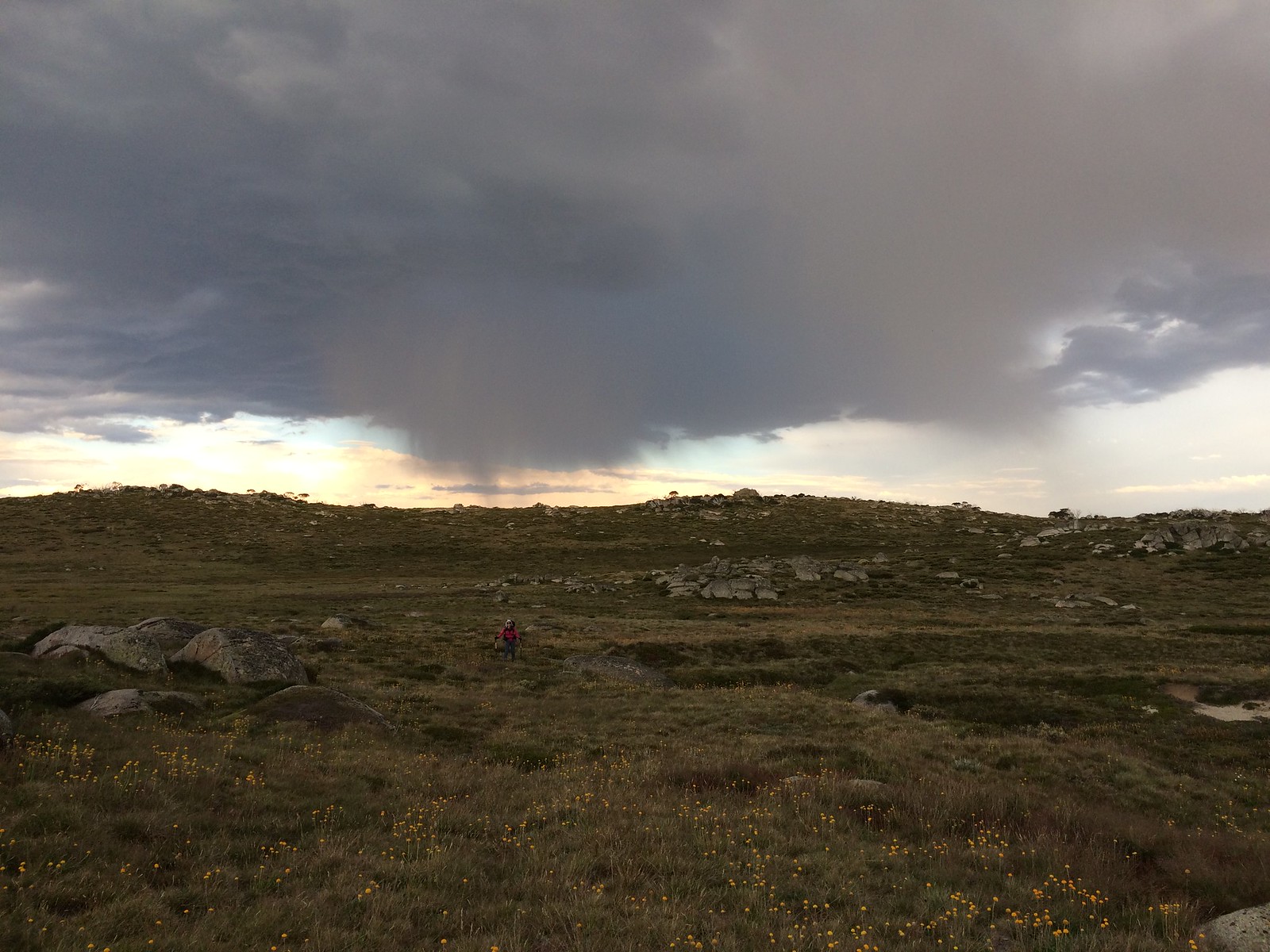
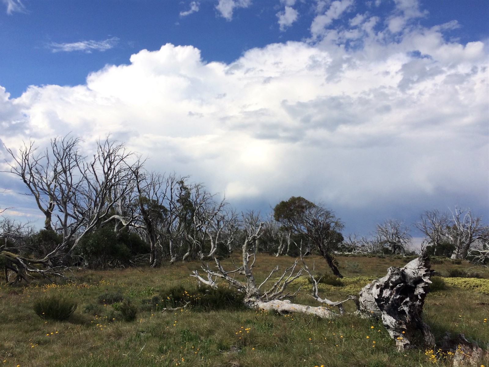
The wife arriving at camp with a little rain in the distance (Looking east from Geehi Forks)
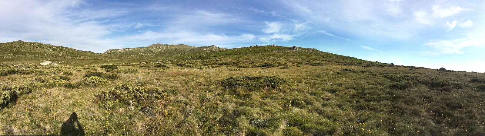
Looking north from a ridge close to McAlister Saddle
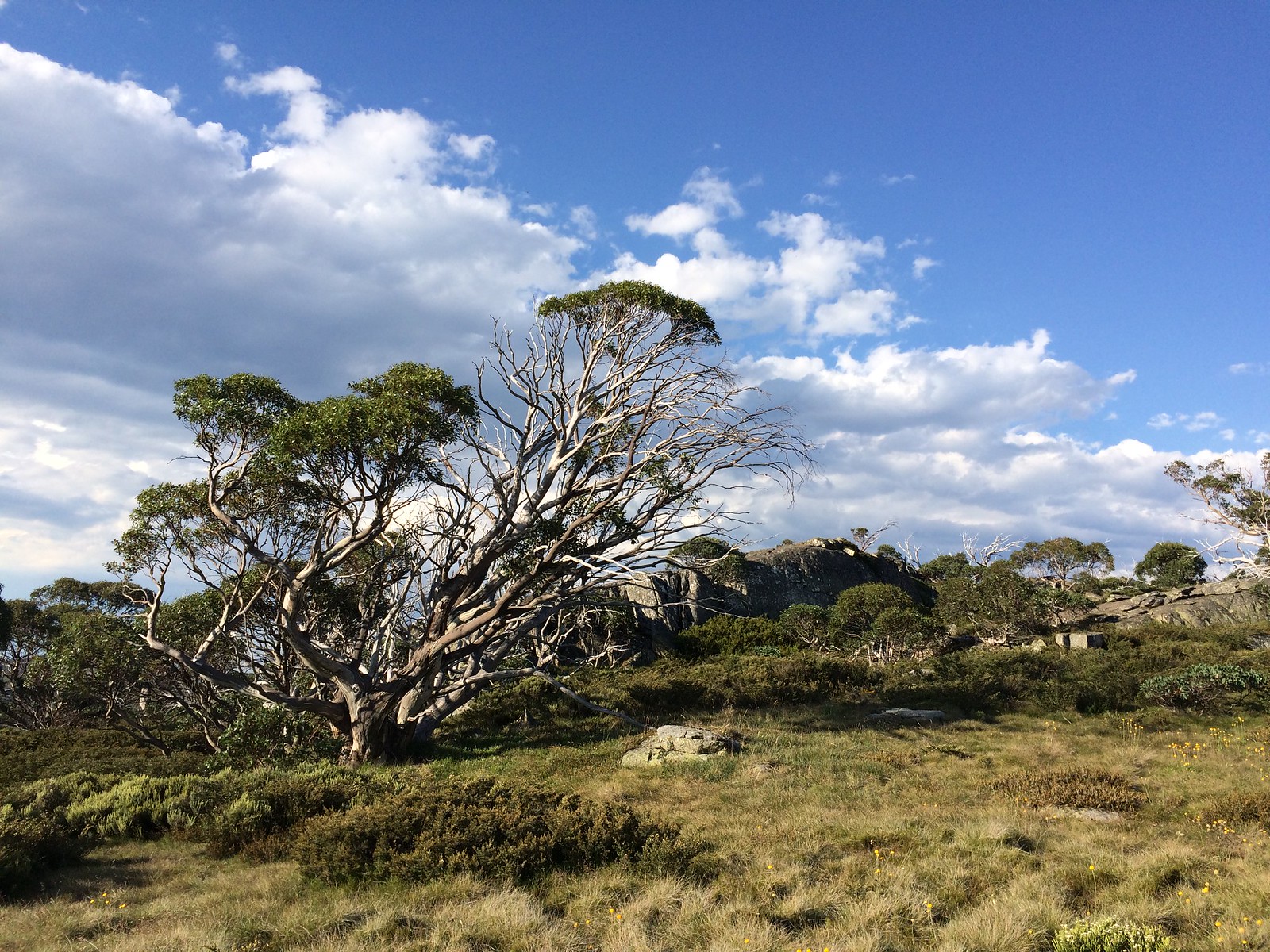
A little rock outcrop close to the same saddle
Part of the track heading south from the car before turning off to the saddle.
Last edited by Luke001 on Sun 28 Jan, 2018 2:36 pm, edited 4 times in total.
- Luke001
- Nothofagus gunnii
- Posts: 33
- Joined: Wed 10 Nov, 2010 7:03 pm
- Location: Illawarra
- Region: New South Wales
Re: Jagungal circuit
![]() by rcaffin » Sat 27 Jan, 2018 6:52 am
by rcaffin » Sat 27 Jan, 2018 6:52 am
We had a look from the top and decided to keep on going north down a shallow valley towards I think its a weather station? The top section was straight forwards easy walking but the bottom section although not so long is a tough bash through thick trees and scrub. I would probably (read definitely) go the long way the next time.
Yeah, a bit of sub-alpine scrub there. There are better routes. (We came up that way once, via the very steep part.)
We continued on to Doubtful creek which we followed back towards Cesjacks. We crossed the river a few times to keep to the easiest walking and least scrub bashing before the valley narrowed into a bit of a gorge. Here it got kinda thick so we climbed out on the west side of the river and found nice views and easier walking in open country.
Nice open ski route if you stay a couple of hundred metres to the west all the time.
I started feeling very sick as we continued. I think I hadn't left enough time for the water purification tablets to do there thing after filling up earlier. We crossed doubtful creek again just before the ascent unto Cesjacks. We had a rest here and I downed some hydralyte which I promptly threw up along with pretty much all the water I had drank since Bogong but soon felt much improved.
Nothing to do with the water. We don't bother treating that water anyhow. I suspect you were just a bit over-stressed. Throwing up is the normal reaction to that.
Good photos though. We love that country.
Cheers
Roger
-
rcaffin - Athrotaxis selaginoides

- Posts: 1296
- Joined: Thu 17 Jul, 2008 3:46 pm
Re: Jagungal circuit
![]() by Luke001 » Sat 27 Jan, 2018 10:40 am
by Luke001 » Sat 27 Jan, 2018 10:40 am
Nothing to do with the water. We don't bother treating that water anyhow. I suspect you were just a bit over-stressed. Throwing up is the normal reaction to that.
Really, I havnt felt like that before while walking. I'm getting old.
- Luke001
- Nothofagus gunnii
- Posts: 33
- Joined: Wed 10 Nov, 2010 7:03 pm
- Location: Illawarra
- Region: New South Wales
Re: "Exploring the Jagungal Wilderness"
![]() by rcaffin » Sat 27 Jan, 2018 10:53 am
by rcaffin » Sat 27 Jan, 2018 10:53 am
Explaining a bit.
You were probably suffering a bit from the heat - aka heat stress. You had just spent some time coming down through the scrub, with hard work. That's fine, it just means your body was pumping all your blood into either your head or your legs. There was precious little available for your stomach.
Then you had a good drink at Bogong Creek - yes? (Assumption!)
That put a lot of water into your stomach, and it had some trouble handling that big load, even if it was just water. Then you went up Doubtful Creek with more hard work. Your stomach could not cope and it rejected the water, in the normal way.
Small sips while walking are quite OK, but not big drinks. Best to leave the big drinks until you have been resting for a while, so your circulation can rebalance. Same goes for eating while you are walking: don't do it. Well, that's my version of things.
Cheers
Roger
-
rcaffin - Athrotaxis selaginoides
- Posts: 1296
- Joined: Thu 17 Jul, 2008 3:46 pm
Re: Jagungal circuit
![]() by Zapruda » Sat 27 Jan, 2018 11:01 am
by Zapruda » Sat 27 Jan, 2018 11:01 am
I agree with Roger, I don’t think you would fall ill that quickly. It would usually take 24 hours for any gastro intestinal issues to present themselves after drinking bad water.
I disagree with Roger about not treating the water. I have seen feral horse skeletons in creeks and feral horse droppings in a large amount of the water all over KNP. Especially in Jagungal and further north. With the weight of modern filters there is no excuse not to filter the water.
Unfortunately, there is no such thing as safe water up in our mountains.
Thanks for the trip report and I loved the photos. You guys are brave in facing those flies this time of year.
- Attachments
-
-
-

Zapruda - Athrotaxis selaginoides
- Posts: 1682
- Joined: Thu 07 Apr, 2016 10:46 am
- Region: Australian Capital Territory
- Gender: Male
Re: Jagungal circuit
![]() by Luke001 » Sat 27 Jan, 2018 11:04 am
by Luke001 » Sat 27 Jan, 2018 11:04 am
I think you hit the nail on the head there Roger. Thanks for the explanation.
- Luke001
- Nothofagus gunnii
- Posts: 33
- Joined: Wed 10 Nov, 2010 7:03 pm
- Location: Illawarra
- Region: New South Wales
Re: Jagungal circuit
![]() by Luke001 » Sat 27 Jan, 2018 11:11 am
by Luke001 » Sat 27 Jan, 2018 11:11 am
You guys are brave in facing those flies this time of year.
I havnt been out there this time of year before. We did Main Range and Cascade hut at xmas and they were a little annoying but *&%$#! hell they were crazy persistent and in massive numbers last week. Dont think I'll persuade the wife to get back out there any time soon. When do they settle back down again?
- Luke001
- Nothofagus gunnii
- Posts: 33
- Joined: Wed 10 Nov, 2010 7:03 pm
- Location: Illawarra
- Region: New South Wales
Re: Jagungal circuit
![]() by Zapruda » Sat 27 Jan, 2018 11:17 am
by Zapruda » Sat 27 Jan, 2018 11:17 am
Jan and Feb are when they are at their worst. They settle down in March usually after a cold snap and frost.
They bite me sometimes but they relentlessly bite my partner. She won’t come out this time of year because of them.
They bite me sometimes but they relentlessly bite my partner. She won’t come out this time of year because of them.
-
Zapruda - Athrotaxis selaginoides
- Posts: 1682
- Joined: Thu 07 Apr, 2016 10:46 am
- Region: Australian Capital Territory
- Gender: Male
Re: Jagungal circuit
![]() by rcaffin » Sat 27 Jan, 2018 11:26 am
by rcaffin » Sat 27 Jan, 2018 11:26 am
Hi Luke: no worries.
Zapruda - what is that yellow thing in the water in the second photo? I really doubt it has anything to do with horse poo - we have kept horses ourselves and I know what their droppings look like. They are grass-based and will wash away in an hour or two if dropped in a flowing creek. (Banana skin???)
Now, whether YOU (anyone) should treat your water - that is up to YOU. I just mentioned that WE don't bother, and haven't bothered for years - and have not suffered any problems as a result. I still have a huge range of treatment methods in stock: filter, tablets, UV: I have tested all of them and reviewed many of them. Around the Blue Mts - ah well, sometimes.
Up in the Alps the water flow is high, and it washes things away quickly. Ah - some exceptions! Whites River anywhere near or below Whites River Hut: historically notorious for Giardia. With the new toilet Parks put in that may have changed. (The floor on the old one was so rotten few were game to stand on it, so they pooed around the Hut.) Anywhere downstream of the ski resorts as well: Giardia or E coli.
I think it was Thredbo which once had a wave of E coli infections. The sewerage treatment ponds, safely downstream of the village, were open. Eventually the wild ducks found them and swam in them. Eventually some of them took residual E coli bugs up the hillside to the creeks which supply Thredbo with water. Someone got ill from the untreated water and put a lot more E coli into the STP - which was not able to remove them. The cycle accelerated! The solution was to upgrade the STP: they covered the ponds and kept the ducks out. The infection died out quickly.
Cheers
Roger
-
rcaffin - Athrotaxis selaginoides
- Posts: 1296
- Joined: Thu 17 Jul, 2008 3:46 pm
Re: Jagungal circuit
![]() by peregrinator » Sat 27 Jan, 2018 11:38 am
by peregrinator » Sat 27 Jan, 2018 11:38 am
Thanks for posting the report and the excellent photographs, Luke. I was also inspired by Robert’s book to walk in this area. As you wrote, it is extremely helpful. Roger also contributes lots of good information here. Can I ask whether you might add some captions to the shots to note their locations? I’ve only had one trip in the some parts of area you visited so I’d love to know where they were taken.
There’s a current discussion here which includes some comments on alpine flies. Perhaps they might help next time. See http://bushwalk.com/forum/viewtopic.php?f=5&t=27164&start=30
There’s a current discussion here which includes some comments on alpine flies. Perhaps they might help next time. See http://bushwalk.com/forum/viewtopic.php?f=5&t=27164&start=30
- peregrinator
- Athrotaxis selaginoides
- Posts: 1825
- Joined: Fri 15 Apr, 2011 2:50 pm
- Region: Victoria
Re: Jagungal circuit
![]() by Zapruda » Sat 27 Jan, 2018 11:48 am
by Zapruda » Sat 27 Jan, 2018 11:48 am
Hi Roger. It’s a bone from a horse. I posted these to highlight that anything can end up in the water and if you were collecting and drinking water 100m downstream you would have no idea that a dead horse could be rotting away in that same water.
It’s great that you have never been sick from drinking the water. I have never been in car accident but I wear a seatbelt everytime I go driving... horses for courses - pun intended.
I think WE need to be careful posting things on public forums that may give people the wrong idea. You carry a lot of weight in this community and I’m sure some people would take your word as gospel. I have on occasion
I had no idea about the past E. coli in Thredbo. Thanks for the info.
-
Zapruda - Athrotaxis selaginoides
- Posts: 1682
- Joined: Thu 07 Apr, 2016 10:46 am
- Region: Australian Capital Territory
- Gender: Male
Re: Jagungal circuit
![]() by Luke001 » Sat 27 Jan, 2018 11:51 am
by Luke001 » Sat 27 Jan, 2018 11:51 am
Thanks for the link, I'll give it a read.
Captions added.
Captions added.
Last edited by Luke001 on Sat 27 Jan, 2018 12:34 pm, edited 1 time in total.
- Luke001
- Nothofagus gunnii
- Posts: 33
- Joined: Wed 10 Nov, 2010 7:03 pm
- Location: Illawarra
- Region: New South Wales
Re: Jagungal circuit
![]() by rcaffin » Sat 27 Jan, 2018 11:59 am
by rcaffin » Sat 27 Jan, 2018 11:59 am
Head nets - we tried them one Jan. The March flies and little black flies just ate us elsewhere. Having lunch was ... difficult!
Dead horse rotting away in the creek - well, possible of course. Also birds, wombats, foxes, ... But even so, what (hazardous to humans) bugs and wogs will be in the water as a result? Any the horse might have had will have been washed away quickly. The remaining meat is usually fairly clean. Sounds terrible of course, but medically the risk is insignificant (imho).
The REAL hazards up there are from HUMANS. Tourists in ski resorts are totally unreliable. Novice walkers are also a threat, until they get the message about digging holes and where to put them.
Cheers
Roger
EDIT: My wife has reminded me about the pigs we sometimes see up there. They could be a risk. Hum ...
-
rcaffin - Athrotaxis selaginoides
- Posts: 1296
- Joined: Thu 17 Jul, 2008 3:46 pm
Re: Jagungal circuit
![]() by RVG » Sun 28 Jan, 2018 11:33 am
by RVG » Sun 28 Jan, 2018 11:33 am
Hi Luke
An excellent trip report.
That access through Snowy Plains and Cesjacks gets straight to the heart of the area and saves a days walk in from Round Mountain or elsewhere, so I would recommend it to anyone, especially those coming from the north through Canberra.
Even for Victorians heading for Jagungal it only adds a couple of hours to the drive, but saves a days walk along Fire Trails.
That area between the Bulls Peaks Fire Trail and the Grey Mare Fire Trail is a lovely area with easy walking at a high elevation. If anyone is planning on going in there for a few days I would recommend that a visit to Bluff Tarn be included. It is nearby and one of the prettiest spots in the mountains.
The only comment that I would make about going from Mt Jagungal to the meteorological station is that it is important to keep out of the creek valley by keeping west of it by several hundred metres. It is more open there than following the creek.
As Roger will confirm there are many spots in KNP where, especially on the eastern flanks of a range or a hill, a wet microclimate encourages vigorous regrowth.
- RVG
- Atherosperma moschatum

- Posts: 81
- Joined: Sat 02 May, 2015 2:18 pm
- Region: New South Wales
Re: Jagungal circuit
![]() by rcaffin » Sun 28 Jan, 2018 3:29 pm
by rcaffin » Sun 28 Jan, 2018 3:29 pm
many spots in KNP where, especially on the eastern flanks of a range or a hill, a wet microclimate encourages vigorous regrowth.
'vigorous' may be an understatement.
Somewhere I have a photo of my wife going through such scrub. You can just see her head - but that is all. 0.5 km/hour can be a good speed sometimes.
Cheers
Roger
'vigorous' may be an understatement.
Somewhere I have a photo of my wife going through such scrub. You can just see her head - but that is all. 0.5 km/hour can be a good speed sometimes.
Cheers
Roger
-
rcaffin - Athrotaxis selaginoides
- Posts: 1296
- Joined: Thu 17 Jul, 2008 3:46 pm
Re: Jagungal circuit
![]() by rcaffin » Sun 28 Jan, 2018 3:34 pm
by rcaffin » Sun 28 Jan, 2018 3:34 pm
Hi Luke
When you say 'Geehi Forks', do you mean Four Ways where the Geehi turns abruptly W, or the fork to the north where the Geehi merges two south-bound parallel arms? Probably the latter?
Um ... first photo:
Looking west from the saddle on top of Mt Jagungal
This leaves me puzzled. Should that be 'looking East'? But maybe I am just disoriented.
Cheers
Roger
-
rcaffin - Athrotaxis selaginoides
- Posts: 1296
- Joined: Thu 17 Jul, 2008 3:46 pm
Re: Jagungal circuit
![]() by Luke001 » Sun 28 Jan, 2018 4:17 pm
by Luke001 » Sun 28 Jan, 2018 4:17 pm
When you say 'Geehi Forks', do you mean Four Ways where the Geehi turns abruptly W, or the fork to the north where the Geehi merges two south-bound parallel arms? Probably the latter?
Spot on: Where the parallel arms join. I took the name from the book (I think).
- Luke001
- Nothofagus gunnii
- Posts: 33
- Joined: Wed 10 Nov, 2010 7:03 pm
- Location: Illawarra
- Region: New South Wales
Re: Jagungal circuit
![]() by Luke001 » Sun 28 Jan, 2018 4:20 pm
by Luke001 » Sun 28 Jan, 2018 4:20 pm
Um ... first photo:
Looking west from the saddle on top of Mt Jagungal
This leaves me puzzled. Should that be 'looking East'? But maybe I am just disoriented.
I originally labelled it facing north but it was pointed out to me that its more west. I'd agree it was more west but more accurate would be NW I think.
- Luke001
- Nothofagus gunnii
- Posts: 33
- Joined: Wed 10 Nov, 2010 7:03 pm
- Location: Illawarra
- Region: New South Wales
Re: Jagungal circuit
![]() by Luke001 » Sun 28 Jan, 2018 4:32 pm
by Luke001 » Sun 28 Jan, 2018 4:32 pm
The only comment that I would make about going from Mt Jagungal to the meteorological station is that it is important to keep out of the creek valley by keeping west of it by several hundred metres. It is more open there than following the creek.
We followed the valley until it got too steep then took to the eastern ridge. I will confirm that side should not be used
- Luke001
- Nothofagus gunnii
- Posts: 33
- Joined: Wed 10 Nov, 2010 7:03 pm
- Location: Illawarra
- Region: New South Wales
Re: Jagungal circuit
![]() by Lophophaps » Sun 28 Jan, 2018 5:56 pm
by Lophophaps » Sun 28 Jan, 2018 5:56 pm
Agree, NW or thereabouts. I thought that is was westish. Luke reached the summit area mid-morning, so the sun is in the NE quadrant. Look at the shadows. I have not been there for a while but I reckon that the big gully is probably the one besides the track (if it still exists, marked in red) to the weather station. The track used to be quite good low down but petered out, much like the track that comes up from the baby Tumut and vanishes at about 1900 metres just above the bushline as one swings NE (right) to turn the summit rocks.
One feature of the Jagungal region is that a lot of it looks the same.
One feature of the Jagungal region is that a lot of it looks the same.
- Jagungal ridge.png (357.12 KiB) Viewed 25249 times
-
Lophophaps - Auctorita modica

- Posts: 3467
- Joined: Wed 09 Nov, 2011 9:45 am
- Region: Victoria
- Gender: Male
Re: Jagungal circuit
![]() by rcaffin » Sun 28 Jan, 2018 7:39 pm
by rcaffin » Sun 28 Jan, 2018 7:39 pm
I think the shadows in the oval are misleading. The shadows to the left of the oval from the buttons are more interpretable. But really, I think it was fairly close to the middle of the day.
Perhaps the photo was taken not from the saddle under the summit but over near the bump at the N end of the Toolong Range. In that case all could be as you say. Mind you, I don't think any track down to the met station exists any more. We did try to find it once. Found ourselves going up a very steep face where we were clinging to grass tussocks. Ice axe country!
If so, then the peak above the RH end of the red line would be Mt Toolong and the two valleys above the big rock would be the two arms of the Tumut. Hum - all very possible. View NW indeed.
The 'baby Tumut' track. Do you mean the one which comes up from the Tumut crossing? Maybe not, as you turn left towards the summit rocks at the top, not right. That's a fairly good track these days. Post fire, many old tracks have gone.
Cheers
Roger
-
rcaffin - Athrotaxis selaginoides
- Posts: 1296
- Joined: Thu 17 Jul, 2008 3:46 pm
Re: Jagungal circuit
![]() by Lophophaps » Sun 28 Jan, 2018 8:59 pm
by Lophophaps » Sun 28 Jan, 2018 8:59 pm
There's not really enough features to say for sure. I think NW, but it could be eastish with Toolong and Bulls et al in the haze. I base NW mainly on the shadow - not much to go on! The summit ridge has too many similar bumps. I'd need to see a shot with more perspective. A trig with a flashing neon light would be nice.
The baby Tumut track starts at the road, goes on the creek for a bit, the east up to the ridge, where there's a cairn. Then northish (left) towards the summit, through some burnt trees, then bears NE-ish (right) to turn the summit rocks to come out just east of the summit, where a short scrambly track goes to the trig.
The two pics below were taken in 1991 and 2014, before and after the fire. The track stops in snow grass near the end of the line.
- 91 Jagungal spur.png (878.98 KiB) Viewed 25209 times
-
Lophophaps - Auctorita modica
- Posts: 3467
- Joined: Wed 09 Nov, 2011 9:45 am
- Region: Victoria
- Gender: Male
Re: Jagungal circuit
![]() by rcaffin » Mon 29 Jan, 2018 11:59 am
by rcaffin » Mon 29 Jan, 2018 11:59 am
I don't think it is to the east any more (but to the NW). I was wrong. The view to the E from near the Jag cairn to the Toolong Range is thus:
Nov 2016
The Toolong is much more rocky, and the plains beyond are flatter and more open and grassy.
We had come up from the Tumut Crossing. The track was perhaps a shade better than in 2014?
I had to stop at the foot of the rocks and have some choccy & scroggin. Sue was hammering on. A hard life...
Cheers
Roger
- 7660.jpg (103.21 KiB) Viewed 25160 times
Nov 2016
The Toolong is much more rocky, and the plains beyond are flatter and more open and grassy.
We had come up from the Tumut Crossing. The track was perhaps a shade better than in 2014?
I had to stop at the foot of the rocks and have some choccy & scroggin. Sue was hammering on. A hard life...
Cheers
Roger
-
rcaffin - Athrotaxis selaginoides
- Posts: 1296
- Joined: Thu 17 Jul, 2008 3:46 pm
Re: Jagungal circuit
![]() by Lophophaps » Mon 29 Jan, 2018 3:58 pm
by Lophophaps » Mon 29 Jan, 2018 3:58 pm
If Sue is going too fast, bung a rope around her, jump on the skateboard and hang on. Some people like being tied up. Descending the Toolong Range on a skateboard is mind-blowing! Telemark-cartwheels on the big slopes is a lot of run. Blunder - my comment about the weather station track is before the fire. This was a nice way up; maybe some kind person can mark it, just like a lot of other post-fire tracks in KNP.
I find it illuminating that Roger and I with about 80 years between us in KNP can be confused by the north-west-NW-east pic. I can mostly navigate point to point in low visibility with no GPS quite happily, but picking distant features is sometimes hard.
I find it illuminating that Roger and I with about 80 years between us in KNP can be confused by the north-west-NW-east pic. I can mostly navigate point to point in low visibility with no GPS quite happily, but picking distant features is sometimes hard.
-
Lophophaps - Auctorita modica
- Posts: 3467
- Joined: Wed 09 Nov, 2011 9:45 am
- Region: Victoria
- Gender: Male
Re: Jagungal circuit
![]() by rcaffin » Mon 29 Jan, 2018 8:10 pm
by rcaffin » Mon 29 Jan, 2018 8:10 pm
I am always amused by people, usually novices who have read all the books, who claim that you can triangulate your position with a prismatic compass by sighting off several identifiable peaks. Australia is a FLAT country, and the scrub and the eternal haze (pollution, inland dust, or gum tree oils) makes just seeing the peaks hard at the best of times. 
I find a roughly-oriented topo map more useful.
Except in thick fog.
Cheers
Roger
I find a roughly-oriented topo map more useful.
Except in thick fog.
Cheers
Roger
-
rcaffin - Athrotaxis selaginoides
- Posts: 1296
- Joined: Thu 17 Jul, 2008 3:46 pm
Re: Jagungal circuit
![]() by paidal_chalne_vala » Wed 04 Apr, 2018 1:47 pm
by paidal_chalne_vala » Wed 04 Apr, 2018 1:47 pm
Filtering water in the KNP is not optional for me. Feral horses , dogs and pigs have fouled the water supplies up there.
- paidal_chalne_vala
- Lagarostrobos franklinii

- Posts: 2730
- Joined: Sun 22 Jan, 2012 10:30 pm
- ASSOCIATED ORGANISATIONS: VNPA.BTAC.Friends of Baw Baw.Mt.Bogong Club.
- Region: Victoria
- Gender: Male
27 posts
• Page 1 of 1
Return to NSW & ACT Trip Reports & Track Notes
Who is online
Users browsing this forum: Google [Bot] and 6 guests