trickos wrote:No worries, mate. Best of luck on your trip. Hopefully everything you need is covered in that topic. would like to hear about your trip if you've got time to post it.
Trip Report:
Just a quick trip report.
First day
Drove in to the north side of Tali Karng along a 4WD (Mt Wellington Track) track to Millers Hut with the old man. From Melbourne it took about 3 hours to get into Licola, and another two to three hours to get to Millers Hut This track was very bumpy and should only be attempted with a capable 4WD. There was one creek crossing but it was fairly shallow. The track was also very rocky, mostly round rocks but still if you are going along it be careful as they can easily do a lot of damage to the underside of the car, as we found out with the running board on the Triton.
Millers hut was beautiful, nice little camping area there, where we stayed the first night. There was about an hour of really heavy rain then it cleared up for the rest of the night.
The second day we tried to drive to Sentinel rock, which is further along Mt Wellington Track but part of it was washed away, the tracks condition deteriorated the further we got along, and became impossible for us to continue without risking doing some serious damage to the car.
Now, to the walking!
So we went back to Millers Hut and I began my hike through Tali Karng alone. Millers Hut Track was in good condition. Followed it to Gillios Track which as said in another post, is steep. However, the track is in good condition and easy to follow. it appears that it has been cut back recently as there was no climbing over fallen trees. Tali Karng has dropped a meter and a bit of water since November, and you can hike around to Snowden Falls, although I didn't as there wasn't time to do too much exploring.
I then followed Echo Point Track which was relatively steep compared to Gillios, but doesn't climb up as far - still hard work! Went west along the Riggalis Spur (Why I took the spur on a 35 degree day with a liter and a half of water I don't really remember but if it's hot weather, I would probably suggest the Valley of Destruction). Again all the track was in good condition, and by the time I made it to Wellington River I was well in need of filling up my water bottle!
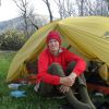
It was a nice little camp site just next to the Wellington River Track and the Riggalis Spur Track. With a cool alpine stream literally 5 meters away from it

.
End of second day
Third day:
The Wellington River Track has around 16 river crossings, and in rainy weather it may be dangerous to attempt some of these if the river is high. However, I only had a nice, warm, shallow river to contend with. If you don't want to get your boots wet, make sure you have some easy sandals to slip on and off with your boots. The track was in excellent condition, lots of markers to guide you where to go. I only managed to get lost once, where I had to walk down about 800 meters of river till I could find the track again, as the track snakes to the left and right of the river.
12km from Riggali Spur - Wellington River Track to Tampora Road. Apart from the River Crossings its easy - medium difficulty. There are places to camp all along Tampora Road right next to the River. Would definitely recommend anyone to go there for a 2-3 day hike!
Take it easy guys, any questions just ask