For those interested, there are a couple of articles on the Border Mail website regarding the Feathertop fire and evacuations. I'd hope that it can be brought under control but I think with the expected weather over the next couple of days and the lay of the land it seems like it might be pretty stuffed.
http://www.bordermail.com.au/story/1252340/footballers-olympian-evacuate-burning-mountain/?cs=53
Feathertop Fires.
Forum rules
Victoria specific bushwalking discussion. Please avoid publishing details of access to sensitive areas with no tracks.
Victoria specific bushwalking discussion. Please avoid publishing details of access to sensitive areas with no tracks.
47 posts
• Page 1 of 2 • 1, 2
Feathertop Fires.
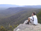
![]() by Kinsayder » Wed 23 Jan, 2013 1:10 pm
by Kinsayder » Wed 23 Jan, 2013 1:10 pm
-
Kinsayder - Athrotaxis cupressoides

- Posts: 361
- Joined: Tue 15 Nov, 2011 8:23 am
- Region: Victoria
Re: Feathertop Fires.
![]() by ryantmalone » Wed 23 Jan, 2013 1:49 pm
by ryantmalone » Wed 23 Jan, 2013 1:49 pm
He said the team were aware there was fire in the area before they began their trek but it wasn’t expected to effect the hike.
“We checked the status of the fire before we set off, we weren’t going to take any risks. It just all of a sudden took off,” Mr Thompson said.
Because climbing a mountain that is currently on fire is never risky.
At the time that they started walking, there would have been a 7HA fire burning on NW Spur. If that doesn't ring alarm bells, I don't know what else would...
-

ryantmalone - Phyllocladus aspleniifolius

- Posts: 511
- Joined: Tue 10 Jan, 2012 6:53 pm
- Location: Devonport, Tasmania
- Region: Tasmania
- Gender: Male
Re: Feathertop Fires.
![]() by Kinsayder » Wed 23 Jan, 2013 1:59 pm
by Kinsayder » Wed 23 Jan, 2013 1:59 pm
ryantmalone wrote:He said the team were aware there was fire in the area before they began their trek but it wasn’t expected to effect the hike.
“We checked the status of the fire before we set off, we weren’t going to take any risks. It just all of a sudden took off,” Mr Thompson said.
Because climbing a mountain that is currently on fire is never risky.
At the time that they started walking, there would have been a 7HA fire burning on NW Spur. If that doesn't ring alarm bells, I don't know what else would...
Now, I don't want to be snobby (because I really love several codes of football, except rugby, of course) but they were footballers. From Morwell.
-
Kinsayder - Athrotaxis cupressoides
- Posts: 361
- Joined: Tue 15 Nov, 2011 8:23 am
- Region: Victoria
Re: Feathertop Fires.
![]() by ryantmalone » Wed 23 Jan, 2013 2:12 pm
by ryantmalone » Wed 23 Jan, 2013 2:12 pm
Kinsayder wrote:...but they were footballers.
Luckily it weren't Collingwood.
Not sure if they would have been rescued...
-
ryantmalone - Phyllocladus aspleniifolius
- Posts: 511
- Joined: Tue 10 Jan, 2012 6:53 pm
- Location: Devonport, Tasmania
- Region: Tasmania
- Gender: Male
Re: Feathertop Fires.
![]() by Kinsayder » Wed 23 Jan, 2013 2:19 pm
by Kinsayder » Wed 23 Jan, 2013 2:19 pm
ryantmalone wrote:Kinsayder wrote:...but they were footballers.
Luckily it weren't Collingwood.
Not sure if they would have been rescued...
Collingwood would never demean themselves with the Australian high-country (pretty snooty for a team covered in prison tattoos). Geelong, on the other hand, do spend time up around Falls Creek. And you could argue that the results speak for themselves...
-
Kinsayder - Athrotaxis cupressoides
- Posts: 361
- Joined: Tue 15 Nov, 2011 8:23 am
- Region: Victoria
Re: Feathertop Fires.
![]() by bailz66 » Wed 23 Jan, 2013 3:28 pm
by bailz66 » Wed 23 Jan, 2013 3:28 pm
I have a few trips planned through this area this year. Really hoping the impact isn't too bad.
The gipsland power footy team that was rescued were on the radio this morning. They didn't mention anything about knowing that the fire was there before starting their trek
The gipsland power footy team that was rescued were on the radio this morning. They didn't mention anything about knowing that the fire was there before starting their trek
- bailz66
- Athrotaxis cupressoides
- Posts: 187
- Joined: Mon 20 Jun, 2011 11:39 am
- Region: Victoria
- Gender: Male
Re: Feathertop Fires.
![]() by ryantmalone » Wed 23 Jan, 2013 3:37 pm
by ryantmalone » Wed 23 Jan, 2013 3:37 pm
bailz66 wrote:The gipsland power footy team that was rescued were on the radio this morning. They didn't mention anything about knowing that the fire was there before starting their trek
The big plume of smoke at the end of the razorback would have been a dead giveaway.
bailz66 wrote:I have a few trips planned through this area this year. Really hoping the impact isn't too bad.
Looks like NW Spur, North Razorback, and Bungalow Spur were hit. Not sure about the southern Razorback yet, however I'd assume that access would be very questionable for a bit.
I'm also hoping that this is not the case, but it would seem from the pics that I have seen already, that both MUMC and Federation Huts would have come under threat. Hoping we didn't lose Federation Hut again, and hoping that MUMC Hut hasn't used up its last life.
-
ryantmalone - Phyllocladus aspleniifolius
- Posts: 511
- Joined: Tue 10 Jan, 2012 6:53 pm
- Location: Devonport, Tasmania
- Region: Tasmania
- Gender: Male
Re: Feathertop Fires.
![]() by magichat » Wed 23 Jan, 2013 4:33 pm
by magichat » Wed 23 Jan, 2013 4:33 pm
bailz66 wrote:I have a few trips planned through this area this year. Really hoping the impact isn't too bad.
This
- magichat
- Nothofagus gunnii

- Posts: 38
- Joined: Mon 24 Sep, 2012 11:04 am
- Region: Victoria
- Gender: Male
Re: Feathertop Fires.
![]() by magichat » Wed 23 Jan, 2013 4:37 pm
by magichat » Wed 23 Jan, 2013 4:37 pm
ryantmalone wrote:bailz66 wrote:The gipsland power footy team that was rescued were on the radio this morning. They didn't mention anything about knowing that the fire was there before starting their trek
The big plume of smoke at the end of the razorback would have been a dead giveaway.bailz66 wrote:I have a few trips planned through this area this year. Really hoping the impact isn't too bad.
Looks like NW Spur, North Razorback, and Bungalow Spur were hit. Not sure about the southern Razorback yet, however I'd assume that access would be very questionable for a bit.
I'm also hoping that this is not the case, but it would seem from the pics that I have seen already, that both MUMC and Federation Huts would have come under threat. Hoping we didn't lose Federation Hut again, and hoping that MUMC Hut hasn't used up its last life.
Actually they said it escalated very quickly and there had been no sign of it until then.
Just sounded more like bad luck than them being innately thick because they are footballers from morwell.
Sobering. I was in thereabouts with my 8yo during the last hot spell.
- magichat
- Nothofagus gunnii
- Posts: 38
- Joined: Mon 24 Sep, 2012 11:04 am
- Region: Victoria
- Gender: Male
Re: Feathertop Fires.
![]() by Kinsayder » Wed 23 Jan, 2013 5:17 pm
by Kinsayder » Wed 23 Jan, 2013 5:17 pm
The Hotham snow cam gives a vague picture. http://ski.com.au/snowcams/australia/vic/hotham/hotham-heavenly2.html
My understanding is that the helicopters have the capacity to drop fire retardant on the huts if need be. Aside from the natural devastation it would be heart breaking to hear of any of the huts going.
My understanding is that the helicopters have the capacity to drop fire retardant on the huts if need be. Aside from the natural devastation it would be heart breaking to hear of any of the huts going.
-
Kinsayder - Athrotaxis cupressoides
- Posts: 361
- Joined: Tue 15 Nov, 2011 8:23 am
- Region: Victoria
Re: Feathertop Fires.
![]() by tsangpo » Wed 23 Jan, 2013 6:19 pm
by tsangpo » Wed 23 Jan, 2013 6:19 pm
http://osom.dse.vic.gov.au/public/osom/ ... 3_Land.pdf
If the boundary is accurate it looks like Fed hut just escaped the fire-edge and MUMC hut is pretty much right on the edge
If the boundary is accurate it looks like Fed hut just escaped the fire-edge and MUMC hut is pretty much right on the edge
- tsangpo
- Atherosperma moschatum

- Posts: 85
- Joined: Thu 08 Jul, 2010 8:25 pm
- Location: Melbourne
- Region: Victoria
- Gender: Male
Re: Feathertop Fires.
![]() by ryantmalone » Wed 23 Jan, 2013 6:29 pm
by ryantmalone » Wed 23 Jan, 2013 6:29 pm
magichat wrote:Actually they said it escalated very quickly and there had been no sign of it until then.
Just sounded more like bad luck than them being innately thick because they are footballers from morwell.
My bad. They must have missed the big plume of smoke that was coming up from behind Mt Feathertop all day then. Sounds like an easy thing to miss.

This is a pic taken on Mt Bogong on the 7th Janurary 2003, only ten minutes after the black possum spur fire started. This is the fire that grew to massive proportions, and burnt everything from Mt Bogong to Mt Feathertop, plus joined up with many others, and created probably the worst forest fire that we have seen in the Alps for as long as I have been alive.
If you don't know what a fire is capable of doing in the bush, or not capable of assessing risk before a walk, don't risk it. Its that simple.
tsangpo wrote:http://osom.dse.vic.gov.au/public/osom/attachments/1279719290/20130123_1738_Harrietville_Feathertop_Public_A3_Land.pdf
If the boundary is accurate it looks like Fed hut just escaped the fire-edge and MUMC hut is pretty much right on the edge
Oh god thats close. At MUMC, there was a lot of low lying scrub along the ridge to MUMC, was quite dry too. Lead right up to the hut too.
As for Fed Hut, the area was pretty bare when I was there a few weeks back. Hoping that both huts are unscathed.
-
ryantmalone - Phyllocladus aspleniifolius
- Posts: 511
- Joined: Tue 10 Jan, 2012 6:53 pm
- Location: Devonport, Tasmania
- Region: Tasmania
- Gender: Male
Re: Feathertop Fires.
![]() by russell2pi » Thu 24 Jan, 2013 5:29 am
by russell2pi » Thu 24 Jan, 2013 5:29 am
My understanding is that another fire within 20 years of the last would prevent any future regeneration of Alpine Ash stands. All viable seed would have germinated after 2003 and the regrowth from that would not yet have set seed itself. Not good  .
.
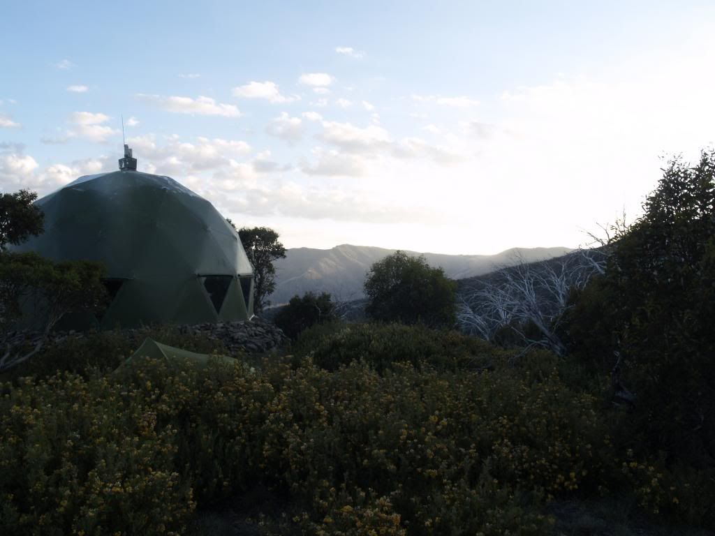
A pic from my last trip up there - I think the straight ones are mostly Alpine Ash.

A pic from my last trip up there - I think the straight ones are mostly Alpine Ash.
- russell2pi
- Nothofagus gunnii
- Posts: 27
- Joined: Sun 06 Jan, 2013 2:11 pm
- Region: Victoria
- Gender: Male
Re: Feathertop Fires.
![]() by ryantmalone » Thu 24 Jan, 2013 7:18 am
by ryantmalone » Thu 24 Jan, 2013 7:18 am
Looks like both huts are fine at this stage. Fed Hut is still surrounded by lots of fuel, but has not been burnt.
MUMC Hut area has been burnt out, however the hut seems to have come out lucky again. Makes me wonder how many lives that hut has!
Bungalow Spur Track has been mostly burnt out as well.
MUMC Hut area has been burnt out, however the hut seems to have come out lucky again. Makes me wonder how many lives that hut has!
Bungalow Spur Track has been mostly burnt out as well.
-
ryantmalone - Phyllocladus aspleniifolius
- Posts: 511
- Joined: Tue 10 Jan, 2012 6:53 pm
- Location: Devonport, Tasmania
- Region: Tasmania
- Gender: Male
Re: Feathertop Fires.
![]() by Kinsayder » Thu 24 Jan, 2013 8:45 am
by Kinsayder » Thu 24 Jan, 2013 8:45 am
ryantmalone wrote:Looks like both huts are fine at this stage. Fed Hut is still surrounded by lots of fuel, but has not been burnt.
MUMC Hut area has been burnt out, however the hut seems to have come out lucky again. Makes me wonder how many lives that hut has!
Bungalow Spur Track has been mostly burnt out as well.
Great news on the huts!
Terrible to think though, as Russell mentioned, that the Alpine Ash might not regenerate.
Does anybody know if it swept down the North Razorback?
-
Kinsayder - Athrotaxis cupressoides
- Posts: 361
- Joined: Tue 15 Nov, 2011 8:23 am
- Region: Victoria
Re: Feathertop Fires.
![]() by ryantmalone » Thu 24 Jan, 2013 10:24 am
by ryantmalone » Thu 24 Jan, 2013 10:24 am
Kinsayder wrote:
Great news on the huts!
Terrible to think though, as Russell mentioned, that the Alpine Ash might not regenerate.
Does anybody know if it swept down the North Razorback?
As of last night, it appears that the fires haven't touched the North Razorback at all.
http://osom.dse.vic.gov.au/public/osom/attachments/1279719290/20130123_1738_Harrietville_Feathertop_Public_A3_Land.pdf
That said, today is a new day. The fire is still said to be heading south east as per the CFA website, however winds are going to be anywhere up to 40kph heading north westerly today, away from the North Razorback, which puts Harrietville at significant risk today.
Hoping everyone in Harrietville plays it safe today.
-
ryantmalone - Phyllocladus aspleniifolius
- Posts: 511
- Joined: Tue 10 Jan, 2012 6:53 pm
- Location: Devonport, Tasmania
- Region: Tasmania
- Gender: Male
Re: Feathertop Fires.
![]() by ryantmalone » Thu 24 Jan, 2013 1:23 pm
by ryantmalone » Thu 24 Jan, 2013 1:23 pm
Concerning images out there at the moment:
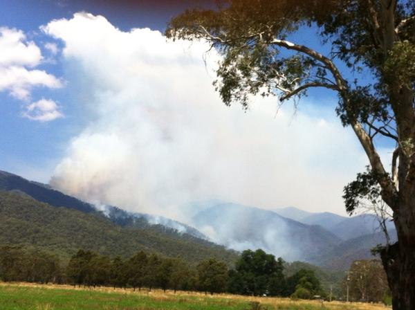
Shows the fires are uncomfortably close to town.
Warnings saying that the fire is travelling south east, however the fires have been travelling north west all day, and will continue to do so as the wind blows that way.
Hoping that town folk get the idea before CFA realizes they have been giving the town a false sense that the fires are heading away from them.
-
ryantmalone - Phyllocladus aspleniifolius
- Posts: 511
- Joined: Tue 10 Jan, 2012 6:53 pm
- Location: Devonport, Tasmania
- Region: Tasmania
- Gender: Male
Re: Feathertop Fires.
![]() by neilmny » Thu 24 Jan, 2013 1:23 pm
by neilmny » Thu 24 Jan, 2013 1:23 pm
I'm a bit confused by the directions Ryan, a north westerly comes from the noth west and travels south east away from Harrietville and towards Hotham Heights.
http://www.abc.net.au/news/2013-01-24/s ... le/4481504
http://www.abc.net.au/news/2013-01-24/s ... le/4481504
-

neilmny - Lagarostrobos franklinii

- Posts: 2576
- Joined: Fri 03 Aug, 2012 11:19 am
- Region: Victoria
- Gender: Male
Re: Feathertop Fires.
![]() by ryantmalone » Thu 24 Jan, 2013 1:28 pm
by ryantmalone » Thu 24 Jan, 2013 1:28 pm
neilmny wrote:I'm a bit confused by the directions Ryan, a north westerly comes from the noth west and travels south east away from Harrietville and towards Hotham Heights.
http://www.abc.net.au/news/2013-01-24/s ... le/4481504
Oh wow, that's embarrassing. Wind direction is based on origin. That would definitely make sense then.
Kind of.
I do like their approach to battling the fires at Hotham though. All snow making equipment on standby!!
-
ryantmalone - Phyllocladus aspleniifolius
- Posts: 511
- Joined: Tue 10 Jan, 2012 6:53 pm
- Location: Devonport, Tasmania
- Region: Tasmania
- Gender: Male
Re: Feathertop Fires.
![]() by Kinsayder » Thu 24 Jan, 2013 3:06 pm
by Kinsayder » Thu 24 Jan, 2013 3:06 pm
An easy mistake to make, Ryan! Pretty funny though...
That ABC picture from Hotham is pretty scary looking, Neil.
Just as an aside (and I don't wish to trivialise the danger and devastation of these fires at all); I've never done the North Razorback but I've heard it was quite achievable after the 2003(?) fires. Does it seem that this will be the case again? Has anybody done it before?
-
Kinsayder - Athrotaxis cupressoides
- Posts: 361
- Joined: Tue 15 Nov, 2011 8:23 am
- Region: Victoria
Re: Feathertop Fires.
![]() by ryantmalone » Thu 24 Jan, 2013 3:36 pm
by ryantmalone » Thu 24 Jan, 2013 3:36 pm
Kinsayder wrote:
Just as an aside (and I don't wish to trivialise the danger and devastation of these fires at all); I've never done the North Razorback but I've heard it was quite achievable after the 2003(?) fires. Does it seem that this will be the case again? Has anybody done it before?
From my understanding, it is easy to follow, and a little scrubby. The old face track still exists partly as well (you can see part of it from the summit winding around the North Peak), however Parks Victoria have made it very clear that they will no longer maintain this track at all. Its apparently very airy in parts as well. With the track in that condition, if coming up from the North Razorback, I'd assume it'd be a climb straight over the summit from the North Peak.
-
ryantmalone - Phyllocladus aspleniifolius
- Posts: 511
- Joined: Tue 10 Jan, 2012 6:53 pm
- Location: Devonport, Tasmania
- Region: Tasmania
- Gender: Male
Re: Feathertop Fires.
![]() by russell2pi » Thu 24 Jan, 2013 3:56 pm
by russell2pi » Thu 24 Jan, 2013 3:56 pm
ryantmalone wrote:Oh wow, that's embarrassing. Wind direction is based on origin. That would definitely make sense then.
You can also see the smoke is blowing away from town. Fires do spread into the wind, too - slowly.
What's concerning is tomorrow - very hot and windy (50 km/h) with a NW pushing it probably a long way towards Hotham/Dinner Plain - and then and a SE/SW change. If SE it will head for Harrietville. If SW it will head for Mt Beauty/Bogong/Falls Creek, across a much larger front (starting from what was the the NE flank at the time of the wind change).
- russell2pi
- Nothofagus gunnii
- Posts: 27
- Joined: Sun 06 Jan, 2013 2:11 pm
- Region: Victoria
- Gender: Male
Re: Feathertop Fires.
![]() by davids » Thu 24 Jan, 2013 8:32 pm
by davids » Thu 24 Jan, 2013 8:32 pm
I don't think you all should give the footballers too hard a time. If ParksVic had been concerned, they would have closed the park (as they have now).
Have just got back from a six day walk Razorback, Diamantina spur, Weston's, Rover Lodge, Roper, CC and over Bogong.
When climbing out of Big River on Tuesday arvo we had this small storm cell go over, thunder, lightening and mod downpour. That's when the fire started on NW spur. Later the local police told me the storm was only about 5k wide, so very unlucky for the area. DSE knew about the fire and apparently had a crew on it Tuesday and then Wed am. Certainly we were up on Bogong taking photos etc for an hour on Wed am and saw no smoke. Coming down staircase around lunchtime the wind really picked up, and then that's apparently when it got away. Another local (?rumour mill now) said on Wed am that it was when 2 choppers were both refuelling.
Coming in our transport from Mountain Ck back to the car left at Diamantina Hut the fire was obviously taking off with fresh large billows of smoke (not sure how to upload photos - will try later). We just missed the Hotham/Omeo road closure by 30 min, so had to overnight in Harrietville. Received the locally broadcast CFA text at 4:14pm that the fire was impacting Bungalow Trk and hikers on Ftop should move to safer ground. Local police rang accom places looking for the hikers whose Subaru was parked behind D hut - very reassuring that they were looking out for us.
Up early Wed am at about 0500 and the the air was beautifully still, with the active front seen gently coming down the Hville side of the ridgeline. Lucky to have great care and support from local police, took me up to bring my car down, fill up with our party, and back up to Hotham in convoy, then home to Gippsland.
So, should we go hiking in summer at all?
Should we have bailed last Thursday night from Westons with worried rels ringing about the fire at Licola, and a red sunset from the smoke very visible in the distance?
Good debate to be had on lots of these issues. Probably no simple answers. I am convinced though that the Parks, DSE and police do the very best they can in difficult uncertain circumstances and with lots of competing interests.
Cheers
David
- davids
- Atherosperma moschatum
- Posts: 54
- Joined: Wed 31 Mar, 2010 7:28 am
- Region: Victoria
- Gender: Male
Re: Feathertop Fires.
![]() by inxs » Fri 25 Jan, 2013 12:06 am
by inxs » Fri 25 Jan, 2013 12:06 am
Looks like Federation Hut will be impacted if the latest CFA Map is any indication.
http://osom.cfa.vic.gov.au/public/osom/attachments/1283460034/Harrietville-Feathertop%20Fire%20Map%2020130124%201414hrs.pdf
They should Total Fire Ban the whole of the state until the next good dump of rain.
http://osom.cfa.vic.gov.au/public/osom/attachments/1283460034/Harrietville-Feathertop%20Fire%20Map%2020130124%201414hrs.pdf
They should Total Fire Ban the whole of the state until the next good dump of rain.
- inxs
- Nothofagus cunninghamii

- Posts: 7
- Joined: Tue 01 Nov, 2011 11:31 am
- Region: Victoria
- Gender: Male
Re: Feathertop Fires.
![]() by Kinsayder » Fri 25 Jan, 2013 5:56 am
by Kinsayder » Fri 25 Jan, 2013 5:56 am
inxs wrote:Looks like Federation Hut will be impacted if the latest CFA Map is any indication.
http://osom.cfa.vic.gov.au/public/osom/attachments/1283460034/Harrietville-Feathertop%20Fire%20Map%2020130124%201414hrs.pdf
They should Total Fire Ban the whole of the state until the next good dump of rain.
The Victorian High Country Huts Association are stating that the Fed and MUMC huts are okay.
David, I'm glad you're okay. I think you're right about the dangers of summer hiking. It's something a lot of people obviously need to either assess or reassess. Especially with climate change suggesting that these conditions are simply going to become more and more frequent.
russell2pi wrote:You can also see the smoke is blowing away from town. Fires do spread into the wind, too - slowly.
What's concerning is tomorrow - very hot and windy (50 km/h) with a NW pushing it probably a long way towards Hotham/Dinner Plain - and then and a SE/SW change. If SE it will head for Harrietville. If SW it will head for Mt Beauty/Bogong/Falls Creek, across a much larger front (starting from what was the the NE flank at the time of the wind change).
Thanks for the update, Russell.
ryantmalone wrote:From my understanding, it is easy to follow, and a little scrubby. The old face track still exists partly as well (you can see part of it from the summit winding around the North Peak), however Parks Victoria have made it very clear that they will no longer maintain this track at all. Its apparently very airy in parts as well. With the track in that condition, if coming up from the North Razorback, I'd assume it'd be a climb straight over the summit from the North Peak.
Thanks, Ryan. It might be worth having a look at when I get a chance (probably not until October).
-
Kinsayder - Athrotaxis cupressoides
- Posts: 361
- Joined: Tue 15 Nov, 2011 8:23 am
- Region: Victoria
Re: Feathertop Fires.
![]() by Kinsayder » Fri 25 Jan, 2013 6:00 am
by Kinsayder » Fri 25 Jan, 2013 6:00 am
Just noticed this. http://www.theage.com.au/environment/in-the-line-of-fire-but-digging-in-as-harrietville-fire-makes-its-move-20130125-2dai2.html
I'm not sure if I'd be knocking back beers if the fire was potentially heading my way (I sort of imagine the waving generally in the fires direction, slurring loudly, "you don't know me, you don't even know me.").
I'm not sure if I'd be knocking back beers if the fire was potentially heading my way (I sort of imagine the waving generally in the fires direction, slurring loudly, "you don't know me, you don't even know me.").
-
Kinsayder - Athrotaxis cupressoides
- Posts: 361
- Joined: Tue 15 Nov, 2011 8:23 am
- Region: Victoria
Re: Feathertop Fires.
![]() by neilmny » Fri 25 Jan, 2013 7:40 am
by neilmny » Fri 25 Jan, 2013 7:40 am
Just noticed this. http://www.theage.com.au/environment/in ... 2dai2.html
Definitely not making light of a fairly ugly situation but those photos look a tad enhanced to my eyes.
-
neilmny - Lagarostrobos franklinii
- Posts: 2576
- Joined: Fri 03 Aug, 2012 11:19 am
- Region: Victoria
- Gender: Male
Re: Feathertop Fires.
![]() by ryantmalone » Thu 31 Jan, 2013 4:11 pm
by ryantmalone » Thu 31 Jan, 2013 4:11 pm
Emergency warning issued for Mt Hotham not long ago, fires expected to directly affect the resort before 5pm.
Snowcam images do not look promising at all.
Looks like they have turned on all the snow making equipment as a last ditch attempt to stop the fire from hitting the resort. Scary stuff, hope everyone is ok!
Snowcam images do not look promising at all.
Looks like they have turned on all the snow making equipment as a last ditch attempt to stop the fire from hitting the resort. Scary stuff, hope everyone is ok!
-
ryantmalone - Phyllocladus aspleniifolius
- Posts: 511
- Joined: Tue 10 Jan, 2012 6:53 pm
- Location: Devonport, Tasmania
- Region: Tasmania
- Gender: Male
Re: Feathertop Fires.
![]() by Hallu » Thu 31 Jan, 2013 4:20 pm
by Hallu » Thu 31 Jan, 2013 4:20 pm
Gee, and the fire is moving South-East, maybe I'll cancel my Mt Howitt trip afterall...
- Hallu
- Athrotaxis selaginoides

- Posts: 1833
- Joined: Fri 28 Sep, 2012 11:19 am
- Location: Grenoble
- Region: Other Country
Re: Feathertop Fires.
![]() by ryantmalone » Thu 31 Jan, 2013 4:25 pm
by ryantmalone » Thu 31 Jan, 2013 4:25 pm
Hallu wrote:Gee, and the fire is moving South-East, maybe I'll cancel my Mt Howitt trip afterall...
I'd be keeping close watch for sure. All depends on what the weather wants to do.
-
ryantmalone - Phyllocladus aspleniifolius
- Posts: 511
- Joined: Tue 10 Jan, 2012 6:53 pm
- Location: Devonport, Tasmania
- Region: Tasmania
- Gender: Male
47 posts
• Page 1 of 2 • 1, 2
Who is online
Users browsing this forum: No registered users and 50 guests