While we're compiling a history of Lees Paddocks bridges...
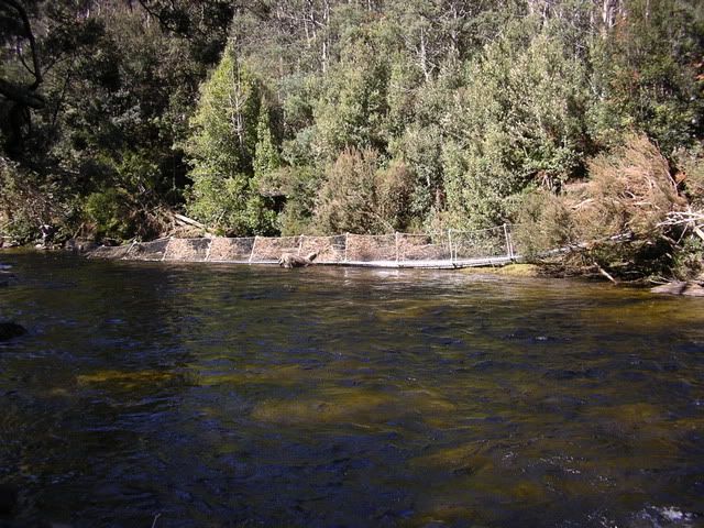
I clearly remember Steers Log in its hey day. Gorby's photo shows the log after it suffered a severe set-back in the late 80s. The log was originally well above the water and stretched from the top of a tall stump on the shingled side of the river to the top of the bank on the cut-in side.
In 1990 (I think), the hand-rail cable was knocked down by floods but the log managed to stay in it's lofty position. One evening my family went up to check the bridge after heavy rain. The river was still in a furious mood as I inched my way over. A mate was leaning on the cable to give it a little tension. Unfortunately my 'mate' did not notice me cross the cable halfway over. He gave it an extra heave in the wrong direction and sent me flying. Somehow my feet stayed on the log and there was just enough tension in the cable to hold me upside-down a whisker above the raging torrent.
A year or two after that episode, the log snapped and only lasted in Gorby's position just above normal water level for a short while.
There was another Mersey River bridge on the Lees Paddocks Track that lasted a mere 3 months. It was a very impressive structure with steel arches at either end. A new track was constructed along the east bank from Moses Creek to the bridge 200 metres above Lewis Falls.
Unfortunately, the bridge was built just above normal river height in a gorge where the river could go no where but up. The hard efforts of walking club volunteers were sadly brought undone by the first flood to come along.
Follow this link to a photo of the ill-fated bridge:
http://bushwalk.com/forum/download/file.php?id=6954&t=1You can still follow the orange markers from the end of the Mersey Forrest Road over Moses up to the crossing above Lewis Falls. It's a great place to cross but only when the river is VERY low. These orange markers are also the way to access the many falls of Moses Creek.