Peaks around Pelion Area

Discussion specifically about the Overland Track should be posted in this subforum, including side trips and the Cradle Mountain day walk area. Alternative access routes and connecting routes belong in the parent forum.
Forum rules
Overland Track App
An electronic guidebook for planning and walking the Overland Track.
Download this app for loads of information about planning, gear, food, accommodation and much more about the Overland Track.
You will also find topo maps, terrain profiles and track notes for offline use.
$10 -- Discount to $3 until December 15
Image

Peaks around Pelion Area

Postby kramster » Wed 21 May, 2008 4:38 pm

Howdy
I'm planning on visiting the Pelion area in June, going in via Arm-River track.

Trying to find some more information on some of the seldom-visited peaks around the Pelion area (Mt Thetis, Mt Archillies, Paddy's Nut etc)
Has anyone been to these places, and able to provide advice as to what access is like (there are "tracks" marked on various 1:25000 maps, but I doubt they are much good, or even tagged).

Cheers
Kramster :)
User avatar
kramster
Athrotaxis cupressoides
 
Posts: 235
Joined: Wed 05 Dec, 2007 10:18 am
Location: Hobart, Tasmania
Region: Tasmania
Gender: Male

Re: Peaks around Pelion Area

Postby norts » Wed 21 May, 2008 5:55 pm

Chapmans book on Cradle and the Walls describe how to get up to Paddys Nut etc. His description was good enough for me to find the track and get up to Paddys. Beautiful campsite under Paddys. I didn't go any further than Paddys, ran out of time.

http://www.david-noble.net/Tasmania/Res ... serve.html

Also gives details on peaks in the Park.

Roger
User avatar
norts
Lagarostrobos franklinii
 
Posts: 2013
Joined: Wed 01 Aug, 2007 10:45 am
Location: Germantown Tas.
Region: Tasmania

Re: Peaks around Pelion Area

Postby tastrekker » Wed 21 May, 2008 10:34 pm

I did all the Pelions as a 14 year old on a Scripture Union 'Summer Camp' bushwalk. We had 6 days of magnificent cloudless weather and followed an agenda as follows:
Day 1 - Arm River Track to New Pelion, climbing Pillinger along the way.
Day 2 - Abandon packs and climb Pelion West as a day walk. I did this a couple of years ago and the track is quite clear. You can read about it here.
Day 3 - Up Ewarts Track to camp beside pencil pines below Paddy's Nut. Up Thetis and Paddys Nut after lunch. On the recent Pelion West walk, I spotted the first track marker for Ewarts Track so despite being removed from recent maps, traces of the track have not been completely wiped out.
Day 4 - Day walk sidling around Thetis through intermittent patches of scree and scrub to climb Perins Bluff and Achilies. No tracks but route selection is easy in clear weather.
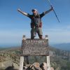
Day 5 - Shift camp back to New Pelion Hut before breakfast then climb Ossa and Pelion East as a day walk.
Day 6 - Climb Oakleigh before heading out via Arm River Track.

I have since read notes describing a 'Pelion Mountaineering Circuit' where packs are carried in a loop including traverses of Pelion West, Thetis and Ossa. Judging by more recent trips to the 'other' side of these peals, I think it would be quite achievable if you're keen to cart full packs over mountains. You would also need to be good with off track navigation and sensitive about minimal impact bushwalking.
User avatar
tastrekker
Athrotaxis cupressoides
 
Posts: 498
Joined: Thu 20 Sep, 2007 9:04 pm
Location: Lenah Valley
Region: Tasmania
Gender: Male


Return to Overland Track and Cradle Mountain

Who is online

Users browsing this forum: No registered users and 22 guests