Page 1 of 1

Navionics SonarChart Garmin Beta testers RQ'ed

PostPosted: Fri 03 Apr, 2015 3:23 pm
by Zone-5
Navionics SonarChart Garmin Beta testers RQ'ed

Works effortlessly on my Etrex 20 and iPhone...

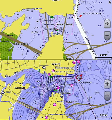
Ok, so this is underwater stuff and not really in the realm of bush walking unless you subscribe to bush diving! But hey some of you may be fisher people and so these HD sonar charts which cost a heap retail (but free here) can give you all the hidden the 'nooks and crannies' for better fishing and crabbing. They are free to anyone who asks for it and would be willing to submit there own corrections to their chart data. They even offer to give you for free an HD sonar for your boat with their special FREE offer! :mrgreen:


http://www.navionics.com/en/news/garmin-testers-wanted
http://www.navionics.com/en/compatibili ... n-plotters

Image

Image

:mrgreen:

Re: Navionics SonarChart Garmin Beta testers RQ'ed

PostPosted: Fri 03 Apr, 2015 4:23 pm
by Zone-5
Did some boating and fishing up at Hinchinbrook Island and used these sonar charts to pre-plan where to fish...

Zoomed in map of Hinchinbrook Channel.

Image

Using Garmin HomePort to display the Navionics SonarChart for Hinchinbrook Island.
Black box indicates the zoomed map:

Image

;)

Re: Navionics SonarChart Garmin Beta testers RQ'ed

PostPosted: Wed 08 Apr, 2015 11:49 pm
by keithy
Did you previously say you have the Garmin Bluechart as well?

How does this one compare to the Bluechart?

Re: Navionics SonarChart Garmin Beta testers RQ'ed

PostPosted: Fri 10 Apr, 2015 12:18 am
by Zone-5
keithy wrote:Did you previously say you have the Garmin Bluechart as well?

How does this one compare to the Bluechart?


Yes I do have Blue-chart but not the G2 versions.
I haven't tried them out together but I think the Blue-chart is specific for navigation and better handles that. As this is still in Beta stage the data is approx. and should not be relied on specifically.
The only reason why I mentioned this here is that you can get if for free if you apply now, as it makes for interesting fishing and crabbing between walks...

When I test them out together I will post some shots of the same location using the two maps for comparison, but here is an example of the differences...

Image

:)

Re: Navionics SonarChart Garmin Beta testers RQ'ed

PostPosted: Fri 10 Apr, 2015 6:44 am
by andrewa
Thx for the link. Looks good, and potentially useful.

Andrew A

Re: Navionics SonarChart Garmin Beta testers RQ'ed

PostPosted: Fri 10 Apr, 2015 7:02 am
by north-north-west
Wonder if Rowan and Sandy know about this . . .

Re: Navionics SonarChart Garmin Beta testers RQ'ed

PostPosted: Sun 03 May, 2015 1:58 am
by Zone-5
By just asking I have been supplied with the entire coastline of Australia.
You never know when this stuff comes in handy and offers like this are rare and should be taken advantage of...

Works beautifully on my Etrex 20!

;)

Re: Navionics SonarChart Garmin Beta testers RQ'ed

PostPosted: Mon 04 May, 2015 5:57 am
by GPSGuided
Expired.

Re: Navionics SonarChart Garmin Beta testers RQ'ed

PostPosted: Mon 04 May, 2015 5:24 pm
by Zone-5
Ah well, good things seldom last forever...

Image

:(