Hi Guys
I am heading home to Blenheim in late Jan/early Feb 2013 for 2 1/2 weeks and am considering walking the QCT. The times listed here (http://www.qctrack.co.nz/track/walk/) seem fairly reasonable - what are the chances of packing it into 3 days?
Also, is camping permitted along the track? Would prefer to do it on the cheap if possible.
Aidan
Queen Charlotte Track
Forum rules
Please avoid publishing details of access to sensitive areas with no tracks.
Please avoid publishing details of access to sensitive areas with no tracks.
51 posts
• Page 1 of 2 • 1, 2
Queen Charlotte Track
![]() by Strider » Wed 04 Jul, 2012 8:49 pm
by Strider » Wed 04 Jul, 2012 8:49 pm
-
Strider - Lagarostrobos franklinii

- Posts: 6030
- Joined: Mon 07 Nov, 2011 6:55 pm
- Location: Point Cook
- Region: Victoria
- Gender: Male
Re: Queen Charlotte Track
![]() by wayno » Thu 05 Jul, 2012 7:15 am
by wayno » Thu 05 Jul, 2012 7:15 am
you can only camp at designated DOC camp sites, see the link below for those, there are also backpackers type accomodation along the way as well
it's doable in three days. hilly in places but good track underfoot. no deep mud
i did part of it with a day pack, tore my calf muscle so missed out camp bay to the portage, which is the hilliest section. It was an old injury, it wasnt from any problems from the track. just the result of a long days walk
took six hours from ship cove to camp bay.
three hours from the portage over the hill going south including the trip up to the lookout.
the final section to anakiwa is easy, no major hills,,, took my time on that section, but its doable in two and a half hours without having to bust a gut...
http://doc.govt.nz/parks-and-recreation/tracks-and-walks/marlborough/sounds/queen-charlotte-track/
from the land of the long white clouds...
-
wayno - Lagarostrobos franklinii
- Posts: 8784
- Joined: Sun 19 Jun, 2011 7:26 am
- Location: NZ
- Region: New Zealand
- Gender: Male
-
Strider - Lagarostrobos franklinii
- Posts: 6030
- Joined: Mon 07 Nov, 2011 6:55 pm
- Location: Point Cook
- Region: Victoria
- Gender: Male
Re: Queen Charlotte Track
![]() by wayno » Thu 05 Jul, 2012 8:44 am
by wayno » Thu 05 Jul, 2012 8:44 am
if you book accomodation, the water boat services charge around $100 and that includes taking you to the start of the track, and picking you up from the end and ferrying your luggage between accomodation each day so all you need is a day pack on the track, I used cougar (no thats not A cougar) I just walked it in running shoes no problem,
from the land of the long white clouds...
-
wayno - Lagarostrobos franklinii
- Posts: 8784
- Joined: Sun 19 Jun, 2011 7:26 am
- Location: NZ
- Region: New Zealand
- Gender: Male
Re: Queen Charlotte Track
![]() by Strider » Thu 05 Jul, 2012 9:03 am
by Strider » Thu 05 Jul, 2012 9:03 am
Is the track itself fairly demanding? Im not looking for a walk in the park.
My other option is Mt Tapaeuenuku.
My other option is Mt Tapaeuenuku.
-
Strider - Lagarostrobos franklinii
- Posts: 6030
- Joined: Mon 07 Nov, 2011 6:55 pm
- Location: Point Cook
- Region: Victoria
- Gender: Male
Re: Queen Charlotte Track
![]() by wayno » Thu 05 Jul, 2012 9:08 am
by wayno » Thu 05 Jul, 2012 9:08 am
depends, one day is 27k's of hilly track, the other days are easy...
tapuaenuku is an eight hour approach walk to the hut constantly crossing a stream that can't be done in heavy rain. then you're up for another eight hour day climbing 1500m to the top, its a steep walk, no actual climbing involved.
tapuaenuku is an eight hour approach walk to the hut constantly crossing a stream that can't be done in heavy rain. then you're up for another eight hour day climbing 1500m to the top, its a steep walk, no actual climbing involved.
from the land of the long white clouds...
-
wayno - Lagarostrobos franklinii
- Posts: 8784
- Joined: Sun 19 Jun, 2011 7:26 am
- Location: NZ
- Region: New Zealand
- Gender: Male
Re: Queen Charlotte Track
![]() by Strider » Thu 05 Jul, 2012 10:41 am
by Strider » Thu 05 Jul, 2012 10:41 am
Is that 8 hours including the return leg from summit back to the huts?
-
Strider - Lagarostrobos franklinii
- Posts: 6030
- Joined: Mon 07 Nov, 2011 6:55 pm
- Location: Point Cook
- Region: Victoria
- Gender: Male
Re: Queen Charlotte Track
![]() by wayno » Thu 05 Jul, 2012 11:36 am
by wayno » Thu 05 Jul, 2012 11:36 am
yes, I did it in 7 when i was young and fit, including a half hour wasted by walking in the wrong direction,
i walked up the valley up staircase creek, it wsa october and still in snow but we basically went up a slope that corresponds with the stream branch just to the south west of the peak, we saw another group come onto the saddle to the north of the peak from the north west side.
we made the mistake of heading for the saddle to the south west of 2711 not realising there was no way up from there and had to back track across the slope, the slope narrows at the top, it wasnt obvious from the bottom that was the way up
http://www.topomap.co.nz/NZTopoMap/nz38672/Tapuae-o-Uenuku/Canterbury
from the land of the long white clouds...
-
wayno - Lagarostrobos franklinii
- Posts: 8784
- Joined: Sun 19 Jun, 2011 7:26 am
- Location: NZ
- Region: New Zealand
- Gender: Male
Re: Queen Charlotte Track
![]() by wayno » Thu 05 Jul, 2012 11:43 am
by wayno » Thu 05 Jul, 2012 11:43 am
from the land of the long white clouds...
-
wayno - Lagarostrobos franklinii
- Posts: 8784
- Joined: Sun 19 Jun, 2011 7:26 am
- Location: NZ
- Region: New Zealand
- Gender: Male
Re: Queen Charlotte Track
![]() by wayno » Thu 05 Jul, 2012 11:48 am
by wayno » Thu 05 Jul, 2012 11:48 am
from the land of the long white clouds...
-
wayno - Lagarostrobos franklinii
- Posts: 8784
- Joined: Sun 19 Jun, 2011 7:26 am
- Location: NZ
- Region: New Zealand
- Gender: Male
Re: Queen Charlotte Track
![]() by peregrinator » Fri 06 Jul, 2012 3:19 pm
by peregrinator » Fri 06 Jul, 2012 3:19 pm
Strider wrote:Hi Guys
I am heading home to Blenheim in late Jan/early Feb 2013 for 2 1/2 weeks and am considering walking the QCT. The times listed here (http://www.qctrack.co.nz/track/walk/) seem fairly reasonable - what are the chances of packing it into 3 days?
Also, is camping permitted along the track? Would prefer to do it on the cheap if possible.
Aidan
I agree with Wayno that doing it in three days would not be at all difficult. I went with a relatively slow companion and strolled along, doing it over five very easy days.
- peregrinator
- Athrotaxis selaginoides

- Posts: 1781
- Joined: Fri 15 Apr, 2011 2:50 pm
- Region: Victoria
Re: Queen Charlotte Track
![]() by Onestepmore » Sun 23 Sep, 2012 7:41 pm
by Onestepmore » Sun 23 Sep, 2012 7:41 pm
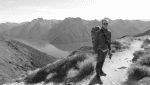
It's a beautiful track, fantastic scenery often on both sides as you spend a lot of time walking on ridges, so you get to see over the Malborough Sounds. We walked it over NYE period earlier this year - humid and overcast for 2 days, poured with rain for 2, but still great. We walked the 71 kms with our children so we took the easy option of staying in the resort style lodges, with our overnight stuff transported via water taxi, via Malborough Sounds Adventure Company. We just carried a day pack each, with a great lunch provided. We did do the walk over 4 days, but an adult used to some walking could easily do it over 3. The middle day would be the toughest. The tracks are very well mantained. Make sure you have a drink at the pub at Furneaux Lodge (it's a public bar - you don't have to be staying there), and the bar on the jetty if you visit Punga Cove. At the end near the last ferry wharf that takes you back to Picton is a very welcome coffee and ice cream kiosk!
http://www.marlboroughsounds.co.nz/?gcl ... pQodIW4AQg
http://www.marlboroughsounds.co.nz/?gcl ... pQodIW4AQg
We can learn a lot from crayons. They come in different shapes and colours, but they all have to live in the same box
-

Onestepmore - Athrotaxis selaginoides
- Posts: 1329
- Joined: Mon 02 Jul, 2012 11:33 am
- Location: Picton
- Region: New South Wales
- Gender: Female
Re: Queen Charlotte Track
![]() by Strider » Sat 27 Oct, 2012 2:55 pm
by Strider » Sat 27 Oct, 2012 2:55 pm
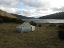
Looking into the QCT a bit more closely and have realised that DOC (very sneakily) have not included any of the private campsites on their website/maps. Without knowledge of these, it makes camping look like a 5-6 day affair due to the massive spacings between DOC campsites.
Is anyone familiar enough with the QCT to give me advice on which campsites to stay at for a 4 day/3 night trip? Would prefer to keep walking times under 8 hours per day. So far, I am thinking:
Night 1 - Miners Camp
Night 2 - Black Rock Shelter
Night 3 - Mistletoe Bay
Is anyone familiar enough with the QCT to give me advice on which campsites to stay at for a 4 day/3 night trip? Would prefer to keep walking times under 8 hours per day. So far, I am thinking:
Night 1 - Miners Camp
Night 2 - Black Rock Shelter
Night 3 - Mistletoe Bay
-
Strider - Lagarostrobos franklinii
- Posts: 6030
- Joined: Mon 07 Nov, 2011 6:55 pm
- Location: Point Cook
- Region: Victoria
- Gender: Male
Re: Queen Charlotte Track
![]() by wayno » Sat 27 Oct, 2012 3:07 pm
by wayno » Sat 27 Oct, 2012 3:07 pm
i wasnt aware there were private campsites, I never saw any just private accomodationn one of the placs i stayed had camping some of the backpackers might have campsites so check with them.... some places the accomodation is limited, at the portage there's three small backpackers or the hotel and the backpackers fill up in summer.
have a look here
http://www.queencharlottetrack.co.nz/ac ... sites.aspx
have a look here
http://www.queencharlottetrack.co.nz/ac ... sites.aspx
from the land of the long white clouds...
-
wayno - Lagarostrobos franklinii
- Posts: 8784
- Joined: Sun 19 Jun, 2011 7:26 am
- Location: NZ
- Region: New Zealand
- Gender: Male
Re: Queen Charlotte Track
![]() by Strider » Sat 27 Oct, 2012 3:35 pm
by Strider » Sat 27 Oct, 2012 3:35 pm
wayno wrote:i wasnt aware there were private campsites, I never saw any just private accomodationn one of the placs i stayed had camping some of the backpackers might have campsites so check with them.... some places the accomodation is limited, at the portage there's three small backpackers or the hotel and the backpackers fill up in summer.
have a look here
http://www.queencharlottetrack.co.nz/ac ... sites.aspx
Thanks Wayno.
Miner's, Madsen's, and Mistletoe are the private campsites. Would prefer to camp if I can - in the hope to make an otherwise unchallenging walk that little bit more interesting.
-
Strider - Lagarostrobos franklinii
- Posts: 6030
- Joined: Mon 07 Nov, 2011 6:55 pm
- Location: Point Cook
- Region: Victoria
- Gender: Male
Re: Queen Charlotte Track
![]() by wayno » Sat 27 Oct, 2012 4:03 pm
by wayno » Sat 27 Oct, 2012 4:03 pm
its not totally unchallenging. the day between camp bay and torea is 24 k of a lot of up and downhill.
you can get to camp bay in a day from ship cove, the last 15k are pretty flat.
you can get to camp bay in a day from ship cove, the last 15k are pretty flat.
from the land of the long white clouds...
-
wayno - Lagarostrobos franklinii
- Posts: 8784
- Joined: Sun 19 Jun, 2011 7:26 am
- Location: NZ
- Region: New Zealand
- Gender: Male
Re: Queen Charlotte Track
![]() by Strider » Sat 27 Oct, 2012 4:07 pm
by Strider » Sat 27 Oct, 2012 4:07 pm
wayno wrote:its not totally unchallenging. the day between camp bay and torea is 24 k of a lot of up and downhill.
you can get to camp bay in a day from ship cove, the last 15k are pretty flat.
Of course not totally unchallenging. Thanks for that snippet of info
-
Strider - Lagarostrobos franklinii
- Posts: 6030
- Joined: Mon 07 Nov, 2011 6:55 pm
- Location: Point Cook
- Region: Victoria
- Gender: Male
Re: Queen Charlotte Track
![]() by wayno » Sat 27 Oct, 2012 4:17 pm
by wayno » Sat 27 Oct, 2012 4:17 pm
from the land of the long white clouds...
-
wayno - Lagarostrobos franklinii
- Posts: 8784
- Joined: Sun 19 Jun, 2011 7:26 am
- Location: NZ
- Region: New Zealand
- Gender: Male
Re: Queen Charlotte Track
![]() by wayno » Sat 27 Oct, 2012 4:20 pm
by wayno » Sat 27 Oct, 2012 4:20 pm
on my trip
i aggravated old calf injuries and had to bypass camp bay to torea bay for safety and take the boat
i'm going back in december to complete it.
we came in in mid march as a major storm had passed through, we guessed our flight to wellington would be cancelled and we were right, teh airport closed so we had changed to a direct flight later in the day to blenheim, the ferries werent running. and the water taxi's for teh track werent running either the day before. end result only four people started the track the day we did, ...
then when we got off the track another storm blew through delaying our ferry sailing to wellington. the joys of cook strait weather... theres few things to compare with standing on the deck of the interisland ferry in a storm....
from the land of the long white clouds...
-
wayno - Lagarostrobos franklinii
- Posts: 8784
- Joined: Sun 19 Jun, 2011 7:26 am
- Location: NZ
- Region: New Zealand
- Gender: Male
Re: Queen Charlotte Track
![]() by wayno » Sun 28 Oct, 2012 3:58 am
by wayno » Sun 28 Oct, 2012 3:58 am
this brochure supposedly shows the location of non doc campsites as well as doc ones,
http://www.doc.govt.nz/documents/parks- ... ochure.pdf
it shows all of one non doc campsite... perhaps only campsite owners who pay get their campsites listed? the doc brochures now include paid advertising of services for walking tracks, although its not so obvious that that is the case on this one, it may be all the accommodation owners paid to have their accommodation included on the brochure.
doc have been instructed to collaborate more with businesses to finance themselves.... you'll see ads for booking with air new zealand on their great walks websites. ironical a massive carbon emitter gets to associate with a dept associated with environmental conservation... but nz being nz you're most likely to fly here from overseas....
http://www.doc.govt.nz/documents/parks- ... ochure.pdf
http://www.doc.govt.nz/documents/parks- ... ochure.pdf
it shows all of one non doc campsite... perhaps only campsite owners who pay get their campsites listed? the doc brochures now include paid advertising of services for walking tracks, although its not so obvious that that is the case on this one, it may be all the accommodation owners paid to have their accommodation included on the brochure.
doc have been instructed to collaborate more with businesses to finance themselves.... you'll see ads for booking with air new zealand on their great walks websites. ironical a massive carbon emitter gets to associate with a dept associated with environmental conservation... but nz being nz you're most likely to fly here from overseas....
http://www.doc.govt.nz/documents/parks- ... ochure.pdf
from the land of the long white clouds...
-
wayno - Lagarostrobos franklinii
- Posts: 8784
- Joined: Sun 19 Jun, 2011 7:26 am
- Location: NZ
- Region: New Zealand
- Gender: Male
Re: Queen Charlotte Track
![]() by Strider » Sun 28 Oct, 2012 8:39 am
by Strider » Sun 28 Oct, 2012 8:39 am
wayno wrote:this brochure supposedly shows the location of non doc campsites as well as doc ones,
http://www.doc.govt.nz/documents/parks- ... ochure.pdf
Perfect!
Although after seeing where they are located on a map, it may be easier just to go straight through to Camp Bay on the first day.
-
Strider - Lagarostrobos franklinii
- Posts: 6030
- Joined: Mon 07 Nov, 2011 6:55 pm
- Location: Point Cook
- Region: Victoria
- Gender: Male
Re: Queen Charlotte Track
![]() by wayno » Sun 28 Oct, 2012 8:47 am
by wayno » Sun 28 Oct, 2012 8:47 am
the track is basically a lone lane dirt road.... we cruised to camp bay in five and a half hours...
i sent you a link to my photos
i sent you a link to my photos
from the land of the long white clouds...
-
wayno - Lagarostrobos franklinii
- Posts: 8784
- Joined: Sun 19 Jun, 2011 7:26 am
- Location: NZ
- Region: New Zealand
- Gender: Male
Re: Queen Charlotte Track
![]() by Strider » Sun 28 Oct, 2012 8:59 am
by Strider » Sun 28 Oct, 2012 8:59 am
wayno wrote:the track is basically a lone lane dirt road.... we cruised to camp bay in five and a half hours...
i sent you a link to my photos
Saw that. Thanks
-
Strider - Lagarostrobos franklinii
- Posts: 6030
- Joined: Mon 07 Nov, 2011 6:55 pm
- Location: Point Cook
- Region: Victoria
- Gender: Male
Re: Queen Charlotte Track
![]() by wayno » Sun 28 Oct, 2012 9:19 am
by wayno » Sun 28 Oct, 2012 9:19 am
the rule for camping on great walks is only at designated campsites OR at least 500 metres from the track.... based on how thick the bush is on most great walks thats to basically deter people from camping near the track while walking it for free, but in places you could camp closer than 500m and no one would know... i know someone who did, he basically walked until daylight ran out so it would have been hard to see him anyway. considering you dont get charged for entering the park its a bit rude, people take advantage of the high grade track and dont want to contribute.
queen charlotte is a bit different as there is a fee for accessing the track over certain sections. it would be hard for doc to recoup costs for the track otherwise since theres no doc huts and all the accommodation is on private land.
outward bound school maintain the southern end of the track. probably an agreement since they use it regularly and go into areas that are probably doc managed. no doubt they'll clip the ticket on guided walking companies, but why anyone would want to fork out money for a guided walk on such a straight forward track that has plenty of options for accommodation is beyond me
from the land of the long white clouds...
-
wayno - Lagarostrobos franklinii
- Posts: 8784
- Joined: Sun 19 Jun, 2011 7:26 am
- Location: NZ
- Region: New Zealand
- Gender: Male
Re: Queen Charlotte Track
![]() by peregrinator » Mon 29 Oct, 2012 6:48 am
by peregrinator » Mon 29 Oct, 2012 6:48 am
wayno wrote:but why anyone would want to fork out money for a guided walk on such a straight forward track that has plenty of options for accommodation is beyond me
Well said, Wayno. This is beyond my comprehension as well, whether at Queen Charlotte Sound or anywhere else. For example, in national parks in Victoria, where the state government seems to think it is appropriate that assorted opportunists should make money out of various "developments" in public land.
But we, of course, are bushwalkers and understand this, while the travel industry continues to offer "amazing experiences" for those with significant disposable income and little practical knowledge. I'm not sure how this issue can be resolved while capitalism prevails.
- peregrinator
- Athrotaxis selaginoides
- Posts: 1781
- Joined: Fri 15 Apr, 2011 2:50 pm
- Region: Victoria
Re: Queen Charlotte Track
![]() by wayno » Mon 29 Oct, 2012 7:33 am
by wayno » Mon 29 Oct, 2012 7:33 am
queen charlotte is basically a benched hard packed one lane road a lot of the way, no end of accommodation with all the mod cons and restaurants. its not like you need to pay a guide company for additional support, its just money down the drain. some people go for guides by default, especially older people and asians, but if they did the slightest bit of homework they'd realise for tracks like this its just overkill... and easy money for the guiding companies... if thres a group of you you'd save several thousand booking group accomodation on your own..
from the land of the long white clouds...
-
wayno - Lagarostrobos franklinii
- Posts: 8784
- Joined: Sun 19 Jun, 2011 7:26 am
- Location: NZ
- Region: New Zealand
- Gender: Male
Re: Queen Charlotte Track
![]() by wayno » Sun 18 Nov, 2012 9:08 am
by wayno » Sun 18 Nov, 2012 9:08 am
i'm hitting the queen charlotte in a fortnight doing camp bay to anakiwa as a warm up for more tramping over summer
from the land of the long white clouds...
-
wayno - Lagarostrobos franklinii
- Posts: 8784
- Joined: Sun 19 Jun, 2011 7:26 am
- Location: NZ
- Region: New Zealand
- Gender: Male
Re: Queen Charlotte Track
![]() by Strider » Sun 18 Nov, 2012 11:54 am
by Strider » Sun 18 Nov, 2012 11:54 am
wayno wrote:i'm hitting the queen charlotte in a fortnight doing camp bay to anakiwa as a warm up for more tramping over summer
I'm doing about 5km a day warming up for the QCT
-
Strider - Lagarostrobos franklinii
- Posts: 6030
- Joined: Mon 07 Nov, 2011 6:55 pm
- Location: Point Cook
- Region: Victoria
- Gender: Male
Re: Queen Charlotte Track
![]() by wayno » Sun 18 Nov, 2012 11:58 am
by wayno » Sun 18 Nov, 2012 11:58 am
i've been up and down so many hills i'm getting fed up with them.... time to take it easy before i hit the trail. otherwise i know i'll get there and think, oh god not another @#$%Z&! walk!
have you sorted out the campsites you're staying at yet?
have you sorted out the campsites you're staying at yet?
from the land of the long white clouds...
-
wayno - Lagarostrobos franklinii
- Posts: 8784
- Joined: Sun 19 Jun, 2011 7:26 am
- Location: NZ
- Region: New Zealand
- Gender: Male
Re: Queen Charlotte Track
![]() by wayno » Sun 18 Nov, 2012 12:05 pm
by wayno » Sun 18 Nov, 2012 12:05 pm
didnt really want to repeat the endeavour inlet stint again, head in the scrub. flat mundane walking. i think my girlfriend would suffer if we did the full track with the 24 k hilly stretch. so decided to cut out the first 25k of the track so we only have one hard day..
found that decent accomodation sells out fast at punga cove.. its expensive so we took the back packers option which was a complete rip off. no sheets or towels. dodgy plumbing. we were staying in a portacom on a cold night, I've been in warmer tents in those conditions.... it was a tiny room. id just torn my calf muscle after walking the 27k from ship cove , wasnt in a good mood at all...
found that decent accomodation sells out fast at punga cove.. its expensive so we took the back packers option which was a complete rip off. no sheets or towels. dodgy plumbing. we were staying in a portacom on a cold night, I've been in warmer tents in those conditions.... it was a tiny room. id just torn my calf muscle after walking the 27k from ship cove , wasnt in a good mood at all...
from the land of the long white clouds...
-
wayno - Lagarostrobos franklinii
- Posts: 8784
- Joined: Sun 19 Jun, 2011 7:26 am
- Location: NZ
- Region: New Zealand
- Gender: Male
51 posts
• Page 1 of 2 • 1, 2
Who is online
Users browsing this forum: No registered users and 52 guests