Water report
Forum rules
The place for bushwalking topics that are not location specific.
The place for bushwalking topics that are not location specific.
7 posts
• Page 1 of 1
Water report
![]() by corvus » Thu 06 Mar, 2008 7:23 pm
by corvus » Thu 06 Mar, 2008 7:23 pm
In view of the feedback I have been getting for the NW ,Cradle and Central Plateau can we have a Statewide water report as to the state of water flow in your normal walking replenishment areas,mate has just gone to Cape Pillar and I suspect even Luncheon Creek may be low.
collige virgo rosas
-

corvus - Vercundus gearus-freakius

- Posts: 5538
- Joined: Mon 23 Apr, 2007 7:24 pm
- Location: Devonport
- Region: Tasmania
- Gender: Male
Re: Water report
![]() by Joe » Thu 06 Mar, 2008 8:17 pm
by Joe » Thu 06 Mar, 2008 8:17 pm
Another user posted this link a while ago which I have found really handy. Thanks to whoever that user was BTW 
http://www.hydro.com.au/home/Tourism+an ... Levels.htm
http://www.hydro.com.au/home/Tourism+an ... Levels.htm
-

Joe - in vino veritas
- Posts: 675
- Joined: Mon 26 Mar, 2007 10:35 pm
- Location: Devonport Tas
- ASSOCIATED ORGANISATIONS: Stoney Creek Outdoor Equipment.
- Region: Tasmania
Re: Water report
![]() by Son of a Beach » Fri 07 Mar, 2008 7:30 am
by Son of a Beach » Fri 07 Mar, 2008 7:30 am
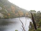
On my last walk on the central plateau a few weeks ago, I found it to be the driest I've ever seen (in my few short years). There were a lot of areas where what would normally be pools, are now just depressions in the ground. Some of them have been dry for so long that they are nice little lawns in the bottom of them, with very healthy grass. Likewise, some of the lakes that are lower than normal have nice new lawns around the egde of them in some places (Lake Little Johnny was one of these, I think?).
Thankfully, in this area, there is still plenty of water... just a little less than usual. Lake McKenzie (hydro) was still low enough that you could have walked across the ridge in the middle from one side to the other (although I believe there's a narrow channel across this where you'd have to swim or wade for a few metres).
Thankfully, in this area, there is still plenty of water... just a little less than usual. Lake McKenzie (hydro) was still low enough that you could have walked across the ridge in the middle from one side to the other (although I believe there's a narrow channel across this where you'd have to swim or wade for a few metres).
- Son of a Beach
- Lagarostrobos franklinii

- Posts: 7024
- Joined: Thu 01 Mar, 2007 7:55 am
- ASSOCIATED ORGANISATIONS: Bit Map (NIXANZ)
- Region: Tasmania
- Gender: Male
Re: Water report
![]() by frank_in_oz » Mon 10 Mar, 2008 6:46 am
by frank_in_oz » Mon 10 Mar, 2008 6:46 am
My wife is heading off to do the Overland Track, in a party of one, in a couple of weeks. Does anyone know the state of water supply at Windy Ridge Hut? We know they are working on it at the moment, but she is not sure whether water is still being collected in the tanks? (Know there is a creek just down from the hut that is reasonably reliable)
Thanks in advance
Thanks in advance
Frank
Check out "Our Hiking Blog" Overland Track guide, Food to Go-recipe ideas and Trekking to Everest Base Camp.
Check out "Our Hiking Blog" Overland Track guide, Food to Go-recipe ideas and Trekking to Everest Base Camp.
-
frank_in_oz - Athrotaxis cupressoides

- Posts: 372
- Joined: Fri 02 Nov, 2007 12:43 pm
- Location: Geelong, Vic
Re: Water report
![]() by tasadam » Mon 10 Mar, 2008 5:48 pm
by tasadam » Mon 10 Mar, 2008 5:48 pm
frank_in_oz wrote:My wife is heading off to do the Overland Track, in a party of one, in a couple of weeks. Does anyone know the state of water supply at Windy Ridge Hut? We know they are working on it at the moment, but she is not sure whether water is still being collected in the tanks? (Know there is a creek just down from the hut that is reasonably reliable)
Thanks in advance
Best way to find this out if no-one here responds, is to give the Ranger at Lake St Clair a quick call.
-
tasadam - Magnus administratio

- Posts: 5940
- Joined: Tue 10 Apr, 2007 6:58 pm
- Location: Near Devonport, Tasmania
- ASSOCIATED ORGANISATIONS: TasmaniART, Smitten Merino, Macpac
- Region: Tasmania
- Gender: Male
Re: Water report
![]() by kramster » Tue 11 Mar, 2008 12:15 pm
by kramster » Tue 11 Mar, 2008 12:15 pm
frank_in_oz wrote:My wife is heading off to do the Overland Track, in a party of one, in a couple of weeks. Does anyone know the state of water supply at Windy Ridge Hut? We know they are working on it at the moment, but she is not sure whether water is still being collected in the tanks? (Know there is a creek just down from the hut that is reasonably reliable)
Thanks in advance
It has been about 10 years since I was up that way (so correct me if I am wrong), if you go down hill past the heli-pads, over the hill where the Yuppie Hut (Cradle-Huts) stands, you should find one of the main tributories of Narcissus River (could be a little scrubby to get to it, but it is water, nonetheless).
-

kramster - Athrotaxis cupressoides
- Posts: 235
- Joined: Wed 05 Dec, 2007 10:18 am
- Location: Hobart, Tasmania
- Region: Tasmania
- Gender: Male
Re: Water report
![]() by tas-man » Wed 09 Apr, 2008 8:39 am
by tas-man » Wed 09 Apr, 2008 8:39 am
Absolutely no problems with water along the south coast track over Easter and week after - walked in it for 5 days so hydrated by the absorption method.  Our camp on top of the New Harbour Range was next to a good soak that provided water, but we carried 3 litres up each just in case for dinner and breakfast.
"The world reveals itself to those who travel on foot."
Werner Herzog
Werner Herzog
-

tas-man - Athrotaxis selaginoides

- Posts: 1469
- Joined: Mon 03 Sep, 2007 8:55 pm
- Location: Riverside
- Region: Tasmania
- Gender: Male
7 posts
• Page 1 of 1
Return to Bushwalking Discussion
Who is online
Users browsing this forum: No registered users and 31 guests