Oakdale to Yerranderie
Forum rules
Posting large/multiple images in this forum is OK. Please start topic titles with the name of the location or track.
For topics focussed on photos rather than the trip, please consider posting in the 'Gallery' forum instead.
This forum is for posting information about trips you have done, not for requesting information about a track or area.
12 posts
• Page 1 of 1
Oakdale to Yerranderie
![]() by Solohike74 » Sat 31 May, 2014 7:57 pm
by Solohike74 » Sat 31 May, 2014 7:57 pm
Has anyone walked into Yerranderie or beyond from ghe water board gate at Sheehys Road?
-

Solohike74 - Athrotaxis cupressoides

- Posts: 244
- Joined: Tue 07 Feb, 2012 7:20 pm
- Location: NSW
- ASSOCIATED ORGANISATIONS: VNPA; Friends of: Bogong, The Prom, Cobberas, Baw Baw
- Region: Australia
- Gender: Female
Re: Oakdale to Yerranderie
![]() by michael_p » Sat 31 May, 2014 10:52 pm
by michael_p » Sat 31 May, 2014 10:52 pm
Hi Solohike74,
It's illegal to walk through that area as the Schedule 1 Catchment exclusion zone extends all the way to the gate. Have a look here: http://www.sca.nsw.gov.au/catchment/manage/special-areas.
And here is the end of the road: https://maps.google.com.au/maps?q=-34.128716,150.503404&hl=en&num=1&t=m&z=16&layer=c&cbll=-34.128695,150.503457&panoid=FSJ73bWz3AzAV2HjVtNj4w&cbp=12,276.36,,0,1.18
And for a laugh have a look here: http://users.tpg.com.au/users/eirvine/warragamba/story.htm.
Cheers,
Michael.
One foot in front of the other.
-
michael_p - Athrotaxis selaginoides

- Posts: 1378
- Joined: Sun 15 Nov, 2009 6:58 pm
- Location: Macarthur Region of Sydney.
- Region: New South Wales
- Gender: Male
Re: Oakdale to Yerranderie
![]() by kanangra » Sun 01 Jun, 2014 8:20 am
by kanangra » Sun 01 Jun, 2014 8:20 am
Promise not to tell anyone? But I rode out that way about 30 years ago. 
K
K
- kanangra
- Athrotaxis selaginoides
- Posts: 1335
- Joined: Sun 25 May, 2008 3:52 pm
Re: Oakdale to Yerranderie
![]() by Grabeach » Sun 01 Jun, 2014 9:35 am
by Grabeach » Sun 01 Jun, 2014 9:35 am
25 years ago I was visiting a mate who lived out that way and we drove through the open gate down to the water. Not sure what we would have done if someone had locked it while we were down there. Didn't have enough petrol to get to Oberon.
- Grabeach
- Athrotaxis cupressoides
- Posts: 309
- Joined: Wed 12 Oct, 2011 2:09 pm
- Region: New South Wales
- Gender: Male
Re: Oakdale to Yerranderie
![]() by michael_p » Sun 01 Jun, 2014 1:37 pm
by michael_p » Sun 01 Jun, 2014 1:37 pm
I've never been down into the forbidden zone.
I do remember as a kid going to the Burragorang Lookout and there were several walking tracks that headed away from the picnic area. Last time I visited the lookout there were no entry signs about every 10m's around the area. How things change.
I do remember as a kid going to the Burragorang Lookout and there were several walking tracks that headed away from the picnic area. Last time I visited the lookout there were no entry signs about every 10m's around the area. How things change.
One foot in front of the other.
-
michael_p - Athrotaxis selaginoides
- Posts: 1378
- Joined: Sun 15 Nov, 2009 6:58 pm
- Location: Macarthur Region of Sydney.
- Region: New South Wales
- Gender: Male
-
Solohike74 - Athrotaxis cupressoides
- Posts: 244
- Joined: Tue 07 Feb, 2012 7:20 pm
- Location: NSW
- ASSOCIATED ORGANISATIONS: VNPA; Friends of: Bogong, The Prom, Cobberas, Baw Baw
- Region: Australia
- Gender: Female
Re: Oakdale to Yerranderie
![]() by michael_p » Tue 03 Jun, 2014 11:06 am
by michael_p » Tue 03 Jun, 2014 11:06 am
Solohike74 wrote:How are the water crossings?
River height data for the Wollondilly can be found here: http://www.bom.gov.au/cgi-bin/wrap_fwo.pl?IDN60143.html. As far as I am aware there is no height data for the Nattai.
Michael.
One foot in front of the other.
-
michael_p - Athrotaxis selaginoides
- Posts: 1378
- Joined: Sun 15 Nov, 2009 6:58 pm
- Location: Macarthur Region of Sydney.
- Region: New South Wales
- Gender: Male
Re: Oakdale to Yerranderie
![]() by Mark F » Tue 03 Jun, 2014 10:26 pm
by Mark F » Tue 03 Jun, 2014 10:26 pm
Look below the Warragamba Dam heading and you will see a height for the Nattai at Smallwoods Crossing just below the Kowmung entry
"Perfection is attained not when there is nothing more to add, but when there is nothing more to remove".
-

Mark F - Lagarostrobos franklinii

- Posts: 2332
- Joined: Mon 19 Sep, 2011 8:14 pm
- Region: Australian Capital Territory
- Gender: Male
Re: Oakdale to Yerranderie
![]() by michael_p » Wed 04 Jun, 2014 9:53 am
by michael_p » Wed 04 Jun, 2014 9:53 am
Mark F wrote:Look below the Warragamba Dam heading and you will see a height for the Nattai at Smallwoods Crossing just below the Kowmung entry
Well there you go. Never thought to look under Warragamba. Thanks Mark F, you learn something new every day.
One foot in front of the other.
-
michael_p - Athrotaxis selaginoides
- Posts: 1378
- Joined: Sun 15 Nov, 2009 6:58 pm
- Location: Macarthur Region of Sydney.
- Region: New South Wales
- Gender: Male
Re: Oakdale to Yerranderie
![]() by DaveNoble » Wed 04 Jun, 2014 10:43 am
by DaveNoble » Wed 04 Jun, 2014 10:43 am
Solohike74 wrote:How are the water crossings?
You cross the Nattai on a bridge - well above the river. It used to provide access to coal mines on the west side of the river, as well as access to Yerranderie via the Wollondilly arm of Lake Burragorang. The Wollondilly at the ford can be harder to cross if the water is high.
Dave
- DaveNoble
- Athrotaxis selaginoides
- Posts: 1031
- Joined: Sun 03 Feb, 2008 3:56 pm
Re: Oakdale to Yerranderie
![]() by Haematocrit » Wed 04 Jun, 2014 9:29 pm
by Haematocrit » Wed 04 Jun, 2014 9:29 pm
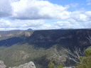
I don't know who, but someone took a trip on Sunday into the Nattai. He had hoped to skirt the edges of the restricted zone, entering from Wattle ridge, down Nattai road to exit at Thirlmere lakes. He left the car park at 5 am, and using a head torch initially, made good time, crossing the nattai for the first time at 8am and reaching the turn-off to Beloon pass at 9am
. The idiot, who shall remain nameless, had previously come this way on a trip to yerranderie on the june long w/e last year. So it was only at this point, 19.5kms into the trip that he realised that he had left his map in the car. Carrying on regardless, he made good time reaching another locked gate which clearly indicated that walkers only could continue. The next stretch offered only occasional glimpses of sandstone cliffs due to light rain and mist, but the going was good and to an agriculturalists eye it was obvious how fertile these river flats, now being reclaimed by regrowth, once were. With a map, the idiot would have turned right about 5km after the locked gate to quickly leave the restricted zone and exit via Little river and Blue gum creek. Foolishly he turned left.
Smallwoods crossing is a concrete causeway in a U shaped river bed
. There is a very well engineered flying fox adjacent which would allow crossing during flood - the river depth could easily reach 15meters, but today was only a couple of inches over the causeway.
There is a small fibro house here and a large grassed clearing, the road veers easterly for about a km before meeting a sealed road at a T intersection. The idiot fortunately considered it wise to turn right to follow the Nattai downstream and trudged for kilometers down the sealed road expecting to be accosted and fined any moment. He crossed the bridge referred to by a previous poster
and the continued east to slog up what he realised was Sheehy's Creek road. At just after 2pm, about 42km after setting off he was picked up on Barkers Lodge road by his long suffering beloved and delivered back to his starting point to pick up his car and return home to nurse his blisters. She was sensible enough to bring a beer 
Smallwoods crossing is a concrete causeway in a U shaped river bed
There is a small fibro house here and a large grassed clearing, the road veers easterly for about a km before meeting a sealed road at a T intersection. The idiot fortunately considered it wise to turn right to follow the Nattai downstream and trudged for kilometers down the sealed road expecting to be accosted and fined any moment. He crossed the bridge referred to by a previous poster
- Haematocrit
- Nothofagus gunnii

- Posts: 10
- Joined: Tue 21 Aug, 2012 1:31 pm
- Region: New South Wales
- Gender: Male
Re: Oakdale to Yerranderie
![]() by kanangra » Thu 05 Jun, 2014 10:58 am
by kanangra » Thu 05 Jun, 2014 10:58 am
Great little circuit isn't it? Hard to think that heavy colliery trucks once rumbled down those now deserted roads. As a matter of interest you also have the option of returning via the Little River Rd. That ends up at Thirlmere Lakes NP. There is also a track that cuts across from Sheeys Ck Rd to the Little River Road. You need low water though because at maximum storage the last section is flooded.
K.
K.
- kanangra
- Athrotaxis selaginoides
- Posts: 1335
- Joined: Sun 25 May, 2008 3:52 pm
12 posts
• Page 1 of 1
Return to NSW & ACT Trip Reports & Track Notes
Who is online
Users browsing this forum: No registered users and 2 guests