Between Christmas and New Year I got away for my annual trip in the Northern Snowies. This year I thought I would visit the Bogong Peaks area as I had not been there before. I drove down to Tumut late one night and arrived at the Thomas Boyd Track Head at about Midnight. There were several families camped there some of whom were still up when I pulled in. It was a clear night so I didn't worry about the tent. There was no moon and the night sky was ablaze with stars. I could feel it doing me good already.
I was up and going before sunrise. All was quiet and still in the camp ground as I made my way through in the early morning gloom. I began by following the Hume and Hovell walking tack which led across the river on a large swing bridge. Once on the other side it passed through farming properties never straying far from the bank of the river. Another large swing bridge led back to the northern side at a Travelling Stock Reserve and then out onto the road for a short distance before recrossing on a concrete causeway on the "Federal Park" property. This led by the homestead and shed. As usual farming equipment from over the last 100 years lay strewn about the paddocks. I couldn't believe how quickly the country side had dried out in only a few months.
A little further on the track passed through a section of bush. There was no sign but on consulting the map later I noticed this was a thin extension of KNP which protruded all the way to the southern bank of the river. This is very close to the northern most point of the park, which here is only about 400m wide. The track began to swing to the left and leave the valley of the Goobarragandra behind. I would not see the river again till late on the afternoon of the following day. The way now led up the side valley of Walls Ck. I passed a side track which crossed the creek and a set of old yards before noting what looked like a minor farm track heading up to the left. Even though there was no sign this was the beginning of the Warogong Track which would be my way of route for the remainder of the day as it traversed the length of the Bogong Peaks Wilderness. Sure enough after a short climb there was a KNP sign declaring that I was entering the wilderness. The track continued to climb and then passed a swampy area on the far side of which was the turn off to Buckleys Track. This is marked on some maps as the Sugarloaf Track because it leads to the Warogong Sugarloaf which is the northern most of the Bogong Peaks. Not far past here I walked off the Lacmalac 1:25,000 sheet and onto Blowering. (I've often wondered if signs should be posted on trees whenever a map boundary is crossed much like local government boundaries on roads, though I suspect this would conflict somewhat with the wilderness values of the area?)
Before long I came to signpost announcing Nicholas Track off to my left. This track was marked but not named on my map. I noted it led back down to the river after passing through an old mining area. (There had been a lot of goldmining in these hills in years past and I would see evidence of that as my trip progressed.) The track continued to climb, steeply in parts, but despite that the views were quite limited. The surrounding country was heavily forested mainly with Mountain Gum and Messmate. After a good couple of hours I passed below and around the summit of Mt Hovell. Named after Capt. Hovell, one of the two leaders of the Hume and Hovell expedition. But the explorers crossed well to the north of here where the country is easier. Mt. Hovell is one of the Bogong Peaks but as this was an introductory trip I had no time to explore further.
The next landmark was the Cliffords Ck Fire Trail junction on the right. This leads all the way down to the Snowy Mts highway in the west. It actually comes out at the Hume crossing rest area on Blowering Reservoir. According to my GPS I had come 31.8 km. It was 12:30 and I thought about stopping for lunch but decided to keep going as it was a hot day and I wanted to wait until I struck some water. There had been none at all since I had left Walls Ck. I continued heading south along the range seeing very little wildlife except that I did come upon the largest wild sow I have ever seen. She was accompanied by a litter of piglets. No more than a few months old those things scampered fast in all directions as I approached. Fortunately the boar was nowhere to be seen.
Sometime in the early afternoon I walked off the Blowering sheet and onto Talbingo. As there is roughly 15 1 km. grid squares from the top to bottom of each map this gave some rough indication of distance travelled. Near here I came across my first running water since Walls Ck. and topped up my supplies which were running low. Next Cotterill Fire Trail came in on the left. This leads down across the Peak River to the Goobarragandra Powerline Rd. (For future reference this would probably be a shorter way in.) Past here the track began to descend and soon I came to the lovely flowing waters of Rings Ck. Named after aboriginal bora rings which are reported to be on the tops nearby. Apparently this area was important to the aborigines not just for food gathering (bogong moths) but also for ceremonial purposes. It had been a long hot day and I was very glad for the refreshing waters of the mountain stream. It was 2:45 and time for lunch. I had come 42.3km. I lay back on the grassy banks looking up at the rocky summit of nearby Bogong Mt and thought I have to return to explore this area more thoroughly.
TBC.
K.
Goobarragandra Gallop
Forum rules
Posting large/multiple images in this forum is OK. Please start topic titles with the name of the location or track.
For topics focussed on photos rather than the trip, please consider posting in the 'Gallery' forum instead.
This forum is for posting information about trips you have done, not for requesting information about a track or area.
19 posts
• Page 1 of 1
Goobarragandra Gallop
![]() by kanangra » Tue 07 Jan, 2014 3:12 pm
by kanangra » Tue 07 Jan, 2014 3:12 pm
- kanangra
- Athrotaxis selaginoides

- Posts: 1335
- Joined: Sun 25 May, 2008 3:52 pm
Re: Goobarragandra Gallop
![]() by puredingo » Wed 08 Jan, 2014 6:19 am
by puredingo » Wed 08 Jan, 2014 6:19 am
Whoa! What a hit out. I bet whoever you buy your shoes off is rubbing his hands together.
I've never been in the area but i can imagine buy your report it would be impressive. I seem to see a pig every time i leave the tar these days too...adaptive, versitile animals to be sure.
I've never been in the area but i can imagine buy your report it would be impressive. I seem to see a pig every time i leave the tar these days too...adaptive, versitile animals to be sure.
- puredingo
- Athrotaxis selaginoides
- Posts: 1270
- Joined: Mon 13 Feb, 2012 6:54 am
- Region: New South Wales
Re: Goobarragandra Gallop
![]() by kanangra » Sat 11 Jan, 2014 10:42 am
by kanangra » Sat 11 Jan, 2014 10:42 am
After a late lunch it was 3:45 before I was on the move again. The track now followed a course below the summits and so crossed several delightful mountain streams including, Big Plain Creek, Big Creek, and Cave Creek. It was good to have ready access to water again. After leaving Cave Ck the track passed within a k or so of Black Perry Mt. This is a prominent outcrop of weather resistant rock visible across the valley from the lookout on the Snowy Mts. Hwy. Past here the track descended to Ruby Ck. where I decided to call it a day. It was 7:00PM and I had come 56km since leaving the Thomas Boyd Track Head at 5:30 that morning. The bush was fairly thick and so I set up camp on the track itself thinking that as I hadn't seen a soul all day and no sign of any vehicle use that I would be safe.
I no sooner stopped than the mosquitoes descended but once I had the fire going they were no longer a problem. By 9:00 I was ready for bed and was nodding off to sleep when I thought I heard the sound of an engine revving? It can't be I thought, not out here. Then I saw lights reflected in the trees? Surely not? Then I saw them, 4 headlights bearing down on my camp! I desperately tried to disentangle myself from my sleeping bag and unzip the tent in time. Without even stopping he swerved at the last moment and just kept on going, driving right over the smouldering embers of my campfire. This had never happened to me before. I was just getting back off to sleep when he came back the other way. This time I had my torch handy and gesticulated wildly with it. This time he stopped and said he was sorry to have disturbed me but was looking for sheep dogs that had escaped? Next morning I found that both gates between my camp and the powerline road had been cut.
TBC
K.
- kanangra
- Athrotaxis selaginoides
- Posts: 1335
- Joined: Sun 25 May, 2008 3:52 pm
Re: Goobarragandra Gallop
![]() by perfectlydark » Sat 11 Jan, 2014 8:48 pm
by perfectlydark » Sat 11 Jan, 2014 8:48 pm
Wait.. havnt I read that before?
- perfectlydark
- Phyllocladus aspleniifolius

- Posts: 950
- Joined: Tue 04 Jun, 2013 6:13 pm
- Region: New South Wales
- Gender: Male
Re: Goobarragandra Gallop
![]() by kanangra » Sun 12 Jan, 2014 12:57 pm
by kanangra » Sun 12 Jan, 2014 12:57 pm
Ah yes, sorry about that. On the general page. Only now getting around to noting up the trip.
K.
K.
- kanangra
- Athrotaxis selaginoides
- Posts: 1335
- Joined: Sun 25 May, 2008 3:52 pm
Re: Goobarragandra Gallop
![]() by perfectlydark » Sun 12 Jan, 2014 5:49 pm
by perfectlydark » Sun 12 Jan, 2014 5:49 pm
All good  had to do a double take there
- perfectlydark
- Phyllocladus aspleniifolius
- Posts: 950
- Joined: Tue 04 Jun, 2013 6:13 pm
- Region: New South Wales
- Gender: Male
Re: Goobarragandra Gallop
![]() by iandsmith » Tue 14 Jan, 2014 8:24 am
by iandsmith » Tue 14 Jan, 2014 8:24 am
Wow, my legs felt tired just reading about it....
Glad you know where you're going!
Cheers, Ian
Glad you know where you're going!
Cheers, Ian
-
iandsmith - Athrotaxis cupressoides

- Posts: 366
- Joined: Thu 22 Jan, 2009 3:27 pm
- Location: Newcastle
Re: Goobarragandra Gallop
![]() by north-north-west » Tue 14 Jan, 2014 8:53 am
by north-north-west » Tue 14 Jan, 2014 8:53 am
I love reading about your walks, but I really wish you took photos.
"Mit der Dummheit kämpfen Götter selbst vergebens."
-

north-north-west - Lagarostrobos franklinii

- Posts: 15139
- Joined: Thu 14 May, 2009 7:36 pm
- Location: The Asylum
- ASSOCIATED ORGANISATIONS: Social Misfits Anonymous
- Region: Tasmania
Re: Goobarragandra Gallop
![]() by kanangra » Tue 14 Jan, 2014 9:15 am
by kanangra » Tue 14 Jan, 2014 9:15 am
I do actually take a few but I'm such a clutz when it comes to posting them. I will try and put that right later today.
K.
K.
- kanangra
- Athrotaxis selaginoides
- Posts: 1335
- Joined: Sun 25 May, 2008 3:52 pm
Re: Goobarragandra Gallop
![]() by kanangra » Tue 14 Jan, 2014 9:40 am
by kanangra » Tue 14 Jan, 2014 9:40 am
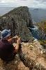
I will try a selection.
- Federal Park on the H&H WT
- Attachments
-
- Park boundary
-
- On the track
-
- On the way down to Rings Ck.
- kanangra
- Athrotaxis selaginoides
- Posts: 1335
- Joined: Sun 25 May, 2008 3:52 pm
Re: Goobarragandra Gallop
![]() by kanangra » Tue 14 Jan, 2014 9:41 am
by kanangra » Tue 14 Jan, 2014 9:41 am
Gee what do you know? That actually worked???
K
K
- kanangra
- Athrotaxis selaginoides
- Posts: 1335
- Joined: Sun 25 May, 2008 3:52 pm
Re: Goobarragandra Gallop
![]() by kanangra » Tue 14 Jan, 2014 9:49 am
by kanangra » Tue 14 Jan, 2014 9:49 am
I'll try a few more.
- Attachments
-
- Rings Ck.
-
- Bogong Mt from Rings Ck
-
- Day 2 and a new wilderness area.
-
- Jounama trail.
-
- Trail down to Long Flat.
- kanangra
- Athrotaxis selaginoides
- Posts: 1335
- Joined: Sun 25 May, 2008 3:52 pm
Re: Goobarragandra Gallop
![]() by kanangra » Tue 14 Jan, 2014 9:56 am
by kanangra » Tue 14 Jan, 2014 9:56 am
While I'm on a roll I'll try a few more.
- Attachments
-
- All that remains of the Long Flat homestead.
-
- LongFlat homestead.
-
- Long Flat
-
- On the descent to the river.
-
- The Goobarragandra River.
- kanangra
- Athrotaxis selaginoides
- Posts: 1335
- Joined: Sun 25 May, 2008 3:52 pm
Re: Goobarragandra Gallop
![]() by kanangra » Tue 14 Jan, 2014 10:02 am
by kanangra » Tue 14 Jan, 2014 10:02 am
I can't believe these are actually working. 
- Attachments
-
- Kells Hut
-
- Kells Hut.
-
- The old and the new.
-
- Emu flat Ck.
-
- Nothing like cooling the feet off after a long day on the track.
- kanangra
- Athrotaxis selaginoides
- Posts: 1335
- Joined: Sun 25 May, 2008 3:52 pm
Re: Goobarragandra Gallop
![]() by kanangra » Tue 14 Jan, 2014 10:10 am
by kanangra » Tue 14 Jan, 2014 10:10 am
Now all I have to work out is how to put text between the photos and I'll be laughing.
Day 3 and i'm on my way out.
Well I can't believe I just did that.
K.
Day 3 and i'm on my way out.
- Venables or Plonkeys Hut
- View from the verandah.
- The valley starts to open out.
- The Peak River flowing into the Goobarragandra
- The valley starts to open out.
- Rock Flat camping area.
Well I can't believe I just did that.
K.
- kanangra
- Athrotaxis selaginoides
- Posts: 1335
- Joined: Sun 25 May, 2008 3:52 pm
- perfectlydark
- Phyllocladus aspleniifolius
- Posts: 950
- Joined: Tue 04 Jun, 2013 6:13 pm
- Region: New South Wales
- Gender: Male
Re: Goobarragandra Gallop
![]() by north-north-west » Tue 14 Jan, 2014 6:23 pm
by north-north-west » Tue 14 Jan, 2014 6:23 pm
See, k, you can do anything if you set your mind to it. Thank you.
"Mit der Dummheit kämpfen Götter selbst vergebens."
-
north-north-west - Lagarostrobos franklinii
- Posts: 15139
- Joined: Thu 14 May, 2009 7:36 pm
- Location: The Asylum
- ASSOCIATED ORGANISATIONS: Social Misfits Anonymous
- Region: Tasmania
Re: Goobarragandra Gallop
![]() by kanangra » Tue 14 Jan, 2014 6:37 pm
by kanangra » Tue 14 Jan, 2014 6:37 pm
All I needed was a bit of encouragement.
K.
K.
- kanangra
- Athrotaxis selaginoides
- Posts: 1335
- Joined: Sun 25 May, 2008 3:52 pm
Re: Goobarragandra Gallop
![]() by north-north-west » Sun 19 Jan, 2014 5:19 pm
by north-north-west » Sun 19 Jan, 2014 5:19 pm
I'd clap, but there isn't an emoticon for that.
Far as interweaving the text and photos, the simplest method is to upload all the images first. Then - and it's easiest if you start with the first and go through in order - click on the spot in the text where you want to insert the photo - make sure the cursor is in the right place -and then click on 'place inline' next to the photo you want in that spot.
That 'place inline' command simply positions the photo in the place where the cursor is. Nice and straightforward (it has to be - Ms cybercretin here figured it out for herself).
"Mit der Dummheit kämpfen Götter selbst vergebens."
-
north-north-west - Lagarostrobos franklinii
- Posts: 15139
- Joined: Thu 14 May, 2009 7:36 pm
- Location: The Asylum
- ASSOCIATED ORGANISATIONS: Social Misfits Anonymous
- Region: Tasmania
19 posts
• Page 1 of 1
Return to NSW & ACT Trip Reports & Track Notes
Who is online
Users browsing this forum: No registered users and 6 guests