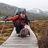
After years of yearning I finally made it up to Lake Rhona over Easter - it was a magical experience. The weather was warm and clear, the Gordon River was non-threatening and the mud didn't slow me down too much. Now I can't wait to go back.
Finding the Richea Creek trailhead is straightforward with the 1:100000 map WEDGE and the route was relatively clear - marked by mud when there's no tape. The Richea Creek track is not marked on the Gordonvale 1:25000 though. It took me about 5 hours each way, and about 2 hours to get up Reids Peak and back lakeside.
Lovely walking up above the lake - lots to explore on the Denison Range.
For those that are interested, I've got a few more pictures at https://flic.kr/s/aHsk9guvkK
Lake Rhona - Easter 2015
Forum rules
Posting large/multiple images in this forum is OK. Please start topic titles with the name of the location or track.
For topics focussed on photos rather than the trip, please consider posting in the 'Gallery' forum instead.
This forum is for posting information about trips you have done, not for requesting information about a track or area.
5 posts
• Page 1 of 1
Lake Rhona - Easter 2015
![]() by M_o_N » Tue 07 Apr, 2015 8:00 pm
by M_o_N » Tue 07 Apr, 2015 8:00 pm
- Attachments
-
- Sunrise at Lake Rhona, Easter 2015
- 16863534878_d57a3fe474_z.jpg (192.31 KiB) Viewed 6430 times
- M_o_N
- Nothofagus cunninghamii

- Posts: 2
- Joined: Sat 28 Jun, 2014 2:27 pm
- Location: Hobart, Tasmania
- Region: Tasmania
- Gender: Male
Re: Lake Rhona - Easter 2015
![]() by Tas Tom » Thu 09 Apr, 2015 2:20 pm
by Tas Tom » Thu 09 Apr, 2015 2:20 pm
Brings back some good memories. Out of interest, were there many people camping at the lake over the Easter weekend?
Less Work, More Walk
- Tas Tom
- Nothofagus gunnii

- Posts: 33
- Joined: Sat 09 Feb, 2013 7:00 pm
- Location: Tasmania
- Region: Tasmania
- Gender: Male
Re: Lake Rhona - Easter 2015
![]() by whynotwalk » Thu 09 Apr, 2015 3:45 pm
by whynotwalk » Thu 09 Apr, 2015 3:45 pm
Thanks for posting Daniel - some great photos there. And "yearning" is just the right word for Lake Rhona! I've been there at least five times, but still have that same yearning to return as you now do. A special place,
cheers
Peter
cheers
Peter
Solvitur ambulando (Walking solves it) - attributed to St Augustine, 4th century AD.
-
whynotwalk - Athrotaxis selaginoides

- Posts: 1345
- Joined: Tue 24 Jun, 2008 12:57 pm
- Location: Cascades
- Region: Tasmania
- Gender: Male
Re: Lake Rhona - Easter 2015
![]() by M_o_N » Fri 10 Apr, 2015 8:15 am
by M_o_N » Fri 10 Apr, 2015 8:15 am
Tas Tom wrote:Brings back some good memories. Out of interest, were there many people camping at the lake over the Easter weekend?
Very few! A party of two were there when I arrived, and as I left I passed another party of two at Gordonvale. I believe they were in the process of deciding the mud was too much for them.
- M_o_N
- Nothofagus cunninghamii
- Posts: 2
- Joined: Sat 28 Jun, 2014 2:27 pm
- Location: Hobart, Tasmania
- Region: Tasmania
- Gender: Male
Re: Lake Rhona - Easter 2015
![]() by stepbystep » Fri 10 Apr, 2015 8:19 am
by stepbystep » Fri 10 Apr, 2015 8:19 am
Lovely stuff Daniel! Very special place.
The idea of wilderness needs no defense, it only needs defenders ~ Edward Abbey
-
stepbystep - Lagarostrobos franklinii

- Posts: 7707
- Joined: Tue 19 May, 2009 10:19 am
- Location: Street urchin
- Region: Tasmania
- Gender: Male
5 posts
• Page 1 of 1
Return to TAS Trip Reports & Track Notes
Who is online
Users browsing this forum: No registered users and 20 guests