Hi there forum members and guests
Anyone got any reasonably up to date information regards the stretcher track and its navigational and foot slogging character. I note it roughly follows a ridge line between two drainage catchments. I have heard it is fairly overgrown and a lot of tree falls to negotiate.
Is it overgrown with regrowth scunge or is it naturally thick old unlogged rainforest?
Any recent reports?
Anyone been or planning to go earlier this month or planning to go thru earlyish this year?
Generally wondering about a two night walk from Green Mountains to Ratatat (first night), then via Pt Lookout / Stinson, and the Stretcher Track to Running Ck (second night), then out via Running Creek by lunch on 3rd day (as a car shuffle arrangement. And yes I believe the second day is a biggy - just don't know what to expect regards current state of stretcher track.
Stretcher Track - Lamington NP
Forum rules
Queensland specific bushwalking discussion. Please avoid publishing details of access to sensitive areas with no tracks.
Queensland specific bushwalking discussion. Please avoid publishing details of access to sensitive areas with no tracks.
11 posts
• Page 1 of 1
Stretcher Track - Lamington NP
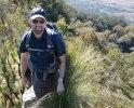
![]() by johnwmck » Wed 15 Feb, 2012 9:48 pm
by johnwmck » Wed 15 Feb, 2012 9:48 pm
- johnwmck
- Nothofagus gunnii

- Posts: 11
- Joined: Mon 16 Jan, 2012 10:25 pm
- Region: Queensland
- Gender: Male
Re: Stretcher Track - Lamington NP
![]() by cams » Thu 16 Feb, 2012 9:18 am
by cams » Thu 16 Feb, 2012 9:18 am
Yeah. Second day would be big. If you start reasonably early and you don't have too many route finding issues you should be at ratatat by lunch time. Depends if you've been that way before too. Following false tracks can waste a lot of time. We camped on top of Mt. Throakban for our first night heading for the wreck. Would take the pressure off the second day. I can't comment on the stretcher track but if you do a bit of a search through some older threads I think there are some reports from last year saying that it is very overgrown with plenty of lawyer vine and route finding can be tricky.
-
cams - Phyllocladus aspleniifolius

- Posts: 725
- Joined: Tue 24 Aug, 2010 1:54 pm
- Region: Tasmania
- Gender: Male
Re: Stretcher Track - Lamington NP
![]() by Pteropus » Thu 16 Feb, 2012 9:22 am
by Pteropus » Thu 16 Feb, 2012 9:22 am
Hi mate, some info has been posted here ->
viewtopic.php?f=48&t=4167
and here
viewtopic.php?f=38&t=4785
viewtopic.php?f=48&t=4167
and here
viewtopic.php?f=38&t=4785
- Pteropus
- Athrotaxis selaginoides

- Posts: 1051
- Joined: Sun 09 May, 2010 6:42 pm
- Location: Neither here nor there
- Region: Australia
- Gender: Male
Re: Stretcher Track - Lamington NP
![]() by kbm63 » Fri 17 Feb, 2012 9:49 pm
by kbm63 » Fri 17 Feb, 2012 9:49 pm
Pteropus I think is talking about the track that goes from Christmas Creek up to the Stinson. The Stretcher track run along the ridge and I not sure it exist anymore.
It is years since i have walked in this area , but one walk I had planned to avoid a long car shuffle was start at Running Crk , go up Blacksnake Ridge and follow the ridge to Tweed Trig. It is very slow going from the top of Blacksnake out to Tweed Trig but it is achievable in a day. From Tweed Trig it about 2-3 hour walk to Pt Lookout. From there you could descend along the Stretcher track and descend into Running Creek Falls. On Old Lamington maps a trail is shown from the Stretcher Track to Running Creek coming out near the falls. Once you hit Running Creek it would be a couple of hours back to your car. This walk does cross private property and you would need permission first.
I did attempt this walk once but did get a little bit geographically challenged around tweed trig , we would of made Point Lookout on the first night. It was a May weekend and a small party . If you do walk the Stretcher track it would be good to read a report on it.
- kbm63
- Athrotaxis cupressoides

- Posts: 124
- Joined: Thu 09 Sep, 2010 10:10 pm
- Location: Toowoomba
- Region: Queensland
- Gender: Male
Re: Stretcher Track - Lamington NP
![]() by tomh » Sat 18 Feb, 2012 10:40 am
by tomh » Sat 18 Feb, 2012 10:40 am
Go to Pteropus's post second reference and find the post from Phil Box - that Stretcher to Running Creek track marked on maps no longer exists. Also, in the words of a fellow walker from March last year, the Stretcher track itself is 'nearly non-existent' - it does not exist in many places due to treefalls and new growth.
- tomh
- Athrotaxis cupressoides
- Posts: 157
- Joined: Wed 02 Jun, 2010 3:44 pm
- Region: Queensland
- Gender: Male
Re: Stretcher Track - Lamington NP
![]() by flyinglion2000 » Sun 04 Mar, 2012 3:41 pm
by flyinglion2000 » Sun 04 Mar, 2012 3:41 pm
Me and a mate did the full circuit - Christmas Ck campground - Stinson wreck - Stretcher track and return in a long day about 14 years ago. The stretcher track even then had many instances of tree fall which meant detouring off track. I would think it could only be much worse now especially in the flattest parts of the plateau whereas on the ridge west out of the rainforest it would be easy navigation. Don't remember ever seeing the turn-off to Running Creek. Still that is what "off the beaten track" is all about isn't it?
- flyinglion2000
- Nothofagus gunnii
- Posts: 32
- Joined: Tue 26 Apr, 2011 4:30 pm
- Region: Queensland
- Gender: Male
Re: Stretcher Track - Lamington NP
![]() by johnwmck » Sun 11 Mar, 2012 11:24 am
by johnwmck » Sun 11 Mar, 2012 11:24 am
Thanks everyone for your responses - a wealth of knowledge and experience. Based on feedback received, I will defer tackling the stretcher track for the moment. If anyone does do that route in 2012 walking season, I am interested in a post to summarise the experience, especially regards route condition.
- johnwmck
- Nothofagus gunnii
- Posts: 11
- Joined: Mon 16 Jan, 2012 10:25 pm
- Region: Queensland
- Gender: Male
Re: Stretcher Track - Lamington NP
![]() by Griffo » Sun 01 Jul, 2012 8:01 pm
by Griffo » Sun 01 Jul, 2012 8:01 pm
My brother Dale, nephew Jono and I walked the Stinson Stretcher Track over two days starting on the 25th of April 2012.
We set out from Stinson Memorial Camp at 8am and made our way up Gap Creek Road, we passed the hut after which the road quickly disappeared. With a bit of scrambling on hands and knees at the steepest part of the climb we made the ridge line in about an hour.
We walked along the ridge line which can be quite steep in places for about an hour, after which we encountered heavy jungle and quickly lost the track. If you look at lamington map (9541-34), the jungle starts at the first point you reach 800 meters elevation. I don't know how long it took us to locate the track but it must have been over 30 minutes. We finally found the trail marker (yellow or orange tape) and continued along the ridge line.
A couple of weeks earlier Dale and Jono had walked up to the crash site from Christmas creek and found the going good, steep but overall a good trail. Nothing like the jungle we were now climbing through!
From the point where the jungle starts, the track was overgrown with lawyer vine, lantana and a nasty vine the thickness of fishing line. This razor wire like vine hooks on to your skin and to remove it you need to reverse up and peel it back off your skin. Dale has still got a line on his face where this razor wire ripped into his cheek and ear. A special mention must go to the large broad leaf stinging nettle that was up to 2m tall. Not long after entering the jungle Dale and I heard wild sounds and some serious swearing coming from Jono. At first we thought he had broken his ankle. Fortunately it turned out that he had only been stung by a nettle across the entire length of his shin, something he had never experienced before and I suggest something he will try to avoid in the future. Dale and I subsequently experienced this not so pleasurable experience.
4 hours into the walk the jungle was so thick and the track so hard to find in places, we would leave Jono at the last trail marker while Dale and I would fan out ahead to look for the trail. Often we would not find the track on the first try so we had Jono call us back, then we would try again. This technique finding the trail and coupled with the knowledge that the trail followed the ridge line most surely prevented us from becoming totally lost. Dale did bring a Garmin GPS but this was useless under jungle canopy.
At this point a word of warning is appropriate. It appears that a few other walkers have been lost in this area. This is borne out in the many tracks leading in different directions along the route. With so many red herrings, inevitably you will come unstuck and take the wrong path finding yourself closed in, stuck in lantana and disorientated. At this point you will probably be yelling “F%$# wrong F%$#en way, lets back track!!!”
From one of our books the stretcher track leg was meant to take 8 hours. At the 8 hour mark of the walk we were still 1.5 hours to 2 hours from the Stinson camp site and semi lost in dense jungle. Luckily we found a marker at 4pm and decided to make an emergency camp under a large tree as it was starting to get dark. We had passed a decent clearing (still under canopy) approximately an hour or so before, not long after passing a rocky outcrop and in hindsight we should have set up camp there, although this would have made the second day a very big one.
At our camp site we set two tents up on the uneven ground over large and lumpy tree roots. As fires are banned in the area we used a gas cooker to heat our food. Even if we were to attempt a fire it would have been very difficult to get one going as all the fuel around the camp was damp and rotting due to being constantly wet under the jungle canopy.
Whilst we were at the camp the GPS was still not giving co-ordinates but did give us our altitude which was 980 meters elevation. We later estimated the coordinated to be roughly 28°19'03.7"S, 153°06'16.8"E.
At dusk the temperature became quite cool due to the altitude and jungle dampness. This was something that we were not as well prepared for as we could have been. The low temperature, lack of camp fire and overall exhaustion assisted us in deciding to turn in for the night at around 6.30pm to the sound of wild dogs howling somewhere far too close by.
The next day we took stock of our water and luckily we had just enough to finish the walk. We left camp around 7.30am, the terrain became a little easier to navigate and we walked to Point lookout which happened to be the only place I could get a reception on my phone(Optus). We visited the crash site and walked out to Christmas Creek. This took around 6 hours in total.
From Christmas Creek Jono jogged the 4 km back to Stinson Memorial Camp to get the car which took around 30 minutes. Whilst Jono was away Dale and I sat and cooled our feet in the cool running water of the creek whilst laughing at the state of Dales legs and our bent and broken walking sticks (not recommended to be used as a machete) and what we had just put ourselves through.
For future Stretcher Track hackers we recommend wearing a hat (or full face helmet), long sleeve shirt, long trousers, gaiters, safety glasses and gloves. Take a swearing jar with plenty of coins, walking poles and secateurs or a machete to cut yourself out of the vines. Take a topographic map, compass, emergency beacon. Pack plenty of water and food.
Be sure to start as early as possible if you begin from Stinson Memorial Camp as it takes ½ an hour to get to the gate where the recommended start point is. Last of all and I know your would never do this but, do not attempt this track alone.
If there is a body that conducts maintenance on these tracks, I think some general work should be carried out to reroute around tree falls and recut the track where it disappears totally. A few more blazers or ribbons are also needed to replace lost and damaged ones.
This maintenance will go a long way to make the Stretcher Track safer and a much more pleasant experience for future trekkers.
Happy Trails
Scott and Dale
- Griffo
- Nothofagus cunninghamii

- Posts: 2
- Joined: Sun 29 Apr, 2012 9:51 pm
- Region: New South Wales
- Gender: Male
Re: Stretcher Track - Lamington NP
![]() by tas-man » Tue 10 Jul, 2012 7:07 pm
by tas-man » Tue 10 Jul, 2012 7:07 pm
Thanks Scott and Dale for your your detailed report. Your close encounters with "Wait-a-while" vine and Gympie Stinging Tree bring back memories of my trips in this region in the 1970's.  I doubt that there is any official interest in keeping historic tracks like this open, so it's up to the walking community to continue to use them or they will become dotted lines on old maps and eventually fade from the collective memory. Did you attempt any photos along the way? If so, it would be interesting to see them.
"The world reveals itself to those who travel on foot."
Werner Herzog
Werner Herzog
-

tas-man - Athrotaxis selaginoides
- Posts: 1469
- Joined: Mon 03 Sep, 2007 8:55 pm
- Location: Riverside
- Region: Tasmania
- Gender: Male
Re: Stretcher Track - Lamington NP
![]() by tas-man » Tue 10 Jul, 2012 10:34 pm
by tas-man » Tue 10 Jul, 2012 10:34 pm
johnwmck wrote:<snip>I note it roughly follows a ridge line between two drainage catchments. I have heard it is fairly overgrown and a lot of tree falls to negotiate.
Is it overgrown with regrowth scunge or is it naturally thick old unlogged rainforest? <snip>
I dug out all my old Lamington area maps and was interested to find that none of the National Parks Maps from the 1970's & 80's showed the Stretcher Track, but the 1981 first issue of the LAMINGTON 1:25,000 metric map did show it. For historical reference I have attached a copy below, but as discussed in this and other threads on the Stinson and Stretcher Track, it's a historic route only and no longer a track and to be attempted by experienced parties only.
"The world reveals itself to those who travel on foot."
Werner Herzog
Werner Herzog
-
tas-man - Athrotaxis selaginoides
- Posts: 1469
- Joined: Mon 03 Sep, 2007 8:55 pm
- Location: Riverside
- Region: Tasmania
- Gender: Male
Re: Stretcher Track - Lamington NP
![]() by Griffo » Tue 24 Jul, 2012 8:10 pm
by Griffo » Tue 24 Jul, 2012 8:10 pm
tas-man wrote:Thanks Scott and Dale for your your detailed report. Your close encounters with "Wait-a-while" vine and Gympie Stinging Tree bring back memories of my trips in this region in the 1970's.
Hi Ian
Sorry to say we only took an Ifone which was not much chop when dealing with the dark conditions encountered on the track. Thanks for your comments and posting the map.
Cheers
Scott
- Griffo
- Nothofagus cunninghamii
- Posts: 2
- Joined: Sun 29 Apr, 2012 9:51 pm
- Region: New South Wales
- Gender: Male
11 posts
• Page 1 of 1
Who is online
Users browsing this forum: No registered users and 54 guests