Is it at all possible to walk from Lake St Clair to link up with the south west track? I am happy to utilise tracks/trails/forestry tracks.
Thanks in advance.
Lake St Clair to South West Track?
Forum rules
Tasmania specific bushwalking discussion. Please avoid publishing details of access to sensitive areas with no tracks.
Tasmania specific bushwalking discussion. Please avoid publishing details of access to sensitive areas with no tracks.
43 posts
• Page 1 of 2 • 1, 2
Lake St Clair to South West Track?
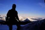
![]() by willy » Wed 25 Jun, 2008 9:11 am
by willy » Wed 25 Jun, 2008 9:11 am
- willy
- Nothofagus cunninghamii

- Posts: 2
- Joined: Wed 25 Jun, 2008 9:05 am
- Region: Tasmania
Re: Lake St Clair to South West Track?
![]() by Azza » Wed 25 Jun, 2008 12:45 pm
by Azza » Wed 25 Jun, 2008 12:45 pm
lol... yes, you'd be mad though. Easiest way is probably.
Walk the King William Range down to the Gordon River near the top of the Denison Range, then along the Vale of Rasselas Track through Gordonvale and Adamsfield out the Gordon Road. Then walk down Scotts Peak Rd to Scotts Peak Dam - start of the Port Davey Track. Round guess is 3-4 days to get down to the Gordon, then 2-4 days out to the Rd. Then hitch down to Scotts Pk.
Other more adventurous variations would be over the Spires, then somewhere across Lake Gordon to the Dam then over the Wilmot and Frankland Range to meet up with the Port Davey track.
This is going to take weeks...
These are both pretty serious undertakings and you'll need good navigation skills, lots of planning, probably food drops and be seriously hardcore. These are recognised routes as opposed to formed tracks.
-
Azza - Phyllocladus aspleniifolius

- Posts: 980
- Joined: Thu 06 Mar, 2008 11:26 am
Re: Lake St Clair to South West Track?
![]() by scrub boy » Wed 25 Jun, 2008 1:30 pm
by scrub boy » Wed 25 Jun, 2008 1:30 pm
check out Andrew Hughes' article in Wild, not sure of the date, it was some time ago. I think he might have walked from Penguin.
- scrub boy
- Atherosperma moschatum

- Posts: 84
- Joined: Thu 28 Feb, 2008 7:22 am
- Region: Tasmania
Re: Lake St Clair to South West Track?
![]() by norts » Wed 25 Jun, 2008 1:31 pm
by norts » Wed 25 Jun, 2008 1:31 pm
It is but you would have to do alot of off track walking and some road walking. This area is very wild and not for the inexperienced.
A description of some off the walk is below. If you scroll down to near the bottom of the first page you will get a description of his walk. The description is in English. His walk was alot longer than what you are considering.
http://louphi.blogspot.com/
Also a description of a similar walk in an old edition of Wild Magazine. I think they used a kayak to get across Lake Gordon.
If you only really wanted to Walk Overland /Port Davey / South Coast track I would adviseget a ride from Lake St Clair to Scotts Peak Dam(Huon Camp Ground). There is a bus service that passes Lake St Clair going to Hobart and there is a bus service to Scotts Peak (not sure if it is every day).
Roger
-
norts - Lagarostrobos franklinii

- Posts: 2013
- Joined: Wed 01 Aug, 2007 10:45 am
- Location: Germantown Tas.
- Region: Tasmania
Re: Lake St Clair to South West Track?
![]() by willy » Wed 25 Jun, 2008 3:42 pm
by willy » Wed 25 Jun, 2008 3:42 pm
Thank you for the info, in 2009 I am planning a trip from Penguin to the south coast, I am a trail runner and experienced in navigation and bush skills. My plan is to basically run (via trails where possible). Roads of any description must be kept to an absolute minimum where possible. The entire run is to be done without cheating(vehicle rides etc). I will be running to raise awareness of mental illness affecting men. The adventure is obviously very much in the early stages.
I appreciate everyones advice and help.
Thankyou.
I appreciate everyones advice and help.
Thankyou.
- willy
- Nothofagus cunninghamii
- Posts: 2
- Joined: Wed 25 Jun, 2008 9:05 am
- Region: Tasmania
Re: Lake St Clair to South West Track?
![]() by tastrekker » Thu 26 Jun, 2008 10:02 pm
by tastrekker » Thu 26 Jun, 2008 10:02 pm
Congratulations, willy, on your noble cause. I wish you all the best in your quest. I have often pondered the possibility of a North-South walking track through Tassie's wilderness areas. I have an old copy of the NWWC's original guide when they first built the Penguin to Pencil Pine track approx 30 years ago. In the description, they said it was their contribution to a future north-south track. Unfortunately, the section from Lake St Clair to Scotts Peak is still missing.
While small in the context of the whole thing, I think the track from the Cradle Visitor Centre to Ronny Creek was a great addition as it links the Penguin to Pencil Pine Track with the Overland Track. Once upon a time, there was talk of a walking track along the river banks at Gunns Plains to avoid roads in that area. I don't think it ever happened though.
Back to the question at hand, the route described by aljscott is certainly the way to go. The road bash from Adamsfield, over Frodshams Pass and down to Scotts Peak is the main detraction from this route for people wanting to minimise road exposure. However, the routes west of Lakes Gordon and Pedder via the Denisons, POWs, etc are massive undertakings. I strongly recommend the following two articles from SUBW as compulsory pre-reading before considering trackless walks in the area:
A Royal Thrash
The Hand that Bashed the Bauera
A personal favourite trip of mine was from Mount Cripps to Reynold Falls (not far NW of Cradle Valley). I have a photo of my 2 mates, both 6 foot tall standing in bauera scrub. One of them is standing on the ground. The other looks like he is standing on the first bloke's shoulders. The second bloke is actually standing on a tea tree that was growing horizontally due to the weight of the bauera. This stuff was a good 10 to 12 feet deep. It is not strong enough to support your weight so all you can do is painstakingly thrash your way through. The other trees growing through it such as tea tree, horizontal and scoparia just add to the joy. We made excellent time, covering 1500 metres in only 3 hours. The bauera thickets you will potentially encounter in the SW are far worse and as the SUBW and louphi articles show, a slightly wrong turn can have you thrashing about in it for days.
I can't imagine attempting to run in either horizontal or bauera.
All that having been said, I have heard of plenty of groups doing the King William Range to the Vale of Rasselas trip so it can't be too bad for experienced walkers.
-
tastrekker - Athrotaxis cupressoides

- Posts: 498
- Joined: Thu 20 Sep, 2007 9:04 pm
- Location: Lenah Valley
- Region: Tasmania
- Gender: Male
Re: Lake St Clair to South West Track?
![]() by tasadam » Sat 28 Jun, 2008 3:42 pm
by tasadam » Sat 28 Jun, 2008 3:42 pm
tastrekker wrote:SUBW as compulsory pre-reading before considering trackless walks in the area:
A Royal Thrash
The Hand that Bashed the Bauera
Excellent reading indeed.
An insight into something I always wanted to try.
Maybe not.
-
tasadam - Magnus administratio

- Posts: 5940
- Joined: Tue 10 Apr, 2007 6:58 pm
- Location: Near Devonport, Tasmania
- ASSOCIATED ORGANISATIONS: TasmaniART, Smitten Merino, Macpac
- Region: Tasmania
- Gender: Male
Re: Lake St Clair to South West Track?
![]() by Ultrarunner » Sat 31 Jul, 2010 6:36 pm
by Ultrarunner » Sat 31 Jul, 2010 6:36 pm
I had originally planned to do this run in 2009 , but due to moving to another state and work issues had to put on hold.
Well it is all going to happen on 02nd November this year!
Probably not the ideal site to be posting something about running but I am also an avid bush walker who used to live in Tasmania, so forgive me if I offend the hardened walkers on the site.
Here are the event details - Tassie - North to South Solo Run 2nd November 2010
I will run approximately 450+kilometres (solo) from the north coast (Penguin) of Tasmania to the south coast (Cockle Creek) of Tasmania utilizing walking tracks where possible. Unfortunately some minor roads will have to be utilized, though these will be kept to an absolute minimum. It is anticipated that I will complete the run in 6-8 days.
I will be raising money for the Black Dog Institute - The Black Dog Institute is a not-for-profit, educational, research, clinical and community-oriented facility offering specialist expertise in depression and bipolar disorder. http://www.everydayhero.com.au/gary_burgess
Thanks to PWS Tasmania for their support and assistance and those who have made donations (big and small) and those that have offered encouragement and donations of gear to help me.
- Ultrarunner
- Nothofagus gunnii

- Posts: 14
- Joined: Tue 04 May, 2010 11:35 am
- Region: Australian Capital Territory
- Gender: Male
Re: Lake St Clair to South West Track?
![]() by ILUVSWTAS » Sat 31 Jul, 2010 6:42 pm
by ILUVSWTAS » Sat 31 Jul, 2010 6:42 pm
Just a question, From Lake St Clair, How are you getting to the Port Davey Track?
Nothing to see here.
-
ILUVSWTAS - Lagarostrobos franklinii
- Posts: 11046
- Joined: Sun 28 Dec, 2008 9:53 am
- Region: Tasmania
- Gender: Male
Re: Lake St Clair to South West Track?
![]() by stepbystep » Sat 31 Jul, 2010 6:44 pm
by stepbystep » Sat 31 Jul, 2010 6:44 pm
[quote="Ultrarunner"]I had originally planned to do this run in 2009 , but due to moving to another state and work issues had to put on hold.
Here are the event details - Tassie - North to South Solo Run 2nd November 2010
Good luck ultrarunner,
my mind spins, but the details don't work, any chance at a link that works?
Would love to see your route....
Here are the event details - Tassie - North to South Solo Run 2nd November 2010
Good luck ultrarunner,
my mind spins, but the details don't work, any chance at a link that works?
Would love to see your route....
The idea of wilderness needs no defense, it only needs defenders ~ Edward Abbey
-
stepbystep - Lagarostrobos franklinii
- Posts: 7707
- Joined: Tue 19 May, 2009 10:19 am
- Location: Street urchin
- Region: Tasmania
- Gender: Male
Re: Lake St Clair to South West Track?
![]() by Nuts » Sat 31 Jul, 2010 6:51 pm
by Nuts » Sat 31 Jul, 2010 6:51 pm
(I think they were the details?)
I'm interested also ultrarunner...
I'm interested also ultrarunner...
-
Nuts - Lagarostrobos franklinii
- Posts: 8638
- Joined: Sat 05 Apr, 2008 12:22 pm
- Region: Tasmania
Re: Lake St Clair to South West Track?
![]() by ILUVSWTAS » Sat 31 Jul, 2010 6:57 pm
by ILUVSWTAS » Sat 31 Jul, 2010 6:57 pm
Nuts wrote:(I think they were the details?)
I'm interested also ultrarunner...
Interested in the route or in joining him?
It is indeed a good question though. Surely if running, the only option is to rin the highway, then down thru the roads from Wayatinah to the Florentine road, then down to Scotts peak..... There's just no possible way one could run through the off track areas surrounding.
Nothing to see here.
-
ILUVSWTAS - Lagarostrobos franklinii
- Posts: 11046
- Joined: Sun 28 Dec, 2008 9:53 am
- Region: Tasmania
- Gender: Male
Re: Lake St Clair to South West Track?
![]() by Ultrarunner » Sat 31 Jul, 2010 7:05 pm
by Ultrarunner » Sat 31 Jul, 2010 7:05 pm
From Lake St Clair, south to Derwent Bridge, south around Lake King William to Butlers Gorge, across Vale of Rasselas, cross Gordon River, to eventually meet up with Adamsfield Track, onto Saw Back Track , south to Gordon Road. Continue onto Scotts Peak Road to start of Port Davey Track
- Ultrarunner
- Nothofagus gunnii
- Posts: 14
- Joined: Tue 04 May, 2010 11:35 am
- Region: Australian Capital Territory
- Gender: Male
Re: Lake St Clair to South West Track?
![]() by ILUVSWTAS » Sat 31 Jul, 2010 7:12 pm
by ILUVSWTAS » Sat 31 Jul, 2010 7:12 pm
Wow. Very impressive/ambitious! 6-8 days for the whole thing?? Good luck! I really wish you all the best!
Make sure you come back and let us all know how it goes!!
Make sure you come back and let us all know how it goes!!
Nothing to see here.
-
ILUVSWTAS - Lagarostrobos franklinii
- Posts: 11046
- Joined: Sun 28 Dec, 2008 9:53 am
- Region: Tasmania
- Gender: Male
Re: Lake St Clair to South West Track?
![]() by Azza » Sat 31 Jul, 2010 7:46 pm
by Azza » Sat 31 Jul, 2010 7:46 pm
Ultrarunner wrote:Lake King William to Butlers Gorge, across Vale of Rasselas
Wow, I wish you the best.. but I think you're pushing it very hard to get through in the time frames you've nominated.
My understanding is that its pretty scrubby and any tracks that might be shown on the maps have long since overgrown.
Effectively Butlers Gorge to Vale of Rasselas is going to be a scrub bash.
-
Azza - Phyllocladus aspleniifolius
- Posts: 980
- Joined: Thu 06 Mar, 2008 11:26 am
Re: Lake St Clair to South West Track?
![]() by Nuts » Sat 31 Jul, 2010 10:22 pm
by Nuts » Sat 31 Jul, 2010 10:22 pm
ILUVSWTAS wrote:
Interested in the route or in joining him?

-
Nuts - Lagarostrobos franklinii
- Posts: 8638
- Joined: Sat 05 Apr, 2008 12:22 pm
- Region: Tasmania
Re: Lake St Clair to South West Track?
![]() by ILUVSWTAS » Sat 31 Jul, 2010 10:24 pm
by ILUVSWTAS » Sat 31 Jul, 2010 10:24 pm
Haha yeh i'd probably find it hard to keep going past the visitor center. Especially knowing what some of the country is like in the proposed route
Nothing to see here.
-
ILUVSWTAS - Lagarostrobos franklinii
- Posts: 11046
- Joined: Sun 28 Dec, 2008 9:53 am
- Region: Tasmania
- Gender: Male
Re: Lake St Clair to South West Track?
![]() by Nuts » Sat 31 Jul, 2010 10:31 pm
by Nuts » Sat 31 Jul, 2010 10:31 pm
tbh, while we cant save some from themselves (and you guys would know far better than me) after reading those accounts (now several times), I would also like to know I had done my best to gauge the sanity of any attempt (especially if down that western side). The mad Belgian (whos name i wont recall...) seemed to have relied heavily on luck. I do admire the energy he must have had to complete some of those long days in the area i'm more familiar with.
-
Nuts - Lagarostrobos franklinii
- Posts: 8638
- Joined: Sat 05 Apr, 2008 12:22 pm
- Region: Tasmania
Re: Lake St Clair to South West Track?
![]() by ILUVSWTAS » Sat 31 Jul, 2010 10:35 pm
by ILUVSWTAS » Sat 31 Jul, 2010 10:35 pm
That story never ceases to amaze me. The lost jumper, cant find the pack once he finds his jumper, trench foot, 2 PACKS!! 49kg.
The guy was VERY lucky to survive! Especially as the further south you come off the Lyell Highway, the nastier the terrain/scrub gets!
Hows those pics of him after the trip? He's wasted away to nothing!!
The guy was VERY lucky to survive! Especially as the further south you come off the Lyell Highway, the nastier the terrain/scrub gets!
Hows those pics of him after the trip? He's wasted away to nothing!!
Nothing to see here.
-
ILUVSWTAS - Lagarostrobos franklinii
- Posts: 11046
- Joined: Sun 28 Dec, 2008 9:53 am
- Region: Tasmania
- Gender: Male
Re: Lake St Clair to South West Track?
![]() by ILUVSWTAS » Sat 31 Jul, 2010 10:42 pm
by ILUVSWTAS » Sat 31 Jul, 2010 10:42 pm
In Bushrunners favour, he has picked the most likely route for success. But as Ascott accurately points out, the tracks that once existed in there are long grown over and even if found, near impossible to stay on.
The buttongrass through the Vale is oldman b'grass. It is HUGE. One minute your walking on it, then next your falling 3 feet inbetween the huge clumps. I can only imagine trying to run through it would restult in a twisted ankle at best.
Scrubmaster gave us an interesting article about a HWC party many years ago who thought the route from Butlers gorge to the Denison range would be faster than the original (Tims track) way in.
I think from memory it took them 3+ exhausting days.
Nothing to see here.
-
ILUVSWTAS - Lagarostrobos franklinii
- Posts: 11046
- Joined: Sun 28 Dec, 2008 9:53 am
- Region: Tasmania
- Gender: Male
Re: Lake St Clair to South West Track?
![]() by Nuts » Sat 31 Jul, 2010 10:47 pm
by Nuts » Sat 31 Jul, 2010 10:47 pm
his gear all soaked, the 10m fall... serious stuff for those who Do value life (or at least minimal pain). I guess he met the odd person here and there so suppose that would have narrowed the search a fraction...
-
Nuts - Lagarostrobos franklinii
- Posts: 8638
- Joined: Sat 05 Apr, 2008 12:22 pm
- Region: Tasmania
Re: Lake St Clair to South West Track?
![]() by Nuts » Sat 31 Jul, 2010 10:50 pm
by Nuts » Sat 31 Jul, 2010 10:50 pm
(edit) to slow a post, sorry, yer I had gotten of track a bit there...
-
Nuts - Lagarostrobos franklinii
- Posts: 8638
- Joined: Sat 05 Apr, 2008 12:22 pm
- Region: Tasmania
Re: Lake St Clair to South West Track?
![]() by ILUVSWTAS » Sat 31 Jul, 2010 10:57 pm
by ILUVSWTAS » Sat 31 Jul, 2010 10:57 pm
Not at all. I should have edited and made that one post, Just went from one topic back to the thread topic in about 1 minute.
Nothing to see here.
-
ILUVSWTAS - Lagarostrobos franklinii
- Posts: 11046
- Joined: Sun 28 Dec, 2008 9:53 am
- Region: Tasmania
- Gender: Male
Re: Lake St Clair to South West Track?
![]() by Nuts » Sat 31 Jul, 2010 11:06 pm
by Nuts » Sat 31 Jul, 2010 11:06 pm
that's probably a good thing, some take days to get back on track lol sometimes I wonder if (in that time) the original poster's havent abandoned plans and taken up knitting
-
Nuts - Lagarostrobos franklinii
- Posts: 8638
- Joined: Sat 05 Apr, 2008 12:22 pm
- Region: Tasmania
Re: Lake St Clair to South West Track?
![]() by walkinTas » Sat 31 Jul, 2010 11:11 pm
by walkinTas » Sat 31 Jul, 2010 11:11 pm
I am loving this. Self-moderation. Sure makes the new job easy.Nuts wrote:(edit) to slow a post, sorry, yer I had gotten of track a bit there...
- walkinTas
- Lagarostrobos franklinii
- Posts: 2934
- Joined: Thu 07 Jun, 2007 1:51 pm
- Region: Tasmania
Re: Lake St Clair to South West Track?
![]() by MJD » Sun 01 Aug, 2010 10:06 am
by MJD » Sun 01 Aug, 2010 10:06 am
I'm willing to bet that he/she won't run the whole way on the currently proposed route. Perhaps he/she could take Bear Grylls with him.
Last edited by MJD on Sun 01 Aug, 2010 10:14 am, edited 1 time in total.
Carpe diem
-

MJD - Athrotaxis selaginoides

- Posts: 1023
- Joined: Mon 26 May, 2008 11:24 pm
- Region: Tasmania
Re: Lake St Clair to South West Track?
![]() by ILUVSWTAS » Sun 01 Aug, 2010 10:08 am
by ILUVSWTAS » Sun 01 Aug, 2010 10:08 am
Bear wont come to SW Tas. He prefers the tropics.
Nothing to see here.
-
ILUVSWTAS - Lagarostrobos franklinii
- Posts: 11046
- Joined: Sun 28 Dec, 2008 9:53 am
- Region: Tasmania
- Gender: Male
Re: Lake St Clair to South West Track?
![]() by ollster » Sun 01 Aug, 2010 10:42 am
by ollster » Sun 01 Aug, 2010 10:42 am
ILUVSWTAS wrote:Bear wont come to SW Tas. He prefers the tropics.
Bear fears the horrie and donga!!! Kinda like some Northern forum members...
"I refuse to join any club that would have me as a member."
-

ollster - Lagarostrobos franklinii
- Posts: 3983
- Joined: Tue 02 Sep, 2008 4:14 pm
- ASSOCIATED ORGANISATIONS: LoveMyGoat.com
- Region: Australia
Re: Lake St Clair to South West Track?
![]() by ILUVSWTAS » Sun 01 Aug, 2010 10:43 am
by ILUVSWTAS » Sun 01 Aug, 2010 10:43 am
ollster wrote:ILUVSWTAS wrote:Bear wont come to SW Tas. He prefers the tropics.
Bear fears the horrie and donga!!! Kinda like some Northern forum members...
LMAO!! You know I was thinking it.....
Nothing to see here.
-
ILUVSWTAS - Lagarostrobos franklinii
- Posts: 11046
- Joined: Sun 28 Dec, 2008 9:53 am
- Region: Tasmania
- Gender: Male
Re: Lake St Clair to South West Track?
![]() by Ultrarunner » Sun 01 Aug, 2010 10:52 am
by Ultrarunner » Sun 01 Aug, 2010 10:52 am
WOW, thanks for the feedback everyone.
Happy for anyone to come along, remember though that day 1 is Penguin to Cradle and day 2 is Cradle to St Clair, so I hope you are fit some days will entail being on the move for up to 16 hours
Seriously though, the weather is obviously a big factor in completing the run, all the training in the world is not going to change that. My obvious concerns are the weather (snow and floods - considering it is November, anything could happen) and of course injury, I am hoping that my training will help negate the injury factor.
I think my time frames are realistic, the first day is a big one but the cross country section from Butlers Gorge and across the Vale is a concern, namely because of lack of tracks and of course the Gordon Crossing. I have allowed extra time to cover the this section.
As for running the whole way - this is is not possible, I doubt there would be a human in the world that could do it. The idea of trail running is to run the flats and walk the hills basically. Quite often you can walk up hills more efficiently and quickly by walking them. On flatter open sections you run and thus you can cover extraordinary distances. I have competed in enough events to know that this works. The key is to always keep moving, keep hydrated and eat well.
My challenge is a huge undertaking that is for sure, I may not succeed, but then again.....
Happy for anyone to come along, remember though that day 1 is Penguin to Cradle and day 2 is Cradle to St Clair, so I hope you are fit
Seriously though, the weather is obviously a big factor in completing the run, all the training in the world is not going to change that. My obvious concerns are the weather (snow and floods - considering it is November, anything could happen) and of course injury, I am hoping that my training will help negate the injury factor.
I think my time frames are realistic, the first day is a big one but the cross country section from Butlers Gorge and across the Vale is a concern, namely because of lack of tracks and of course the Gordon Crossing. I have allowed extra time to cover the this section.
As for running the whole way - this is is not possible, I doubt there would be a human in the world that could do it. The idea of trail running is to run the flats and walk the hills basically. Quite often you can walk up hills more efficiently and quickly by walking them. On flatter open sections you run and thus you can cover extraordinary distances. I have competed in enough events to know that this works. The key is to always keep moving, keep hydrated and eat well.
My challenge is a huge undertaking that is for sure, I may not succeed, but then again.....
- Ultrarunner
- Nothofagus gunnii
- Posts: 14
- Joined: Tue 04 May, 2010 11:35 am
- Region: Australian Capital Territory
- Gender: Male
43 posts
• Page 1 of 2 • 1, 2
Who is online
Users browsing this forum: No registered users and 24 guests