Ironstone Hut & Forty Lakes Peak
I am looking to walk into Ironstone Hut & also Forty Lakes Peak, & am looking for any info on Higgs track & Syds track, including approx times & also road access into these tracks.
Information for bushwalkers from bushwalkers
https://bushwalk.com/forum/
absolom wrote:I am looking to walk into Ironstone Hut & also Forty Lakes Peak, & am looking for any info on Higgs track & Syds track, including approx times & also road access into these tracks.
Dick wrote:I am confused, I have read the forum and conducted a search but still do not know where Lady lake and Higgs track exactly is, or how to get there, can some one please help me out on this, I am new to Tasmania, which road do you take and where is the nearest town .
Dick wrote:I am confused, I have read the forum and conducted a search but still do not know where Lady lake and Higgs track exactly is, or how to get there, can some one please help me out on this, I am new to Tasmania, which road do you take and where is the nearest town .
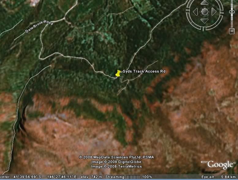
tastrekker wrote:Back to the tracks off Westrope Road, there are 5! In order as you head up the gravel road, they are:
* Higgs Track - The lowest road, starting at 750m above seal level. This is the best marked and most well used of the tracks.
* Western Creek Track - This starts from a carpark at the 850 metre level and essentially follows the valley of Western Creek to the plateau. At one point, it crosses a ledge halfway up a waterfall. (Have you been there taswaterfalls.com?) This track ends at Whiteleys Hut which is beside a clearing NW of Mt Ironstone. Not near any lakes or streams though.
* Lees Track - This starts from the Western Creek Track carpark. Instead of heading towards the creek, this track is a slightly shorter route as it heads directly uphill, joining the Western Creek Track beside a scree slope before you reach the waterfall. Not very well used and may be tricky to find.
* Syds Track - Definitely the shortest route onto the platea as the carpark is around 950m. Last time I walked this one (10 years ago), we had to walk the last 500 metres due to a large log over the track. Small cars were able to proceed as they could fit under the log! This is the track described in "The Abels" book as the way to Mount Ironstone although Western Creek/Lees Track would be a shorter route.
* Mother Cummings Peak (North) Track - This is the furthest track along Westrope Road and it climbs straight up the pointy northern peak of Mother Cummings. However, if you want to climb the highest part of Mother Cummings, this is on the long flat bluff further south and is accessed either from Scotts Road or Smoko Road via Meander.
taswaterfalls.com wrote:Park car at s41* 40.048 e146*28.188 which is the start of higgs track. The track is well marked.
access to higgs is via westrope rd near western creek. It depends which way you are coming but i find quickest way from launceston is to turn off into deloirain and head out that way. From Devonport end turn off just after the antiques place at Christmas Hills onto c163 road (Bengeo road i believe) and follow this (staying on bengeo not taking the dunorlan turn off) all the way to red hills. Turn left at red hills t junction then your next left onto what i believe is called the western creek road...or maybe dairy plains road...cant remember. according to my map its c168. Follow this till you hit another T intersection. Turn right and then take your first left onto westropes.
Hope that helps