Pokana , Conical, Flame peak.
Forum rules
Tasmania specific bushwalking discussion. Please avoid publishing details of access to sensitive areas with no tracks.
Tasmania specific bushwalking discussion. Please avoid publishing details of access to sensitive areas with no tracks.
3 posts
• Page 1 of 1
Pokana , Conical, Flame peak.
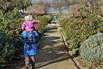
![]() by iaindtiler » Mon 19 Dec, 2022 12:12 pm
by iaindtiler » Mon 19 Dec, 2022 12:12 pm
Hi all. 2 of us are looking to kayak up to the top of lake Gordon. From there we are looking to hike Pokana, on to Conical and on to Flame peak. We are both relatively fit and have experience of off track, multi day hikes in Tassie. Just after some information on best route / routes and a time frame? Any help would be much appreciated. Many thanks, Iain
-
iaindtiler - Athrotaxis cupressoides

- Posts: 103
- Joined: Tue 25 May, 2010 4:42 pm
- Location: Malcahy bay , Tas
- Region: Tasmania
Re: Pokana , Conical, Flame peak.
![]() by headwerkn » Tue 20 Dec, 2022 2:00 pm
by headwerkn » Tue 20 Dec, 2022 2:00 pm
Short answer: take whatever conservative time estimate you have and double it. Take at least twice as much water as you think you'll need too. Unless you're cheeky and optimistic about your water consumption like me, in which case... take three times as much! 
--
NW Lake Gordon/Pokana Bay to Pokana Peak itself is deceptively steep, very scrubby in many places and - this time of year especially - likely to be very dry and hot. It's slow country to move through, especially heading up. Don't underestimate how energy sapping buttongrass is in the middle of summer.
Be aware the current lake level is lower than what's shown on any topo map. That's an extra 1-3km of walking, already, depending on what direction you head in.
Most people who come in from this direction (apparently the minority, most come in from the Denisons) seem to go up at or just north of The Pleiades ridgeline and follow the ridges to Pokana. Access to water this way would be a big concern. We tried heading up a bit further north and only found one good water source the entire way. Ended up having to turn around a good 2km from the summit due to lack of time/light.
Our second attempt we headed straight north towards the summit then used a ridgeline to the SW. We were successful but it took almost all day to get to the summit - with a smaller, strong, determined group and more mild conditions too. We ended up bivvying halfway down on the way back after exhaustion and hours bushbashing in the dark got the better of us.
Best to not be tempted by the ridgeline directly south of the summit or its eastern flank. Apparently one or two crazies have managed to descend it, but it's very, very steep, very cliffy and likely to be some combination of extremely difficult, impossible and dangerous to attempt to climb.
Can't offer much advice beyond Pokana itself. Check out the NatureLoverWalks and Rock Monkey blogs. Mouser on YouTube did a Pokana Bay-Denisons loop trip recently too.
It's a beautiful place, but it makes you earn it every step of the way.
-
headwerkn - Phyllocladus aspleniifolius

- Posts: 633
- Joined: Sat 09 Nov, 2013 3:50 pm
- Region: Tasmania
- Gender: Male
Re: Pokana , Conical, Flame peak.
![]() by north-north-west » Thu 22 Dec, 2022 8:38 am
by north-north-west » Thu 22 Dec, 2022 8:38 am
The easiest route if you're carrying full packs is to climb the Pleaides ridge towards its northern end and then traverse across to the Pokana ridge. Pokana is a lovely sidetrip, the whole ridgeline worth exploring out past the summit. Trouble is, as headwerkin said, the climb up from Pokana Bay is a lot slower than it looks on the maps or than you expect it to be, regardless of your level of experience. And there's only one place on the Pleaides ascent and traverse where you have a reasonable - though not guaranteed - chance of finding water, and campable spots aren't exactly prolific either.
Once past Pokana, there are plenty of potential campsites, and water is easier to find, although mostly requires a bit of a drop from the ridgetops.
The deepest of the dips on the ridge traverse to Conical and Shining is very scrubby and awkward in places; this is the one immediately past the connection to Mt Curly. There's only one good route down/up on the Pokana side and the top of it is difficult to find. Last summer there were a couple of small cairns marking the point you want to begin to drop down, but they're very much blink and miss.
From there to Conical and Shining it's straightforward. Shining to Reverend Ck to The Font is also mostly straightforward but the drop to Reverend and the start of the climb up to The Font were all overgrown and hard work last summer. A few more people have been in since so it should be a bit clearer now.
There are pads all through here, but they're variable, braided and often overgrown.
It is possible to do Shining - Spires - return as a long daytrip but you need ideal conditions for that (and preferably someone with you who knows the area). Don't even think about trying to camp near Reverend Creek, it just isn't possible.
Oh, and despite what the maps say, Flame Peak is considered by peakbaggers to be the one hanging over The Font, the Spires Abel is the tower west of it; no, not that one, the one south of that. It's very complex topography. The route up the Abel from the Font is not exactly a stroll in the park.
That's about as much info as I'm comfortable putting online. Just don't underestimate the terrain; it's beautiful but brutal.
"Mit der Dummheit kämpfen Götter selbst vergebens."
-

north-north-west - Lagarostrobos franklinii

- Posts: 15153
- Joined: Thu 14 May, 2009 7:36 pm
- Location: The Asylum
- ASSOCIATED ORGANISATIONS: Social Misfits Anonymous
- Region: Tasmania
3 posts
• Page 1 of 1
Who is online
Users browsing this forum: No registered users and 11 guests