As far as the running goes it is a fantastic training tool, most of my runs suddenly became much shorter and I was doing slower minutes per k, I could write a lot about its running capabilities but this is a Bushwalking site.
When I brought my 305 I could not find a portable USB charger so I built one myself, I found a suitable power supply chip and on some Vero board made one, I used 4 AA 2700 mA rechargeable batteries. I found that I could get 3+ charges out of the charger. Shortly after I made my charger Jaycar brought one out that is lighter and uses Lithium batteries and it has more charge in it, Ct no MB-3300 cost $70. I do sometimes bring the 305 along on walks and only turn it on when I need a landmark point so I do not have to bring the charger.
I have now used the Forerunner several times for bushwalking and I would rate it at about 6 out of 10 as a bushwalking GPS.
What I like
Very light 77g
As it is a worn on the wrist it is easily read, I do not have to get it from a bag or pocket.
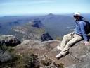
The sensitivity is excellent, It has given me readings in deep narrow deep gullies (Monolith Valley, Budawangs), the SiRFstar111 chip is a big improvement on the old chip.
What I do not like.
Landmarks are only in lat longs, UTM option is not available. I have to draw Lat Long lines across my maps and I have made a measuring scale to suit which is printed out on a piece of clear overhead sheet. When I want to put a route into the 305 I get the UTM co-ordinance off a map and then use software to convert to Lat Longs
All landmarks have to be put into the 305 with the soft keys. I have been unable to do this through the USB computer interface, they say it can be done but I have not been able do it yet (I have average technical abilities but I am no techno wiz).
The start stop button is easily knocked which happens regularly (this can be seen in the Pictures below.
The battery charge lasts up to 10 hours, I have found this not long enough for some days that I walk,
My Walking partner now owns a garmin e-trex and we use it in preference to the Forerunner 305 as it is easier to interface with a computer and put the landmarks into it, I am now thinking of getting my own e-trex for walking.
If anybody wants the KMZ files of the walks below just PM me.
Tony
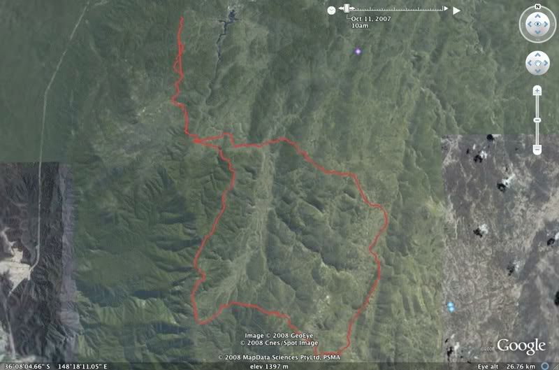
A four day walk in the Western Jagungal Wilderness KNP
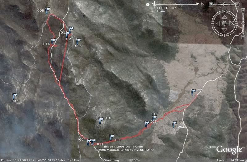
3 day walk in the Scabby Wilderness Namadgi NP Southern ACT
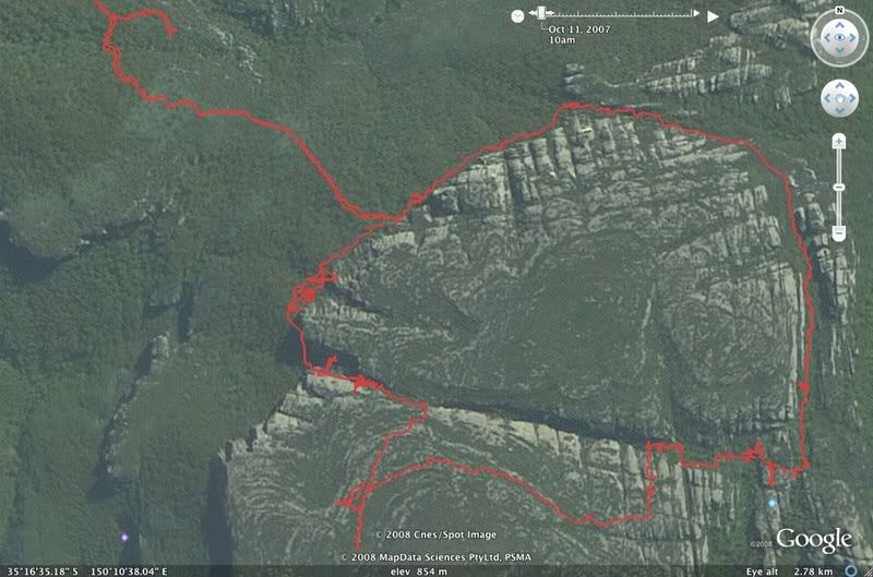
Monolith Valley Budawangs Np, the track in places was very hard to follow note our wanderings