Free maps - Contour Aus matched with Open Street Map (OSM)

For all high tech electronic equipment including GPS, PLB, chargers, phones, computers, software. Discussion of simple electrical devices such as torches, belongs in the main 'Equipment' forum.

Re: Free maps - Contour Aus matched with Open Street Map (OS

Postby Ent » Tue 10 Jul, 2012 9:40 pm

Hi Tastrax I subscribed the mail out list. Did find on wikiOSM an article by and Australian on the various view points. My understanding that NearMap is the catalyst for the chaos. Lot of firms were happy to have their surveying work uploaded and used but then found that the underlying data they used came from this mob and when the lawyer letters came out all hell was played.

Here is the circular

Hello all,

I'm pleased to announce that the licence change bot is ready to get
underway.

Starting this week, we will be 'redacting' the contributions (less than
1%) from the live database that are not compatible with the new
Contributor Terms and Open Database Licence (ODbL) - in other words,
they will no longer be accessible. We are expecting to begin on
_Wednesday_ (9th July) assuming a couple of final setup details are
completed by then.

The bot will run in the following order:
1. Ireland
2. UK
3. Western Europe
4. North America
5. Australia
6. rest of the world

Once it is complete, we will be ready to distribute data under the ODbL
and we'll advise of that with a separate announcement. The final
pre-redaction dataset available under CC-BY-SA has now been generated at
http://planet.openstreetmap.org/planet-120704.osm.bz2 . Where data has
been redacted, any attempt to access it from the API or the site's
'browse' pages will return a response to that effect.

Test runs have shown that the bot is functioning as we want it to, but
we will of course be monitoring its progress. We are currently expecting
it to take in the order of one month to complete; given the many
variables I'm afraid we can't give a more precise steer yet, but we'll
aim to keep everyone updated as it runs (via the announce@ and talk@ lists).

There will be _no_ API outage and no other interruption to editing. When
the bot is running in your area, please do save your edits frequently to
minimise the likelihood of conflict.

(Separate messages are going to talk-ie@ and talk-gb@ as the first two
areas to be affected. Please do forward and translate this for your
local mailing lists.)

As you know we were expecting this to start just after 1st April and the
complexity of the task incurred the delay. Thank you all very much for
your patience in waiting for it to get underway. Thank you especially to
those who have contributed to the code, whether by patches, suggestions
or just helping to firm up the workings.

Richard

for the OSMF board
"lt only took six years. From now on, l´ll write two letters a week instead of one."
(Shawshank Redemption)
User avatar
Ent
Lagarostrobos franklinii
 
Posts: 4086
Joined: Tue 13 May, 2008 3:38 pm
Region: Tasmania

Re: Free maps - Contour Aus matched with Open Street Map (OS

Postby photohiker » Tue 10 Jul, 2012 10:37 pm

Unsurprisingly, my understanding is somewhat different.

See: http://www.osmfoundation.org/wiki/Licen ... he_License

Our current user license is Creative Commons Attribution Share-Alike 2.0. It was not designed for data and the creators of the license state, "Creative Commons does not recommend using Creative Commons licenses for informational databases, such as educational or scientific databases.".

The main issues for the OpenStreetMap project are:

The current license uses only copyright law. This clearly protects creative works such as written documents, pictures and photos. It does not clearly protect data, particularly in the US.

The current license is not written for data and databases. It is therefore very difficult to interpret. If someone uses your data in a map in a book and the map has several layers, what should be placed under CC-BY-SA? Just the OpenStreetMap layer and any enhancements? The whole map, including any unconnected layers and markers? The whole book?

It is difficult or impossible to ask questions about what can and cannot be done, as this means asking all the thousands of contributors individually to give their permission.

This means that “good guys” are stopped from using our data but the “bad guys” may be able to use it anyway.

It is difficult or impossible for folks to mix our data with data under other licenses.

You can read more here: http://www.osmfoundation.org/wiki/Licen ... Unsuitable


The license change has created issues with Nearmap. "NearMap clarified that the new OpenStreetMap license would not be compatible with the CC-BY-SA style license under which data can be derived from NearMap PhotoMaps" Nearmap is friendly with OSM but unwilling to bend to the new license for their own reasons. They did allow any data already derived from their photomaps to remain in the OSM data regardless, which is an act of goodwill on their part.

From the link:
Again, I'd like to clarify that nearmap.com *have not changed anything in our licensing terms*. This is not us withdrawing our support. The OSMF are making a change to the contributor terms which makes them incompatible with the requirement, under our community licence, that derived works be distributed only under CC-BY-SA. We are not able to change our licence to allow distribution of derived works under unspecified future licences.


Hardly an issue with Tasmania in any case.

So the summary is that OSM realised they had originally chosen an unsuitable license and set about to fix the issues that created by helping to develop a new license. Unfortunately, the new license is incompatible with the license and goals of NearMap and therefore, NearMap can no longer be used as an input source for openstreetmap.

Organisationally, this is a big deal, and anyone who has not signed the new license will have their edits removed as Ent has reported above. This does not apply to Ent as he joined with the new license about a month ago, and not to me either as I signed the new license when the first email came around a year ago, as did practically every active mapper. OSM will lose the edits of mappers who have contributed and who have not agreed to the new license for whatever reason (lost email, died, don't care, etc etc) If they are going to have a change like this, better sooner than later I guess.
Michael
User avatar
photohiker
Lagarostrobos franklinii
 
Posts: 3130
Joined: Sun 17 May, 2009 12:31 pm
Location: Adelaide, dreaming up where to go next.

Free maps - Contour Aus matched with Open Street Map (OSM)

Postby Ent » Wed 11 Jul, 2012 12:49 pm

Hi Photohiker

I am not sure if we disagree or agree on our understanding. My understanding was the old licence terms had issues and the new ones allows for unrestricted use.

The underlying issue is not for non commercial users like us but say if Nik decided that his proposed product came with OSM maps. Here the issue for Nik would have been sorting through achieving a commercial agreement with all contributors. Something not a pretty job.

Frankly , all I care about is my work can be used by anyone and good on Nik and others if they can turn a quid from it. The big issue is mapping data is extemly expensive unless brought from "special" resellers. I for one would be happy to pay Tasmaps a fair price for their work and then select the best software I like to use it.

The OSM mail list almost got driven to useless by people not willing/able to handle this change. The "lawyers" in site as you post are using rethroic to support their view.

Simple fact, in a lot of countries' governments make mapping data available at minimal cost but not in Australia.

I support the concept of free maps and if the changes by OSM allow anyone to piggy back off a mapping database then I am there. As for the decliners it is time for them to move on rather than endless "legal" point scoring.

Cheers
"lt only took six years. From now on, l´ll write two letters a week instead of one."
(Shawshank Redemption)
User avatar
Ent
Lagarostrobos franklinii
 
Posts: 4086
Joined: Tue 13 May, 2008 3:38 pm
Region: Tasmania

Re: Free maps - Contour Aus matched with Open Street Map (OS

Postby Ent » Sun 15 Jul, 2012 11:24 pm

Ok lot of map data is up on OSM and now to play with the Garmin 62s.

The download to the Garmin by direct copy of the map file worked well and Contours Australia 5m as well from Basecamp but the issue as mentioned is the 5m intervals are too much data on the small and low resolution screen of the Garmin.

Found a problem though. That is one of zoom. By this, when things show up and when they are hidden. Lakes are good as they show up at high levels so you get a sense of place but tracks and more importantly mountains only show at 300 metre zoom which means trying to navigated with a magnifying glass looking at grass blades rather than large features. Ok, time to play with setting on the Garmin 62s and shift from auto zoom or play with the data on OSM. Now how do you do that? More time with Google I suppose :P

Also found that Custom maps do not play well with Birdseye. More digging required.

Oh and any hints from OSM users would be gratefully appreciated.

Cheers
"lt only took six years. From now on, l´ll write two letters a week instead of one."
(Shawshank Redemption)
User avatar
Ent
Lagarostrobos franklinii
 
Posts: 4086
Joined: Tue 13 May, 2008 3:38 pm
Region: Tasmania

Re: Free maps - Contour Aus matched with Open Street Map (OS

Postby photohiker » Mon 16 Jul, 2012 12:06 am

Ent wrote:Oh and any hints from OSM users would be gratefully appreciated.


On the 62s, look in Map Setup Options, Advanced Map Setup. Page 12 of the 'Manual'

Have a tinker with Zoom Levels and Detail. I don't have a 62 to play with, but you just might find the data is already there, you just have to tease it out at the zoom level you want to use.

Be aware that more detail = more work - the Garmin may slow down if it has to draw more of the data on the screen.
Michael
User avatar
photohiker
Lagarostrobos franklinii
 
Posts: 3130
Joined: Sun 17 May, 2009 12:31 pm
Location: Adelaide, dreaming up where to go next.

Free maps - Contour Aus matched with Open Street Map (OSM)

Postby Ent » Mon 16 Jul, 2012 12:27 pm

Hi Photohiker

I will give that a shot. First time round made everything disappear so was likely going the wrong way.

I think in OSM you can set the zoom level of the objectives. Now mountains are not too important in street view so likely have not been set to show on large scale.

Cheers.
"lt only took six years. From now on, l´ll write two letters a week instead of one."
(Shawshank Redemption)
User avatar
Ent
Lagarostrobos franklinii
 
Posts: 4086
Joined: Tue 13 May, 2008 3:38 pm
Region: Tasmania

Re: Free maps - Contour Aus matched with Open Street Map (OS

Postby Ent » Tue 17 Jul, 2012 7:44 pm

Hi

Well MEM are coming along with a few tips and lot of learning to do.

Special thanks to the person or people that put together the peaks of Tassie list on the forum. Top piece of work and the multiple sort options are great. Thanks for the brilliant effort. Things like that make this forum a good place to glean information on bushwalking/

Cheers
"lt only took six years. From now on, l´ll write two letters a week instead of one."
(Shawshank Redemption)
User avatar
Ent
Lagarostrobos franklinii
 
Posts: 4086
Joined: Tue 13 May, 2008 3:38 pm
Region: Tasmania

Free maps - Contour Aus matched with Open Street Map (OSM)

Postby Son of a Beach » Tue 17 Jul, 2012 9:16 pm

Yeah I wrote a script that turned that list into KML for me once. Was very handy.
Son of a Beach
Lagarostrobos franklinii
 
Posts: 7024
Joined: Thu 01 Mar, 2007 7:55 am
ASSOCIATED ORGANISATIONS: Bit Map (NIXANZ)
Region: Tasmania
Gender: Male

Free maps - Contour Aus matched with Open Street Map (OSM)

Postby Ent » Sun 22 Jul, 2012 11:20 am

Well my journey is continuing. OSM is enduring a significant reduction in information due to the mentioned license bun fight but many people are putting their noses to the screen and rebuilding the maps.

Created my first Garmin map as mentioned and now have a link to improving my processes so yet more learning.

Still a way from a " workable" map but what I am finding is mapping systems are still rather geek driven. By that, you need to have a reasonable understanding of many technical things.

I have found commercial products have their own issues that are either masked or ignored by users. More than a few claims have feet of straw and a read of their legal disclaimers suggest that they have not much faith themselves. OSM I feel will ultimately be the "standard" for offline maps and Google Earth, Bing etc will push commercial map products off the stage into the few prepared to pay the high price for what will be lower quality maps.

Cheers
"lt only took six years. From now on, l´ll write two letters a week instead of one."
(Shawshank Redemption)
User avatar
Ent
Lagarostrobos franklinii
 
Posts: 4086
Joined: Tue 13 May, 2008 3:38 pm
Region: Tasmania

Re: Free maps - Contour Aus matched with Open Street Map (OS

Postby Ent » Sun 22 Jul, 2012 11:44 pm

Well this weekend has been one of success and frustration with mapping. The planning for the off track walk stepped up a gear with all stops being pulled out on the mapping front. Gave a chance to look at different options.

1. Bing kills Google earth for imagine quality in the area that we are looking at except for clouds and missing tiles :cry: It looks very possible to plan a walk by this means. Err this is from the comfort of an armchair and maybe I will not be so enthusiastic with the reality on the ground.

2. Friend's MemoryMap system showed up the ancient maps that are flogged off by them compared to the more recent 2010 and 2011 versions. Tasmap have improved the quality of the data on the new printed maps by a significant margin in the area that we are looking at. You still get sold the old maps with MemoryMap though.

3. Bitmapper set a new record for the latest night with mapping products due to a variety or reasons. Windows can not handle a corrupted DVD very well, actually on my ASUS NX90 not at all! Sorry but the calibration sequence is reminiscent of a disarming a nuclear missile plot in a B grade movie. Ancient Geek is the language of choice. Still I got a chance to prove that cmd line renaming of files is faster (and more accurate) than mouse driven clicks :D Dinosaurs rule once again :wink: Bitmap is easy to slam for its import interface but it by all accounts kills MemoryMap on battery life performance and plotting accuracy. I am old school when it comes to reliability and dealing with data failures so can be hyper critical of less than 100% results with an ability to remove troublesome files. A corrupted ZIP file permanently took out Bitmap requiring a removal and reinstall. Hopefully, I will be in a better place to understand the ancient Geek. If I get charged twice by iStore for it then it is war!!!!

4. OSM has suffered rather dramatically in areas from the license bun fight requiring data removal. I have rebuilt the broken road route to our jump off point. I am impressed though by the efforts of the OSM community to put things right, especially the out of country armchair mappers worldwide. Who says that certain people do not make this world a wonderful place to be.

5. Openmtbmap.org is about to make it on to the permanent vEnting rant list. I have absolutely nothing against people turning a quid and if my work can add to their wealth then good on them but please do not insult my intelligence by asking for a yearly donation and special membership fees to access premium data. This is not a donation it is a subscription. Yes a user commercial charge :roll: Beside, a very expensive fee given the very poor data available for bushwalking in Australia. And yes a lot of bushwalking mapping data in Tassie is now from this keyboard. And this is not that much data. So I get to pay for the privilege of using my own efforts. Big red line through that site.

6. OSM community have been generous with their suggestions but like a large group of people you can find at least twenty ways to do something. Time to start my own written instructions.

7. I have a very old OSM dataset for Garmin Basecamp loaded and working on "rolling my own" maps. But fear not. If I can pull this off then the resulting IMG and Basecamp file are dead easy to get install, at least on the newer Garmins.

8. Xerox map laminating looks good but a $11 a map cheap it is not. Now only if Tasmapa would have a waterproof series apart from the OLT. Oops! almost went into a vEnting rant against this bureaucratic example of why government departments cannot or should not become for profit organizations. Big hint Mr/Mrs/Miss/Ms Tasmap. Visit Xerox and cut a deal with them so a customer can order maps from them. Get Xerox to print on waterproof paper to order and you have zero overhead apart from a server :idea: Even give the customer a bonus CD with the maps on them. Drats still can not overcome the rant feature of the Ent persona.

Cheers
"lt only took six years. From now on, l´ll write two letters a week instead of one."
(Shawshank Redemption)
User avatar
Ent
Lagarostrobos franklinii
 
Posts: 4086
Joined: Tue 13 May, 2008 3:38 pm
Region: Tasmania

Re: Free maps - Contour Aus matched with Open Street Map (OS

Postby photohiker » Mon 23 Jul, 2012 8:25 am

Ent wrote:5. Openmtbmap.org is about to make it on to the permanent vEnting rant list. I have absolutely nothing against people turning a quid and if my work can add to their wealth then good on them but please do not insult my intelligence by asking for a yearly donation and special membership fees to access premium data. This is not a donation it is a subscription. Yes a user commercial charge :roll: Beside, a very expensive fee given the very poor data available for bushwalking in Australia. And yes a lot of bushwalking mapping data in Tassie is now from this keyboard. And this is not that much data. So I get to pay for the privilege of using my own efforts. Big red line through that site.


Look harder. Subscription is not required. :)
Michael
User avatar
photohiker
Lagarostrobos franklinii
 
Posts: 3130
Joined: Sun 17 May, 2009 12:31 pm
Location: Adelaide, dreaming up where to go next.

Free maps - Contour Aus matched with Open Street Map (OSM)

Postby Ent » Mon 23 Jul, 2012 12:37 pm

Hi Photohiker

Look harder. I click on a map and I get the "donate" screen. Attempt a log in I get the same thing. I wasted an hour and all I got was the donate screen. Post a hyperlink where this does not happen and I can download Base-camp and img files of Tassie/Australia as I can not get past the "donate" screen.

Cheers
"lt only took six years. From now on, l´ll write two letters a week instead of one."
(Shawshank Redemption)
User avatar
Ent
Lagarostrobos franklinii
 
Posts: 4086
Joined: Tue 13 May, 2008 3:38 pm
Region: Tasmania

Re: Free maps - Contour Aus matched with Open Street Map (OS

Postby photohiker » Mon 23 Jul, 2012 2:47 pm

Well Ent, you didn't turn out to be much of a hacker, did you? :P :mrgreen:

If you look at the url's you can see that the first bunch of continents including the Aussie one have /donate/ in the url. The last of the continents does not. Copy that url and remove the last file name, paste the rest into your browser address field and you will get to see a list of continents, one of which is Aus.

Thanks for the reminder, the image there at the moment is July 13, before the big deletion, I think.

Can't blame them for making it harder for those that do not donate. Someone has to pay for the server and bandwidth...
Michael
User avatar
photohiker
Lagarostrobos franklinii
 
Posts: 3130
Joined: Sun 17 May, 2009 12:31 pm
Location: Adelaide, dreaming up where to go next.

Re: Free maps - Contour Aus matched with Open Street Map (OS

Postby Ent » Mon 23 Jul, 2012 10:07 pm

Hi Photohiker

Given that I was kicked out of computing at high-school for a while after repeatedly hacking on the central server including a school visit by Digital system engineers to find out how I did the last "breakin" I sort have figured that the law might not be so forgiving of me as a middle age adult so shelved my "skills". It was good fun until it was pointed out that I brought down the entire state education department :oops: For a while I could have had very impressive grades.

I do not mind contributing, in time probably over one hundred hours to-date getting some basic bushwalking mapping data up, and even money but for a sight unseen product no thanks. Besides, I have already been feeling around who in OSM themselves should get the benefit. This MTB mob feed off the servers and OSM community. From what I gather the Australian OSM site is largely funded by a single person who does a lot of work and like Nik puts up with a lot of, well you know the word.

Actually it does the soul good to see the effort by OSM volunteers. They are driven by the simple belief that mapping data should not be product to flog for hundreds if not thousands of dollars.

Interesting what you find out about deals and false claims by at least one company that sells maps. Sufficient to say the data with one mob is rather old for reasons that have nothing to do with the data availability :wink:

Well having finished yet another "Dear Telstra" letter I will get back into mapping. Oh yes, Telstra's latest trick. Well my data plan reset on 22nd of the month so I madly use up the last of it but Telstra decided to shift last month usage into this month :roll: I am sure after numerous emails and phones calls with a final three year old level performance they will accept that this was a "system" mistake, but only one to me, or other users have had their account corrected, and fix the problem. Telstra has huge problems with its data recording of internet usage over the 3G network and if you monitor you own usage you will find some very strange things. Complain and you will be told no problem. Hit them with the proof and offer to go public and the issues are then "fixed". As for the TIO. Well everyone should have a pen friend.

Cheers and thanks I will give that hack a try.
"lt only took six years. From now on, l´ll write two letters a week instead of one."
(Shawshank Redemption)
User avatar
Ent
Lagarostrobos franklinii
 
Posts: 4086
Joined: Tue 13 May, 2008 3:38 pm
Region: Tasmania

Re: Free maps - Contour Aus matched with Open Street Map (OS

Postby photohiker » Mon 23 Jul, 2012 11:17 pm

Ent wrote:This MTB mob feed off the servers and OSM community.


Perhaps. That's a perfectly reasonable and legal activity of course. Probably, you'll find a bunch of people doing mapping just like you behind it. They want maps for their MTB obsession, so pumping data into OSM and then creating a custom garmin image out of it is probably a good way to get them. If you load the mtb image as mtb, you will see that considerable effort has gone into it to make the data useful on a mtb (not so useful for bushwalking though) If you load the hike map, it's not too bad with CA contours.
Michael
User avatar
photohiker
Lagarostrobos franklinii
 
Posts: 3130
Joined: Sun 17 May, 2009 12:31 pm
Location: Adelaide, dreaming up where to go next.

Free maps - Contour Aus matched with Open Street Map (OSM)

Postby Ent » Tue 24 Jul, 2012 12:09 am

Hi Photohiker

Do not get me wrong every bit of data adds to OSM. I downloaded Aus-Oc but even though the installer asked the question on do I want contours I did not get any. Um? How do you integrate them so they appear on Basecamp?

The OSM Aus community pointed me to a promising site to roll my own maps. The main thing is to change the zoom level for huts, peaks and foot tracks then integrate in contours and just break out Tassie for better download speed and make it possible for the less memory capable Garmins to use them.

Also stumbled across a free source and means to put up Garmin Birdseye maps. The instructions are rather ancient geek but I an beginning to understand the Garmin way.

Garmin actually have done a remarkable job with their vector database and giving the newer Garmins the ability to load raster maps as Tony has achieved. They still make it clunky to do but at least they have the ability to do it.

I just wish we could get a
Map
Hardwear
Application
Split so we can mix and match.

It appears that even Tasmap are thinking long and hard on providing electronic maps at a reasonable price. Still think they should cut a deal with Xerox and you buy the map and then get Xerox to print it on the paper type of your choice. Given that the category killer stores do not have maps it is getting harder to get them so need another means for paper copies.

Cheers
"lt only took six years. From now on, l´ll write two letters a week instead of one."
(Shawshank Redemption)
User avatar
Ent
Lagarostrobos franklinii
 
Posts: 4086
Joined: Tue 13 May, 2008 3:38 pm
Region: Tasmania

Re: Free maps - Contour Aus matched with Open Street Map (OS

Postby photohiker » Tue 24 Jul, 2012 8:06 am

Ent wrote:Um? How do you integrate them so they appear on Basecamp?


Basecamp can only show contours if they are baked into the image you are viewing. The GPS on the other hand has no problem showing them on top of the map. Go figure.

I think the mtb contours are a separate download. Never looked at them as I can't imagine they would be better than CA.
Michael
User avatar
photohiker
Lagarostrobos franklinii
 
Posts: 3130
Joined: Sun 17 May, 2009 12:31 pm
Location: Adelaide, dreaming up where to go next.

Re: Free maps - Contour Aus matched with Open Street Map (OS

Postby Ent » Tue 31 Jul, 2012 9:40 pm

It was experiment time on the weekend and mother nature gave a big hand to test out the mapping efforts in instrument navigation conditions as well as a spur of the moment off track wander adding to the fun. The target was Lake Myrtle to clean up the route in via the Lake Bill. I had used a GPS plot taken by another Stroller in heavy snow so the plot was rather abstract and I was keen to improve on this. The aim was to head out via the Jackson Creek Track after some off track wandering.

We arrived at Lake Myrtle as snow was about to settle in and as my back was rebelling from too many hours hunched over a desk the safe option was to pitch tents. Excellent plan as the weather closed in. This gave a chance to plan a different route out. The idea was a straightish line to the Moses Creek Track above Grail Falls. Printed maps, GPS and iPhone were consulted to pick a path that avoid steep climbs and scrub. This is where the first hint of an issue came.

My Tasmap was the 1988 edition and Sthughes was the 2010 or 2011 edition. Tasmap had done a lot of revision so the newer map was much improved on its older stable mate. But Sthughes MemoryMaps iPhone application used the 1988 edition rather than the newer edition of maps. Some background checking revealed that MemoryMaps appears not to have update their maps for what looks like seven years :( This means you are using maps that can be twenty-four years or older despite that Tasmap have reissued newer maps. On the Cathedral map this means the Moses Creek Track had shifted along with the Lake Bill Track. Also the 1988 map was likely pre GPS so the Moses Creek Track was an approximate location only. Anyway, after the usual brawls with the Garmin 62s a rough route was laid in that used the far superior information from the newer Tasmap.

The next day brought about four or more inches of snow so the tracks were largely obscured and scrub was collapsing on to the track. Off we went and the Garmin 62s running OSM and Contours Australia went to work. Having walked the Jackson Creek Track a few times with GPS I had good plots to map the track. It was amazing the accuracy. When the track disappeared it was easy to find and on one tricky section the track was right where the GPS had it. Big thumbs up for OSM and the value to developing good maps. But once up the hill then the off track bit started.

Sthughes' efforts in avoiding scrub and cliff lines paid off and we made excellent time cross country. Tasmap's newer edition was accurate and vastly superior to the older version. Sthughes also had ploted the track on the iPhone using MemoryMaps so we had a chance to see how maps last revised twenty-four years ago stood up. While much of the base data was there the conditions on ground did not match closely. While the recent printed revision did extremely well. The thing learned from this is do not rely in MemoryMaps and hunt out if there is a more recent Tasmap which would be in printed form.

Anyway the tricky bit was the drop down to the Moses Creek Track. As fate would have it snow was very heavy there and the track in the section that we were coming in to was rather indistinct plus very steep. So using gravity assist we overshot my GPS plot of the track as Simon went for the track using the iPhone with MemoryMap. Bad move as the track on the maps from twenty-four years ago was way out. In fairness to Tasmap it was marked on my paper edition as "approximate". Scrub bashing in heavy snow can be rather exhausting and time consuming. We took the punt and then used the OSM track that I had developed from Sthughes plot a couple of years earlier. Trouble was in the section that we were on Sthughes indicated that the plot might not be spot on as they had lost the track in that area as well. Any way up the slope we went as Sthughes did recall being higher. We encountered a cliff line so even though the OSM track said twenty more metres to the right we could not get up so bash our way along the base of the cliff and then eventually fought our way up the valley side. Within a couple of metres of the plot the track appeared :D

From there is was follow your nose and if the track disappeared under the snow then a quick check of the GPS and an a few metres the track was found again.

So, what to take from this experience. You can using OSM develop very impressive maps. Better still if a community of mappers do this. Contour Australia are very valuable but Tasmap's latest maps are very useful as they have good quality ground condition information. The older Tasmaps are rather imprecise but heck a lot can change in twenty-four years. I for one was converted to the GPS as a navigation tool as heavy snow falls makes traditional navigation techniques rather hit and miss. Big tick for OSM and congratulations to Tasmap for the newer maps. Brickbats to MemoryMap for selling very old maps.

Cheers
"lt only took six years. From now on, l´ll write two letters a week instead of one."
(Shawshank Redemption)
User avatar
Ent
Lagarostrobos franklinii
 
Posts: 4086
Joined: Tue 13 May, 2008 3:38 pm
Region: Tasmania

Re: Free maps - Contour Aus matched with Open Street Map (OS

Postby tastrax » Wed 01 Aug, 2012 9:10 am

Thanks for the insight Ent,

Just a few points to consider. Whilst OSM mapping can provide added detail you need to remember that you have no way of knowing how accurate the data actually is (unless its your own data). Older GPS traces may not be as accurate as newer GPS's so over time its likely to get better and better as GPS technologies improve.

Much of the track data on Tasmaps was originally from aerial photography and some basic field checks (especially in remote areas). In recent years some of the updating has come from Parks and Wildlife using consumer grade GPS's. I think this is likely to be a trend in the future as Land Information Services have probably lost cartographers and will rely more on the land managers to provide them with updates. Also with lots of GPS's in the hands of the public its now much easier to get a fairly reasonable plot. In the old days it was probably someone leaning over the cartographers desk with a pencil drawing a line on the map. I suspect that much of the "approximate location" notations was simply that minimal field checks had been undertaken.

As for Memory Map and the currency of the images. I suspect that they purchased some license at "a point in time" and those are the maps they continue to sell. Maybe if they pay again they can get the updated images and provide them as updates to existing users (maybe even for free!.... cough cough!). Maybe they need a "lifetime maps guarantee" like some of the Garmins (which isn't actually a lifetime guarantee).
Cheers - Phil

OSM Mapper
User avatar
tastrax
Lagarostrobos franklinii
 
Posts: 2048
Joined: Fri 28 Mar, 2008 6:25 pm
Location: What3words - epic.constable.downplayed
ASSOCIATED ORGANISATIONS: RETIRED! - Parks and Wildlife Service
Region: Tasmania

Free maps - Contour Aus matched with Open Street Map (OSM)

Postby Ent » Wed 01 Aug, 2012 12:32 pm

Hi Tastrax

Yeap pretty much agree with your comments. Mapping in this state at least is rather interesting with an emphasis on user beware or at least needing to understand the source of the map data.

As examined in another thread not all GPSs are created equal with the worry people recording tracks with phone apps. Now before I get toasted in a flame war, phones with the right app and placed with a good view of the sky they can do a good job but with a poor logging app, like MemoryMap, and placed in a chest pocket the logs will be very suspect.

Everytime I walk a track I upload the GPS plot and refine the track using an average method to gradually refine out the wayward points. This means accuracy will improve over time.

The Garmin 62s is very impressive in accuracy as are most Garmins. In fact much better than a person tracing a track from a photograph.

OSM has a long way to go to be considered a replacement for the commercial mapping products but as I found it can be a very useful source of mapping data. Problem is Tassie has very few active mappers.

Cheers
"lt only took six years. From now on, l´ll write two letters a week instead of one."
(Shawshank Redemption)
User avatar
Ent
Lagarostrobos franklinii
 
Posts: 4086
Joined: Tue 13 May, 2008 3:38 pm
Region: Tasmania

Re: Free maps - Contour Aus matched with Open Street Map (OS

Postby andrewp » Wed 08 Aug, 2012 9:23 am

Does anyone know where I can download the Contours Australia map. It doesn't seem to be available from www.lizarddrinking.net any more?
Thnaks.
User avatar
andrewp
Athrotaxis cupressoides
 
Posts: 274
Joined: Mon 29 Aug, 2011 10:34 am
Region: Victoria
Gender: Male

Re: Free maps - Contour Aus matched with Open Street Map (OS

Postby tastrax » Wed 08 Aug, 2012 10:11 am

Its a 2Gb download so I reckon they have removed the download link due to bandwidth issues. You can however buy it from them.

Alternative is to try and find contour_australia_5m_win32.zip on the web somewhere
Cheers - Phil

OSM Mapper
User avatar
tastrax
Lagarostrobos franklinii
 
Posts: 2048
Joined: Fri 28 Mar, 2008 6:25 pm
Location: What3words - epic.constable.downplayed
ASSOCIATED ORGANISATIONS: RETIRED! - Parks and Wildlife Service
Region: Tasmania

Re: Free maps - Contour Aus matched with Open Street Map (OS

Postby photohiker » Wed 08 Aug, 2012 10:39 am

GPS Australia has it in their store bundled with Shonky and stuff for $15:

Bundle 2X DVD - Contours Australia 3.0 + ShonkyMaps 3.51 + NZ, POIs and much more - datacard not included
Michael
User avatar
photohiker
Lagarostrobos franklinii
 
Posts: 3130
Joined: Sun 17 May, 2009 12:31 pm
Location: Adelaide, dreaming up where to go next.

Re: Free maps - Contour Aus matched with Open Street Map (OS

Postby Ent » Mon 13 Aug, 2012 11:46 am

Hi

My tendency is for total and absolute precision which admittedly is rather over the top but a noble goal IMHO. Reading up on alternative units to the Garmin 62S and I stumbled across the limitation built into the Garmin range. That being the use of 24 digit referencing for their maps. This means regardless of the units' accuracy the map format can only resolve to +-2.5 metres. Now to avoid the usual bun fight I fully accept that 2.5metres is more than accurate enough for bushwalking. But it does place a limit on claims of better accuracy from maps as this is a limit of the mapping format common to the Garmins.

Another brand has a GIS range which is intended for surveying type use but not sure on their theoretical limitations. The cost the unit is not prohibitive as around $700 AUD. It appears more than a few GPS units claim +- 5 metre accuracy. Handy to know but 1:25,000 data sources generally only resolve to +-30 metre accuracy so you potentially have better theoretical accuracy with the units than with the commercial maps that you might be using. When using MemoryMap it was very hard to follow tracks on the ground (unless clearly identifiable by traditional means) due to the +-30 metre resolution issue.

I am not sure on the theoretical accuracy of OSM in its map resolution but when combined with my Garmin 62S developed plots the accuracy is highly impressive and makes snow navigation a breeze. The tracks used for the recent test were derived from using my Garmin 62s, Garmin 305 Edge and friends Etrex over a few years. The superior antenna of the Garmin 62s means its plots hold up in difficult terrain but a well position Garmin Edge 305 and Etrex do not give much away. So practical considerations means a reasonable GPS positioned with a view of the sky can be remarkably precise. Snow walking means track following is a chooks' lottery as the on ground reference gets lost under the snow and snow laden scrub collapsing on the track means it is easy to lose the track.

Using a mapping GPS it was easy to "pick" the track and/or re-find it, providing that the track was well recorded in the first place. And this is where users of OSM need to be aware. A track taken with an iPhone kept in the chest pocket using a poor plotting software such as MemoryMap will generate plots that vary wildly. If these plots are uploaded to OSM and converted to tracks you will have the accuracy issue to contend with. Now, for good weather conditions no issue as a good track "hound" will likely never look at a GPS but in adverse conditions, such as snow, following such GPS tracks will be an experience of scrub bashing crisscrossing a track.

It is interesting therefore to evaluate "claims" of accuracy against the actual theoretical limitations. So for Garmin units +-2.5 metres is the best expected while MemoryMap +-30 metres is the limit ignoring the human element on making the maps.

Cheers
"lt only took six years. From now on, l´ll write two letters a week instead of one."
(Shawshank Redemption)
User avatar
Ent
Lagarostrobos franklinii
 
Posts: 4086
Joined: Tue 13 May, 2008 3:38 pm
Region: Tasmania

Re: Free maps - Contour Aus matched with Open Street Map (OS

Postby Ent » Tue 21 Aug, 2012 9:41 pm

Being concentrating on mapping areas rather than playing with creating custom maps but did have a look at OSM_Australia site and decided to have a look at the cycle maps. Here is the link http://www.osmaustralia.org/garmincycle.php Now these maps are still biased to wheel vehicles so the tracks do not show up until zoomed into 300 metre level but the big bonus is the mountains show up at at just about all practical zoom levels :D So with the lakes gradually being added and a few more peaks (once again thanks to the people on this site that contributed to the list of peaks) it is easier to get a macro level view of where you are and where you want to be.

Now the process to get them onto say the Garmin 62S is dead easy. Just connect the Garmin by USB and copy the file to Garmin. Then in the map set menu disable the Garmin maps and enable the OSM map. Bingo, you should have then the map. Helps to have Contours Australia installed as a transparent map as this will give additional detail. As mentioned probably would go with 10 or 20 metre contours rather than 5 metre ones.

As mentioned, assuming someone has plotted the track correctly you can get remarkable accuracy. It is also interesting with lakes to see that the contours are a little suspect as lakes should be flat. Me thinks that the radar mapping from space has a few issues. One could be it penetrates water to a certain depth and/or there is some interpolation of the data points. As I have raised before the contours' line spacing are little too even to be believed. But that aside they are still remarkably good for navigation.

This Thursday once again get a chance to ground truth (just have to love the jargon) the mapping efforts. Stay tuned for Ent lost in the wilderness or Ent makes it home. Just to avoid the "flak" I have map, compass and "professional" maps on a GPS as standby. And yes the standard warning. OSM are developed by the general public so might be works of fiction. Ok, I have found the plotted tracks very good but then again having put them up myself I am not impartial :wink: Oh, and yes they are free :D

Cheers
"lt only took six years. From now on, l´ll write two letters a week instead of one."
(Shawshank Redemption)
User avatar
Ent
Lagarostrobos franklinii
 
Posts: 4086
Joined: Tue 13 May, 2008 3:38 pm
Region: Tasmania

Re: Free maps - Contour Aus matched with Open Street Map (OS

Postby Ent » Wed 22 Aug, 2012 10:15 pm

As they say a picture is worth a thousand words. Here is progress to date in my favourite part of Tassie.

OpenStreetMap - Mozilla Firefox_2012-08-22_22-13-09.jpg
Progress to date
"lt only took six years. From now on, l´ll write two letters a week instead of one."
(Shawshank Redemption)
User avatar
Ent
Lagarostrobos franklinii
 
Posts: 4086
Joined: Tue 13 May, 2008 3:38 pm
Region: Tasmania

Re: Free maps - Contour Aus matched with Open Street Map (OS

Postby Ent » Mon 27 Aug, 2012 8:17 pm

Hi

Well the ground truthing continued with the OSM uploads. The idea was to check the route up from Wadley's Hut to Kiora and then on to the Arm River Track and map the Lees Paddocks track down to Lees Hut. As of mice and men things went astray at times. My Garmin 62s played silly buggers and swung the track up 180 degrees around. In a epic Ent temper tantrum the structural integrity of the Garmin case was put to the test and it came out with flying colours. Turns out the compass plays a significant role in deciding the track up direction and was refusing to recalibrate. I think it did not like the closeness of the second camera or maybe my iPhone. Anyway, I have learned yet another undocumented feature of the Garmin 62s :? So the testing of the Lees Track plot was frustrated.

Anyway the real test was from Wadley's Hut to Kiora Hut following the Paddy Harnett Track. This route dates back to at least the 1930's. Sthughes did a masterful job of track following using traditional methods and managed to remove a fair few false turns and cleaned up the path. Pine Creek and lower Kiora were a challenge to cross given the weather but we made it. At Kiora a warm fire greeted use courtesy of a Mainland group of walkers. In the chin waging one revealed that the raster Garmins were rather difficult to use due to their small low resolution screen.

The long and cold haul to the Gap was achieved and much to the disappointment of my college I pike the chance to tent test on Pelion East or even Doris. The crummy weather with wet snow and minimal visibility plus frozen feet from a creek crossing gone wrong and the bog hole on the track from Kiora killed my enthusiasm. It was a cold night at Pelion as the heater was not working and just to annoy you the smoke alarm fired twice during the night for no reason.

So off we went to find the Lees Paddocks track. Tasmap on the 1988 edition had it starting in no-man's land and on the 2011 version eight hundred meters from the registration box. It is a hard thing to walk past the obvious start to Tasmap's location but we did. Tasmap had the track heading across a swamp. In the middle of the swamp we could see the markers that followed the tree line :roll: Thanks Tasmap for your care and attention to detail :evil: Anyway the track was found then lost and found again. It was well marked so we could follow a clear path down to Lees Paddocks. Just means my track has a straight line from the proper start to the first marker I found.

Found that the cycle maps downloaded from OSM Austalia were great for the zoom level of peaks so once I have cleaned up the tracks I will load in a few more peaks. In all very impressed with OSM and Contours Australia as map creation and following tools. The lack of data on the area in OSM means it is far from being a navigation tool to be relied on but hopefully it now has enough useful data for the experienced Tassie walker to wander with. And as mentioned on another thread, nothing can beat good track sense.

All the data is now up and now I have the job of repositioning the lakes as Bing is out a bit in the area.

Cheers
"lt only took six years. From now on, l´ll write two letters a week instead of one."
(Shawshank Redemption)
User avatar
Ent
Lagarostrobos franklinii
 
Posts: 4086
Joined: Tue 13 May, 2008 3:38 pm
Region: Tasmania

Re: Free maps - Contour Aus matched with Open Street Map (OS

Postby Ent » Sat 01 Sep, 2012 11:53 pm

Hi

The planned Whitely's Hut to Lake Nameless then Blue Peaks and back to Lady Lake Hut walk came a little off the rails due to the high waterway levels. But still good fun was had.

The climb up to Whitely's Hut gave the first sign of impending difficulties with the small creek you cross having a fierce water flow. The wire rope was handy but still due consideration was required before crossing. It was clear that it would be a wet boot trip. Up top the walking was on track until it petered out near Lake Ironstone so away we went. The primary tool was the Asus Nexus capably driven by Sthughes running the latest Tasmap that he had scanned in. The quality improvement on terrain conditions was noticeably better than the older map on MemoryMap. The 7" tablet is as good as paper maps to read from with the bonus of current GPS position. The Garmin 62s' small screen size does make it challenging to get a sense of location, a case of either being lost in the trees at micro level or lost in lack of screen resolution at the macro level. Yeap, the Garmin 62S is heavily dependent on the inbuilt compass being correctly calibrated and time for me to dump my case for it as to be expected the magnetic clip plays merry hell with it if you use track up rather than north up. Still I must admit I have no great faith in electronic compasses. It would have been a wonderful site for old timers seeing two electronic devices being checked by an old fashion compass :lol:

So around the lake we went on the eastern side. The partly snow covered scree made life interesting at times but apart from wishing I had gone lighter weight when pinned by my pack in a tumble we all managed largely unscathed. We then had the fun of crossing the swampy ground to Lake Nameless and the Ironstone Hut. One of the minor mysteries of naming in Tasmanian is that Ironstone Hut is on Lake Nameless :? Two decided to jump across a waterway while one decided to wade across a wider but shallower section of it. But if somewhat soggier we made it to the hut.

The next day was follow your nose to to Blue Peaks. It was fantastic crossing between the northern end of Lake Jonny and the pond above it as per the traces I had put into OSM from Bing. Bing can be either spot on or maybe fifty-hundred metres out and the ground truthing in the area revealed it was pretty much on the money. I was very happy with that result :D

Then we hit the Fisher River and the wheels fell off. In the pre planning the Fisher River was always going to be a bit suspect but having crossed it lower down on the Lake Explorer track a couple of years earlier I felt " how hard can it be higher up"? Err, rather hard. I was amazed by the water speed on the flat sections of the river with water appearing to be a rapid. We went lower down as it narrow hopping for a crossing point but the sheer water speed meant such a crossing was ill advise so like all sensible walkers we beat an "honourable" retreat over a saddle. Nature rewarded our common-sense with stunning views from a high alpine meadow that we stopped for lunch at.

Then we made the second over optimistic choice of heading for the northern side of Snake Lake between it and Lake Explorer. I will now be looking for in OSM a way of saying, "do not cross unless low water levels or you can represent the USA on the long jump". It was just on the horrible side of maybe, maybe not, you can jump and if you miss then you will freeze as the water was deep. Time to retreat and go around the lake and look at crossing on the Lake Nameless side on the Higgs Track. So we arrived at the crossing and it was not one to take lightly either. We got across with only wet boots but took some careful footwork to avoid visiting Lake Snake again :shock:

We then camped at Weston Lake and again Bing was pretty much on the money. The lake tracing panned out well and it was at a much higher level of detail than the Tasmap 1:25,000 map was. It was a freezing night so woke up with frozen socks and boots that rang when bumped together. But oh what a morning. The sun had warmth and streamed into to the well placed tents so we made like lizards.

The next "challenge" was to use the Garmin 62S and my rather poor close in eyesight to plan a way to Whitely's Hut. Decided on the southern side of the Lake though in retrospect the first up option of the northern side would have been better. But what the heck this proved that the two Shadow packs were more than up to "some scrub". We arrived at the eastern end and sure enough the promised by Contours Australia 5M "path" it was good going. The little lake at the top was pretty close to the OSM trace. By following the path of least resistance we soon found the fishing track and like most of the "traditional" routes it wisely skirted the swamp that Tasmap's had marked. We soon arrived at the hut.

Then we had the decision. Set up camp and climb Ironstone, take an easy day off, or head out and enjoy fathers' day. We decided that mother nature had intended us to be home for fathers' day so off we went. To spruce the journey up we took the alternative route back to the car on the way down.

We then checked out the lower brook for the Lady Lake Hut and found as mention the foot bridge destroyed and wire across a bit further up to help in the crossing. The water level was soaked boots but crossable. However, people need to be aware that a reasonable night's rain may make this rather more challenging to the point of ill-advised.

So the learning.

1. OSM with Bing pre planning can produce some very useful maps :D

2. The Asus Nexus 7" tablet is very impressive in the field providing it is well protected from the elements.

3. When push comes to shove two technological geeks trust a traditional compass more than their fancy electronic devices when it comes to finding a compass bearing.

4. The paper maps were never touched.

5. The One Planet Shadow pack is more than up to the conditions encountered. The McMillan is its usual tank and prone to encourage over packing of stuff. All packs were very comfortable.

6. We live an a beautiful part of the world :D

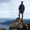
And now a few pictures.
Attachments
P1050866.JPG
Fisher River
P1050871.JPG
Not quite from Bing's view point
P1050890.JPG
Did I say it was a cold night!
P1050882.JPG
Homes for the night.
"lt only took six years. From now on, l´ll write two letters a week instead of one."
(Shawshank Redemption)
User avatar
Ent
Lagarostrobos franklinii
 
Posts: 4086
Joined: Tue 13 May, 2008 3:38 pm
Region: Tasmania

Re: Free maps - Contour Aus matched with Open Street Map (OS

Postby Ent » Sat 08 Sep, 2012 9:01 am

Well homework is completed for the walk in the Lake Ironstone/Nameless area with more lakes aligned to the GPS position and tracks put in including completing the road link from Devonport. Even managed to put in two short sections of creeks as I continue to learn how to map geographical features. The main peaks are largely there. Good to see the area starting to come alive from the blank OSM screen it once was. Rather curious if anyone is using OSM data for that area. I have noticed a couple of tracks have been put in by others.

The cycle map is being very slow to update but given that one person is doing the whole planet this is not unexpected. Here is a screen shot of the area. As mentioned on another thread more than happy to receive information on other paths and ways into the area. The next plan is to "conquer" the Blue Peaks from the Lake Mackenzie side.

Cheers
Attachments
OpenStreetMap - Mozilla Firefox_2012-09-08_08-56-23.jpg
Zoomed out hence Lake names not showing at this level.
"lt only took six years. From now on, l´ll write two letters a week instead of one."
(Shawshank Redemption)
User avatar
Ent
Lagarostrobos franklinii
 
Posts: 4086
Joined: Tue 13 May, 2008 3:38 pm
Region: Tasmania

Re: Free maps - Contour Aus matched with Open Street Map (OS

Postby north-north-west » Sun 09 Sep, 2012 2:02 pm

I always thought it was PanOrama . . .
"Mit der Dummheit kämpfen Götter selbst vergebens."
User avatar
north-north-west
Lagarostrobos franklinii
 
Posts: 15123
Joined: Thu 14 May, 2009 7:36 pm
Location: The Asylum
ASSOCIATED ORGANISATIONS: Social Misfits Anonymous
Region: Tasmania

PreviousNext

Return to Techno-Babble

Who is online

Users browsing this forum: No registered users and 10 guests